Olmos Park, Texas
| Olmos Park, Texas | |
|---|---|
| City | |
 Location of Olmos Park, Texas | |
| Coordinates: 29°28′30″N 98°29′17″W / 29.47500°N 98.48806°WCoordinates: 29°28′30″N 98°29′17″W / 29.47500°N 98.48806°W | |
| Country | United States |
| State | Texas |
| County | Bexar |
| Incorporated | May 1939[1] |
| Government | |
| • Mayor | Ronald Hornberger |
| • City Council |
Juliana Dusek Casey Fry Kenyon McDonald Sharon Plant Deb Prost |
| Area | |
| • Total | 0.6 sq mi (1.6 km2) |
| • Land | 0.6 sq mi (1.6 km2) |
| • Water | 0.0 sq mi (0.0 km2) |
| Elevation | 807 ft (246 m) |
| Population (2000) | |
| • Total | 2,343 |
| • Density | 3,860.1/sq mi (1,490.4/km2) |
| Time zone | Central (CST) (UTC-6) |
| • Summer (DST) | CDT (UTC-5) |
| ZIP code | 78212 |
| Area code(s) | 210, 726 (planned) |
| FIPS code | 48-53988[2] |
| GNIS feature ID | 1343270[3] |
| Website | http://www.olmospark.org/ |
Olmos Park is an enclave city located within San Antonio in Bexar County, Texas, United States. The population was 2,237 at the 2010 census.
Government
Ronald Hornberger is Mayor of the City of Olmos Park. He was declared elected at the March 17, 2016 Olmos Park City Council meeting and is serving a term of two years.
History
Olmos Park was developed in the 1920s as an exclusive suburb of San Antonio, which completely surrounds it. The city occupied the site where Camp John Wise was built in 1917. Camp John Wise was a US Army balloonist training site. The camp shut down in 1919 when the balloonist training was moved to nearby Brooks Field.
Sometimes confused with the City of Olmos Park, Olmos Park Terrace, was developed by the same developer a few years later in the 1930s as part of his larger Olmos District development and borders Olmos Park's western edge. Olmos Park Terrace was designated a San Antonio Historic District on Oct. 4, 2007 by Ord. 2007-10-04-1070.[4][5]
Geography
Olmos Park is located at 29°28′30″N 98°29′17″W / 29.47500°N 98.48806°W (29.474981, -98.488016).[6] This is 4 miles north of Downtown San Antonio.
According to the United States Census Bureau, the city has a total area of 0.6-square-mile (1.6 km2), all land. It is an enclave of San Antonio, as it is completely bounded by the city.
US Route 281 is a north-south highway through the community.
Demographics
| Historical population | |||
|---|---|---|---|
| Census | Pop. | %± | |
| 1940 | 1,822 | — | |
| 1950 | 2,841 | 55.9% | |
| 1960 | 2,457 | −13.5% | |
| 1970 | 2,250 | −8.4% | |
| 1980 | 2,069 | −8.0% | |
| 1990 | 2,161 | 4.4% | |
| 2000 | 2,343 | 8.4% | |
| 2010 | 2,237 | −4.5% | |
| Est. 2015 | 2,390 | [7] | 6.8% |
As of the census[2] of 2000, there were 2,343 people, 1,043 households, and 616 families residing in the city. The population density was 3,860.1 people per square mile (1,483.0/km²). There were 1,131 housing units at an average density of 1,863.3/sq mi (715.9/km²). The racial makeup of the city was 93.60% White, 2.09% African American, 0.47% Native American, 0.68% Asian, 0.09% Pacific Islander, 2.30% from other races, and 0.77% from two or more races. Hispanic or Latino of any race were 14.60% of the population.
There were 1,043 households out of which 28.5% had children under the age of 18 living with them, 51.0% were married couples living together, 7.0% had a female householder with no husband present, and 40.9% were non-families. 36.1% of all households were made up of individuals and 8.2% had someone living alone who was 65 years of age or older. The average household size was 2.24 and the average family size was 2.96.
In the city the population was spread out with 23.6% under the age of 18, 5.1% from 18 to 24, 28.1% from 25 to 44, 29.2% from 45 to 64, and 14.1% who were 65 years of age or older. The median age was 41 years. For every 100 females there were 88.6 males. For every 100 females age 18 and over, there were 84.5 males.
The median income for a household in the city was $87,560, and the median income for a family was $128,814. Males had a median income of $81,296 versus $35,500 for females. The per capita income for the city was $65,697. About 1.9% of families and 3.9% of the population were below the poverty line, including 3.0% of those under age 18 and 2.1% of those age 65 or over. The median home price for 2005 was $400,960.
Education
Olmos Park is served by the Alamo Heights Independent School District.[9] Schools serving Olmos Park include Howard Early Childhood Center in San Antonio,[10] Cambridge Elementary School in Alamo Heights,[11][12][13] Alamo Heights Junior High School in San Antonio,[14] and Alamo Heights High School in Alamo Heights.[11]
The Hannah Landa Memorial Library of the San Antonio Public Library, located in the Monte Vista Historic District in Midtown San Antonio, serves Olmos Park.[15]
References
- ↑ http://olmospark.org/vertical/sites/%7BC363F155-8965-4219-9F03-A72E929D1E68%7D/uploads/12financialreport.pdf
- 1 2 "American FactFinder". United States Census Bureau. Retrieved 2008-01-31.
- ↑ "US Board on Geographic Names". United States Geological Survey. 2007-10-25. Retrieved 2008-01-31.
- ↑ City of San Antonio Website
- ↑ Olmos Park Terrace Neighborhood
- ↑ "US Gazetteer files: 2010, 2000, and 1990". United States Census Bureau. 2011-02-12. Retrieved 2011-04-23.
- ↑ "Annual Estimates of the Resident Population for Incorporated Places: April 1, 2010 to July 1, 2015". Retrieved July 2, 2016.
- ↑ "Census of Population and Housing". Census.gov. Retrieved June 4, 2015.
- ↑ "Olmos Park city, Texas." U.S. Census Bureau. Retrieved on March 24, 2010.
- ↑ "Welcome." Howard Early Childhood Center. Retrieved on March 24, 2010.
- 1 2 "Zoning Map." Alamo Heights Independent School District. Retrieved on March 24, 2010.
- ↑ "Welcome to Cambridge Elementary School." Alamo Heights Independent School District. Retrieved on March 24, 2010.
- ↑ "District Map PDF." Alamo Heights Independent School District. Retrieved on March 24, 2010.
- ↑ "Welcome to the Alamo Heights Junior High School." Alamo Heights Independent School District. Retrieved on March 24, 2010.
- ↑ "Landa Library." San Antonio Public Library. Retrieved on April 20, 2012.
External links
Municipalities and communities of Bexar County, Texas, United States | ||
|---|---|---|
| Cities | 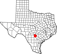 | |
| Towns | ||
| CDPs | ||
| Other unincorporated communities | ||
| Footnotes | ‡This populated place also has portions in an adjacent county or counties | |