Olmo al Brembo
| Olmo al Brembo | |
|---|---|
| Comune | |
| Comune di Olmo al Brembo | |
|
Church | |
 Olmo al Brembo Location of Olmo al Brembo in Italy | |
| Coordinates: 45°58′N 9°38′E / 45.967°N 9.633°ECoordinates: 45°58′N 9°38′E / 45.967°N 9.633°E | |
| Country | Italy |
| Region | Lombardy |
| Province / Metropolitan city | Province of Bergamo (BG) |
| Area | |
| • Total | 7.8 km2 (3.0 sq mi) |
| Elevation | 556 m (1,824 ft) |
| Population (Dec. 2004) | |
| • Total | 522 |
| • Density | 67/km2 (170/sq mi) |
| Demonym(s) | Olmesi |
| Time zone | CET (UTC+1) |
| • Summer (DST) | CEST (UTC+2) |
| Postal code | 24010 |
| Dialing code | 0345 |

Olmo al Brembo is a comune (municipality) in the Province of Bergamo in the Italian region of Lombardy, located about 70 kilometres (43 mi) northeast of Milan and about 45 kilometres (28 mi) north of Bergamo. As of 31 December 2004, it had a population of 522 and an area of 7.8 square kilometres (3.0 sq mi).[1]
Olmo al Brembo borders the following municipalities: Averara, Cassiglio, Mezzoldo, Piazza Brembana, Piazzatorre, Piazzolo, Santa Brigida. Olmo al Brembo is an ancient village built along Strada Priula. About 15 kilometres (9 mi) from there is San Marco Pass, which links Valle Brembana and Valtellina
Notable residents
Roberto Regazzoni, meteorologist.
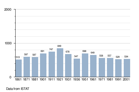
Demographic evolution
References
This article is issued from Wikipedia - version of the 8/16/2016. The text is available under the Creative Commons Attribution/Share Alike but additional terms may apply for the media files.