Old Speck Mountain
| Old Speck Mountain | |
|---|---|
|
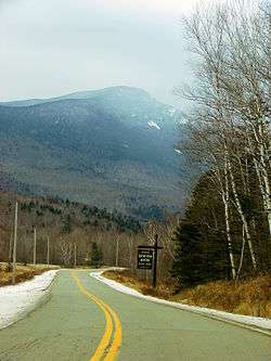
Old Speck Mountain seen from Eyebrow Trail | |
| Highest point | |
| Elevation | 4,170 ft (1,270 m) |
| Prominence | 2,730 ft (830 m) [1] |
| Listing |
New England 4000 footers #13 New England Fifty Finest |
| Coordinates | 44°34.27′N 70°57.22′W / 44.57117°N 70.95367°WCoordinates: 44°34.27′N 70°57.22′W / 44.57117°N 70.95367°W [2] |
| Geography | |
 Old Speck Mountain | |
| Parent range | Mahoosuc Range |
| Topo map | USGS Old Speck Mountain |

Old Speck Mountain is a mountain located in Oxford County, Maine, United States.[3] The mountain, the fourth-highest in the state, is the northeasternmost and highest of the Mahoosuc Range, the northeasternmost part of the White Mountains. Old Speck is flanked to the southwest by Mahoosuc Arm, and faces Baldpate Mountain to the northeast across Grafton Notch.
Old Speck is within the watershed of the Androscoggin River, which drains into Merrymeeting Bay, the estuary of the Kennebec River, and then into the Gulf of Maine. The north and east faces of Old Speck drain into the Bear River, then into the Androscoggin. The southeast and southwest faces drain into the Bull Branch of Goose Eye Brook, then into the Sunday River and the Androscoggin. The northwest face drains into Silver Stream, then into Chickwolnepy Stream and the Androscoggin.
The summit of Old Speck is on the southern boundary of Grafton Notch State Park. The Appalachian Trail, a 2,170-mile (3,490 km) National Scenic Trail from Georgia to Maine, runs along the Mahoosuc Range, 0.3 miles (0.5 km) west of the summit of Old Speck. A short side trail runs from the Appalachian Trail to the summit of the mountain. There is a fire tower, which is no longer used for fire spotting but is now used to obtain a better view (from the ground, views are limited as the summit is wooded, but an excellent 360 degree view is present for those who ascend the fire tower). Speck Pond is located below the mountain's summit, at 3,400 feet (1,000 m), and provides an ideal spot for the more adventurous of fly fishers, because it is annually stocked with brook trout. The Appalachian Trail descends 1.1 miles (1.8 km) from a location near the summit of Old Speck Mountain to the pond.
See also
References
- ↑ "Old Speck, Maine". Peakbagger.com.
- ↑ U.S. Geological Survey Geographic Names Information System: Old Speck
- ↑ "Old Speck". SummitPost.org.