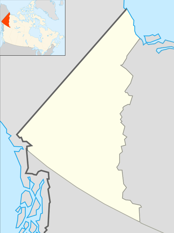
Old Crow, Yukon
| Old Crow Teechik | |
|---|---|
 | |
 Old Crow  Old Crow | |
| Coordinates: 67°34′N 139°48′W / 67.567°N 139.800°WCoordinates: 67°34′N 139°48′W / 67.567°N 139.800°W | |
| Country | Canada |
| Territory | Yukon |
| Area[1] | |
| • Land | 14.17 km2 (5.47 sq mi) |
| Population (2011)[1] | |
| • Total | 245 |
| • Density | 17.3/km2 (45/sq mi) |
| • Change 2006-11 |
|
| Time zone | Pacific (PST) (UTC-8) |
| • Summer (DST) | PDT (UTC-7) |
| Canadian Postal code | Y0B 1N0 |
| Area code(s) | 867 |
| Telephone exchange | 966 |
Old Crow (Teechik[2] in Gwich’in) is a dry community in the Canadian Territory of Yukon and is a periglacial environment. It had 245 inhabitants as of 2011, most of them belonging to the Gwichʼin-speaking Aboriginal Vuntut Gwitchin First Nation. The community is situated on the Porcupine River in the far north of the territory. Old Crow is the only Yukon community that cannot be reached by car, requiring visitors to fly in to Old Crow Airport in order to reach it.
History
A large number of apparently human modified animal bones have been discovered in the Old Crow area, notably at Bluefish Caves, located near the shores of the Arctic Ocean, that have been dated to 25,000-40,000 years ago by carbon dating, several thousand years earlier than generally accepted human habitation of North America.[3]
An indigenous chief named Deetru` K`avihdik, literally "Crow-May-I-Walk", helped settle a community here around the 1870s. The town was named after him.[4] The village was founded around muskrat trapping, which continues to provide basic income.
The people of Old Crow are dependent on the Porcupine caribou herd for food and clothing.[5] The Porcupine caribou herd migrates to the coastal plain in the Arctic National Wildlife Refuge (ANWR) in Alaska to give birth to their young. Many citizens of Old Crow believe the herd is being seriously threatened by oil-drilling in the ANWR and have been heavily involved in lobbying to prevent it.
Transportation
Old Crow Airport provides year-round transportation to other communities. During winter time, a temporary winter road is sometimes built to transport freight into Old Crow; it is not annual, but only when a significant need arises such as a major building project.[6]
Communications
Old Crow is served by Northwestel since 1971. The long distance connection originally relied on a microwave relay at Rat Pass near the Yukon/NWT border, which also provide a radio-telephone base station along the Dempster Highway, but it was frequently out of service in winter when weather conditions made helicopter access hazardous. In the late 1980s, a satellite ground station was installed in Old Crow, providing more reliable service.
The long distance connection is noteworthy for two minor incidents. In 1985, the Yukon territorial election was covered by live television coverage for the first time, sent by satellite to Toronto for switching into the network stations in the Yukon; however, results from Old Crow were unavailable due to the microwave failure. On 11 September 2001, the satellite connection went out of service, and an aircraft bringing a technician to repair it was challenged by Canadian Forces aircraft for violating the closure of airspace throughout North America.
The community operated its own television transmitter to carry CBC television signals from satellite. The current status of this transmitter is unknown since the CBC in 2012 closed down analog transmitters it owned. The community has APTN television, as well as CHON-FM and CKRW transmitters and a community-owned transmitter picking up CBC station CHAK-AM in Inuvik.
Climate

Old Crow has a cold subarctic climate. Average annual temperature is −8.3 °C (17.1 °F).[7] Old Crow experiences annual temperature average daily highs of 20.2 °C (68.4 °F) in July and average daily lows of −33.5 °C (−28.3 °F) in January.[7] Record high temperature was 32.8 °C (91.0 °F) on August 30, 1976 and the lowest was −59.4 °C (−74.9 °F) on January 5, 1975.[7] Old Crow has little precipitation with an average annual snowfall of 141.4 centimetres (55.67 in) and 154.8 millimetres (6.09 in) of rainfall.[7]
As Old Crow is located north of the Arctic Circle, it experiences polar day or midnight sun in summer and polar night in winter. The midnight sun is typically between May 5 and August 8 inclusive, while the polar night usually starts around December 14 and ends by December 29.[8]
| Climate data for Old Crow Airport, 1981–2010 normals, extremes 1951–present | |||||||||||||
|---|---|---|---|---|---|---|---|---|---|---|---|---|---|
| Month | Jan | Feb | Mar | Apr | May | Jun | Jul | Aug | Sep | Oct | Nov | Dec | Year |
| Record high °C (°F) | 2.5 (36.5) |
3.0 (37.4) |
6.7 (44.1) |
15.9 (60.6) |
28.1 (82.6) |
32.3 (90.1) |
32.4 (90.3) |
32.8 (91) |
23.9 (75) |
17.5 (63.5) |
6.1 (43) |
1.7 (35.1) |
32.8 (91) |
| Average high °C (°F) | −25.2 (−13.4) |
−21.7 (−7.1) |
−14.8 (5.4) |
−3.7 (25.3) |
8.4 (47.1) |
19.1 (66.4) |
20.2 (68.4) |
16.2 (61.2) |
7.9 (46.2) |
−5.3 (22.5) |
−19.0 (−2.2) |
−20.7 (−5.3) |
−3.2 (26.2) |
| Daily mean °C (°F) | −29.2 (−20.6) |
−26.5 (−15.7) |
−21.2 (−6.2) |
−10.1 (13.8) |
2.7 (36.9) |
12.9 (55.2) |
14.6 (58.3) |
10.9 (51.6) |
3.5 (38.3) |
−8.8 (16.2) |
−22.9 (−9.2) |
−25.1 (−13.2) |
−8.3 (17.1) |
| Average low °C (°F) | −33.5 (−28.3) |
−31.1 (−24) |
−27.6 (−17.7) |
−16.5 (2.3) |
−3.0 (26.6) |
6.6 (43.9) |
8.9 (48) |
5.4 (41.7) |
−0.9 (30.4) |
−12.2 (10) |
−27.1 (−16.8) |
−29.6 (−21.3) |
−13.4 (7.9) |
| Record low °C (°F) | −59.4 (−74.9) |
−54.4 (−65.9) |
−48.3 (−54.9) |
−39.5 (−39.1) |
−28.0 (−18.4) |
−8.3 (17.1) |
−2.5 (27.5) |
−9.5 (14.9) |
−22.5 (−8.5) |
−38.0 (−36.4) |
−47.0 (−52.6) |
−56.7 (−70.1) |
−59.4 (−74.9) |
| Average precipitation mm (inches) | 13.1 (0.516) |
13.8 (0.543) |
14.4 (0.567) |
9.5 (0.374) |
14.4 (0.567) |
37.2 (1.465) |
43.5 (1.713) |
46.7 (1.839) |
29.0 (1.142) |
22.1 (0.87) |
18.1 (0.713) |
16.7 (0.657) |
278.6 (10.969) |
| Average rainfall mm (inches) | 0.0 (0) |
0.1 (0.004) |
0.0 (0) |
0.7 (0.028) |
8.3 (0.327) |
34.5 (1.358) |
43.5 (1.713) |
45.8 (1.803) |
20.0 (0.787) |
2.0 (0.079) |
0.0 (0) |
0.0 (0) |
154.8 (6.094) |
| Average snowfall cm (inches) | 15.5 (6.1) |
16.4 (6.46) |
16.6 (6.54) |
9.7 (3.82) |
6.6 (2.6) |
2.8 (1.1) |
0.0 (0) |
1.0 (0.39) |
9.3 (3.66) |
23.0 (9.06) |
21.6 (8.5) |
18.9 (7.44) |
141.4 (55.67) |
| Average precipitation days (≥ 0.2 mm) | 9.2 | 9.6 | 9.4 | 6.6 | 6.3 | 10.8 | 13.6 | 14.4 | 12.6 | 13.6 | 11.9 | 11.4 | 129.3 |
| Average rainy days (≥ 0.2 mm) | 0.0 | 0.0 | 0.0 | 0.6 | 3.6 | 10.5 | 13.6 | 14.3 | 9.3 | 1.0 | 0.0 | 0.0 | 53.0 |
| Average snowy days (≥ 0.2 cm) | 10.0 | 9.9 | 9.5 | 6.2 | 3.1 | 0.8 | 0.0 | 0.4 | 3.9 | 13.2 | 12.6 | 11.8 | 81.5 |
| Average relative humidity (%) | 78.7 | 76.5 | 77.0 | 70.4 | 54.6 | 47.0 | 53.3 | 60.2 | 66.5 | 80.3 | 79.5 | 78.9 | 68.6 |
| Source: Environment Canada[7][9][10][11][12][13] | |||||||||||||
Population data
| Canada census – Old Crow, Yukon community profile | |||
|---|---|---|---|
| 2011 | 2006 | ||
| Population: | 245 (-3.2% from 2006) | 253 (-15.4% from 2001) | |
| Land area: | 14.17 km2 (5.47 sq mi) | 14.15 km2 (5.46 sq mi) | |
| Population density: | 17.3/km2 (45/sq mi) | 17.9/km2 (46/sq mi) | |
| Median age: | N/A (M: 39.0, F: 39.5) | ||
| Total private dwellings: | 162 | 153 | |
| Median household income: | $28,244 | ||
| References: 2011[14] 2006[15] | |||
| Historical populations | ||
|---|---|---|
| Year | Pop. | ±% |
| 1991 | 256 | — |
| 1996 | 278 | +8.6% |
| 2001 | 299 | +7.6% |
| 2006 | 253 | −15.4% |
| 2011 | 245 | −3.2% |
Notable residents
Edith Josie, journalist
References
- 1 2 Population and dwelling counts, for Canada, provinces and territories, and census subdivisions (municipalities), 2011 and 2006 censuses
- ↑ ANLC : Alaska Native Place Names
- ↑ Morlan, R.E. (1986), Pleistocene archaeology in Old Crow Basin: a critical reappraisal. In Bryan, A.L.,ed. New Evidence for the Pleistocene Peopling of the Americas. Orono, Maine,Center for the study of Early Man, pp.27-48.
- ↑ http://www.oldcrow.ca/history.htm
- ↑ Fralic, Shelley (5 November 2009). "Olympic celebration and survival in Old Crow". National Post. Retrieved 4 February 2011.
- ↑ "Old Crow winter road challenges truckers". CBC News. 2014-03-03.
- 1 2 3 4 5 "Old Crow A". Canadian Climate Normals 1981–2010. Environment Canada. Climate ID: 2100800. Retrieved 25 July 2016.
- ↑ Sunrise Sunset Old Crow 2012
- ↑ "Old Crow RCS". Canadian Climate Data. Environment Canada. Climate ID: 2100805. Retrieved 25 July 2016.
- ↑ "Daily Data Report for April 2009". Canadian Climate Data. Environment Canada. Climate ID: 2100805. Retrieved 25 July 2016.
- ↑ "Daily Data Report for May 2010". Canadian Climate Data. Environment Canada. Climate ID: 2100805. Retrieved 25 July 2016.
- ↑ "Daily Data Report for June 2004". Canadian Climate Data. Environment Canada. Climate ID: 2100805. Retrieved 25 July 2016.
- ↑ "Daily Data Report for July 1998". Canadian Climate Data. Environment Canada. Climate ID: 2100805. Retrieved 25 July 2016.
- ↑ "2011 Community Profiles". Canada 2011 Census. Statistics Canada. July 5, 2013. Retrieved 2012-05-14.
- ↑ "2006 Community Profiles". Canada 2006 Census. Statistics Canada. March 30, 2011. Retrieved 2009-02-24.
Further reading
- Josie, Edith. Old Crow News: The Best of Edith Josie, 1964. Whitehorse, Yukon: Whitehorse Star, 1964.
- McSkimming, Robert James. Territory, Territoriality and Cultural Change in an Indigenous Society: Old Crow, Yukon Territory. [S.l: s.n.], 1975.
External links
| Wikimedia Commons has media related to Old Crow, Yukon. |
- Old Crow's official website
- Vuntut Gwitchin Government website
- Old Crow: Land of the Vuntut Gwitch'in
- Community profile
- Webpage about the Old Crow Airport on the Canadian Owners & Pilots Association Places to Fly Airport Directory
- Watch The Challenge in Old Crow, a National Film Board of Canada documentary
| Regions | |
|---|---|
| Municipalities | |
| Communities | |
| Ghost towns | |
| Parks | |
| |