Okha Port
| Okha Port Okha port | |
|---|---|
| city | |
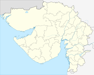 Okha Port  Okha Port Location in Gujarat, India | |
| Coordinates: 22°28′00″N 69°05′00″E / 22.4667°N 69.0833°ECoordinates: 22°28′00″N 69°05′00″E / 22.4667°N 69.0833°E | |
| Country |
|
| State | Gujarat |
| District | Jamnagar |
| Population (2001) | |
| • Total | 18,847 |
| Languages | |
| • Official | Gujarati, Hindi |
| Time zone | IST (UTC+5:30) |
| Vehicle registration | GJ |
| Website |
gujaratindia |
Okha port is a census town in Jamnagar district in the Indian state of Gujarat.
Demographics
As of 2001 India census,[1] Okha port had a population of 18,847. Males constitute 55% of the population and females 45%. Okha port has an average literacy rate of 60%, higher than the national average of 59.5%: male literacy is 70%, and female literacy is 48%. In Okha port, 13% of the population is under 6 years of age.
It is located at the sea coast and Pakistan is quite close to the Port of Okha. Okha has Coast Guard as well as Navy protecting the sea border which has been very helpful during wars in the past. Import - Export business is carried out in a large scale which mainly consists of the aluminium ore bauxite and the chemicals manufactured at Tata Chemicals Limited situated in Mithapur (10 km away)
Interesting Places Beyt Dwarka is a pilgrimage place to visit which is just 2 km away from Okha Nageshwar, one of the 12 jyotilings of Lord Shiva is at a distance of 22 km from Okha Dwarka, the golden city of Lord Krishna is 30 km from Okha
Now in 2014 Okha comes Under New District name "DevBhumi Dwarka".
References
- ↑ "Census of India 2001: Data from the 2001 Census, including cities, villages and towns (Provisional)". Census Commission of India. Archived from the original on 2004-06-16. Retrieved 2008-11-01.