Ohatchee, Alabama
| Ohatchee, Alabama | |
|---|---|
| Town | |
 Location in Calhoun County and the state of Alabama | |
| Coordinates: 33°48′11″N 86°2′12″W / 33.80306°N 86.03667°W | |
| Country | United States |
| State | Alabama |
| County | Calhoun |
| Area | |
| • Total | 5.9 sq mi (15.4 km2) |
| • Land | 5.9 sq mi (15.3 km2) |
| • Water | 0.04 sq mi (0.1 km2) |
| Elevation | 509 ft (155 m) |
| Population (2010) | |
| • Total | 1,170 |
| • Density | 198/sq mi (76.5/km2) |
| Time zone | Central (CST) (UTC-6) |
| • Summer (DST) | CDT (UTC-5) |
| ZIP code | 36271 |
| Area code | 256 |
| FIPS code | 01-56472 |
| GNIS feature ID | 0124185 |
| Website | https://www.facebook.com/OhatcheePolice/ |
Ohatchee (inc. 1956) is a town in Calhoun County, Alabama, United States. At the 2010 census the population was 1,170.[1] It is included in the Anniston–Oxford, Alabama Metropolitan Statistical Area.
History
Andrew Jackson used the area around present-day Ohatchee to prepare for the Battle of Talladega. It was at this battle that Jackson found an Indian boy next to the body of his mother. Jackson adopted the child, naming him Lyncoya Jackson. Lyncoya died of tuberculosis in 1828 at the age of sixteen.[2][3] The site of the battle is marked with a large stone marker along Alabama Highway 144 between Alexandria and Ohatchee, near Tallaseehatchee Creek.
Between 1863 and 1864, Alfred A. Janney built a furnace, now named Janney Furnace, to produce pig iron for the Confederate States of America during the Civil War.[4] The furnace never went into production, but locals often speak of the quality of the construction because the structure was supposedly built by slaves. The site is now a part of the Calhoun County Park System and features a Civil War memorial alongside a Civil War and Native American museum. The site hosts a town festival every year that includes vendors, children's activities, music, and a Civil War reenactment.
Ohatchee became an incorporated town in 1956.
Geography
Ohatchee is located in western Calhoun County at 33°48'10.944" North, 86°2'11.864" West (33.803040, -86.036629).[5] The town center lies just north of the confluence of Tallaseehatchee Creek with Ohatchee Creek, a tributary of the Coosa River. A northwest extension of the town limits reaches to the shores of the Coosa River along Neely Henry Lake.
According to the U.S. Census Bureau, the town has a total area of 5.9 square miles (15.4 km2), of which 5.9 square miles (15.3 km2) is land and 0.039 square miles (0.1 km2), or 0.69%, is water.[1]
Demographics
| Historical population | |||
|---|---|---|---|
| Census | Pop. | %± | |
| 1960 | 437 | — | |
| 1970 | 445 | 1.8% | |
| 1980 | 860 | 93.3% | |
| 1990 | 1,042 | 21.2% | |
| 2000 | 1,215 | 16.6% | |
| 2010 | 1,170 | −3.7% | |
| Est. 2015 | 1,146 | [6] | −2.1% |
| U.S. Decennial Census[7] 2013 Estimate[8] | |||
As of the census[9] of 2010, there were 1,170 people, 474 households, and 361 families residing in the town. The population density was 198 people per square mile (76.5/km²). There were 571 housing units at an average density of 96.8 per square mile (63.1/km²). The racial makeup of the town was 94.1% White, 3.2% Black or African American, 0.6% Native American, 0.0% Asian, and 2.1% from two or more races. 0.6% of the population were Hispanic or Latino of any race.
There were 474 households out of which 25.5% had children under the age of 18 living with them, 61.8% were married couples living together, 9.9% had a female householder with no husband present, and 23.8% were non-families. 22.2% of all households were made up of individuals and 8.3% had someone living alone who was 65 years of age or older. The average household size was 2.47 and the average family size was 2.84.
In the town the age distribution of the population shows 21.1% under the age of 18, 7.1% from 18 to 24, 22.6% from 25 to 44, 35.0% from 45 to 64, and 14.1% who were 65 years of age or older. The median age was 44.4 years. For every 100 females there were 105.3 males. For every 100 females age 18 and over, there were 99.0 males.
The median income for a household in the town was $55,769, and the median income for a family was $62,266. Males had a median income of $50,817 versus $26,563 for females. The per capita income for the town was $23,041. About 3.4% of families and 4.6% of the population were below the poverty line, including 1.6% of those under age 18 and 8.1% of those age 65 or over.
Notable people
- Clyde Propst, American football coach
- Robert Bruce Propst, United States federal judge
- Rush Propst, head coach of football at Colquitt County High School in Moultrie, Georgia. He is the former head coach of the team at Hoover High School in Hoover, Alabama
- Tom Sims, co-wrote the comic strip Popeye from 1938 to 1955 with Bela Zaboly.[10]
- Rev. Homer Longoria (World Renowned Gospel preacher.)
References
- 1 2 "Geographic Identifiers: 2010 Demographic Profile Data (G001): Ohatchee town, Alabama". U.S. Census Bureau, American Factfinder. Retrieved June 2, 2014.
- ↑ Rachel Donelson Robards Jackson. From: National First Ladies' Library. Retrieved October 27, 2010.
- ↑ Rachel Jackson.
- ↑ About Janney Furnace
- ↑ "US Gazetteer files: 2010, 2000, and 1990". United States Census Bureau. 2011-02-12. Retrieved 2011-04-23.
- ↑ "Annual Estimates of the Resident Population for Incorporated Places: April 1, 2010 to July 1, 2015". Retrieved July 2, 2016.
- ↑ "U.S. Decennial Census". Census.gov. Archived from the original on May 11, 2015. Retrieved June 6, 2013.
- ↑ "Annual Estimates of the Resident Population: April 1, 2010 to July 1, 2013". Retrieved June 3, 2014.
- ↑ "American FactFinder". United States Census Bureau. Archived from the original on September 11, 2013. Retrieved 2015-07-10.
- ↑ Popeye, Alabama's Sailor Man | AL.com
Coordinates: 33°48′11″N 86°02′12″W / 33.80304°N 86.036629°W
Municipalities and communities of Calhoun County, Alabama, United States | ||
|---|---|---|
| Cities | 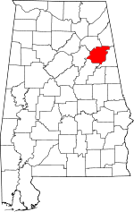 | |
| Towns | ||
| CDPs | ||
| Unincorporated communities | ||
| Ghost town | ||
| Footnotes | ‡This populated place also has portions in an adjacent county or counties | |