Ochlenberg
| Ochlenberg | |
|---|---|
 Ochlenberg | |
|
Location of Ochlenberg 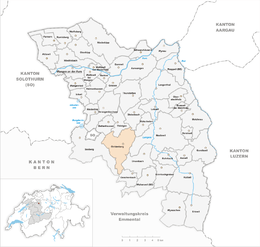 | |
| Coordinates: 47°9′N 7°44′E / 47.150°N 7.733°ECoordinates: 47°9′N 7°44′E / 47.150°N 7.733°E | |
| Country | Switzerland |
| Canton | Bern |
| District | Oberaargau |
| Area[1] | |
| • Total | 12.13 km2 (4.68 sq mi) |
| Elevation | 580 m (1,900 ft) |
| Population (Dec 2015[2]) | |
| • Total | 573 |
| • Density | 47/km2 (120/sq mi) |
| Postal code | 3367 |
| SFOS number | 0985 |
| Surrounded by | Bleienbach, Bollodingen, Hermiswil, Leimiswil, Oeschenbach, Rütschelen, Seeberg, Thörigen, Ursenbach, Wynigen |
| Website |
http://www.ochlenberg.ch SFSO statistics |
Ochlenberg is a municipality in the Oberaargau administrative district in the canton of Bern in Switzerland.
History
Ochlenberg is first mentioned in 1612 as Ochliberg.[3]
Geography
Ochlenberg has an area, as of 2009, of 12.13 square kilometers (4.68 sq mi). Of this area, 7.61 km2 (2.94 sq mi) or 62.7% is used for agricultural purposes, while 3.93 km2 (1.52 sq mi) or 32.4% is forested. Of the rest of the land, 0.52 km2 (0.20 sq mi) or 4.3% is settled (buildings or roads), 0.02 km2 (4.9 acres) or 0.2% is either rivers or lakes.[4]
Of the built up area, housing and buildings made up 2.5% and transportation infrastructure made up 1.7%. Out of the forested land, 31.3% of the total land area is heavily forested and 1.1% is covered with orchards or small clusters of trees. Of the agricultural land, 31.2% is used for growing crops and 29.2% is pastures, while 2.4% is used for orchards or vine crops. All the water in the municipality is in rivers and streams.[4]
Demographics
Ochlenberg has a population (as of 31 December 2015) of 573.[5] As of 2007, 1.0% of the population was made up of foreign nationals. Over the last 10 years the population has decreased at a rate of -11.9%. Most of the population (as of 2000) speaks German (99.4%), with French being second most common ( 0.5%) and Russian being third ( 0.2%).
In the 2007 election the most popular party was the SVP which received 65.6% of the vote. The next three most popular parties were the CSP (9.9%), the SPS (6.8%) and the Green Party (6.6%).
The age distribution of the population (as of 2000) is children and teenagers (0–19 years old) make up 25.6% of the population, while adults (20–64 years old) make up 54.3% and seniors (over 64 years old) make up 20.1%. In Ochlenberg about 79.9% of the population (between age 25-64) have completed either non-mandatory upper secondary education or additional higher education (either university or a Fachhochschule).
Ochlenberg has an unemployment rate of 0.55%. As of 2005, there were 212 people employed in the primary economic sector and about 67 businesses involved in this sector. 4 people are employed in the secondary sector and there are 3 businesses in this sector. 9 people are employed in the tertiary sector, with 4 businesses in this sector.[6] The historical population is given in the following table:[3]
| year | population |
|---|---|
| 1764 | 666 |
| 1850 | 1,093 |
| 1900 | 914 |
| 1950 | 839 |
| 2000 | 641 |
References
- ↑ Arealstatistik Standard - Gemeindedaten nach 4 Hauptbereichen
- ↑ Swiss Federal Statistical Office - STAT-TAB, online database – Ständige und nichtständige Wohnbevölkerung nach institutionellen Gliederungen, Geburtsort und Staatsangehörigkeit (German) accessed 30 August 2016
- 1 2 Ochlenberg in German, French and Italian in the online Historical Dictionary of Switzerland.
- 1 2 Swiss Federal Statistical Office-Land Use Statistics 2009 data (German) accessed 25 March 2010
- ↑ Swiss Federal Statistical Office - STAT-TAB, online database – Ständige und nichtständige Wohnbevölkerung nach institutionellen Gliederungen, Geburtsort und Staatsangehörigkeit (German) accessed 30 August 2016
- ↑ Swiss Federal Statistical Office accessed 21-Jul-2009
External links
| Wikimedia Commons has media related to Ochlenberg. |
- Ochlenberg in German, French and Italian in the online Historical Dictionary of Switzerland.