Oban Airport
| Oban Airport North Connel Airport | |||||||||||
|---|---|---|---|---|---|---|---|---|---|---|---|
|
Oban Airport from 600 ft (180 m) | |||||||||||
| IATA: OBN – ICAO: EGEO | |||||||||||
| Summary | |||||||||||
| Airport type | Public | ||||||||||
| Operator | Argyll and Bute Council | ||||||||||
| Serves | Oban | ||||||||||
| Location | North Connel, Argyll and Bute | ||||||||||
| Elevation AMSL | 24 ft / 7 m | ||||||||||
| Coordinates | 56°27′49″N 005°24′00″W / 56.46361°N 5.40000°WCoordinates: 56°27′49″N 005°24′00″W / 56.46361°N 5.40000°W | ||||||||||
| Website | http://obanandtheislesairports.com/ | ||||||||||
| Map | |||||||||||
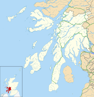 EGEO Location in Argyll and Bute | |||||||||||
| Runways | |||||||||||
| |||||||||||

Oban Airport (IATA: OBN, ICAO: EGEO) is located 5 nautical miles (9.3 km; 5.8 mi) northeast[1] of Oban, near the village of North Connel, Argyll and Bute, Scotland. Operated by Argyll and Bute council, it has a CAA licence as a commercial airport following recent upgrading. Currently Hebridean Air Services[2] is the only airline based at Oban. It operates scheduled flights on two routes, to the Isles of Colonsay and Islay return and to the Isles of Coll and Tiree return.
Sightseeing flights also operate out of Oban Airport by Fly Scenic Scotland & Border Air throughout the year, with trips around the Loch Linnhe area. Flights include sites such as the Oban, Gulf of Corryvreckan, Tobermory, Castle Stalker and The Bridge over the Atlantic.
Oban airport links the mainland with the islands of Coll, Colonsay, Islay and Tiree.[3] The airstrips on the Islands of Coll and Colonsay, also operated by Argyll and Bute council, have benefitted from extensive upgrading to enable them to attain CAA licensing in 2008 to allow for commercial traffic.[4] Scheduled flights began in 2008.[5][6]
Airlines and destinations
| Airlines | Destinations |
|---|---|
| Hebridean Air Services | Coll, Colonsay, Islay, Tiree |
Incidents
In April 2007, three people were killed after their light aircraft crashed after take-off from the airport. Their destination was Andrewsfield Aerodrome,[7] England.
Controversy
There has been controversy about the running of the airport by Argyll and Bute Council, mainly in the letters and news pages of The Oban Times. It is claimed that costs have soared and the amount of traffic dropped since the takeover.[8] In 2008, police looked into the possible sabotage of an airport fire appliance.[9]
There was further controversy in July 2009 when Argyll Aero Club 'PK' erected a fence around the land that it leases from the airport. The council claimed this reduced the length of the runway meaning fixed wing ambulance flights cannot land.[10]
References
- 1 2 "NATS - AIS - Home". Retrieved 2 February 2015.
- ↑ "Air Charter". Hebridean Air Services. Retrieved 2 February 2015.
- ↑ "Destinations". Oban and the Isles Airport. Retrieved 27 September 2014.
- ↑ "Oban Airport Gateway to the skies". Argyll and Bute Council. Retrieved 27 September 2014.
- ↑ "Islands flights set for take off". BBC News. BBC. 10 June 2008.
- ↑ "Take-off for 'lifeline' flights". BBC News. BBC. 16 June 2008.
- ↑ "Piper PA-28R-201T Turbo Cherokee Arrow III, G-JMTT". Air Accident Investigation Branch. June 2008. Retrieved 29 October 2014.
- ↑ Oban Times
- ↑ "Police probe fire engine sabotage". BBC News. BBC. 6 March 2008.
- ↑ Press and Journal, 2 July 2009, Furious row between council and aero club after runway shortened
External links
| Wikimedia Commons has media related to Oban Airport. |