Oakfield (village), New York
| Oakfield, New York | |
|---|---|
| Village | |
_highlighted.svg.png) Location in Genesee County and the state of New York. | |
| Coordinates: 43°4′0″N 78°16′13″W / 43.06667°N 78.27028°WCoordinates: 43°4′0″N 78°16′13″W / 43.06667°N 78.27028°W | |
| Country | United States |
| State | New York |
| County | Genesee |
| Area | |
| • Total | 0.7 sq mi (1.7 km2) |
| • Land | 0.7 sq mi (1.7 km2) |
| • Water | 0.0 sq mi (0.0 km2) |
| Elevation | 755 ft (230 m) |
| Population (2010) | |
| • Total | 1,813 |
| • Density | 2,600/sq mi (1,100/km2) |
| Time zone | Eastern (EST) (UTC-5) |
| • Summer (DST) | EDT (UTC-4) |
| ZIP code | 14125 |
| Area code(s) | 585 |
| FIPS code | 36-54155 |
| GNIS feature ID | 0959164 |
Oakfield is a village in Genesee County, New York, United States. As of the 2010 census, the village population was 1,813.
The Village of Oakfield lies within the Town of Oakfield on Genesee County's northern border. The village is at the intersection of Route 63 (Lewiston Road) and Route 262. It is northwest of Batavia.
History
The community was once called "Caryville" and "Plain Brook" in the past. The village was incorporated in 1858, changing its name to "Oakfield" at that time.
Geography
According to the United States Census Bureau, the village has a total area of 0.7 square miles (1.7 km²). None of the area is covered with water.
Demographics
| Historical population | |||
|---|---|---|---|
| Census | Pop. | %± | |
| 1890 | 578 | — | |
| 1900 | 714 | 23.5% | |
| 1910 | 1,226 | 71.7% | |
| 1920 | 1,422 | 16.0% | |
| 1930 | 1,919 | 35.0% | |
| 1940 | 1,876 | −2.2% | |
| 1950 | 1,781 | −5.1% | |
| 1960 | 2,070 | 16.2% | |
| 1970 | 1,964 | −5.1% | |
| 1980 | 1,791 | −8.8% | |
| 1990 | 1,818 | 1.5% | |
| 2000 | 1,805 | −0.7% | |
| 2010 | 1,813 | 0.4% | |
| Est. 2015 | 1,762 | [1] | −2.8% |
As of the census[3] of 2000, there are 1,805 people, 648 households, and 465 families residing in the village. The population density is 2,721.4 people per square mile (1,055.9/km²). There are 702 housing units at an average density of 1,058.4 per square mile (410.7/km²). The racial makeup of the village is 96.95% White, 1.22% Black or African American, 0.06% Native American, 0.22% Asian, 0.66% from other races, and 0.89% from two or more races. 0.94% of the population are Hispanic or Latino of any race.
There are 648 households out of which 39.4% have children under the age of 18 living with them, 57.3% are married couples living together, 11.0% have a female householder with no husband present, and 28.2% are non-families. 22.1% of all households are made up of individuals and 11.4% have someone living alone who is 65 years of age or older. The average household size is 2.77 and the average family size is 3.25.
In the village the population is spread out with 29.7% under the age of 18, 7.5% from 18 to 24, 30.4% from 25 to 44, 19.4% from 45 to 64, and 13.0% who are 65 years of age or older. The median age is 34 years. For every 100 females there are 93.0 males. For every 100 females age 18 and over, there are 88.6 males.
The median income for a household in the village is $40,580, and the median income for a family is $45,270. Males have a median income of $32,981 versus $21,897 for females. The per capita income for the village is $15,962. 11.6% of the population and 8.0% of families are below the poverty line. Out of the total population, 15.8% of those under the age of 18 and 7.8% of those 65 and older are living below the poverty line.
Religion
Religious diversity is low with all religious institutions adhering to Christianity. There are presently five Christian churches in the village.
- Oakfield United Methodist Church
- Oakfield Community Bible Church
- St. Cecilia's Roman Catholic Church
- St. Michael's Episcopal Church
- Genesee Country Church
See also
References
- ↑ "Annual Estimates of the Resident Population for Incorporated Places: April 1, 2010 to July 1, 2015". Retrieved July 2, 2016.
- ↑ "Census of Population and Housing". Census.gov. Archived from the original on May 11, 2015. Retrieved June 4, 2015.
- ↑ "American FactFinder". United States Census Bureau. Archived from the original on September 11, 2013. Retrieved 2008-01-31.
External links
Municipalities and communities of Genesee County, New York, United States | ||
|---|---|---|
| City | 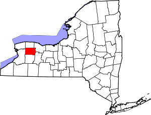 | |
| Towns | ||
| Villages | ||
| CDP |
| |
| Hamlets | ||
| Indian reservation | ||
| Footnotes | ‡This populated place also has portions in an adjacent county or counties | |