Noyers-sur-Jabron
| Noyers-sur-Jabron | ||
|---|---|---|
|
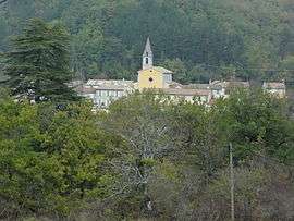
A general view of the village of Noyers-sur-Jabron | ||
| ||
 Noyers-sur-Jabron | ||
|
Location within Provence-A.-C.d'A. region  Noyers-sur-Jabron | ||
| Coordinates: 44°10′11″N 5°50′02″E / 44.1697°N 5.834°ECoordinates: 44°10′11″N 5°50′02″E / 44.1697°N 5.834°E | ||
| Country | France | |
| Region | Provence-Alpes-Côte d'Azur | |
| Department | Alpes-de-Haute-Provence | |
| Arrondissement | Forcalquier | |
| Canton | Noyers-sur-Jabron | |
| Intercommunality | Vallée du Jabron | |
| Government | ||
| • Mayor (2008–2014) | Hervé Dewaele | |
| Area1 | 56.58 km2 (21.85 sq mi) | |
| Population (2008)2 | 398 | |
| • Density | 7.0/km2 (18/sq mi) | |
| Time zone | CET (UTC+1) | |
| • Summer (DST) | CEST (UTC+2) | |
| INSEE/Postal code | 04139 / 04200 | |
| Elevation | 524–1,825 m (1,719–5,988 ft) | |
|
1 French Land Register data, which excludes lakes, ponds, glaciers > 1 km² (0.386 sq mi or 247 acres) and river estuaries. 2 Population without double counting: residents of multiple communes (e.g., students and military personnel) only counted once. | ||

Noyers-sur-Jabron is a commune in the Alpes-de-Haute-Provence department in southeastern France.
Population
| Historical population | ||
|---|---|---|
| Year | Pop. | ±% |
| 1765 | 968 | — |
| 1793 | 1,058 | +9.3% |
| 1800 | 931 | −12.0% |
| 1806 | 1,064 | +14.3% |
| 1821 | 1,107 | +4.0% |
| 1831 | 1,186 | +7.1% |
| 1836 | 1,366 | +15.2% |
| 1841 | 1,254 | −8.2% |
| 1846 | 1,193 | −4.9% |
| 1851 | 1,177 | −1.3% |
| 1856 | 1,092 | −7.2% |
| 1861 | 1,061 | −2.8% |
| 1866 | 995 | −6.2% |
| 1872 | 937 | −5.8% |
| 1876 | 877 | −6.4% |
| 1881 | 898 | +2.4% |
| 1886 | 866 | −3.6% |
| 1891 | 840 | −3.0% |
| 1896 | 797 | −5.1% |
| 1901 | 708 | −11.2% |
| 1906 | 630 | −11.0% |
| 1911 | 565 | −10.3% |
| 1921 | 459 | −18.8% |
| 1926 | 475 | +3.5% |
| 1931 | 437 | −8.0% |
| 1936 | 405 | −7.3% |
| 1946 | 304 | −24.9% |
| 1954 | 272 | −10.5% |
| 1962 | 236 | −13.2% |
| 1968 | 252 | +6.8% |
| 1975 | 232 | −7.9% |
| 1982 | 240 | +3.4% |
| 1990 | 291 | +21.2% |
| 1999 | 337 | +15.8% |
| 2008 | 398 | +18.1% |
See also
References
| Wikimedia Commons has media related to Noyers-sur-Jabron. |
This article is issued from Wikipedia - version of the 2/4/2015. The text is available under the Creative Commons Attribution/Share Alike but additional terms may apply for the media files.