Nowata County, Oklahoma
| Nowata County, Oklahoma | |
|---|---|
 Nowata County Courthouse | |
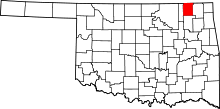 Location in the U.S. state of Oklahoma | |
 Oklahoma's location in the U.S. | |
| Founded | 1907 |
| Seat | Nowata |
| Largest city | Nowata |
| Area | |
| • Total | 581 sq mi (1,505 km2) |
| • Land | 566 sq mi (1,466 km2) |
| • Water | 15 sq mi (39 km2), 2.6% |
| Population (est.) | |
| • (2013) | 10,555 |
| • Density | 19/sq mi (7/km²) |
| Congressional district | 2nd |
| Website |
nowata |
Nowata County is a county located in northeastern Oklahoma. As of the 2010 census, the population was 10,536.[1] Its county seat is Nowata.[2] The county name is derived from a Delaware word "no-we-ata," meaning "come here" or "welcome."[3][4] It is located on the Kansas border.
History

For millennia, the land now known as Oklahoma was inhabited by Native Americans. The Encyclopedia of Oklahoma History and Culture states that archaeological evidence indicates that humans first lived in this area in the Verdigris River valley over six thousand years ago.[3] In the 17th century, white trappers first visiting the area found it occupied mostly by the Osage and Quapaw tribes. It was recognized as Osage territory by the time United States secured it as part of the Louisiana Purchase in 1803. In 1819, the Arkansas Territory was organized, then was split in 1824 and 1828. An 1828 treaty with the Cherokee Nation assigned the area of Nowata County to the Cherokees, who included it in 1856 in their newly created Cooweescoowee District. The Cherokees and the Delaware signed a treaty in 1867 that resulted in Delaware settlements near the present towns of Delaware, Lenapah and Nowata, Oklahoma.[3]
The state of Oklahoma and Nowata County was established in 1907, and the county had a population of 10,453. The town of Nowata was named as county seat.[3] The exact origin is unknown, but the two most common stories are that railroad surveyors used the Delaware word noweta for welcome or that a sign was posted indicating that local springs had no water: No wata.
Geography
According to the U.S. Census Bureau, the county has a total area of 581 square miles (1,500 km2), of which 566 square miles (1,470 km2) is land and 15 square miles (39 km2) (2.6%) is water.[5]
The Verdigris River divides the county into eastern and western halves. Creeks in the extreme western part of the county drain into the Caney River. All other creeks drain into the Verdigris River. Lake Oologah lies partly in this county.[3]
Major highways
Adjacent counties
- Montgomery County, Kansas (north)
- Labette County, Kansas (northeast)
- Craig County (east)
- Rogers County (south)
- Washington County (west)
Demographics
| Historical population | |||
|---|---|---|---|
| Census | Pop. | %± | |
| 1910 | 14,223 | — | |
| 1920 | 15,899 | 11.8% | |
| 1930 | 13,611 | −14.4% | |
| 1940 | 15,774 | 15.9% | |
| 1950 | 12,734 | −19.3% | |
| 1960 | 10,848 | −14.8% | |
| 1970 | 9,773 | −9.9% | |
| 1980 | 11,486 | 17.5% | |
| 1990 | 9,992 | −13.0% | |
| 2000 | 10,569 | 5.8% | |
| 2010 | 10,536 | −0.3% | |
| Est. 2015 | 10,539 | [6] | 0.0% |
| U.S. Decennial Census[7] 1790-1960[8] 1900-1990[9] 1990-2000[10] 2010-2013[1] | |||
As of the census[11] of 2000, there were 10,569 people, 4,147 households, and 2,989 families residing in the county. The population density was 7/km² (19/mi²). There were 4,705 housing units at an average density of 3/km² (8/mi²). The racial makeup of the county was 72.43% White, 2.46% Black or African American, 16.56% Native American, 0.12% Asian, 0.26% from other races, and 8.17% from two or more races. 1.23% of the population were Hispanic or Latino of any race.
There were 4,147 households out of which 31.80% had children under the age of 18 living with them, 58.80% were married couples living together, 9.80% had a female householder with no husband present, and 27.90% were non-families. 25.50% of all households were made up of individuals and 13.30% had someone living alone who was 65 years of age or older. The average household size was 2.50 and the average family size was 2.97.
In the county, the population was spread out with 26.10% under the age of 18, 7.60% from 18 to 24, 25.30% from 25 to 44, 23.70% from 45 to 64, and 17.30% who were 65 years of age or older. The median age was 39 years. For every 100 females there were 96.70 males. For every 100 females age 18 and over, there were 93.20 males.
The median income for a household in the county was $29,470, and the median income for a family was $36,354. Males had a median income of $27,047 versus $19,371 for females. The per capita income for the county was $14,244. About 9.00% of families and 14.10% of the population were below the poverty line, including 18.00% of those under age 18 and 11.30% of those age 65 or over.
Economy
The economy of Nowata County has been based on agriculture. The most important crops are wheat, corn, oats, and sorghum. Cattle raising is also important to the local economy.
Politics
| Voter Registration and Party Enrollment as of January 15, 2016[12] | |||||
|---|---|---|---|---|---|
| Party | Number of Voters | Percentage | |||
| Democratic | 2,695 | 46.35% | |||
| Republican | 2,419 | 41.60% | |||
| Unaffiliated | 701 | 12.06% | |||
| Total | 5,815 | 100% | |||
| Year | Republican | Democrat |
|---|---|---|
| 2012 | 69.48% 2,832 | 30.52% 1,244 |
| 2008 | 68.24% 3,031 | 31.76% 1,411 |
| 2004 | 62.82% 2,805 | 37.18% 1,660 |
| 2000 | 53.75% 2,069 | 44.25% 1,703 |
Communities
- Delaware
- Lenapah
- New Alluwe
- Nowata (county seat)
- South Coffeyville
- Wann
- Childers, Oklahoma
NRHP sites
The followings sites in Nowata County are listed on the National Register of Historic Places:
- Cemetery Patent 110, Delaware
- Diamond Point School, Nowata
- Nowata County Courthouse, Nowata
References
- 1 2 "State & County QuickFacts". United States Census Bureau. Retrieved November 12, 2013.
- ↑ "Find a County". National Association of Counties. Retrieved 2011-06-07.
- 1 2 3 4 5 Cheatham, Gary L. "Nowata County," Encyclopedia of Oklahoma History and Culture, Oklahoma Historical Society, 2009. Accessed April 4, 2015.
- ↑ "Origin of County Names in Oklahoma." In:Chronicles of Oklahoma. Volume 2, Number 1. March 1924. Retrieved October 3, 2013.
- ↑ "2010 Census Gazetteer Files". United States Census Bureau. August 22, 2012. Retrieved February 21, 2015.
- ↑ "County Totals Dataset: Population, Population Change and Estimated Components of Population Change: April 1, 2010 to July 1, 2015". Retrieved July 2, 2016.
- ↑ "U.S. Decennial Census". United States Census Bureau. Retrieved February 21, 2015.
- ↑ "Historical Census Browser". University of Virginia Library. Retrieved February 21, 2015.
- ↑ Forstall, Richard L., ed. (March 27, 1995). "Population of Counties by Decennial Census: 1900 to 1990". United States Census Bureau. Retrieved February 21, 2015.
- ↑ "Census 2000 PHC-T-4. Ranking Tables for Counties: 1990 and 2000" (PDF). United States Census Bureau. April 2, 2001. Retrieved February 21, 2015.
- ↑ "American FactFinder". United States Census Bureau. Retrieved 2008-01-31.
- ↑ https://www.ok.gov/elections/documents/20160115%20-%20Registration%20By%20County%20%28vr2420%29.pdf
- ↑ "Dave Leip's Atlas of U.S. Presidential Elections". Retrieved 2016-03-19.
 |
Montgomery County, Kansas | Labette County, Kansas | | |
| Washington County | |
Craig County | ||
| ||||
| | ||||
| Rogers County |
Municipalities and communities of Nowata County, Oklahoma, United States | ||
|---|---|---|
| City | | |
| Towns | ||
| Unincorporated communities |
| |
| Ghost town | ||
Coordinates: 36°47′N 95°37′W / 36.79°N 95.62°W