Nova Lima
.png)
Belo Horizonte and Environs
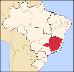
Nova Lima is a municipality of about 87,000 people, whose downtown is located about 20 kilometers of Belo Horizonte, the capital of the south-eastern Brazilian state of Minas Gerais.[4] Mining is one of the main economical activities of the city, including the extraction of Iron Ore and Gold. The most famous mine in the city is Morro Velho (Old Hill), a gold mine of 2700m depth.
Location
Historically, the city was known as known as Campos de Congonhas, Congonhas de Sabará and until 1923 as Villa Nova de Lima.[6] The city belongs to the mesoregion Metropolitana de Belo Horizonte and to the microregion of Belo Horizonte.
The city is home to several mines, including the Morro Velho, Mostardas, and Rio de Peixe mines. A number of minerals are extracted from these and other sites in and around the city, including gold.
The St. John Del Rey Mining Company was founded by British interests in 1834 for the extraction of gold and also caused the settlement of some 150 families from Britain which led to the establishment of the Anglican Church in town.
The municipality contains the 912 hectares (2,250 acres) Mata do Jambreiro Private Natural Heritage Reserve, a protected area operated by the State Forestry Institute in partnership with the MBR mining company.[7]
It also contains a small part of the 31,270 hectares (77,300 acres) Serra do Gandarela National Park, created in 2014.[8]
Sports
The city is home to the Villa Nova Atlético Clube, the second oldest football club of Minas Gerais still active. The club was a major force in the 1930s until the early 1950s and won in that period five state championships. It is still a regular participant in the first division of Minas Gerais. From the late 1920s until the end of the 1930s th Sport Club Retiro also took part in the state championship. With José Perácio in 1938 and Luiz Carlos Ferreira "Luizinho" in 1982 two players born in Nova Lima represented Brazil in World Cups.
Images
St John Del Rey Mining Co., ca. 1868-69
Municipal Chambers
Teatro Municipal
Matriz do Pilar
Main Square
Hospital Nossa Senhora de Lourdes
Quarter of the English
Bicame, aqueduct for gold-washing
See also
References
 |
Wikimedia Commons has media related to Nova Lima. |
|
|---|
|
|
|
| Mesoregion Campo das Vertentes |
|---|
| Barbacena | |
|---|
| Lavras | |
|---|
| São João del Rei | |
|---|
|
| |
|
| Mesoregion Central Mineira |
|---|
| Bom Despacho | |
|---|
| Curvelo | |
|---|
| Três Marias | |
|---|
|
|
|
| Mesoregion Jequitinhonha |
|---|
| Almenara | |
|---|
| Araçuaí | |
|---|
| Capelinha | |
|---|
| Diamantina | |
|---|
| Pedra Azul | |
|---|
|
|
|
| Mesoregion Metropolitana de Belo Horizonte |
|---|
| Belo Horizonte | |
|---|
| Conceição do Mato Dentro | |
|---|
| Conselheiro Lafaiete | |
|---|
| Itabira | |
|---|
| Itaguara | |
|---|
| Ouro Preto | |
|---|
| Pará de Minas | |
|---|
| Sete Lagoas | |
|---|
|
|
|
| Mesoregion Noroeste de Minas |
|---|
| |
|
|
| Mesoregion Norte de Minas |
|---|
| Bocaiúva | |
|---|
| Grão Mogol | |
|---|
| Janaúba | |
|---|
| Januária | |
|---|
| Montes Claros | |
|---|
| Pirapora | |
|---|
| Salinas | |
|---|
|
|
|
| Mesoregion Oeste de Minas |
|---|
| Campo Belo | |
|---|
| Divinópolis | |
|---|
| Formiga | |
|---|
| Oliveira | |
|---|
| Piui | |
|---|
|
|
|
| Mesoregion Sudoeste de Minas |
|---|
| Alfenas | |
|---|
| Andrelândia | |
|---|
| Itajubá | |
|---|
| Passos | |
|---|
| Poços de Caldas | |
|---|
| Pouso Alegre | |
|---|
| Santa Rita do Sapucaí | |
|---|
| São Lourenco | |
|---|
| São Sebastiao do Paraíso | |
|---|
| Varginha | |
|---|
|
|
|
| Mesoregion Triângulo Mineiro/Alto Paranaiba |
|---|
| Araxá | |
|---|
| Frutal | |
|---|
| Ituiutaba | |
|---|
| Patos de Minas | |
|---|
| Patrocínio | |
|---|
| Uberaba | |
|---|
| Uberlândia | |
|---|
|
|
|
| Mesoregion Vale do Mucuri |
|---|
| |
|
|
| Mesoregion Zona da Mata |
|---|
| Cataguases | |
|---|
| Juiz de Fora | |
|---|
| Manhuaçu | |
|---|
| Muriaé | |
|---|
| Ponte Nova | |
|---|
| Ubá | |
|---|
| Viçosa | |
|---|
|
|
|
| Mesoregion Vale do Rio Doce |
|---|
| Aimorés | |
|---|
| Caratinga | |
|---|
| Governador Valadares | |
|---|
| Guanhães | |
|---|
| Ipatinga | |
|---|
| Mantena | |
|---|
| Peçanha | |
|---|
|
|


_-_Vista_parcial.jpg)


_-_St_John_Del_Rey_Mining_Co_-_1869.jpg) St John Del Rey Mining Co., ca. 1868-69
St John Del Rey Mining Co., ca. 1868-69 Municipal Chambers
_-_Teatro_Municipal.jpg) Teatro Municipal
Teatro Municipal_-_Matriz_do_Pilar_at_night.jpg) Matriz do Pilar
Matriz do Pilar_-_Pra%C3%A7a_Principal.jpg) Main Square
Main Square_-_Hospital_Nossa_Senhora_de_Lourdes.jpg) Hospital Nossa Senhora de Lourdes
Hospital Nossa Senhora de Lourdes_-_Bairro_dos_Ingleses.jpg) Quarter of the English
Quarter of the English_-_Bicame.jpg) Bicame, aqueduct for gold-washing
Bicame, aqueduct for gold-washing