Noto Province
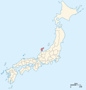
Noto Province (能登国 Noto no Kuni) was an old province in the area that is today the northern part of Ishikawa Prefecture in Japan, including the Noto Peninsula (Noto-hantō) which is surrounded by the Sea of Japan.[1] It was sometimes called Nōshū (能州). Noto bordered on Etchū and Kaga provinces. The ichinomiya of the province was Keta Shrine.
Nanao, Ishikawa was the ancient capital and the main castle town of Noto. For much of the Sengoku Period Noto was ruled by a minor branch of the Maeda clan of Kaga.
Following the Meiji Restoration and the abolition of the han system in 1871, Noto Province was renamed Nanao Prefecture and Imizu District from Etchu Province was added. However, in 1872 Nanao was merged with Kanazawa Prefecture (the former Kaga Province) to form today's Ishikawa Prefecture and Imizu District was given back to Niikawa Prefecture (the renamed Etchu Province).
Maps of Japan and Noto Province were reformed in the 1870s when the prefecture system was introduced.[2] At the same time, the province continued to exist for some purposes. For example, Noto is explicitly recognized in treaties in 1894 (a) between Japan and the United States and (b) between Japan and the United Kingdom.[3]
Historical districts
Noto Province had 4 districts.
- Ishikawa Prefecture
- Fugeshi District (鳳至郡) - dissolved; now the western part of Hōsu District (鳳珠郡)
- Hakui District (羽咋郡)
- Kashima District (鹿島郡)
- Suzu District (珠洲郡) - dissolved; now the eastern part of Hōsu District
Notes
- ↑ Nussbaum, Louis-Frédéric. (2005). "Noto" in Japan Encyclopedia, p. 728, p. 728, at Google Books.
- ↑ Nussbaum, "Provinces and prefectures" at p. 780.
- ↑ US Department of State. (1906). A digest of international law as embodied in diplomatic discussions, treaties and other international agreements (John Bassett Moore, ed.), Vol. 5, p. 759.
References
- Nussbaum, Louis-Frédéric and Käthe Roth. (2005). Japan encyclopedia. Cambridge: Harvard University Press. ISBN 978-0-674-01753-5; OCLC 58053128
- Papinot, Edmond. (1910). Historical and Geographic Dictionary of Japan. Tokyo: Librarie Sansaisha. OCLC 77691250
External links
![]() Media related to Noto Province at Wikimedia Commons
Media related to Noto Province at Wikimedia Commons