Norwich, New York
| Norwich, New York | |
|---|---|
| City | |
 | |
 Location in Chenango County and the state of New York. | |
| Coordinates: 42°31′55″N 75°31′18″W / 42.53194°N 75.52167°WCoordinates: 42°31′55″N 75°31′18″W / 42.53194°N 75.52167°W | |
| Country | United States |
| State | New York |
| County | Chenango |
| Government | |
| • Type | Mayor-Council |
| • Mayor | Christine Carnrike(R) |
| • Common Council |
Members' List
|
| Area | |
| • Total | 2.1 sq mi (5.5 km2) |
| • Land | 2.1 sq mi (5.5 km2) |
| • Water | 0.0 sq mi (0.0 km2) |
| Elevation | 1,014 ft (309 m) |
| Population (2010) | |
| • Total | 7,190 |
| • Density | 3,385/sq mi (1,306.8/km2) |
| Time zone | Eastern (EST) (UTC-5) |
| • Summer (DST) | EDT (UTC-4) |
| ZIP code | 13815 |
| Area code(s) | 607 |
| FIPS code | 36-53979 |
| GNIS feature ID | 0959025 |
| Website |
www |
Norwich is a city in Chenango County, New York, United States. Surrounded on all sides by the town of Norwich,[1] the city is the county seat of Chenango County. The name is taken from Norwich, England.[2] Its population was 7,190 at the 2010 census.[3]
Lt. Warren Eaton Airport (OIC), serving the area, is located north of the city in the town of North Norwich.
History


The first settlers arrived around 1788. The town of Norwich was formed in 1793 from the towns of Union (now in Broome County) and Bainbridge. Afterwards, Norwich, as a "mother town" of the county, lost substantial territory in the formation of new towns. In 1806, Norwich gave up territory to form the towns of Pharsalia, Plymouth and Preston. More of Norwich was lost in 1807 to form parts of the towns of New Berlin and Columbus. In 1808 and 1820, Norwich exchanged territory with the town of Preston.
The central community of Norwich set itself off from the town in 1816 by incorporating as a village, later becoming the city of Norwich in 1914.
Geography
According to the United States Census Bureau, the city has a total area of 2.1 square miles (5.5 km2), all of it land.[3] Unlike many upstate cities, there are few, if any, defined neighborhoods or districts. Although the city is divided into six wards for political purposes, neighborhoods are seldom referred to in this manner.
Downtown is the main commercial district of Norwich, consisting of North and South Broad streets, East and West Main streets, and lesser side streets, including American Avenue, Lackawanna Avenue, and parts of Mechanic, Fair, and Hayes streets. The downtown district is bordered on the north by Cortland and Mitchell streets, and to the south by Front Street and Eaton Avenue.
Norwich is located in upstate New York, in the Chenango River valley. The river, a tributary of the Susquehanna, winds south along the eastern edge of the city. Along the western border, Canasawacta Creek flows south, until it unites with the Chenango River at the southern city limits.
Location
Norwich lies near the center of the triangle that can be drawn connecting the cities of Syracuse, Albany, and Binghamton, along Interstates 90, 88, and 81, respectively. The city is located at the intersection of New York State Route 12 and New York State Route 23. On Route 12, Utica and access to Interstate 90 is 48 miles (77 km) to the north, while Binghamton (and the Triple Cities) and access to Interstate 81 and Interstate 86 (currently New York State Route 17, known as the Southern Tier Expressway), is 40 miles (64 km) to the south. State Highway 23, which cuts laterally through the northern side of the city, leads east 32 miles (51 km) to the city of Oneonta and access to Interstate 88, while to the west NY 23 leads in the direction of Cortland and Interstate 81, 42 miles (68 km) away.
Economy
Route 12 bisects the city on a north-south axis, becoming North and South Broad Street within city limits. A community of downtown businesses is found along it. On the north side of town lies the North Plaza, desolate since the departure of anchor tenant Jamesway, and a commercial strip of gas stations and fast food outlets. To the south are three plazas just outside city limits, featuring supermarkets, gas stations, fast food, a new Lowe's home center and a recently upgraded Super Walmart.
Norwich residents usually travel to the larger nearby cities of Oneonta, Binghamton, Utica, sometimes Cortland, and occasionally the much larger metropolitan areas of Syracuse and Albany, for goods and services unobtainable locally.
Demographics
| Historical population | |||
|---|---|---|---|
| Census | Pop. | %± | |
| 1890 | 5,212 | — | |
| 1900 | 5,766 | 10.6% | |
| 1910 | 7,422 | 28.7% | |
| 1920 | 8,268 | 11.4% | |
| 1930 | 8,378 | 1.3% | |
| 1940 | 8,694 | 3.8% | |
| 1950 | 8,816 | 1.4% | |
| 1960 | 9,175 | 4.1% | |
| 1970 | 8,843 | −3.6% | |
| 1980 | 8,082 | −8.6% | |
| 1990 | 7,613 | −5.8% | |
| 2000 | 7,355 | −3.4% | |
| 2010 | 7,190 | −2.2% | |
| Est. 2015 | 6,968 | [4] | −3.1% |

As of the census of 2000, there were 7,355 people, 3,131 households, and 1,671 families residing in the city. The population density was 3,609.0 people per square mile (1,392.0/km²). There were 3,500 housing units at an average density of 1,717.4 per square mile (662.4/km²). The racial makeup of the city was 96.48% White, 1.39% Black or African American, 0.27% Native American, 0.69% Asian, 0.19% from other races, and 0.98% from two or more races. Hispanic or Latino of any race were 0.68% of the population.[2]
There were 3,131 households out of which 28.6% had children under the age of 18 living with them, 35.6% were married couples living together, 13.4% had a female householder with no husband present, and 46.6% were non-families. 40.2% of all households were made up of individuals and 19.0% had someone living alone who was 65 years of age or older. The average household size was 2.19 and the average family size was 2.95.[2]
In the city the population was spread out with 24.6% under the age of 18, 8.2% from 18 to 24, 26.1% from 25 to 44, 20.0% from 45 to 64, and 21.2% who were 65 years of age or older. The median age was 39 years. For every 100 females there were 78.9 males. For every 100 females age 18 and over, there were 75.0 males.[2]
The median income for a household in the city was $28,485, and the median income for a family was $39,808. Males had a median income of $33,537 versus $24,430 for females. The per capita income for the city was $17,339. About 14.7% of families and 18.7% of the population were below the poverty line, including 28.5% of those under age 18 and 9.2% of those age 65 or over.[2]
Commerce

For nearly a century, the city had important manufacturing firms. It was the corporate headquarters of the Norwich Pharmacal Company. Formed in 1887 as a partnership between Reverend Lafayette Moore and Oscar G. Bell, a drug store employee, the company grew to become a major developer and manufacturer of medicines and veterinary products, known for its Unguentine antiseptic dressing (introduced in 1893) and Pepto-Bismol, an upset-stomach and anti-diarrhea medication (introduced in 1901 under a different name).
The company merged with Morton International, Inc. in 1969 and later became a subsidiary of Procter & Gamble in 1982. Under corporate restructuring, Procter & Gamble divided the company into several units, each of which was subsequently sold. This caused the loss of many jobs in Norwich, resulting in the city struggling to figure out a new economic model.
From 1845 until 1961, Norwich was also the home of the Maydole Hammer Factory. The founder, David Maydole, was an enterprising blacksmith who set out to create a hammer with a safely attached head. His hammers proved so successful that Maydole had become the largest hammer manufacturer in the United States by the time of its founder's death in 1892.
The Chenango Canal, the New York, Ontario and Western Railway, and the Delaware, Lackawanna & Western Railroad (later Erie-Lackawanna) once served most of the city's transportation needs. Norwich was the NYO&W's Northern Division point until operations ceased on March 29, 1957. Until June 2006, the community was served by the New York, Susquehanna and Western Railroad, which operated trains on the old DL&W line between Binghamton and Utica. That service ended as a result of flood damage in 2011 to the portion of the line between Sangerfield and Chenango Forks.


A new $8 million campus was constructed for the city's small extension of Morrisville State College. Due to loss of jobs in the area, population has declined, affecting both admissions and attendance at the college in recent years.
NBT Bancorp and Chobani are both headquartered in Norwich.
Culture
Numerous festivals and events mark the Norwich calendar, with residents looking forward to several annual cultural traditions. Most notable is the Colorscape Chenango Arts Festival, a two-day event in early September that features regional musicians and artists. The festival drew an estimated 15,000 people in 2005. Since 1993, the Chenango Blues Festival, held at the Chenango County Fairgrounds each August, has attracted thousands and featured nationally renowned artists such as Koko Taylor, Luther Allison, and The Fabulous Thunderbirds. Since the early 1990s, the nationally known Gus Macker organization has hosted a 3-on-3 basketball tournament in early July, with hundreds of teams participating each year. Norwich, is also home to Phoenix Project Dance, an internationally touring modern dance company. Phoenix Project Dance has called Norwich home since 2004.
Museums include the Chenango County Historical Society and the Northeast Classic Car Museum, which houses over 150 classic cars, including the world's largest collection of Franklin cars, which were luxury items.
Notable people
- Inventor and dairy pioneer Gail Borden was born in Norwich.
- Actress Calista Flockhart spent part of her childhood in Norwich.
- Former New York Mets pitcher Jon Matlack currently resides in Norwich.
- Pioneering psychiatrist Harry Stack Sullivan was born in Norwich.
- Folk/rock guitarist Ron Palmer, noted for playing in Harry Chapin's supporting band, is from Norwich.
- Classical song composer John Prindle Scott was born in Norwich.
- ESPN the Magazine's Senior Editor Steve Wulf used to live in Norwich and wrote about coming back in a 1993 issue of Sports Illustrated.[6]
- Former U.S. Department of Justice official and Iowa Attorney General, Bonnie Campbell, grew up in Norwich.
Gallery
 Rock wall
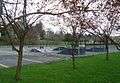 Skateboard park
 Historical society
 Fire station
- Train station
 Train tracks
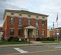 Police station
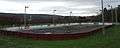 Ice skating rink
 Baseball field
 Town green
References
- ↑ Norwich city (Map). Acme Mapper 2.0. Retrieved 2010-02-14.
- 1 2 3 4 5 "American FactFinder". United States Census Bureau. Retrieved 2008-01-31.
- 1 2 "Geographic Identifiers: 2010 Demographic Profile Data (G001): Norwich city, New York". U.S. Census Bureau, American Factfinder. Retrieved November 18, 2014.
- ↑ "Annual Estimates of the Resident Population for Incorporated Places: April 1, 2010 to July 1, 2015". Retrieved July 2, 2016.
- ↑ "Census of Population and Housing". Census.gov. Retrieved June 4, 2015.
- ↑ Wulf, Steve (1993-12-27) My Kind Of Town, Sports Illustrated
External links
| Wikivoyage has a travel guide for Norwich (New York). |
| Wikimedia Commons has media related to Norwich, New York. |
| Wikisource has the text of a 1921 Collier's Encyclopedia article about Norwich, New York. |
- City of Norwich official website
- Commerce Chenango
- Chenango County Historical Society
- Morrisville State College - Norwich Campus
- Colorscape Chenango Arts Festival
- Chenango Blues Festival
- Northeast Classic Car Museum
- Early history of Norwich area
- Timeline of Norwich Pharmacal Company
-
 "Norwich, a village and the county seat of Chenango co., New York". The American Cyclopædia. 1879.
Municipalities and communities of Chenango County, New York, United States | ||
|---|---|---|
| City | 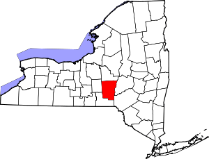 | |
| Towns | ||
| Villages | ||
| CDPs | ||
| Hamlets | ||
| Footnotes | ‡This populated place also has portions in an adjacent county or counties | |