Norwegian trench
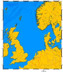
The Norwegian trench or Norwegian channel (Norwegian: Norskerenna; Danish: Norskerenden; Swedish: Norska rännan) is an elongated depression in the sea floor off the southern coast of Norway. It reaches from the Stad peninsula in Sogn og Fjordane in the northwest to the Oslofjord in the southeast. The trench is between 50 and 95 kilometres wide and up to 700 metres deep. Off the Rogaland coast it is 250 – 300 metres deep, and its deepest point is off Arendal where it reaches 700 metres deep – an abyss compared to the average depth of the North Sea, which is about 100 metres.
It was formed during the last 1.1 Ma by the effects of erosion associated with repeated ice stream activity. [1] The trench is not a subduction-related oceanic trench, where one tectonic plate is being forced under another. The Norwegian Trench was created by fluvial erosion processes during the later Tertiary age. Pleistocene glaciers and ice-sheets further deepened the trench.[2] During the main glaciations, the Skagerrak Trough was the meeting point for ice from southeastern Norway, southern Sweden and parts of the Baltic causing a relatively fast-moving ice stream that passed south of the Norwegian coast and then turned north, eventually reaching deepwater at about 62°N. The material carried by the ice stream was then deposited in the North Sea fan. Glacial erratics such as flint and rhomb porphyry, thought to originate from the Skagerrak and Oslo areas respectively,[3] and deformed glacial tills found on the coast of Jæren provide the main onshore evidence for the Norwegian Channel Ice Stream.
The Norwegian current generally flows northeasterly along the Norwegian trench. The depth of the trench, along with density differences between Norwegian current water and the adjacent Atlantic Water, also result in large scale eddies. The Norwegian trench region in the Skagerrak is a biologically productive zone, as upwelling of North Atlantic water in the Skagerrak provides an input of nutrients.
The trench has provided an obstacle for oil and gas pipelines.[4]
References
- ↑ Sejrup,H.P., Larsen,E., Haflidason,H., Berstad,I.M.; Berit O. Hjelstuen,B.O., Jonsdottir,H.E., King,E.L., Jon Landvik,J., Longva,L., NygÅrd,A., Ottesen,D., Raunholm,S., Rise,L. & Stalsberg,K. 2003. Configuration, history and impact of the Norwegian Channel Ice Stream. Boreas, 32, 18-36.
- ↑ Judd, Alan; Martin Hovland (2007). Seabed Fluid Flow: The Impact of Geology, Biology And the Marine Environment (Digitized by Google Books online). Bath, UK: Cambridge University Press. p. 10. ISBN 978-0-521-81950-3. Retrieved 2009-01-10.
- ↑ Raunholm,S., Larsen,E. & Sejrup,H.P. 2004. Weichselian interstadial sediments on Jæren (SW Norway) – paleoenvironments and implications for ice sheet configuration. Norwegian Journal of Geology, 84, 91-106.
- ↑ Gjerde K.Ø. & Hadland G. "Gas pipeline to continental Europe". Retrieved 17 October 2015.
Coordinates: 60°00′N 4°00′E / 60.0°N 4.0°E