Huron County, Ohio
| Huron County, Ohio | |||
|---|---|---|---|
 Huron County Courthouse | |||
| |||
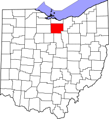 Location in the U.S. state of Ohio | |||
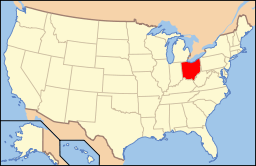 Ohio's location in the U.S. | |||
| Founded | April 1, 1815 | ||
| Named for | Huron tribe | ||
| Seat | Norwalk | ||
| Largest city | Norwalk | ||
| Area | |||
| • Total | 495 sq mi (1,282 km2) | ||
| • Land | 491 sq mi (1,272 km2) | ||
| • Water | 3.3 sq mi (9 km2), 0.7% | ||
| Population | |||
| • (2010) | 59,626 | ||
| • Density | 121/sq mi (47/km²) | ||
| Congressional districts | 4th, 7th | ||
| Time zone | Eastern: UTC-5/-4 | ||
| Website |
www | ||


Huron County is a county located in the U.S. state of Ohio. As of the 2010 census, the population was 59,626.[1] Its county seat is Norwalk.[2] The county was created in 1809 and later organized in 1815.[3]
Huron County is included in the Norwalk, OH Micropolitan Statistical Area, which is also included in the Cleveland-Akron-Canton, OH Combined Statistical Area.
History
Huron County was named in honor of the Huron Indians (Wyandot), an Iroquoian-speaking tribe who occupied large areas in the Great Lakes region. The word "Huron" may be French, although this origin is disputed.[4]
In the late 18th century this area was in the US Northwest Territory, part of the Connecticut Western Reserve in a sub-region called the Firelands. Connecticut had originally claimed the land as part of its original colony, then afterward wanted to use it to grant to veterans as payment for their service in the war. In 1795 the land was purchased for resale and development by the Connecticut Land Company, but was later under the sole administration of the "Fire Land Company".[5]
At its formation, Huron County consisted of all the Firelands. However, as the population increased in the region, the sections in the northern areas of the county were divided and assigned to the newly organized Erie and Ottawa counties, and a township in the southern section became part of the newly established Ashland County.
Geography
According to the U.S. Census Bureau, the county has a total area of 495 square miles (1,280 km2), of which 491 square miles (1,270 km2) is land and 3.3 square miles (8.5 km2) (0.7%) is water.[6]
Adjacent counties
- Erie County (north)
- Lorain County (east)
- Ashland County (southeast)
- Richland County (south)
- Crawford County (southwest)
- Seneca County (west)
- Sandusky County (northwest)
Demographics
| Historical population | |||
|---|---|---|---|
| Census | Pop. | %± | |
| 1820 | 6,675 | — | |
| 1830 | 13,341 | 99.9% | |
| 1840 | 23,933 | 79.4% | |
| 1850 | 26,203 | 9.5% | |
| 1860 | 29,616 | 13.0% | |
| 1870 | 28,532 | −3.7% | |
| 1880 | 31,609 | 10.8% | |
| 1890 | 31,949 | 1.1% | |
| 1900 | 32,330 | 1.2% | |
| 1910 | 34,206 | 5.8% | |
| 1920 | 32,424 | −5.2% | |
| 1930 | 33,700 | 3.9% | |
| 1940 | 34,800 | 3.3% | |
| 1950 | 39,353 | 13.1% | |
| 1960 | 47,326 | 20.3% | |
| 1970 | 49,587 | 4.8% | |
| 1980 | 54,608 | 10.1% | |
| 1990 | 56,240 | 3.0% | |
| 2000 | 59,487 | 5.8% | |
| 2010 | 59,626 | 0.2% | |
| Est. 2015 | 58,469 | [7] | −1.9% |
| U.S. Decennial Census[8] 1790-1960[9] 1900-1990[10] 1990-2000[11] 2010-2013[1] | |||
2000 census
As of the census[12] of 2000, there were 59,487 people, 22,307 households, and 16,217 families residing in the county. The population density was 121 people per square mile (47/km²). There were 23,594 housing units at an average density of 48 per square mile (18/km²). The racial makeup of the county was 95.98% White, 0.97% Black or African American, 0.18% Native American, 0.25% Asian, 0.01% Pacific Islander, 1.63% from other races, and 0.99% from two or more races. 3.56% of the population were Hispanic or Latino of any race.
There were 22,307 households out of which 36.30% had children under the age of 18 living with them, 58.50% were married couples living together, 10.40% had a female householder with no husband present, and 27.30% were non-families. 23.10% of all households were made up of individuals and 9.70% had someone living alone who was 65 years of age or older. The average household size was 2.64 and the average family size was 3.11.
In the county, the population was spread out with 28.30% under the age of 18, 8.50% from 18 to 24, 28.90% from 25 to 44, 21.90% from 45 to 64, and 12.40% who were 65 years of age or older. The median age was 35 years. For every 100 females there were 96.10 males. For every 100 females age 18 and over, there were 92.90 males.
The median income for a household in the county was $40,558, and the median income for a family was $46,911. Males had a median income of $35,760 versus $22,785 for females. The per capita income for the county was $18,133. About 6.50% of families and 8.50% of the population were below the poverty line, including 11.00% of those under age 18 and 7.70% of those age 65 or over.
2010 census
As of the 2010 United States Census, there were 59,626 people, 22,820 households, and 16,141 families residing in the county.[13] The population density was 121.3 inhabitants per square mile (46.8/km2). There were 25,196 housing units at an average density of 51.3 per square mile (19.8/km2).[14] The racial makeup of the county was 94.9% white, 1.0% black or African American, 0.3% Asian, 0.2% American Indian, 2.0% from other races, and 1.6% from two or more races. Those of Hispanic or Latino origin made up 5.6% of the population.[13] In terms of ancestry, 36.4% were German, 14.5% were Irish, 10.8% were English, and 8.9% were American.[15]
Of the 22,820 households, 35.0% had children under the age of 18 living with them, 53.5% were married couples living together, 12.2% had a female householder with no husband present, 29.3% were non-families, and 24.4% of all households were made up of individuals. The average household size was 2.59 and the average family size was 3.05. The median age was 38.4 years.[13]
The median income for a household in the county was $47,058 and the median income for a family was $53,887. Males had a median income of $41,566 versus $30,967 for females. The per capita income for the county was $21,743. About 10.9% of families and 14.5% of the population were below the poverty line, including 23.3% of those under age 18 and 7.0% of those age 65 or over.[16]
Politics
| Year | Republican | Democrat |
|---|---|---|
| 2016 | 64.87% 15,930 | 28.83% 7,080 |
| 2012 | 52.85% 13,060 | 44.54% 11,006 |
| 2008 | 50.36% 12,884 | 47.21% 12,076 |
| 2004 | 57.97% 14,817 | 41.35% 10,568 |
| 2000 | 57.52% 12,286 | 38.31% 8,183 |
Government
Officials
Commissioner - Gary Bauer (President)
Commissioner - Joe Hintz
Commissioner - Tom Dunlap[18]
Auditor - Roland Tkach[19]
Clerk of Courts - Susan Hazel[20]
Coroner - Jeffery Harwood[21]
Engineer - Joseph B. Kovach[22]
Prosecutor - Daivia Kasper[23]
Recorder - Karen Fries[24]
Treasurer - Kathleen Schaffer[25]
Sheriff - Dane Howard[26]
Judge of Court of Common Pleas - James Conway[27]
Court Secretary (non-elected position) - Julie Wise[28]
Education
Infrastructure
Major highways
Communities

Cities
Villages
Townships
Census-designated places
- Celeryville
- Collins
- New Haven
- Holiday Lakes
Unincorporated communities
- Bismark
- Boughtonville
- Centerton
- Clarksfield
- Delphi
- East Norwalk
- East Townsend
- Fitchville
- Guinea Corners
- Hanville Corners
- Hartland
- Hartland Station
- Havana
- Hunts Corners
- Huron Junction
- Myers Mills
- New Pittsburgh
- North Monroeville
- Olena
- Peru (Peru Hollow)
- Phoenix Mills
- Pontiac
- Standardsburg
- Steuben
- Strongs Ridge
- Weavers Corners
- West Clarksfield
- West Hartland
- White Fox
Notable people
- Ezekiel S. Sampson, two-term Republican Congressman from Iowa's 6th congressional district; born in Huron County.[29]
- Paul Brown, American college and professional football coach; member of the Pro Football Hall of Fame
- Lefty Grove, American baseball player, member of the Baseball Hall of Fame
See also
References
- 1 2 "State & County QuickFacts". United States Census Bureau. Retrieved February 8, 2015.
- ↑ "Find a County". National Association of Counties. Retrieved 2011-06-07.
- ↑ "Ohio: Individual County Chronologies". Ohio Atlas of Historical County Boundaries. The Newberry Library. 2007. Retrieved February 14, 2015.
- ↑ "Huron County data". Ohio State University Extension Data Center. Archived from the original on May 18, 2015. Retrieved 2007-04-28.
- ↑ 'Firelands Pioneer' series of publications (Firelands Historical Society) beginning in 1858-
- ↑ "2010 Census Gazetteer Files". United States Census Bureau. August 22, 2012. Retrieved February 8, 2015.
- ↑ "County Totals Dataset: Population, Population Change and Estimated Components of Population Change: April 1, 2010 to July 1, 2015". Retrieved July 2, 2016.
- ↑ "U.S. Decennial Census". United States Census Bureau. Retrieved February 8, 2015.
- ↑ "Historical Census Browser". University of Virginia Library. Retrieved February 8, 2015.
- ↑ Forstall, Richard L., ed. (March 27, 1995). "Population of Counties by Decennial Census: 1900 to 1990". United States Census Bureau. Retrieved February 8, 2015.
- ↑ "Census 2000 PHC-T-4. Ranking Tables for Counties: 1990 and 2000" (PDF). United States Census Bureau. April 2, 2001. Retrieved February 8, 2015.
- ↑ "American FactFinder". United States Census Bureau. Retrieved 2008-01-31.
- 1 2 3 "DP-1 Profile of General Population and Housing Characteristics: 2010 Demographic Profile Data". United States Census Bureau. Retrieved 2015-12-27.
- ↑ "Population, Housing Units, Area, and Density: 2010 - County". United States Census Bureau. Retrieved 2015-12-27.
- ↑ "DP02 SELECTED SOCIAL CHARACTERISTICS IN THE UNITED STATES – 2006-2010 American Community Survey 5-Year Estimates". United States Census Bureau. Retrieved 2015-12-27.
- ↑ "DP03 SELECTED ECONOMIC CHARACTERISTICS – 2006-2010 American Community Survey 5-Year Estimates". United States Census Bureau. Retrieved 2015-12-27.
- ↑ "Dave Leip's Atlas of U.S. Presidential Elections". Retrieved 2016-03-20.
- ↑ "Welcome". Hccommissioners.com. Retrieved 2013-08-15.
- ↑ "Huron County, Ohio: Online Auditor - Home". Huroncountyauditor.org. Retrieved 2013-08-15.
- ↑ "Homepage". Huron County Clerk of Courts. Retrieved 13 December 2013.
- ↑ Archived September 29, 2008, at the Wayback Machine.
- ↑ "Huron County Engineers Official Site". Huroncountyengineer.org. Retrieved 2013-08-15.
- ↑ "Huron County Commissioners". Hccommissioners.com. Retrieved 2013-08-15.
- ↑ "Huron County Recorder's Office". Huroncountyrecorder.org. Retrieved 2013-08-15.
- ↑ "Treasurer". Huron County. Archived from the original on 7 Jun 2007.
- ↑ "Huron County". Buckeye State Sheriff's Association. Archived from the original on 18 Jun 2012. Retrieved 13 December 2013.
- ↑ "Common Pleas Court". Huron County Clerk of Courts. Archived from the original on 1 December 2010.
- ↑ "Court Staff". Huroncountyclerk.com. Retrieved 2013-08-15.
- ↑ "Ezekiel Silas Sampson". Find A Grave. Retrieved September 25, 2012.
Further reading
- William W. Williams, History of the Fire Lands, Comprising Huron and Erie Counties, Ohio: With Illustrations and Biographical Sketches of Some of the Prominent Men and Pioneers. Cleveland, OH: Press of Leader Printing Company, 1879.
External links
| Wikimedia Commons has media related to Huron County, Ohio. |
 |
Sandusky County | Erie County | | |
| Seneca County | |
Lorain County | ||
| ||||
| | ||||
| Crawford County | Richland County | Ashland County |
Municipalities and communities of Huron County, Ohio, United States | ||
|---|---|---|
| Cities | | |
| Villages | ||
| Townships | ||
| CDPs |
| |
| Unincorporated communities | ||
| Footnotes | ‡This populated place also has portions in an adjacent county or counties | |
Coordinates: 41°09′N 82°36′W / 41.15°N 82.60°W