Northampton, Massachusetts
| Northampton, Massachusetts | ||
|---|---|---|
| City | ||
|
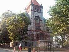
First Church, Main Street, Northampton | ||
| ||
| Nickname(s): The Meadow City,[1] Hamp, Lesbianville USA,[2][3] NoHo,[4][5] NTown, Nton, Paradise City | ||
| Motto: Caritas, educatio, justitia (Latin "Caring, education and justice") | ||
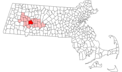 Location in Hampshire County in Massachusetts | ||
 Northampton, Massachusetts Location in the United States | ||
| Coordinates: 42°20′N 72°39′W / 42.333°N 72.650°W | ||
| Country | United States | |
| State | Massachusetts | |
| County | Hampshire | |
| Charter for township granted | May 18th, 1653[6] | |
| Settlers arrive | Early spring, 1654[7] | |
| Established as a city | September 5th, 1883[8][9] | |
| Government | ||
| • Type | Mayor-council city | |
| • Mayor | David Narkewicz | |
| Area | ||
| • Total | 35.8 sq mi (92.6 km2) | |
| • Land | 34.2 sq mi (88.7 km2) | |
| • Water | 1.5 sq mi (3.9 km2) | |
| Elevation | 190 ft (60 m) | |
| Population (2012) | ||
| • Total | 28,592 | |
| • Density | 800/sq mi (310/km2) | |
| Time zone | Eastern (UTC-5) | |
| • Summer (DST) | Eastern (UTC-4) | |
| ZIP code | 01060 | |
| Area code(s) | 413 | |
| FIPS code | 25-46330 | |
| GNIS feature ID | 0606674 | |
| Website |
www | |

The city of Northampton (![]() i/nɔːrˈθæmptən/[10]) is the county seat of Hampshire County, Massachusetts, United States.[11] As of 2012, the estimated total population of Northampton (including its outer villages, Florence and Leeds) was 28,592.[12]
i/nɔːrˈθæmptən/[10]) is the county seat of Hampshire County, Massachusetts, United States.[11] As of 2012, the estimated total population of Northampton (including its outer villages, Florence and Leeds) was 28,592.[12]
Northampton is known as an academic, artistic, musical, and countercultural hub. It features a large politically liberal community along with numerous alternative health and intellectual organizations.[13] Based on U.S. Census demographics, election returns, and other criteria, the website Epodunk rates Northampton as the most politically liberal medium-size city (population 25,000–99,000) in the United States.[14] The city has a high proportion of residents who identify as gay and lesbian[15][16] a high number of same-sex households,[17] and is a popular destination for the LGBTQ community.[18][19]
Northampton is part of the Pioneer Valley and is one of the northernmost cities in the Knowledge Corridor—a cross-state cultural and economic partnership with other Connecticut River Valley cities and towns. Northampton is considered part of the Springfield Metropolitan Area, one of Western Massachusetts's two separate metropolitan areas. It sits approximately 15 miles north of the City of Springfield, Massachusetts.
Northampton is home to Smith College, Northampton High School, and the Clarke Schools for Hearing and Speech.
History
Early settlement
The area now called Northampton was once known as Norwottuck, or Nonotuck, meaning "the midst of the river"[20] by its original Pocumtuc inhabitants. According to various accounts, Northampton was named by John A. King (1629–1703), one of its original settlers, or possibly in King's honor, since it is supposed that he came to Massachusetts from Northampton, England, as he was born there.[21]
The Pocumtuc confederacy occupied the Connecticut River Valley from what is now southern Vermont and New Hampshire into northern Connecticut. The Pocumtuc tribes were Algonquian and traditionally allied with the Mahican confederacy to the west. By 1606 an ongoing struggle between the Mahican and Iroquois confederacies led to direct attacks on the Pocumtuc by the Iroquoian Mohawk nation.[22] The Mahican confederacy had been defeated by 1628, limiting Pocumtuc access to trade routes to the west. The area suffered a major smallpox epidemic in the 1630s following the arrival of Dutch traders in the Hudson Valley and English settlers in the Massachusetts Bay Colony during the previous two decades. It was in this context that the land making up the bulk of modern Northampton was sold to settlers from Springfield, Massachusetts, in 1653.[23]
On May 18, 1653 a petition for township was approved by the general court of Springfield.[6] While some settlers visited the land in the fall of 1653, they waited till early Spring 1654 to arrive and establish a permanent settlement.[7][24] The situation in the region further deteriorated when the Mohawk escalated hostilities against the Pocumtuc confederacy and other Algonquian tribes after 1655, forcing many of the plague-devastated Algonquian groups into defensive mergers.[22] This coincided with a souring of relations between the Wampanoag and the Massachusetts Bay colonists, eventually leading to the expanded Algonquian alliance, which took part in King Philip's War.
Partition
Northampton was part of the Equivalent Lands compromise.[25] Its territory would be enlarged beyond the original settlement, but later portions would be carved up into separate cities, towns, and municipalities. Southampton, for example, was incorporated in 1775 and included parts of the territories of modern Montgomery (incorporated in 1780) and Easthampton.[26] Westhampton was incorporated in 1778 and Easthampton in 1809.[27] A section of Northampton called Smith's Ferry was once separated from the rest of the town by the boundaries of Easthampton. The shortest path to downtown was a road near the Connecticut River oxbow, which was subject to frequent flooding. Smith's Ferry was ceded to Holyoke, Massachusetts, in 1909.[28]
The Great Awakening
Congregational preacher, theologian and philosopher Jonathan Edwards was a leading figure in a 1734 Christian revival in Northampton. In the winter of 1734 and the following spring it reached such intensity that it threatened the town's businesses. In the spring of 1735 the movement began to subside and a reaction set in. But the relapse was brief, and the Northampton revival, which had spread through the Connecticut River Valley and whose fame had reached England and Scotland, was followed in 1739–1740 by the Great Awakening, under the leadership of Edwards.
For this achievement, Edwards is considered one of the founders of evangelical Christianity.[29] He is also credited with being one of the primary inspirations for Transcendentalism, because of passages like this: "That the works of nature are intended and contrived of God to signify and indigitate spiritual things is particularly evident concerning the rainbow, by God's express revelation." [30]
.jpg)
Northampton hosted its own witch trials in the 1700s, although no alleged witches were executed.
After the Revolution
Members of the Northampton community were present at the Constitutional Convention.[31]
On August 29, 1786, Daniel Shays and a group of Revolutionary War veterans (who called themselves Shaysites) stopped the civil court from sitting in Northampton, in an uprising known as Shays' Rebellion.[32]
In 1805 a crowd of 15,000 gathered in Northampton to watch the executions of two Irishmen convicted of murder: Dominic Daley, 34, and James Halligan, 27. The crowd, composed largely of New England Protestants of English ancestry, lit bonfires and expressed virulently anti-Irish and anti-Catholic sentiments. The trial evidence against Daley and Halligan was sparse, circumstantial, contrived, and perjurious.[33] The men were hanged on June 5, 1806, on Pancake Plain. Their bodies were denied a burial; they were destroyed in the local slaughterhouse. This trial "later came to be seen as epitomizing the anti-Irish sentiment that was widespread in New England in the early 19th century."[34] Daley and Halligan were exonerated of all crimes by governor Michael Dukakis in 1984. Today a simple stone landmark stands marking the site of Daley and Halligan's executions.
In 1835 Northampton was linked to the ocean by the New Haven and Northampton Canal,[35] but the canal enterprise foundered and after about a decade was replaced by a railroad running along the same route.[36] A flood on the Mill River on May 16, 1874, obliterated almost the entire Northampton neighborhood of Leeds.[37]
The "Paradise of America"
From 1842[38] until 1846 Northampton was home to a transcendentalist utopian community of abolitionists. Called the Northampton Association of Education and Industry, the community believed that the rights of all people should be "equal without distinction of sex, color or condition, sect or religion". It supported itself by producing mulberry trees and silk. Sojourner Truth, a former slave who became a national advocate for equality and justice, lived in this community until its dissolution (and later in a house on Park Street until 1857).[39]
In 1851 opera singer Jenny Lind, the "Swedish Nightingale", declared Northampton to be the "Paradise of America", from which Northampton took its nickname The Paradise City.
Clarke Schools for Hearing and Speech (formerly the Clarke School for the Deaf) was founded in Northampton in 1867. It was the United States's first permanent oral school for the deaf. Alexander Graham Bell and Grace Coolidge have served as heads of school.
Smith College for women was founded in Northampton in 1871. Today Smith is the largest of the Seven Sisters colleges. Well-known Smith alumnae include Sylvia Plath, Barbara Bush, Nancy Reagan, Tammy Baldwin, Gloria Steinem, Madeleine L'Engle, and Julia Child. The first game of women's basketball was played at Smith College in 1892.
Northampton officially became a city on September 5, 1883 when voters accepted the City Charter (The act to establish the city of Northampton. 1883-Chapter 250) as passed and approved. [8] [9]
Rawls, John. A Theory of Justice. Harvard University Press, 1971, p. 1.
Immigrant groups that settled Northampton in large numbers included Irish, Polish, and French-Canadians.
U.S. President Calvin Coolidge worked as a lawyer in Northampton and served as the city's mayor from 1910 to 1911.[40] He went on to be a Massachusetts State Senator, Lieutenant Governor, and Governor before becoming Vice President and President. After retiring from the U.S. presidency in 1929, Coolidge moved back to Northampton. He died in the city on January 5, 1933.
Decline
During the mid-20th century, Northampton experienced several decades of economic decline, bottoming in the 1970s , related to the emergence of the Rust Belt phenomenon. Though Western Massachusetts lies outside of the Rust Belt geographically, the centrality of commerce and the arts to Northampton's economy left it economically vulnerable, in particular when compounded with the decline of Springfield's manufacturing sector, Holyoke's paper industry, and massive plant closures in the nearby New York Capital District.

Cultural renaissance
Northampton has a thriving cultural center and is a popular tourist destination. The city has many eclectic restaurants and a lively arts and music scene. Two Northampton farmers markets, held weekly, sell fresh produce from local farms.
Since 1995 Northampton has been home to the twice-yearly Paradise City Arts Festival,[41] held at the Three County Fairgrounds on Memorial Day weekend and Columbus Day weekend. The Festival is a national juried showcase for contemporary craft and fine art.
Northampton has a well-established music scene. The city has several live music venues, including Bishops Lounge, The Academy of Music, Calvin Theater, Iron Horse Music Hall, Northampton Community Music Center, Pearl Street and the Pines Theater. Musicians and bands that call the area "home" include Ray Mason, Sonic Youth, Erin McKeown, The Nields, The Young@Heart Chorus, Cordelia's Dad, Speedy Ortiz, and the Funkoholics.
Every summer Django in June[42] offers a week long Gypsy jazz music camp as well as weekend clinics and concerts on the campus of Smith College.
Geography and climate
Northampton sits on the banks of the Connecticut River in the Pioneer Valley of Western Massachusetts. It is located at 42°20′N 72°39′W / 42.333°N 72.650°WCoordinates: 42°20′N 72°39′W / 42.333°N 72.650°W.[43]
According to the United States Census Bureau, the city has a total area of 35.8 square miles (92.6 km2), of which 34.2 square miles (88.7 km2) is land and 1.5 square miles (3.9 km2), or 4.22%, is water.[44] A total of 21% of the city is permanently protected open space.[45]
Within Northampton's city limits are the villages of Florence and Leeds.
Northampton is bordered to the north by the towns of Hatfield and Williamsburg, to the west by Westhampton, to the east by Hadley (across the Connecticut River), and to the south by Easthampton.
The art deco Calvin Coolidge Bridge connects Northampton with Hadley across the Connecticut River. The college town of Amherst is located 7.86 miles (12.65 km) east of Northampton, next to Hadley. Springfield, the Connecticut River Valley's most populous Massachusetts city, is located 15.74 miles (25.33 km) southeast of Northampton. Boston is located 81.57 miles (131.27 km) east of Northampton. New York City is 131.28 miles (211.27 km) southwest of Northampton.
The Connecticut River's famous Oxbow is within Northampton's city limits, at the northern base of Mount Nonotuck.
| Climate data for Northampton, Massachusetts (01060) | |||||||||||||
|---|---|---|---|---|---|---|---|---|---|---|---|---|---|
| Month | Jan | Feb | Mar | Apr | May | Jun | Jul | Aug | Sep | Oct | Nov | Dec | Year |
| Record high °F (°C) | 70 (21) |
70 (21) |
85 (29) |
93 (34) |
94 (34) |
98 (37) |
100 (38) |
100 (38) |
99 (37) |
89 (32) |
82 (28) |
72 (22) |
100 (38) |
| Average high °F (°C) | 33 (1) |
37 (3) |
45 (7) |
58 (14) |
69 (21) |
78 (26) |
82 (28) |
81 (27) |
73 (23) |
62 (17) |
49 (9) |
38 (3) |
58.8 (14.9) |
| Average low °F (°C) | 13 (−11) |
16 (−9) |
24 (−4) |
35 (2) |
45 (7) |
55 (13) |
59 (15) |
58 (14) |
49 (9) |
38 (3) |
30 (−1) |
20 (−7) |
36.8 (2.6) |
| Record low °F (°C) | −30 (−34) |
−27 (−33) |
−17 (−27) |
11 (−12) |
24 (−4) |
32 (0) |
40 (4) |
32 (0) |
25 (−4) |
12 (−11) |
−4 (−20) |
−20 (−29) |
−30 (−34) |
| Average precipitation inches (mm) | 3.34 (84.8) |
3.23 (82) |
3.57 (90.7) |
3.87 (98.3) |
4.14 (105.2) |
4.10 (104.1) |
4.03 (102.4) |
3.76 (95.5) |
4.19 (106.4) |
4.64 (117.9) |
3.83 (97.3) |
3.44 (87.4) |
46.14 (1,172) |
| Source: Weather.com [46] | |||||||||||||
Demographics
| Historical population | ||
|---|---|---|
| Year | Pop. | ±% |
| 1790 | 1,628 | — |
| 1800 | 2,190 | +34.5% |
| 1810 | 2,631 | +20.1% |
| 1820 | 2,854 | +8.5% |
| 1830 | 3,613 | +26.6% |
| 1840 | 3,750 | +3.8% |
| 1850 | 5,278 | +40.7% |
| 1860 | 6,788 | +28.6% |
| 1870 | 10,160 | +49.7% |
| 1880 | 12,172 | +19.8% |
| 1890 | 14,990 | +23.2% |
| 1900 | 18,643 | +24.4% |
| 1910 | 19,431 | +4.2% |
| 1920 | 21,951 | +13.0% |
| 1930 | 24,381 | +11.1% |
| 1940 | 24,794 | +1.7% |
| 1950 | 29,063 | +17.2% |
| 1960 | 30,058 | +3.4% |
| 1970 | 29,664 | −1.3% |
| 1980 | 29,286 | −1.3% |
| 1990 | 29,289 | +0.0% |
| 2000 | 28,978 | −1.1% |
| 2010 | 28,549 | −1.5% |
| 2014 | 28,554 | +0.0% |
| 2015 | 28,540 | −0.0% |
| * = population estimate. Source: United States Census records and Population Estimates Program data.[47][48][49][50][51][52][53][54][55][56][12][57] Source: | ||
As of the census[59] of 2010, there were 28,549 people, 12,000 households, and 5,895 families residing in the city. Northampton has the most lesbian couples per capita of any city in the US.[60] The population density was 833.7 people per square mile (321.6/km²). There were 12,728 housing units (12,000 occupied) at an average density of 360.0 per square mile (139.0/km²). The racial makeup of the city was 87.7% White, 2.7% African American, 0.3% Native American, 4.1% Asian, 0.1% Pacific Islander, 2.4% from other races, and 2.7% from two or more races. Hispanic or Latino of any race were 6.8% of the population.
There were 12,000 households, out of which 21.5% had children under the age of 18 living with them, 34.6% were so-called "Husband-wife" married couples living together, 11.3% had a female householder with no husband present, and 50.9% were non-families. 37.2% of all households were made up of individuals and 10.2% had someone living alone who was 65 years of age or older. The average household size was 2.12 and the average family size was 2.81.[59]
In the city the population was spread out, with 20.7% age 19 and under, 9.8% from 20 to 24, 25.7% from 25 to 44, 30.2% from 45 to 64, and 13.5% who were 65 years of age or older. The median age was 40 years. For every 100 females there were 75.8 males. For every 100 females age 18 and over, there were 71.9 males.[59]
The median income for a household in the city was $56,999, and the median income for a family was $80,179. Males had a median income of $40,470 versus $32,003 for females. The per capita income for the city was $33,440. About 7.8% of families and 13.5% of the population were below the poverty line, including 15.1% of those under age 18 and 7.2% of those age 65 or over.[61]
Northampton's public schools include four elementary schools (kindergarten through 5th grade), one middle school (6th to 8th grade), one high school (9th to 12th grade), and one vocational-agricultural high school (9th to 12th grade). There are a few charter schools and several private schools in Northampton and surrounding towns.
According to the website ePodunk's Gay Index, which is based on figures from the 2000 US Census, Northampton has a score of 535, vs. a national average score of 100 (i.e., Northampton's population includes 5.35 times the national average of same-sex unmarried households).[62]
Government
As of April 2012, David Narkewicz is the mayor.[63] Previous mayors include former president Calvin Coolidge and James "Big Jim" Cahillane, who served from 1954 to 1960. Well-known Judge Sean M. Dunphy was the youngest elected mayor in its history, at age 28.
The Paradise City Forum was founded November 2001 to provide a nonpartisan discussion tool for the community.
| Voter Registration and Party Enrollment as of October 15, 2008[64] | |||||
|---|---|---|---|---|---|
| Party | Number of Voters | Percentage | |||
| Democratic | 10,066 | 49.49% | |||
| Republican | 994 | 4.89% | |||
| Unaffiliated | 8,998 | 44.24% | |||
| Minor Parties | 280 | 1.38% | |||
| Total | 20,338 | 100% | |||
Education
Public schools
Colleges and universities
Northampton is home to Smith College. Smith students (along with those of the associated Five Colleges) contribute to Northampton's college town atmosphere.
Clarke Schools for Hearing and Speech
The Clarke Schools for Hearing and Speech is located in Northampton.
Media
The Daily Hampshire Gazette, a six-day a week morning newspaper, is based in Northampton, covering Hampshire and Franklin counties.
Northampton is the city of license for three commercial radio stations: WLZX, WEIB, and WHMP. Northampton is also home to WXOJ-LP, a low-power community radio station owned and operated by Valley Free Radio. The station was built by more than 400 volunteers from Northampton and around the country in August 2005 at the eighth Prometheus Radio Project barnraising, in conjunction with the tenth annual Grassroots Radio Coalition conference. Valley Free Radio broadcasts music, news, public affairs, and locally produced radio content to listeners at 103.3 FM. Northampton is also the birthplace of The Rainbow Times (ISSN (Online): 2169-6136), a lesbian-owned LGBT newspaper founded in 2006, now based out of Boston but serving all of New England.
In addition, Northampton is home to Northampton Community Television, which has existed in numerous forms since the mid-1980s but experienced a radical change in 2006 when it became an independently run nonprofit community media center. After a new public unveiling in November 2007, NCTV grew to over 200 active members in less than 18 months and had already attracted statewide and national attention in the community media landscape. In 2012, 2013 and 2014 NCTV won awards for best web sites (for two different sites) in the United States for community media organizations with budgets under $300,000.[65]
Infrastructure
Transportation
Northampton is served by Interstate 91, which passes to the east of downtown along the Connecticut River. U.S. Route 5, Massachusetts Route 9, and Massachusetts Route 10 all intersect in the city's downtown area. Massachusetts Route 66 also is partially in Northampton.
The Pioneer Valley Transit Authority operates several local passenger buses that originate in Northampton, with service to local towns such as Amherst, Williamsburg, Hadley, South Hadley, and Holyoke as well as the nearby universities and colleges: Mount Holyoke College, Amherst College, University of Massachusetts Amherst, and Hampshire College. The Franklin Regional Transit Authority operates a bus to Greenfield, Massachusetts. There is a Peter Pan Bus terminal with services to Springfield, Boston, and other locations in New England. The Vermont Transit Lines bus also serves this terminal.
Passenger rail service for Northampton and the surrounding area is provided by Amtrak's Vermonter from a platform that is located just to the south of the Union Station building.[66] More frequent service is available from Springfield Union Station, which is about a 25-minute drive south of Northampton or a short walk from the Peter Pan Bus terminal in Springfield. Part of the American Recovery and Reinvestment Act of 2009 included $8 billion for rail, of which $70 million is being be spent to realign Amtrak's Vermonter train route. Until December 29, 2014 the Vermonter traveled between Springfield and Brattleboro, Vermont via Palmer, Massachusetts. In addition to restoring the Northampton passenger rail stop, a stop has been added in Greenfield and a stop will be added in Holyoke in 2015.
Rail freight transportation on the rail line through Northampton, which is known as the Connecticut River Line, is operated by the Pan Am Railways.
Major domestic and limited international air service is available 40 miles to the south at Bradley International Airport (BDL) in Windsor Locks, Connecticut. Northampton Airport, identified by the airport code 7B2, offers a 3,365 x 50-foot runway and is within a mile-and-a-half walk from downtown.
Northampton serves as the hub of a growing rail trail network. The north-south Manhan Rail Trail extends from the downtown into neighboring Easthampton, and as part of the Farmington Canal Trail is planned eventually to reach New Haven, Connecticut. The Norwottuck Rail Trail runs eastward from Woodmont Road through Hadley, Amherst, and into Belchertown, with planned future integration into the Central Mass Rail Trail to Boston. To the west, the Northampton Bikeway provides access to the city's Florence and Leeds neighborhoods, including a route through historic Look Park, while downtown, the bikeway provides an alternative to the congested King and Main Streets.[67]
The city of Northampton faces daily traffic congestion in the downtown area and connector roads, often resulting in long delays and traffic buildup. The limitation of one bridge, few routes to the nearby city of Amherst, and a narrow main street results in unsafe driving behavior and danger to pedestrians.[68] The City of Northampton is attempting to solve this long-time problem by redesigning problematic intersections and installing traffic cameras.[69]
Points of interest

- First Church,[70] located on Main Street, was the home church of Jonathan Edwards, 18th century theologian, philosopher, and leader of the First Great Awakening.
- Smith College, founded in 1871, is a women's college (one of the Seven Sisters). It is also one of the Five Colleges.
- Clarke Schools for Hearing and Speech (formerly the Clarke School for the Deaf) specializes in oral education (speech and lip-reading, as opposed to signing) and holds an annual summer camp, the theme varying from summer to summer. Clarke is also the oldest oral school for the deaf in the country, established in 1867 on Round Hill Road overlooking the Connecticut River Valley.
- The Elm Street/Round Hill Historic District runs from the commencement of Elm at State Street almost one mile westerly to Woodlawn Avenue and includes a section of Round Hill Road. A local historic district,[71] it includes a range architectural styles from 18th century Colonial to Contemporary with an abundance of Queen Anne and Colonial Revival homes and other styles.
- The Connecticut River and The Oxbow are popular areas for boaters.
- 21% of Northampton is protected open space; this includes Broad Brook/Fitzgerald Lake Conservation Area, Connecticut River Greenway (Elwell and Rainbow Beach), Mill River Greenway, Mineral Hills Conservation Area, and Saw Mill Hills/Roberts Hill Conservation Area.[45]
- Look Park is a 150+ acre recreational park founded in 1930. The park is free for visitors arriving by foot or bicycle, consistent with the will of Frank Newhall Look, who left the property to the city and requested that the park would always have free admission for the public. A day-use fee or annual membership fee provides for parking. Musicians such as Bob Dylan have played at the park's amphitheater.
- Childs Park is a serene 40-acre city park near Cooley Dickinson Hospital. It features two ponds, formal gardens and rose gardens, and an Italian-style garden house.
- The Botanic Garden of Smith College is a diverse, outdoor collection of trees, shrubs, and plants as well as a fine collection of plant conservatories for the tropics, semitropics, and desert regions. It also includes an indoor greenhouse.
- The Mill River Greenway[72] is a walking path on Smith College and adjacent land along the Mill River in the Bay State Village neighborhood of Northampton. The path is sometimes also called the Paradise Pond Trail based on a misleadingly named portion of the river near Smith College's boathouse and pier.
- Northampton is a rail trail hub. Currently, the Norwottuck Rail Trail extends 18 miles (29 km) from Leeds, Florence, and the downtown sections of Northampton to Amherst and Belchertown. The Manhan Rail Trail extends 8 miles (13 km) from the Norwottuck Rail Trail through Northampton and Easthampton to Southampton. Four other rail trail extensions are in the planning process.
- The Three County Fair[73] is the "longest consecutive running agricultural fair in the country", having been established and incorporated in 1818.
- The Calvin Theater, Iron Horse Music Hall, and Pearl Street Nightclub are among the many venues that play host to Northampton's music scene.
- The Academy of Music, built in 1890 by Edward H. R. Lyman, is the only municipally owned theater in the United States and is the first to be so owned. Boris Karloff and Harry Houdini (who installed a trap door in the stage) performed there. Today it serves as a music venue, cinema, and performance space.
- The Northampton Independent Film Festival[74] (NIFF) is held each fall. Founded as the Northampton Film Festival in 1995 by Howard Polonsky and Dee DeGeiso, it has continued to grow under a variety of directors. It is now one of the largest in New England.
- Forbes Library,[75] built in 1894, is Northampton's public library. The second floor houses the Calvin Coolidge presidential library. Charles Ammi Cutter, an important figure in American library science, was the library's first director.
- Mirage Studios, creators of the Teenage Mutant Ninja Turtles franchise. In the TMNT series, the turtles and Casey Jones visit Casey Jones's grandmother's farm in Northampton, Massachusetts.[76]
- As part of an annual Springfest celebration, students from the Northampton Community Music Center (NCMC)[77] fill the streets with music on the third Saturday of May.
- LGBT Pride,[78] on the first Saturday of May, is an annual Lesbian, Gay, Bisexual and Transgender Pride March & Rally, with a colorful parade down Main Street that ends with an all-day, family-friendly festival at a designated location in town.
- Thornes Marketplace in downtown Northampton contains many shops and eateries.
- Northampton State Hospital was a large psychiatric hospital, constructed in 1856. Several abandoned buildings remain, but much of the site has been redeveloped.
- On a small hill overlooking the city, near the site of the former Northampton State Hospital, a simple stone monument marks the spot of the hangings of Domenic Daley and James Halligan, two Irishmen wrongfully convicted of murder in 1806.[33]
- Pioneer Valley Roller Derby, the first co-ed flat track roller derby league, trains in the village of Florence, Massachusetts.
Notable people
Cultural references
- Northampton is the birthplace of the eponymous protagonist in Henry James's 1875 novel Roderick Hudson.[79]
- Northampton is the setting for several stories throughout various Teenage Mutant Ninja Turtles media, especially the original Mirage comics as well as the 2003 animated series. While not specifically referred to by name, the city is featured in the 1990 live-action movie. It is also the real-life headquarters for Mirage Studios, former owners of the franchise.[80] Most recently, it has appeared in the current comic series by IDW Publishing
- Segments of the 1966 film Who's Afraid of Virginia Woolf? were filmed in and around Northampton during the fall of 1965.[81] When not filming, Elizabeth Taylor and Richard Burton frequented Northampton's Academy of Music, where they sat in the balcony to watch movies.
- Other films shot in Northampton include the Academy-Award-winning The Cider House Rules, Malice with Nicole Kidman and Alec Baldwin, In Dreams with Annette Bening and Robert Downey Jr., and Sylvia with Gwyneth Paltrow.[82]
- Edge of Darkness was filmed in October 2008 in Northampton and the surrounding area.[83]
- Author Tracy Kidder documented the many layers of Northampton society at the end of the 20th century in his nonfiction book Home Town.
- Webcomics Questionable Content and Minimalist Stick Figure Theatre[84] take place primarily in Northampton.
- Artist Jeffrey Rowlands makes his home in Northampton and is primarily famous for his Overcompensating Comic.
- The main events of Running with Scissors, a 2002 memoir by Augusten Burroughs detailing his bizarre childhood, take place in Northampton.
- The mystery book Paradise City by Archer Mayor centers on a ring of jewel thieves who deal in that city, and the area and its history are referenced.
- "Massachusetts Afternoon" skit from Saturday Night Live Season 37 Episode 8.[85]
References
- ↑ Kneeland, Frederick N. (1894). Northampton, the meadow city. Northampton, Massachusetts: F. N. Kneeland and L. P. Bryant. OCLC 24093077.
- ↑ Lipsyte, Robert (June 26, 1994). "Gay Games". The New York Times. Retrieved March 22, 2011.
- ↑ Brown, Jane Roy (November 20, 2006). "Paradise found". The Boston Globe. Retrieved March 22, 2011.
- ↑ "Visit Noho.com". Visit Noho.com. Retrieved August 13, 2014.
Northampton, or Noho for short...
- ↑ "18th Annual Northampton International Film Festival". Northampton International Film Festival. Retrieved August 13, 2014.
Northampton Massachusetts or 'NoHo' has been...
- 1 2 Trumbull, James Russell. "History of Northampton Massachusetts from its settlement in 1654." 1898. p. 7.
- 1 2 Trumbull, James Russell. "History of Northampton Massachusetts from its settlement in 1654." 1898. p. 15-16.
- 1 2 Office of the City Clerk of Northampton, Ma. "Records, Volume 1: 1884-1888, City of Northampton." 1883, p. 2.
- 1 2 Office of the Mayor of Northampton, Ma. "1883 - Chapter 250: Act to establish the city of Northampton." 1883, p. 537-554.
- ↑ "Northampton". Dictionary.com. Retrieved 9 November 2014.
- ↑ "Profile for Northampton, Massachusetts, MA". ePodunk. Retrieved September 26, 2012.
- 1 2 "Profile of General Population and Housing Characteristics: 2010 Demographic Profile Data (DP-1): Northampton city, Massachusetts". U.S. Census Bureau, American Factfinder. Retrieved July 17, 2012.
- ↑ Sachs, Andrea. "Northampton, Mass: Where Alternative Goes Main Street". The Washington Post. Retrieved 2011-11-20.
- ↑ "Most liberal places in America". ePodunk. Retrieved 2011-11-20.
- ↑ Human Rights Campaign 2012
- ↑ The Gay & Lesbian Atlas By Gary J. Gates, Jason Ost
- ↑ Location, Inc.Neighborhood Scout By Location, Inc.
- ↑ Frommer's New England 2008
- ↑ Understanding Deviance: Connecting Classical and Contemporary Perspectives By Tammy L. Anderson
- ↑ languagehat at August 19, 2007 02:44 PM (2007-08-19). "Norwottuck". Languagehat.com. Retrieved 2011-11-20.
- ↑ (Allen 9, Dwight 10, Leach 124)
- 1 2 "Pocumtuc". Dickshovel.com. Retrieved 2011-11-20.
- ↑ Trumbull, James Russell. History of Northampton, Massachusetts, From Its Settlement in 1654. Northampton (1898), pp. 5–12.
- ↑ "Map of history of political boundaries, plantation period". Retrieved 2011-11-20.
- ↑ Historical Collections; John Warner Barber; Dorr; 1841; P. 313.
- ↑ "Map of history of political boundaries c1775". Retrieved 2011-11-20.
- ↑ "Map of history of political boundaries, Federal period". Retrieved 2011-11-20.
- ↑ "US-5: A Highway To History". Chronos-historical.org. Retrieved 2011-11-20.
- ↑ see The Great Awakening: The Roots of Evangelical Christianity in Colonial America. Kidd, Thomas.
- ↑ Images and Shadows of Divine Things. Edwards, Jonathan.
- ↑ Historic Northampton: Caleb Strong
- ↑ Historic Northampton: Shays' Rebellion
- 1 2 "Daley & Halligan - Historic Northampton Museum and Education Center". Historic-northampton.org. 2005-11-20. Retrieved 2011-11-20.
- ↑ "Dominic Daley and James Halligan Trial: 1806 - The Crime, The Trial, An Execution And An Exoneration, The Issue Of Bias, Suggestions For Further Reading - JRank Articles". Law.jrank.org. Retrieved 2011-11-20.
- ↑ Hampshire and Hampden Canal
- ↑ Copeland, Alfred M. "Our County And Its People": A History of Hampden County, Massachusetts. Century Memorial Publishing (1902), pp. 174–75.
- ↑ Andrews, E. Benjamin. The United States In Our Own Time: A History from Reconstruction to Expansion. C. Scribner's Sons (1903), pp. 183–84.
- ↑ "Northampton Association of Education and Industry". Retrieved 30 December 2012.
- ↑ Gravity Switch, Inc - www.gravityswitch.com. "City of Northampton: History of Northampton". Northamptonma.gov. Retrieved 2011-11-20.
- ↑ Calvin Coolidge: Forefather of Our Conservatism. Heritage.org (2013-02-20). Retrieved on 2013-08-21.
- ↑ paradisecityarts.com
- ↑ http://www.djangoinjune.com
- ↑ "US Gazetteer files: 2010, 2000, and 1990". United States Census Bureau. 2011-02-12. Retrieved 2011-04-23.
- ↑ "Geographic Identifiers: 2010 Demographic Profile Data (G001): Northampton city, Massachusetts". U.S. Census Bureau, American Factfinder. Retrieved July 17, 2012.
- 1 2 Northampton Open Space, Recreation and MultiUse Trail Plan: 2011-2017
- ↑ The Weather Channel, LLC Retrieved 2013-08-03
- ↑ "TOTAL POPULATION (P1), 2010 Census Summary File 1". American FactFinder, All County Subdivisions within Massachusetts. United States Census Bureau. 2010.
- ↑ "Massachusetts by Place and County Subdivision - GCT-T1. Population Estimates". United States Census Bureau. Retrieved July 12, 2011.
- ↑ "1990 Census of Population, General Population Characteristics: Massachusetts" (PDF). US Census Bureau. December 1990. Table 76: General Characteristics of Persons, Households, and Families: 1990. 1990 CP-1-23. Retrieved July 12, 2011.
- ↑ "1980 Census of the Population, Number of Inhabitants: Massachusetts" (PDF). US Census Bureau. December 1981. Table 4. Populations of County Subdivisions: 1960 to 1980. PC80-1-A23. Retrieved July 12, 2011.
- ↑ "1950 Census of Population" (PDF). Bureau of the Census. 1952. Section 6, Pages 21-10 and 21-11, Massachusetts Table 6. Population of Counties by Minor Civil Divisions: 1930 to 1950. Retrieved July 12, 2011.
- ↑ "1920 Census of Population" (PDF). Bureau of the Census. Number of Inhabitants, by Counties and Minor Civil Divisions. Pages 21-5 through 21-7. Massachusetts Table 2. Population of Counties by Minor Civil Divisions: 1920, 1910, and 1920. Retrieved July 12, 2011.
- ↑ "1890 Census of the Population" (PDF). Department of the Interior, Census Office. Pages 179 through 182. Massachusetts Table 5. Population of States and Territories by Minor Civil Divisions: 1880 and 1890. Retrieved July 12, 2011.
- ↑ "1870 Census of the Population" (PDF). Department of the Interior, Census Office. 1872. Pages 217 through 220. Table IX. Population of Minor Civil Divisions, &c. Massachusetts. Retrieved July 12, 2011.
- ↑ "1860 Census" (PDF). Department of the Interior, Census Office. 1864. Pages 220 through 226. State of Massachusetts Table No. 3. Populations of Cities, Towns, &c. Retrieved July 12, 2011.
- ↑ "1850 Census" (PDF). Department of the Interior, Census Office. 1854. Pages 338 through 393. Populations of Cities, Towns, &c. Retrieved July 12, 2011.
- ↑ "1950 Census of Population" (PDF). 1: Number of Inhabitants. Bureau of the Census. 1952. Section 6, Pages 21-7 through 21-09, Massachusetts Table 4. Population of Urban Places of 10,000 or more from Earliest Census to 1920. Retrieved July 12, 2011.
- ↑ "Census of Population and Housing". Census.gov. Retrieved June 4, 2015.
- 1 2 3 "American FactFinder". United States Census Bureau. Retrieved 2014-07-31.
- ↑ "City Data". City Data. Retrieved 2011-11-20.
- ↑ 2008-2012 American Community Survey 5-Year Estimates
- ↑ "Northampton, MA (Hampshire County) - city gay Index". ePodunk. Retrieved 2011-11-20.
- ↑ Gravity Switch, Inc - www.gravityswitch.com. "Mayor's Office Mayor's Office Home". Northamptonma.gov. Retrieved 2011-11-20.
- ↑ "Registration and Party Enrollment Statistics as of October 15, 2008" (PDF). Massachusetts Elections Division. Retrieved 2010-05-08.
- ↑ "Website Awards - Northampton". Alliance for Community Media. Retrieved 2015-01-16.
- ↑ "Northampton, MA (NHT)". Northeast Stations. Amtrak. Retrieved 2014-12-29.
- ↑ Northampton Open Space, Recreation, and Rail Trail Plan: 2011-2017
- ↑ "City officials address traffic problems on King and Main Streets - News - The Sophian - Smith College". Media.www.smithsophian.com. Retrieved 2011-11-20.
- ↑ Diane Lederman, The Republican. "UMass webcams keep tabs on traffic in Amherst, Hadley, Northampton". masslive.com. Retrieved 2011-11-20.
- ↑ firstchurches.org
- ↑ City of Northampton Historic Properties Register, map
- ↑ millrivergreenway.org
- ↑ 3countyfair.com
- ↑ niff.org
- ↑ forbeslibrary.org
- ↑ "True Stories". Mirage Studios. June 1987. Retrieved 31 January 2012.
- ↑ ncmc.net
- ↑ northamptonpride.org
- ↑ "Roderick Hudson". eNotes. Retrieved 2011-11-20.
- ↑ "Ninja Turtles move to Nickelodeon – Entertainment News, Film News, Media". Variety. 2009-10-21. Retrieved 2010-06-04.
- ↑ "ePodunk community profile Northampton, Massachusetts". US-MA: Epodunk.com. Retrieved 2011-11-20.
- ↑ "filming locations". ePodunk. Retrieved 2011-11-20.
- ↑ The Greenfield Recorder
- ↑ paranoiddreams.com
- ↑ Gallant, Erik (21 November 2011), "Saturday Night Live's 'Blue Jean Committee' debuts a new Northampton anthem", Masslive.com, retrieved 8 July 2014
Further reading
- William Allen D.D. (October 29, 1854). An Address, Delivered at Northampton, Massachusetts on the Evening of October 29, 1854 in Commemoration of the Close of the Second Century since the Settlement of the Town (Speech). Northampton, Mass. Retrieved June 20, 2014.
- Kerry W. Buckley, ed. A Place Called Paradise: Culture and Community in Northampton, Massachusetts, 1654–2004. Northampton: Historic Northampton Museum and Education Center, in association with University of Massachusetts Press, 2004. ix + 523 pp. ISBN 978-1-55849-485-5. reprints 20 essays by scholars
- Dwight, Benjamin (1871). History of the Descendants of Elder John Strong, of Northampton, Massachusetts. Albany: Joel Munsell. ISBN 978-1173841973. Retrieved June 20, 2014.
- Kider, Tracy, Home Town. Washington Square Press, 2000. 464 pp. ISBN 978-0671785215.
- Northampton and Easthampton Directory. Price, Lee & Co. 1883. Retrieved June 20, 2014.
External links
| Wikimedia Commons has media related to Northampton, Massachusetts. |
| Wikivoyage has a travel guide for Northampton, Massachusetts. |
- City of Northampton official website
- Historic Northampton
- Northampton Chamber of Commerce
- VisitNorthampton.net
- Visitnoho.com
Municipalities and communities of Hampshire County, Massachusetts, United States | ||
|---|---|---|
| Cities | 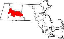 | |
| Towns | ||
| CDPs | ||
| Other villages | ||
| Footnotes | ‡This populated place also has portions in an adjacent county or counties | |
Boston (capital) | |
| Topics |
|
| Society | |
| Regions | |
| Counties | |
| Cities |
|