North Woolwich

Coordinates: 51°30′04″N 0°03′29″E / 51.501°N 0.058°E
North Woolwich is a place in the London Borough of Newham on the north bank of the River Thames. It lies opposite the main part of Woolwich which is on the south bank in the Royal Borough of Greenwich. The two parts of Woolwich are linked by the Woolwich Ferry, the Woolwich foot tunnel and the Docklands Light Railway. North Woolwich consists of two nearby tracts of land, totalling 412 acres (1.7 km2). The western detached part is surrounded on three sides by the parish of East Ham and the eastern portion borders East Ham to the west and Barking Town to the north.[1]
History
North Woolwich has been a detached parts of the historic county of Kent [2] at least since the Norman Conquest when one of William the Conqueror's lords, Hamo, was granted land on both sides of the Thames at this spot, probably to enable him to enjoy the taxes from cross-river traffic. It lies in the parish of Woolwich which was originally used to structure local administration but this later changed with the creation of the Metropolitan Borough of Woolwich. Local administration changed again with the creation of the London Borough of Newham in 1965. At the same time local administration for Woolwich south of the Thames was passed to the Royal Borough of Greenwich. North Woolwich then became detached administratively as well as geographically from the main part of Woolwich. It is unique in Outer London in being part of the County of London before 1965. The population peaked just before the First World War, and reduced substantially in the Second World War when it was heavily bombed.
The area was formerly the site of industries including the cable works of W T Henley (later AEI) and the Western Electric Co (later STC) on the river to the west of the ferry, and a large Harland & Wolff ship building and repair shop at Gallions Point to the south of the King George V Dock entrance lock (not to be confused with their works at the western end of the dock). Often on the day of launch of a new ship, the company would invite children from the local primary school (Storey Street; now closed) to witness the event.
The now disused North Woolwich railway station, which was closed in preparation for future transport developments which will use sections of the line, is situated adjacent to the ferry terminal. An extension of the Docklands Light Railway to the area opened in December 2005. Until 2009, this terminated at King George V; a further extension south of the river, to Woolwich Arsenal, opened in 2009. This situation means that North Woolwich now sports two old station buildings. The closed North London Line station is adjacent to an earlier station which closed in 1979; this housed the now closed Old Station Museum from 1984, which was devoted to the history of the Great Eastern and London and North Eastern railways.
North Woolwich is linked to Woolwich, to its South, by the Woolwich Free Ferry, the Docklands Light Railway and a free pedestrian tunnel.
Population
- 1871: 1,455
- 1881: 1,504
- 1891: 2,055
- 1901: 3,086
- 1911: 4,409
- 1921: 3,970
- 1931: 3,579
Nearby places
The nearest Docklands Light Railway station is King George V.
Education
- For details of education in North Woolwich see the List of schools in the London Borough of Newham
Gallery
 North Woolwich old railway museum frontage. (February 2007)
 North Woolwich old railway museum. The platform for the recently closed North London Line station is visible on the far right. (February 2007)
References
- ↑ 'West Ham: Introduction', A History of the County of Essex: Volume 6 (1973) Date accessed: 27 July 2009
- ↑ "Hansard : Considerations". 18 June 1874. Retrieved 5 Oct 2011.
External links
| Districts | 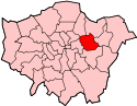 | |
|---|---|---|
| Attractions | ||
| Sports | ||
| Markets | ||
| Parks and open spaces |
| |
| Constituencies | ||
| Tube, rail and DLR stations |
| |
| Other topics | ||