North Terrace, Adelaide


North Terrace is one of the four terraces that bound the central business and residential district of Adelaide, the capital city of South Australia. It runs east-west, along the northern edge of "the square mile". The western end continues on to Port Road, and the eastern end continues across the Adelaide Parklands as Botanic Road.[1][2]
North Side of North Terrace
Theoretically, the northern side of North Terrace is part of the Adelaide Parklands. However, much of the space between North Terrace and the River Torrens is occupied by cultural institutions and other public buildings. Starting from West Terrace and travelling east, these buildings include:
- Parkland
- The new Royal Adelaide Hospital (construction site)
- South Australian Health and Medical Research Institute (SAHMRI)
- Adelaide Medical and Nursing Schools (construction site for the University of Adelaide)
- City Sk8 Park, a skateboarding facility next to the railway yards
(Morphett Street bridge)
- Adelaide Convention Centre, Exhibition Halls (partly above the railway station platforms)
- Riverside Centre (above the railway station platforms)
- InterContinental Hotel (above the railway station platforms)
- Adelaide railway station building
- Adelaide Casino (inside the historic station building)
- Old Parliament House - the original South Australian Parliament building
- Parliament House
- The Adelaide Festival Centre and Elder Park are behind Parliament House, between North Terrace and the River Torrens – also accessible from King William Road
- Government House, the official residence of the Governor of South Australia
- The historic Torrens Parade Ground is behind Government House, between North Terrace and the River Torrens – accessible from King William Road
- The South African War Memorial stands in front of Government House on a traffic island at the corner of North Terrace and King William Road
- The Jubilee 150 Walkway commences in front of Government House
- National War Memorial
(Kintore Avenue)
- State Library of South Australia
- Institute Building (1859)
- Spence Wing
- Mortlock Wing (1884)
- South Australian Museum
- Art Gallery of South Australia
- University of Adelaide (original campus, now called the Main campus):
- Mitchell Building
- Elder Conservatorium of Music
- Bonython Hall[3]
- Napier Building
- Ligertwood Building
- The Jubilee 150 Walkway finishes in front of the Napier/Ligertwood plaza.
- University of South Australia (original campus, now called the City East campus)
- Brookman Building
- The (old/current) Royal Adelaide Hospital
- Adelaide Botanic Gardens
- Adelaide Botanic Gardens
- National Wine Centre of Australia
South Side of North Terrace
Starting at West Terrace and travelling east, the southern side of the street includes:
- The Newmarket Hotel
- Assorted accommodation, businesses and medical practices
- Many buildings forming the City West campus of the University of South Australia
- The Lion Arts Centre (in the old Fowler's Lion Flour Factory building)
(Morphett Street bridge)
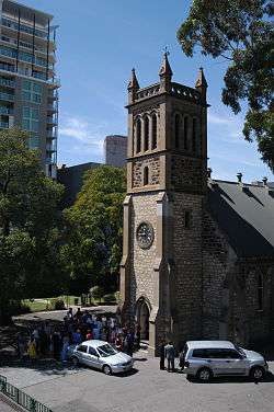
- The historic Holy Trinity Church (Anglican)
- Assorted accommodation, businesses and government offices
- The Dame Roma Mitchell building
- Assorted accommodation and various Adelaide head offices (e.g. MyBudget, Origin Energy)
- The former Adelaide head office of the Westpac Bank
- The exclusive, historic and discreetly labelled Adelaide Club (for gentlemen)
- The Myer Centre, part of the Rundle Mall shopping precinct
- The exclusive, historic and unlabelled Queen Adelaide Club (for ladies)[4]
- "Gawler Chambers", the former Adelaide offices of the South Australian Company
(Gawler Place)
- Assorted businesses and medical practices
- David Jones, part of the Rundle Mall shopping precinct
- Assorted businesses, medical practices and University of Adelaide buildings
- The historic Scots Church (originally Free Church of Scotland, then Presbyterian, now Uniting Church)[5]
- Various buildings occupied by the University of Adelaide
- The historic and architecturally elaborate Freemasons' building
- The Waterhouse house
- Assorted businesses
- The First Church of Christ, Scientist ("Christian Scientist" Church)
(Frome Street)
- Assorted businesses
- The historic Ayers House
- 19th century Terrace houses
- The historic Botanic Hotel
Glenelg Tramline extensions
In October 2007, the extension of the Glenelg Tramline from Victoria Square to the University of South Australia City West campus was completed. In 2009, construction commenced on a further extension of the line west to the Parklands, and then northwest and west through the Parklands to the Adelaide Entertainment Centre at the start of Port Road, Adelaide's major northwestern arterial road.
The tram now operates from Glenelg to South Terrace, along the entire length of King William Street to North Terrace, along North Terrace to West Terrace, and then to the Entertainment Centre. Talk of possible further extensions periodically surfaces in newspapers and politicians' speeches.
Picture gallery
 Monument on the corner of West Terrace (northern side)
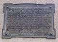 Plaque on monument on the corner of West Terrace
 The Hawke Building, part of the UniSA, City West Campus
 The Yungondi Building, part of the UniSA, City West Campus
- The City West tram stop - left-to-right: InterContinental Hotel, Riverside Building, Morphett Street bridge, multi-storey accommodation, the old Lion Flour factory
 Part of the Adelaide railway station building - main entrance
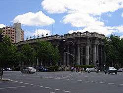 Parliament House with InterContinental Hotel
 Opening of Parliament House, Adelaide, by the Governor-General, 5 June 1939.
 View of the South African War Memorial, looking West along North Terrace, circa 1925
 View of the South African War Memorial, looking West along North Terrace, circa 2008
 View to south along King William Road towards intersection with North Terrace
 Government House, Adelaide in the 1930s
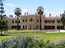
 The Adelaide Club, 165 North Terrace
 The Queen Adelaide Club, cnr North Terrace and Stephens Place
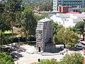
- View of North Terrace, looking east from near King William Street, circa 1940
 Institute Building (1859), now part of the State Library, housing the Sir Donald Bradman collection
 Statue of Edward VII in front of the Institute Building
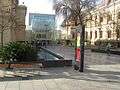 State Library entrance to Spence Wing
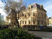 Mortlock Wing of the State Library
 South Australian Museum Complex
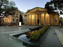 Art Gallery of South Australia and part of the South Australian Museum
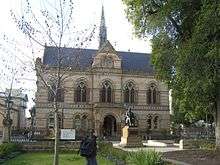 Mitchell Building, University of Adelaide
 Eastern side of Mitchell Building, University of Adelaide


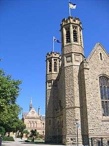 Bonython Hall, University of Adelaide (looking west)
 Freemasons' Hall
 Waterhouse House
 Waterhouse House history
 Brookman Building c.2010 - after renovation
 Looking south-west from Frome Road
 Terrace Houses, East End
 Botanic Hotel, cnr East and North Terraces
 Buildings on North Terrace
See also
| Wikimedia Commons has media related to North Terrace, Adelaide. |
![]() South Australia portal
South Australia portal
![]() Australian Roads portal
Australian Roads portal
References
- ↑ 2003 Adelaide Street Directory, 41st Edition. UBD (A Division of Universal Press Pty Ltd). 2003. ISBN 0-7319-1441-4.
- ↑ Map of the Adelaide city centre, North Adelaide and the Adelaide Park Lands.
- 1 2 Bonython Hall is opposite Pulteney Street, and was built in 1936 as a result of a donation of over £50,000 from Sir John Langdon Bonython. Pulteney Street is the only one of the city's north-south thoroughfares which does not continue north through the parklands. Folklore has it that the Bonython donation was made on the condition that a hall be built opposite Pulteney Street, thus blocking any future path through the parklands and preventing the division of the campus by a major thoroughfare.
- ↑ Queen Adelaide Club > Club history Accessed 15 January 2013.
- ↑ "Our History". Scots Church. Retrieved 8 December 2014.
Streets and squares of Adelaide city centre | ||||||||||||||||||
|---|---|---|---|---|---|---|---|---|---|---|---|---|---|---|---|---|---|---|
| ||||||||||||||||||
Coordinates: 34°55′16″S 138°36′21″E / 34.9212°S 138.6059°E