North Providence, Rhode Island
| North Providence, Rhode Island | |
|---|---|
| City | |
|
Fatima Hospital | |
 Location in Providence County and the state of Rhode Island. | |
| Coordinates: 41°51′36″N 71°27′23″W / 41.86000°N 71.45639°WCoordinates: 41°51′36″N 71°27′23″W / 41.86000°N 71.45639°W | |
| Country | United States |
| State | Rhode Island |
| County | Providence |
| Government | |
| • Type | Mayor-council |
| • Mayor | Charles A. Lombardi |
| • Town Council |
Stephen L. Feola (D) Alice C. Brady (D) Raymond A. DeStefanis (D) Dino P. Autiello (D) Kristen J. Catanzaro (D) William Warren (D) Mansuet J. Giusti (D) |
| Area | |
| • Total | 5.9 sq mi (15.1 km2) |
| • Land | 5.8 sq mi (14.6 km2) |
| • Water | 0.2 sq mi (0.2 km2) |
| Elevation | 184 ft (56 m) |
| Population (2015) | |
| • Total | 32,480 |
| • Density | 5,627.7/sq mi (2,182.2/km2) |
| Time zone | Eastern (EST) (UTC-5) |
| • Summer (DST) | EDT (UTC-4) |
| ZIP codes | 02904, 02908, 02911 |
| Area code(s) | 401 |
| FIPS code | 44-51760[1] |
| GNIS feature ID | 1219763[2] |

North Providence is a town in Providence County, Rhode Island, United States. The population was 32,078 at the 2010 census.
Geography
According to the United States Census Bureau, the town has a total area of 5.8 square miles (15 km2), of which, 5.7 square miles (15 km2) of it is land and 0.1 square miles (0.26 km2) of it (2.07%) is water.
Within the town, there are several villages and neighborhoods, such as Allendale, Centredale, Fruit Hill, Greystone, Louisquisset, Lymansville, Marieville, Woodville, and Geneva.
North Providence is bordered by Providence to the south, Johnston to the west, Smithfield and Lincoln to the north, and Pawtucket to the east. Has a total of 7 elementary schools, 2 middle schools, and a highschool.
History
Founding History
Settled shortly after Roger Williams arrived in 1636, North Providence was incorporated as a town in 1765. It originally included parts of what are today the cities of Providence and Pawtucket. Early colonial settlers built stone-ender houses such as the Joseph Smith House (1705), which is now listed the National Register of Historic Places.
North Providence elected its first mayor in 1974. Since then, the town has been governed by a mayor and seven-member town council.
The town has had four elected mayors:
From 1974 - 1994: Salvatore Mancini
From 1994 - 1996: G. Richard Fossa
From 1996 - 2007: A. Ralph Mollis
From 2007– Present: Charles Lombardi
Tax Collector: Claudette Mooney
The Centredale Manor Restoration Project Superfund Site
From at least 1921-1971, the Centredale Manor area of North Providence was contaminated by textile, chemical, and drum recycling industries that discarded toxic liquids and wastes into the surrounding soil and river (EPA 1999). In 2000, the United States Environmental Protection Agency declared a 9-acre (36,000 m2) area including parts of Centredale Manor and Brook Village, both affordable housing units for senior citizens, a superfund site. The agency documented high levels of toxic chemicals like dioxin, VOCs, and PCBs in fish as well as soil from the area. Because of this the area has been fenced off from the community with warning signs against eating contaminated fish, and is undergoing evaluation for clean-up.
Town Council Arrests
On May 4, 2010, three members of the North Providence Town Council were arrested by the FBI and charged in Federal Court with taking a $25,000 bribe so that a developer could build a supermarket in their town.[3]
Demographics
| Historical population | |||
|---|---|---|---|
| Census | Pop. | %± | |
| 1790 | 1,071 | — | |
| 1800 | 1,067 | −0.4% | |
| 1810 | 1,758 | 64.8% | |
| 1820 | 2,420 | 37.7% | |
| 1830 | 3,503 | 44.8% | |
| 1840 | 4,207 | 20.1% | |
| 1850 | 7,680 | 82.6% | |
| 1860 | 11,818 | 53.9% | |
| 1870 | 20,495 | 73.4% | |
| 1880 | 1,467 | −92.8% | |
| 1890 | 2,084 | 42.1% | |
| 1900 | 3,016 | 44.7% | |
| 1910 | 5,407 | 79.3% | |
| 1920 | 7,697 | 42.4% | |
| 1930 | 11,104 | 44.3% | |
| 1940 | 12,156 | 9.5% | |
| 1950 | 13,927 | 14.6% | |
| 1960 | 18,220 | 30.8% | |
| 1970 | 24,337 | 33.6% | |
| 1980 | 29,188 | 19.9% | |
| 1990 | 32,090 | 9.9% | |
| 2000 | 32,411 | 1.0% | |
| 2010 | 32,078 | −1.0% | |
| Est. 2015 | 32,480 | [4] | 1.3% |
As of the census[1] of 2000, there were 32,523 people, 14,209 households, and 8,368 families residing in the town. The population density was 5,720.2 people per square mile (2,207.0/km²). There were 14,867 housing units at an average density of 2,623.9 per square mile (1,012.4/km²). The racial makeup of the town was 91.98% White, 2.65% African American, 0.17% Native American, 1.85% Asian, 0.02% Pacific Islander, 1.58% from other races, and 1.76% from two or more races. 3.85% of the population were Hispanic or Latino of any race.
There were 14,351 households out of which 22.4% had children under the age of 18 living with them, 44.5% were married couples living together, 11.5% had a female householder with no husband present, and 40.5% were non-families. 34.8% of all households were made up of individuals and 13.8% had someone living alone who was 65 years of age or older. The average household size was 2.23 and the average family size was 2.91.
In the town the population was spread out with 18.3% under the age of 18, 7.5% from 18 to 24, 30.3% from 25 to 44, 24.1% from 45 to 64, and 19.7% who were 65 years of age or older. The median age was 41 years. For every 100 females there were 87.4 males. For every 100 females age 18 and over, there were 83.5 males.
The median income for a household in the town was $37,897, and the median income for a family was $52,795. Males had a median income of $34,352 versus $27,553 for females. The per capita income for the town was $22,284. About 5.6% of families and 8.1% of the population were below the poverty line, including 9.8% of those under age 18 and 8.7% of those age 65 or over.
Notable people
- Ernie DiGregorio, former NBA player
- Jim Gilchrist, founder of the controversial Minuteman Project
- Danielle Lacourse, Miss Rhode Island USA 2007; first runner-up at Miss USA 2007
- Zellio Toppazzini, NHL - AHL hockey player; Rhode Island Reds Player of the Century; Providence College head coach
References
- 1 2 "American FactFinder". United States Census Bureau. Retrieved 2008-01-31.
- ↑ "US Board on Geographic Names". United States Geological Survey. 2007-10-25. Retrieved 2008-01-31.
- ↑ "Town council members accused of corruption". WJAR. 6 May 2010. Retrieved 6 May 2010.
- ↑ "Annual Estimates of the Resident Population for Incorporated Places: April 1, 2010 to July 1, 2015". Retrieved July 2, 2016.
- ↑ "Census of Population and Housing". Census.gov. Retrieved June 4, 2016.
- ↑ Snow, Edwin M. (1867). Report upon the Census of Rhode Island 1865. Providence, RI: Providence Press Company.
External links
-
 North Providence travel guide from Wikivoyage
 - Town website
- North Providence Recreation Department
Municipalities and communities of Providence County, Rhode Island, United States | ||
|---|---|---|
| Cities | 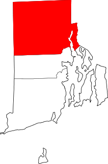 | |
| Towns | ||
| Villages | ||
Providence (capital) | |
| Topics |
|
| Society |
|
| Regions | |
| Cities | |
| Towns |
|