North Cleveland Park
| North Cleveland Park | |
|---|---|
| Neighborhood of Washington, D.C. | |
|
Intelsat headquarters | |
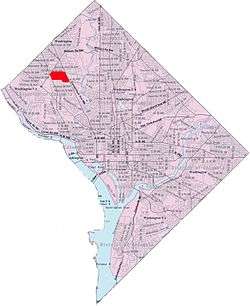 Map of Washington, D.C., with North Cleveland Park highlighted in red | |
| Coordinates: 38°56′59″N 77°05′24″W / 38.9497°N 77.09°WCoordinates: 38°56′59″N 77°05′24″W / 38.9497°N 77.09°W | |
| Country | United States |
| District | Washington, D.C. |
| Ward | Ward 3 |
| Government | |
| • Councilmember | Mary Cheh |

North Cleveland Park is a neighborhood in the Northwest quadrant of Washington, D.C.
It is bounded by Albemarle Street NW to the north, Rodman and Quebec Streets NW to the south, Wisconsin and Nebraska Avenues NW to the west, and Connecticut Avenue to the east. It is served by the Van Ness–UDC station on the Washington Metro's Red Line, and is therefore — like the adjacent Forest Hills neighborhood — frequently referred to as Van Ness.[1][2]
North Cleveland Park should not be confused with the neighboring Cleveland Park to its south: although both are part of the original tract of land on which President Grover Cleveland built his summer estate in the 1880s, they are separate neighborhoods.
The neighborhood is home to the Van Ness campus of the University of the District of Columbia, the headquarters of Intelsat, a major employer in the area, Sidwell Friends School, Sheridan School and several embassies, including those of Austria, Bahrain, Bangladesh, Brunei, China, Egypt, Ethiopia, Ghana, Honduras, Israel, Jordan, Kuwait, Malaysia, Monaco, Morocco (future site), Nigeria, Pakistan, Singapore, Slovakia and the United Arab Emirates.[3]