North Carolina Highway 3
| ||||
|---|---|---|---|---|
| Dale Earnhardt Boulevard | ||||
 | ||||
| Route information | ||||
| Maintained by NCDOT | ||||
| Length: | 27.8 mi[1] (44.7 km) | |||
| Existed: | 2002[2] – present | |||
| Major junctions | ||||
| South end: |
| |||
|
| ||||
| North end: |
| |||
| Highway system | ||||
| ||||

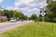
North Carolina Highway 3 (NC 3) is a 27.8 miles (44.7 km) state highway in the U.S. state of North Carolina. The road runs from US 601 in southern Concord, north through Mooresville to US 29 in Kannapolis. It is numbered after Dale Earnhardt, the NASCAR driver, who was driving the #3 car when he died at the 2001 Daytona 500.[3] This state highway runs from Kannapolis, Earnhardt's birthplace, to downtown Mooresville. A short section of NC 3 is named Dale Earnhardt Boulevard, a name which was given to the road prior to Earnhardt's death.
Route description
NC 3's southern terminus is in Concord, at NC 73. From there, NC 3 travels north through Kannapolis and on to Mooresville. After meandering through downtown Mooresville and switching roads multiple times, NC 3 meets its northern terminus at Plaza Drive (NC 150).
History

In 1934, NC 3 was signed as a short 1.5-mile (2.4 km) route on Buck Island traveling from U.S. Highway 158 to the Currituck Sound in Currituck County.[2]
On October 23, 2002, Governor Mike Easley signed into law a bill officially reassigning NC 136 to NC 3's current route and vice versa. NC 3 was moved because it was the hometown of the aforementioned Dale Earnhardt who died in the 2001 Daytona 500. Earnhardt drove the #3 Goodwrench Chevrolet and grew up in the Mooresville region. NC 136 now follows the old NC 3 route.[3]
Major intersections
| County | Location | mi[1] | km | Destinations | Notes |
|---|---|---|---|---|---|
| Cabarrus | Concord | 0.0 | 0.0 | ||
| 2.9 | 4.7 | ||||
| Kannapolis | 8.6 | 13.8 | |||
| Iredell | Mooresville | 27.0 | 43.5 | Western terminus of NC 152 | |
| 27.0 | 43.5 | ||||
| 27.8 | 44.7 | ||||
| 1.000 mi = 1.609 km; 1.000 km = 0.621 mi | |||||
References
- 1 2 Google (January 28, 2016). "North Carolina Highway 3" (Map). Google Maps. Google. Retrieved January 28, 2016.
- 1 2 NCRoads Annex - NC 3 Archived September 18, 2011, at the Wayback Machine.
- 1 2 "SESSION LAW 2002-170 HOUSE BILL 1516" (PDF). General Assembly of North Carolina. Retrieved 2010-01-05.
External links
-
 Media related to North Carolina Highway 3 at Wikimedia Commons
 - NCRoads.com: N.C. 3