North Carolina's 5th congressional district
"NC-5" redirects here. NC-5 may also refer to North Carolina Highway 5.
| North Carolina's 5th congressional district | ||
|---|---|---|
.tif.png) | ||
| Current Representative | Virginia Foxx (R–Banner Elk) | |
| Distribution | 42.95% urban, 57.05% rural | |
| Population (2000) | 619,178 | |
| Median income | $39,710 | |
| Ethnicity | 89.5% White, 6.8% Black, 0.8% Asian, 3.6% Hispanic, 0.2% Native American, 0.2% other | |
| Cook PVI | R+12[1] | |
North Carolina's 5th congressional district covers the northwestern corner of North Carolina from the Appalachian Mountains to the Piedmont Triad.
The fifth district is represented by Rep. Virginia Foxx, a Republican. She has held the office since 2005, defeating Democrats Roger Sharpe and Roy Carter in 2006 and 2008 respectively.
List of representatives
| Representative | Party | Years | District Residence | Note | |
|---|---|---|---|---|---|
 John Sevier John Sevier |
Pro-Administration | June 16, 1790 – March 3, 1791 | Ceded by the state to the Federal government in 1789. Sevier was permitted to serve anyway although he wasn't representing any part of a state. | ||
 William B. Grove William B. Grove |
Pro-Administration | March 4, 1791 – March 3, 1793 | Redistricted to the 7th district after original district ceded to federal government to later become Tennessee. | ||
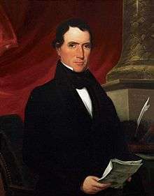
 Nathaniel Macon Nathaniel Macon |
Anti-Administration | March 4, 1793 – March 3, 1795 | Redistricted from the 2nd district | ||
| Democratic-Republican | March 4, 1795 – March 3, 1803 | Redistricted to the 6th district | |||
| James Gillespie |
Democratic-Republican | March 4, 1803 – March 3, 1805 | |||
| Thomas Kenan |
Democratic-Republican | March 4, 1805 – March 3, 1811 | |||
 William R. King William R. King |
Democratic-Republican | March 4, 1811 – November 4, 1816 | Resigned | ||
| Charles Hooks |
Democratic-Republican | December 2, 1816 – March 3, 1817 | |||
| James Owen |
Democratic-Republican | March 4, 1817 – March 3, 1819 | |||
| Charles Hooks |
Democratic-Republican | March 4, 1819 – March 3, 1823 | |||
| Crawford D-R | March 4, 1823 – March 3, 1825 | ||||
| Gabriel Holmes |
Jacksonian | March 4, 1825 – September 26, 1829 | Died | ||
| Edward B. Dudley |
Jacksonian | November 10, 1829– March 3, 1831 | |||
| James I. McKay |
Jacksonian | March 4, 1831 – March 3, 1837 | |||
| Democratic | March 4, 1837 – March 3, 1843 | Redistricted to the 6th district | |||
| Romulus M. Saunders |
Democratic | March 4, 1843 – March 3, 1845 | Redistricted from the 8th district | ||
 James C. Dobbin James C. Dobbin |
Democratic | March 4, 1845 – March 3, 1847 | |||
| Abraham W. Venable |
Democratic | March 4, 1847 – March 3, 1853 | |||
| John Kerr, Jr. |
Whig | March 4, 1853 – March 3, 1855 | |||
| Edwin G. Reade |
Know Nothing | March 4, 1855 – March 3, 1857 | |||
 John A. Gilmer John A. Gilmer |
Know Nothing | March 4, 1857 – March 3, 1859 | |||
| Opposition | March 4, 1859 – March 3, 1861 | ||||
| Civil War and Reconstruction | |||||
| Israel G. Lash |
Republican | July 20, 1868 – March 3, 1871 | |||
 James M. Leach James M. Leach |
Democratic | March 4, 1871 – March 3, 1875 | |||
 Alfred M. Scales Alfred M. Scales |
Democratic | March 4, 1875 – December 30, 1884 | Resigned after being elected Governor | ||
| James W. Reid |
Democratic | January 28, 1885 – December 31, 1886 | Resigned | ||
 John M. Brower John M. Brower |
Republican | March 4, 1887 – March 3, 1891 | |||
| Archibald H. A. Williams |
Democratic | March 4, 1891 – March 3, 1893 | |||
| Thomas Settle III |
Republican | March 4, 1893 – March 3, 1897 | |||
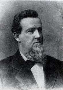
 William W. Kitchin William W. Kitchin |
Democratic | March 4, 1897 – January 11, 1909 | Resigned after being elected Governor | ||
 John M. Morehead John M. Morehead |
Republican | March 4, 1909 – March 3, 1911 | |||
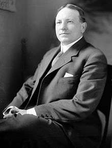
 Charles M. Stedman Charles M. Stedman |
Democratic | March 4, 1911 – September 23, 1930 | Died | ||
| Franklin W. Hancock, Jr. |
Democratic | November 4, 1930 – January 3, 1939 | |||
 Alonzo D. Folger Alonzo D. Folger |
Democratic | January 3, 1939 – April 30, 1941 | Died | ||
| John H. Folger |
Democratic | June 14, 1941 – January 3, 1949 | |||
 Richard T. Chatham Richard T. Chatham |
Democratic | January 3, 1949 – January 3, 1957 | |||
| Ralph J. Scott |
Democratic | January 3, 1957 – January 3, 1967 | |||
 Nick Galifianakis Nick Galifianakis |
Democratic | January 3, 1967 – January 3, 1969 | Redistricted to the 4th district | ||
 Vinegar Bend Mizell Vinegar Bend Mizell |
Republican | January 3, 1969 – January 3, 1975 | |||
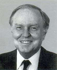 Stephen L. Neal Stephen L. Neal |
Democratic | January 3, 1975 – January 3, 1995 | |||
 Richard Burr Richard Burr |
Republican | January 3, 1995 – January 3, 2005 | |||
 Virginia Foxx Virginia Foxx |
Republican | January 3, 2005 – Present | |||
Historical district boundaries

See also
References
- ↑ "Partisan Voting Index Districts of the 113th Congress: 2004 & 2008" (PDF). The Cook Political Report. 2012. Retrieved 2013-01-10.
- Martis, Kenneth C. (1989). The Historical Atlas of Political Parties in the United States Congress. New York: Macmillan Publishing Company.
- Martis, Kenneth C. (1982). The Historical Atlas of United States Congressional Districts. New York: Macmillan Publishing Company.
- Congressional Biographical Directory of the United States 1774–present
External links
Coordinates: 36°08′42″N 80°57′38″W / 36.14500°N 80.96056°W
This article is issued from Wikipedia - version of the 11/2/2016. The text is available under the Creative Commons Attribution/Share Alike but additional terms may apply for the media files.