North Attleborough, Massachusetts
| North Attleborough, Massachusetts | ||
|---|---|---|
| Town | ||
|
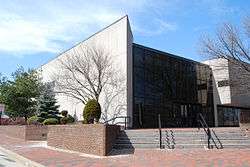
North Attleborough Town Hall | ||
| ||
| Nickname(s): Big Red | ||
 Location in Bristol County in Massachusetts | ||
| Coordinates: 41°59′00″N 71°20′00″W / 41.98333°N 71.33333°WCoordinates: 41°59′00″N 71°20′00″W / 41.98333°N 71.33333°W | ||
| Country | United States | |
| State | Massachusetts | |
| County | Bristol | |
| Settled | 1669 | |
| Incorporated | 1887 | |
| Government | ||
| • Type | Representative town meeting | |
| • Board of Selectmen |
Paul Belham (Chairman) Joan Marchitto (Vice-Chair) Anne Lonzo Patrick Reynolds John C. Rhyno | |
| Area | ||
| • Total | 19.1 sq mi (49.3 km2) | |
| • Land | 18.6 sq mi (48.3 km2) | |
| • Water | 0.4 sq mi (1.1 km2) | |
| Elevation | 200 ft (61 m) | |
| Population (2000) | ||
| • Total | 28,712 | |
| • Density | 1,456.0/sq mi (562.2/km2) | |
| Time zone | Eastern (UTC-5) | |
| • Summer (DST) | Eastern (UTC-4) | |
| ZIP code | 02760 | |
| Area code(s) | 508 / 774 | |
| FIPS code | 25-46575 | |
| GNIS feature ID | 0618284 | |
| Website |
www | |
North Attleborough, commonly written North Attleboro, is a town in Bristol County, Massachusetts, United States. The population was 28,712 at the 2010 United States Census.
The village of North Attleborough Center is located in the town.
History
North Attleborough [formerly a part of Attleborough] is an industrial town on the Rhode Island border. In pre-Colonial times, it was the site of the Bay Path, a major Indian trail to Narragansett Bay, the Seekonk River and Boston. John Woodcock and family established a small settlement in North Attleborough in 1669, which subsisted on agriculture, fishing and hunting. By 1670, Woodcock had received a license to open a tavern. The settlement was attacked during King Philip's War, with two killed and one home burned, but the garrison house which Woodcock had built survived the attack. The Woodcock-Garrison house was used as sleeping quarters for George Washington on his army's march to Boston to rid the city of General Thomas Gage's troops. The Garrison house is still open for tours and is an especially popular destination for field trips by local school children.
By 1776, there were 2200 people living in North Attleborough. In about 1780, a French settler set up a forge for working brass and the industrial era arrived in [1] Attleborough. Englishmen brought with them British machinery from Birmingham in 1794 and designed American improvements in button making which they patented. During the 18th and early 19th centuries, small grist and sawmills were built along the Ten Mile River, and subsequently established nail factories were eventually eclipsed by cotton spinning mills. The development of cotton spinning was spurred by the embargo on imports resulting from the War of 1812. Textiles and jewelry manufacturing were the staple industries of the town by 1832 but buttons were king. By 1834, it was said that North Attleboro produced more buttons than anywhere else in the United States.
Until 1887, North Attleborough was part of Attleborough. The residents of the village of East Attleborough (now Attleborough centre) chose to secede, and had the higher population and the votes to keep the name of Attleboro, the traditional spelling. When re-incorporating as the City of Attleborough, they chose to officially alter the name of their city. North Attleborough, the original settlement, kept the original official spelling, but lost the distinction of being Attleborough, and its founding date of 1694 was also appropriated by Attleborough.
In the twentieth century, North Attleborough was home at various times to the jewelry firms Jostens, the world's largest class ring manufacturer and the Balfour Company, prominent maker of championship rings including for the National Football League's Super Bowl champions and Major League Baseball's World Series' winners.
Through the 19th century there was tremendous growth and innovation in the jewelry industry and the number of firms in the town increased sharply. By 1855, there were 24 shops making almost $1 million in jewelry in both Attleborough and North Attleborough. The American Civil War spurred their growth with profitable U.S. Army orders for badges and medals. In 1887, North Attleboro was officially incorporated as a town. Today it is a thriving center of business and commerce with a small industrial park and many shops and stores along US Route 1 which travels through the center of town.
In 2006, North Attleborough was rated in the top ten for professional sports communities in the entire country and was also listed as one of the most affordable and safest places to raise a family.
Geography
According to the United States Census Bureau, the town has a total area of 19.0 square miles (49 km2), of which 18.6 square miles (48 km2) is land and 0.4 square miles (1.0 km2) (2.15%) is water. The town is roughly quadrilateral-shaped, and makes the northwest corner of Bristol County. It is bordered by Plainville to the north, Mansfield to the east, Attleborough to the south, and Cumberland, Rhode Island to the west. Localities include Adamsdale, Attleborough Falls and Sheldonville Farms. The town is located 16 miles north of Providence, Rhode Island, 38 miles southwest of Boston and 42 miles southeast of Worcester, Massachusetts.
The town has several rivers, streams and brooks running through it, including the Ten Mile River and the Seven Mile River. There are several ponds and lakes, including Greenwood Lake (site of a fish hatchery) and Falls Pond, among others. The town's largest park, World War I Memorial Park, is located in the northern part of town and contains the highest point in Bristol County - Sunrise Hill (Watery Hill) at 390 feet above sea level. World War I Memorial Park features a petting zoo, Petti Field for soccer and lacrosse and a ski/sledding hill with J-bar ski lift which is currently inoperable. There is also the North Attleborough Arboretum adjacent to the park.
On High Street, one block from Route 1A is an ice-skating pond called Titus Pond which is maintained by the North Attleborough Rotary Club and filled each winter by the Fire Department.
There are five cemeteries in North Attleborough: the diminutive and inactive Woodcock Cemetery across from the Woodcock Garrison house just north of downtown; Paine Road Cemetery near the Cumberland, Rhode Island, border; Mt. Hope Cemetery & Arboreum; the old St. Mary's Cemetery and the new St. Mary's Cemetery. The latter three are located in the village of Attleborough Falls.
Demographics
| Historical population | ||
|---|---|---|
| Year | Pop. | ±% |
| 1890 | 6,727 | — |
| 1900 | 7,253 | +7.8% |
| 1910 | 9,562 | +31.8% |
| 1920 | 9,238 | −3.4% |
| 1930 | 10,197 | +10.4% |
| 1940 | 10,359 | +1.6% |
| 1950 | 12,146 | +17.3% |
| 1960 | 14,777 | +21.7% |
| 1970 | 18,665 | +26.3% |
| 1980 | 21,095 | +13.0% |
| 1990 | 25,038 | +18.7% |
| 2000 | 28,978 | +15.7% |
| 2010 | 28,712 | −0.9% |
| Source: United States Census records and Population Estimates Program data.[2][3][4][5][6][7][8] | ||
At the 2000 census,[9] there were 27,143 people, 10,391 households and 7,232 families residing in the town. The population density was 1,456.0 per square mile (562.2/km²). There were 10,635 housing units at an average density of 570.5 per square mile (220.3/km²). The racial makeup of the town was 95.97% White, 0.92% African American, 0.12% Native American, 1.71% Asian, 0.02% Pacific Islander, 0.45% from other races, and 0.81% from two or more races. Hispanic or Latino of any race were 1.32% of the population.
There were 10,391 households of which 36.0% had children under the age of 18 living with them, 57.0% were married couples living together, 9.4% had a female householder with no husband present, and 30.4% were non-families. 24.7% of all households were made up of individuals and 7.3% had someone living alone who was 65 years of age or older. The average household size was 2.60 and the average family size was 3.15.
Age distribution was 26.9% under the age of 18, 6.6% from 18 to 24, 34.4% from 25 to 44, 22.5% from 45 to 64, and 9.7% who were 65 years of age or older. The median age was 36 years. For every 100 females there were 94.6 males. For every 100 females age 18 and over, there were 91.3 males.
The median household income was $59,371, and the median family income was $69,461. Males had a median income of $47,645 versus $31,522 for females. The per capita income for the town was $25,974. About 2.7% of families and 3.8% of the population were below the poverty line, including 5.0% of those under age 18 and 3.9% of those age 65 or over.
Government
State and national government
North Attleborough is represented in the Massachusetts House of Representatives by Elizabeth "Betty" Poirier (R-North Attleborough), since 1999, as part of the Fourteenth Bristol district, which also includes sections of Attleborough and Mansfield.[10] In the State Senate, it is represented by Richard Ross (R-Wrentham) as part of the Norfolk, Bristol & Middlesex district, which includes the towns of Wayland, Sherborn, Millis, Norfolk, Wrentham and Plainville as well as sections of Natick, Wellesley, Needham, Franklin and Attleborough.[11] Ross won the seat in a special election in May 2010.
On the national level, North Attleborough is a part of Massachusetts's 4th congressional district in the United States House of Representatives represented by Joseph P. Kennedy III (D-Brookline). In the United States Senate it is represented by Elizabeth Warren (D-Cambridge) and Ed Markey (D-Malden).
Local government and services
North Attleborough has a representative town meeting form of government, with an elected board of selectmen and a town administrator appointed by the selectmen. The North Attleborough Police Department is located downtown in the old H.F. Barrows Manufacturing Company Building at 102 South Washington St. There are three fire stations, located downtown on Elm Street just off Route 1, Allen Ave behind Emerald Square Mall and on Route 152 in the eastern portion of town. There are also two post offices, downtown (using the 02760 ZIP code) and in Attleboro Falls (02763).
| Voter Registration and Party Enrollment as of October 15, 2008[12] | |||||
|---|---|---|---|---|---|
| Party | Number of Voters | Percentage | |||
| Democratic | 4,262 | 22.68% | |||
| Republican | 3,313 | 17.63% | |||
| Unaffiliated | 11,164 | 59.41% | |||
| Minor Parties | 50 | .28% | |||
| Total | 18,789 | 100% | |||
Education
Public schools
The town has its own school department, led by Superintendent of Schools Suzan Cullen since May 2011. The Superintendent is appointed by an elected School Committee of 7 registered voters serving staggered three year terms. Schools are funded by local RTM appropriation of available funds raised from local taxes and State aid. Between 2002 through 2012 State aid has been reduced by over $1,000,000.00 annually. Between 2012 and 2014 the School Committee has imposed fees for student parking, student activities, busing, and full day kindergarten to address the lack of operating revenue. Resulting in over $600,000 annually from fees, the North Attleborough school System remains one of the lowest funded schools, based on per pupil expenditure, in the Commonwealth of Massachusetts. Efforts to raise revenue by increases in local taxes failed by a 2-1 margin in 2013, and again in 2015, albeit by a much narrower margin. As a result, Allen Avenue Elementary School was closed at the conclusion of the 2014-2015 school year and about 900 elementary school students in all parts of town were redistricted to new elementary schools. According to The Sun Chronicle,[13] enrollment in the North Attleborough Public Schools dropped by 165 in the 2015-16 school year, largely due to an unusually high number of high school students opting to attend nearby private or technical schools in light of the budget issues.
The school system consists of:
- The Early Learning Center (Preschool)
- Amvet Boulevard School (Grades K-5)
- Community School (Grades K-5)
- Falls School (Grades K-5)
- Joseph W. Martin, Jr. Elementary School (Grades K-5)
- Roosevelt Avenue School (Grades K-5)
- North Attleborough Middle School (Grades 6-8)
- North Attleborough High School (Grades 9-12)
http://www.naschools.net/pages/North_Attleborough_Public_Scho
The high school's official team mascot is the Red Rocketeers, a name which comes from North Attleborough's unique red rocks found only in northern Bristol County and Cumberland, RI, and the school colors are red and white. The town's sports teams are also often nicknamed "The Rockets" or "Big Red" and North Attleboro is sometimes referred to as "Big Red Country" due to its proud history of a strong athletic department backed by widespread local and loyal school spirit. North Attleboro High School sports teams compete in the Kelley-Rex (or large school) division of the Hockomock League, consisting of area high schools including rivals Attleboro and Mansfield High Schools. NAHS's chief rival is Attleboro High School. The football teams play each other twice a year, once during the regular season and once on Thanksgiving. The Thanksgiving location alternates each year and the regular season game is held at the opposite site. Almost all other sports play each team in the Kelley-Rex division twice per season and each team in the Davenport (or small school) division once in the regular season. NAHS boasts a tradition of winning sports teams and regularly competes in state playoffs.
High school students may also choose to attend Tri-County Regional Vocational Technical High School, located in Franklin and including communities in Bristol, Norfolk and Middlesex Counties. Students are also able to attend Bristol County Agricultural High School in Dighton free of charge.
Private schools
The town is home to one Catholic K-8 school, Saint Mary-Sacred Heart School. The nearest private high school is Bishop Feehan High School in Attleboro, a Catholic high school.

Library

"The North Attleborough Public Library was established in 1889, by the North Attleborough Union Improvement District, which turned its library over to the town."[14] Today the Richards Memorial Library is located downtown, and is a member of SAILS library network, a network of libraries in Southeastern Massachusetts.[15] In fiscal year 2008, the town spent 0.77% ($572,874) of its budget on its public library—some $20 per person.[16]
Transportation
Interstates 95 and 295 meet just over the Attleborough line, and both run through the town. Each interstate has one exit within town. The town is also bisected by U.S. Route 1, which runs through the retail and downtown districts. Massachusetts state routes 120 and 152 also run through town, as does the "middle" portion of Route 1A, which begins in the town.
The town is set equidistantantly between the three nearest Massachusetts Bay Transportation Authority stops, in Mansfield, Attleborough Center and South Attleborough. The Greater Attleboro Taunton Regional Transit Authority provides bus services between the local towns and cities. The nearest national-level airport is T.F. Green Airport in Rhode Island, approximately 23 miles away, and the nearest international airport is Logan International Airport in Boston, approximately 42 miles away.
Points of interest

Youth Sports Programs
- Kryptonite Wrestling Klub www.KryptoniteKlub.com
- North Soccer Club www.northsoccerclub.com
- Little North Attleborough League
- Metro Basketball
- Park and Recreation soccer, field hockey, basketball, and softball
Boy Scouts of America
Cub Scouts: Grades 1-5
- Pack 9- Chartered out of Grace Episcopal Church in Downtown North Attleboro
- Pack 12- Chartered out of St. Mary's Catholic Church in Downtown North Attleboro
- Pack 32- Chartered out of North Attleboro Elks Club in Attleboro Falls
- Pack 65- Chartered out of Martin Elementary School in North Attleboro
Boy Scouts: Grades 5-12
- Troop 23- Chartered out of Grace Episcopal Church in Downtown North Attleboro
- Troop 33- Chartered out of Sacred Heart Catholic Church in Downtown North Attleboro
Historic
- Angle Tree Stone
- Powder House
- Community Field
- Falls Fire Barn
- First Congregational Church
- Little Red Schoolhouse (moved from its original location in Adamsdale section of North Attleborough)
- Mason Field
- North Attleborough Town Center Historic District
- Powder House
- Woodcock Garrison House
- WWI Memorial Park and Zoo
- WWII Memorial Pool
Natural
- Edward Sheehy Memorial Ski Slope
- Falls Pond
- Hoppin Hill Reservoir
- Whitings Pond
- Bungay Lake
- Mount Hope Cemetery and Arboretum
- National Fish Hatchery
- Balancing Rock in World War I Park
Places of worship
Catholic
- Sacred Heart, 58 Church St
- St. Mark's, Stanley St., Attleborough Falls
- St. Mary's, 14 Park St.
Interdenominational
- Twin Rivers Community Church, 23 Washington Street, downtown North Attleboro
Jewish
- Congregation Agudas Achim, Robert Toner Blvd. & Kelley Blvd.
Non-denominational
- Church of Christ, 444 Kelley Blvd.
Protestant
- Attleboro Area Council of Churches, 505 North Main St., Attleboro
- Central Congregational Church, 115 Commonwealth Ave. Attleborough Falls
- John Wesley African Methodist Episcopal Church, on the corner of Broad & Grove Sts.
- Cushman Union Church, 2 May St., Adamsdale
- First Baptist Church, No. Washington & Park Sts.
- First Congregational Church, 675 Old Post Road, Known as "Oldtown Church"
- First United Methodist, Routes 1 & 120
- Grace Episcopal, 104 No. Washington St., downtown North Attleborough
- Twin Rivers Community Church, 23 Washington Street, downtown North Attleboro
- Waters Church, 15 John L. Dietsch Blvd.
General
- YMCA Downtown Teen Center (The Zone)
- Emerald Square Mall
Notable people
- Brian Deck, notable public speaker, CNN contributor and former columnist for The Washington Post
- Colin Grafton Team USA figure skater, 2012 National bronze Medalist, 2012 Junior World Team Member
- Aaron Hernandez, former New England Patriots tight end[17] and convicted murderer,[18] currently housed at Souza-Baranowski Correctional Center in Lancaster, MA.
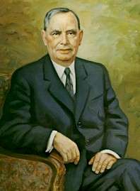
- Joseph W. Martin, Jr. (1884–1968), Republican US representative, Speaker of the House of Representatives from 1947–1949 and 1953–1955. Publisher of the North Attleborough Chronicle. The J.W. Martin Elementary School is named in his honor.
- Jerod Mayo is an American football linebacker for the New England Patriots of the National Football League (NFL)
- Allen Ripley -A former Boston and Pawtucket Red Sox, his best year as a pro came in 1977 with the Red Sox minor league affiliate in Pawtucket when he had a record of 15 wins and four losses. The next year he was promoted to Boston and went 2-5. He also played for the San Francisco Giants and Chicago Cubs. Upon retirement in 1982 he had a career record of 23-27.
- Anthony Sherman, fullback for the Kansas City Chiefs and formerly of the Arizona Cardinals
- Chris Sullivan, former defensive end for the New England Patriots and the Pittsburgh Steelers
- Robert F. Toner - Second lieutenant U.S. Army Air Corp. Second World War co-pilot of the Consolidated B-24 Liberator named Lady be Good which was lost in the Libyan desert in 1943. Toner Boulevard is named in his honor.
- Commander Lester Seneca Wall Jr., (13 April 1916 - 5 April 1950) U.S. Naval Academy graduate, Second World War naval aviator, sank Japanese battleship Ise with one 500 lb.bomb. Awarded the Navy Cross. Died during flight testing crash of an Grumman F8F Bearcat at Miramar Naval Air Station.
- Frank C. Whitmore (1887–1947), notable organic chemist. Provided evidence for the existence of carbocations. Also, published the first advanced organic chemistry book in the English language.
In popular culture
- Right There, an award-winning 2013 silent comedy film, was filmed in downtown North Attleboro.
- In "How to Marry a Millionaire" (1953 film starring Lauren Bacall and Marilyn Monroe) one of the ladies' dates mentions his mother in law is from North Attleborough, Massachusetts.
References
- ↑ A Sketch of the history of Attleborough by John Daggett
- ↑ "TOTAL POPULATION (P1), 2010 Census Summary File 1, All County Subdivisions within Massachusetts". United States Census Bureau. Retrieved September 13, 2011.
- ↑ "Massachusetts by Place and County Subdivision - GCT-T1. Population Estimates". United States Census Bureau. Retrieved July 12, 2011.
- ↑ "1990 Census of Population, General Population Characteristics: Massachusetts" (PDF). US Census Bureau. December 1990. Table 76: General Characteristics of Persons, Households, and Families: 1990. 1990 CP-1-23. Retrieved July 12, 2011.
- ↑ "1980 Census of the Population, Number of Inhabitants: Massachusetts" (PDF). US Census Bureau. December 1981. Table 4. Populations of County Subdivisions: 1960 to 1980. PC80-1-A23. Retrieved July 12, 2011.
- ↑ "1950 Census of Population" (PDF). 1: Number of Inhabitants. Bureau of the Census. 1952. Section 6, Pages 21-10 and 21-11, Massachusetts Table 6. Population of Counties by Minor Civil Divisions: 1930 to 1950. Retrieved July 12, 2011.
- ↑ "1920 Census of Population" (PDF). Bureau of the Census. Number of Inhabitants, by Counties and Minor Civil Divisions. Pages 21-5 through 21-7. Massachusetts Table 2. Population of Counties by Minor Civil Divisions: 1900, 1910, and 1920. Retrieved July 12, 2011.
- ↑ "1890 Census of the Population" (PDF). Department of the Interior, Census Office. Pages 179 through 182. Massachusetts Table 5. Population of States and Territories by Minor Civil Divisions: 1880 and 1890. Retrieved July 12, 2011.
- ↑ "American FactFinder". United States Census Bureau. Retrieved 2008-01-31.
- ↑ Rep. Betty Poirier. . MA House of Reps., 2013.
- ↑ Sen. Richard Ross. . MA Senate, 2013.
- ↑ "Registration and Party Enrollment Statistics as of October 15, 2008" (PDF). Massachusetts Elections Division. Retrieved 2010-05-08.
- ↑ Doerfler, Andrew. "North Attleboro school enrollment tumbles". The Sun Chronicle. The Sun Chronicle. Retrieved 23 October 2015.
- ↑ C.B. Tillinghast. The free public libraries of Massachusetts. 1st Report of the Free Public Library Commission of Massachusetts. Boston: Wright & Potter, 1891.
- ↑ Richards Memorial Library. Retrieved 2010-11-11
- ↑ July 1, 2007 through June 30, 2008; cf. The FY2008 Municipal Pie: What's Your Share? Commonwealth of Massachusetts, Board of Library Commissioners. Boston: 2009. Available: Municipal Pie Reports. Retrieved 2010-08-04
- ↑ http://virtualglobetrotting.com/map/aaron-hernandezs-house/view/bing/
- ↑ "Convicted murderer Aaron Hernandez sentenced to life in prison without parole | Fox News". 2015-04-15. Retrieved 2016-08-18.
External links
| Wikimedia Commons has media related to North Attleborough, Massachusetts. |
 North Attleborough travel guide from Wikivoyage
- The Town of North Attleborough Web Site
- Richards Memorial Library
- North Attleborough Public Schools
- North Attleboro Park & Recreation Department
Municipalities and communities of Bristol County, Massachusetts, United States | ||
|---|---|---|
| Cities | 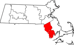 | |
| Towns | ||
| CDPs | ||
| Other villages | ||
| Ghost town | ||