Nohra
For Nohra in the district of Nordhausen, see Nohra, Nordhausen.
| Nohra | ||
|---|---|---|
| ||
 Nohra | ||
Location of Nohra within Weimarer Land district 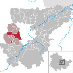 | ||
| Coordinates: 50°57′55″N 11°14′2″E / 50.96528°N 11.23389°ECoordinates: 50°57′55″N 11°14′2″E / 50.96528°N 11.23389°E | ||
| Country | Germany | |
| State | Thuringia | |
| District | Weimarer Land | |
| Municipal assoc. | Grammetal | |
| Government | ||
| • Mayor | Andreas Schiller | |
| Area | ||
| • Total | 19.58 km2 (7.56 sq mi) | |
| Population (2015-12-31)[1] | ||
| • Total | 1,652 | |
| • Density | 84/km2 (220/sq mi) | |
| Time zone | CET/CEST (UTC+1/+2) | |
| Postal codes | 99428 | |
| Dialling codes | 03643 | |
| Vehicle registration | AP | |
| Website | www.vg-grammetal.de | |
.png)
Nohra is a municipality in the Weimarer Land district of Thuringia, Germany. On 1 December 2007, the former municipality Utzberg was incorporated by Nohra.
Nohra was the location of the first Nazi concentration camp, established in March 3, 1933. Prisoners were incarcerated in a school building.[2]
References
This article is issued from Wikipedia - version of the 5/31/2016. The text is available under the Creative Commons Attribution/Share Alike but additional terms may apply for the media files.