Nogliki
| Nogliki (English) Ноглики (Russian) | |
|---|---|
| - Urban-type settlement[1] - | |
 View of Nogliki from the bridge | |
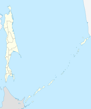
.svg.png) Location of Sakhalin Oblast in Russia | |
 Nogliki | |
|
| |
| Administrative status (as of December 2011) | |
| Country | Russia |
| Federal subject | Sakhalin Oblast[1] |
| Administrative district | Nogliksky District[1] |
| Administrative center of | Nogliksky District[1] |
| Municipal status (as of July 2012) | |
| Urban okrug | Nogliksky Urban Okrug[2] |
| Administrative center of | Nogliksky Urban Okrug[2] |
| Statistics | |
| Population (2010 Census) | 10,231 inhabitants[3] |
| Time zone | MAGT (UTC+11:00)[4] |
| Founded | late 1940s |
| Urban-type settlement status since | 1960 |
| Dialing code(s) | +7 42444[5] |
| Nogliki on Wikimedia Commons | |

Nogliki (Russian: Ноглики) is an urban locality (an urban-type settlement) and the administrative center of Nogliksky District of Sakhalin Oblast, Russia, located near the eastern coast of the Sakhalin Island, about 6 kilometers (3.7 mi) inland from the Sea of Okhotsk shoreline and about 600 kilometers (370 mi) north of Yuzhno-Sakhalinsk. Population: 10,231 (2010 Census);[3] 10,729 (2002 Census);[6] 11,546 (1989 Census).[7]
History
It was founded in the late 1940s with the beginnings of petroleum production in the area. It was granted urban-type settlement status in 1960.
Administrative and municipal status
Within the framework of administrative divisions, Nogliki serves as the administrative center of Nogliksky District and is subordinated to it.[1] As a municipal division, the urban-type settlement of Nogliki and eleven rural localities of Nogliksky District are incorporated as Nogliksky Urban Okrug.[2]
Economy and transportation
Nogliki is a supplier for the oil fields Sakhalin I and Sakhalin II, located in the Pacific Ocean off the coast to the northeast. There is also some logging activity in the area around the settlement. The settlement is also the northern terminus of the Sakhalin Rail Network, with the narrow-gauge line reaching the settlement in 1978. Another railway connecting Nogliki with the town of Okha further to the north was completed in 1953; however, this line closed in to passenger traffic in the 1980s, with only occasional goods traffic thereafter.[8]
An airport servicing the nearby oil and gas developments opened in September 2007.[9]
Climate
The climate is harsh subarctic, with long, very cold winters only marginally moderated by the ocean and very cool, short summers. Nogliki is influenced by the Siberian High and the Russian mainland in winters, resulting in very cold temperatures. Over the course of the year Nogliki sees a massive latitude anomaly in relation to other coastal climates on similar latitudes. For example the area surrounding London, United Kingdom has a 12 °C (22 °F) warmer climate in terms of yearly mean.
| Climate data for Nogliki (1948-2011) | |||||||||||||
|---|---|---|---|---|---|---|---|---|---|---|---|---|---|
| Month | Jan | Feb | Mar | Apr | May | Jun | Jul | Aug | Sep | Oct | Nov | Dec | Year |
| Record high °C (°F) | 2.2 (36) |
3.5 (38.3) |
11.9 (53.4) |
18.2 (64.8) |
29.9 (85.8) |
32.8 (91) |
33.0 (91.4) |
33.9 (93) |
28.4 (83.1) |
22.2 (72) |
11.4 (52.5) |
8.9 (48) |
33.9 (93) |
| Average high °C (°F) | −13.6 (7.5) |
−10.9 (12.4) |
−5.0 (23) |
2.1 (35.8) |
8.6 (47.5) |
15.1 (59.2) |
18.3 (64.9) |
19.6 (67.3) |
15.7 (60.3) |
7.6 (45.7) |
−3.5 (25.7) |
−11.4 (11.5) |
3.4 (38.1) |
| Daily mean °C (°F) | −18.2 (−0.8) |
−16.0 (3.2) |
−10.0 (14) |
−1.8 (28.8) |
3.8 (38.8) |
9.5 (49.1) |
13.2 (55.8) |
14.7 (58.5) |
10.7 (51.3) |
3.2 (37.8) |
−7.7 (18.1) |
−15.7 (3.7) |
−1.4 (29.5) |
| Average low °C (°F) | −23.6 (−10.5) |
−22.3 (−8.1) |
−16.7 (1.9) |
−6.6 (20.1) |
−0.6 (30.9) |
4.2 (39.6) |
8.6 (47.5) |
10.1 (50.2) |
5.8 (42.4) |
−1.6 (29.1) |
−12.6 (9.3) |
−20.9 (−5.6) |
−6.5 (20.3) |
| Record low °C (°F) | −40.0 (−40) |
−42.2 (−44) |
−37.8 (−36) |
−26.1 (−15) |
−10.0 (14) |
−11.0 (12.2) |
0.0 (32) |
−1.0 (30.2) |
−4.0 (24.8) |
−20.0 (−4) |
−33.9 (−29) |
−41.1 (−42) |
−42.2 (−44) |
| Average precipitation mm (inches) | 34.9 (1.374) |
41.8 (1.646) |
34.7 (1.366) |
45.0 (1.772) |
48.1 (1.894) |
58.6 (2.307) |
63.5 (2.5) |
99.6 (3.921) |
86.3 (3.398) |
82.5 (3.248) |
36.6 (1.441) |
38.2 (1.504) |
669.8 (26.37) |
| Average relative humidity (%) | 77.9 | 73.9 | 76.5 | 79.5 | 80.4 | 80.5 | 85.6 | 85.3 | 80.8 | 76.5 | 75.7 | 76.6 | 79.1 |
| Source: climatebase.ru (1948-2011) | |||||||||||||
References
Notes
- 1 2 3 4 5 Law #25-ZO
- 1 2 3 Law #524
- 1 2 Russian Federal State Statistics Service (2011). "Всероссийская перепись населения 2010 года. Том 1" [2010 All-Russian Population Census, vol. 1]. Всероссийская перепись населения 2010 года (2010 All-Russia Population Census) (in Russian). Federal State Statistics Service. Retrieved June 29, 2012.
- ↑ Правительство Российской Федерации. Федеральный закон №107-ФЗ от 3 июня 2011 г. «Об исчислении времени», в ред. Федерального закона №271-ФЗ от 03 июля 2016 г. «О внесении изменений в Федеральный закон "Об исчислении времени"». Вступил в силу по истечении шестидесяти дней после дня официального опубликования (6 августа 2011 г.). Опубликован: "Российская газета", №120, 6 июня 2011 г. (Government of the Russian Federation. Federal Law #107-FZ of June 31, 2011 On Calculating Time, as amended by the Federal Law #271-FZ of July 03, 2016 On Amending Federal Law "On Calculating Time". Effective as of after sixty days following the day of the official publication.).
- ↑ Телефонные коды Сахалина - Dialing codes of Sakhalin (Russian)
- ↑ Russian Federal State Statistics Service (May 21, 2004). "Численность населения России, субъектов Российской Федерации в составе федеральных округов, районов, городских поселений, сельских населённых пунктов – районных центров и сельских населённых пунктов с населением 3 тысячи и более человек" [Population of Russia, Its Federal Districts, Federal Subjects, Districts, Urban Localities, Rural Localities—Administrative Centers, and Rural Localities with Population of Over 3,000] (XLS). Всероссийская перепись населения 2002 года [All-Russia Population Census of 2002] (in Russian). Retrieved August 9, 2014.
- ↑ Demoscope Weekly (1989). "Всесоюзная перепись населения 1989 г. Численность наличного населения союзных и автономных республик, автономных областей и округов, краёв, областей, районов, городских поселений и сёл-райцентров" [All Union Population Census of 1989: Present Population of Union and Autonomous Republics, Autonomous Oblasts and Okrugs, Krais, Oblasts, Districts, Urban Settlements, and Villages Serving as District Administrative Centers]. Всесоюзная перепись населения 1989 года [All-Union Population Census of 1989] (in Russian). Институт демографии Национального исследовательского университета: Высшая школа экономики [Institute of Demography at the National Research University: Higher School of Economics]. Retrieved August 9, 2014.
- ↑ Website about Okha-Nogliki railway, with photos (Russian)
- ↑ Report in the Kommersant
Sources
- Сахалинская областная Дума. Закон №25-ЗО от 23 марта 2011 г. «Об административно-территориальном устройстве Сахалинской области», в ред. Закона №62-ЗО от 27 июня 2013 г. «О внесении изменения в статью 10 Закона Сахалинской области "Об административно-территориальном устройстве Сахалинской области"». Вступил в силу 9 апреля 2011 г.. Опубликован: "Губернские ведомости", №55(3742), 29 марта 2011 г. (Sakhalin Oblast Duma. Law #25-ZO of March 23, 2011 On the Administrative-Territorial Structure of Sakhalin Oblast, as amended by the Law #62-ZO of June 27, 2013 On Amending Article 10 of the Law of Sakhalin Oblast "On the Administrative-Territorial Structure of Sakhalin Oblast". Effective as of April 9, 2011.).
- Сахалинская областная Дума. Закон №524 от 21 июля 2004 г. «О границах и статусе муниципальных образований в Сахалинской области», в ред. Закона №45-ЗО от 27 мая 2013 г. «О внесении изменения в Закон Сахалинской области "О границах и статусе муниципальных образований в Сахалинской области"». Вступил в силу 1 января 2005 г. Опубликован: "Губернские ведомости", №175–176(2111–2112), 31 июля 2004 г. (Sakhalin Oblast Duma. Law #524 of July 21, 2004 On the Borders and Status of the Municipal Formations in Sakhalin Oblast, as amended by the Law #45-ZO of May 27, 2013 On Amending the Law of Sakhalin Oblast "On the Borders and Status of the Municipal Formations in Sakhalin Oblast". Effective as of January 1, 2005.).
External links
![]() Nogliki travel guide from Wikivoyage
Nogliki travel guide from Wikivoyage