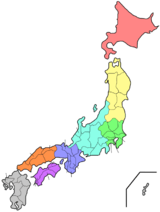
Niigata Prefecture
| Niigata Prefecture 新潟県 | |||
|---|---|---|---|
| Prefecture | |||
| Japanese transcription(s) | |||
| • Japanese | 新潟県 | ||
| • Rōmaji | Niigata-ken | ||
| |||
 | |||
| Country | Japan | ||
| Region | Chūbu (Kōshinetsu) (Hokuriku) | ||
| Island | Honshu | ||
| Capital | Niigata | ||
| Government | |||
| • Governor | Ryuichi Yoneyama | ||
| Area | |||
| • Total | 12,582.47 km2 (4,858.12 sq mi) | ||
| Area rank | 5th | ||
| Population (February 1, 2011) | |||
| • Total | 2,371,574 | ||
| • Rank | 14th | ||
| • Density | 188.48/km2 (488.2/sq mi) | ||
| ISO 3166 code | JP-15 | ||
| Districts | 9 | ||
| Municipalities | 30 | ||
| Flower | Tulip (Tulipa gesneriana) | ||
| Tree | Camellia (Camellia japonica) | ||
| Bird | Crested ibis (Nipponia nippon) | ||
| Website |
www | ||


Niigata Prefecture (新潟県 Niigata-ken) is a prefecture of Japan located on the island of Honshu on the coast of the Sea of Japan.[1] The capital is the city of Niigata with which it shares the same name.[2]
History
Until after the Meiji Restoration, the area that is now Niigata Prefecture was divided into Echigo Province (on the mainland) and Sado Province.[3] During the Sengoku period, the Nagao clan, who were at times vassals to the Uesugi, ruled a fief in the western part of modern Niigata from Kasugayama Castle. The most notable member of the Nagao clan was Nagao Kagetora, later and better known as Uesugi Kenshin. He unified the leaders of Echigo Province and became its sole ruler. By taking the surname Uesugi, he also became the head of the Uesugi clan and effectively brought their realm under his control.
The city of Niigata is now the third largest Japanese city facing the Sea of Japan, after Fukuoka and Kitakyushu. It was the first Japanese port on the Sea of Japan to be opened to foreign trade following the opening of Japan by Matthew Perry. It has since played an important role in trade with Russia and Korea. A freighter from North Korea visits Niigata once a month, in one of the few forms of direct contact between Japan and that country.
The Etsuzankai organization, led by the politician Kakuei Tanaka, was highly influential in bringing infrastructure improvements to Niigata Prefecture in the 1960s and 1970s. These included the Jōetsu Shinkansen high-speed rail line and the Kanetsu Expressway to Tokyo.
On October 23, 2004, the Chūetsu earthquake struck Niigata Prefecture and was measured at Shindo 6+ at Ojiya.
On January 9, 2006, a heavy winter storm struck the prefecture and its neighbors. At least 71 people died and more than 1,000 were injured. Also in 2006, a massive tsunami and earthquake damaged homes and caused casualties in the maritime areas of Niigata Prefecture, especially near Sado Island.
On July 16, 2007, another earthquake hit the area.
Niigata Prefecture hosts the Fuji Rock Festival, an annual event held at the Naeba ski resort. The three-day event, organized by Smash Japan, features more than 200 Japanese and international musicians. It is one of the largest outdoor music events in Japan, with more than 100,000 people attending in 2005.
Geography
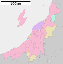

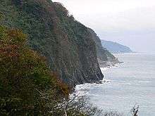
Niigata Prefecture stretches about 240 km along the Sea of Japan, from the southwest to the northeast, with a coastal plain between the mountains and the sea. It also includes Sado Island. Niigata Prefecture could be placed in either the Hokuriku or the Kōshinetsu, both of which are considered parts of the Chūbu region. The prefecture is generally divided into four geographical areas: Jōetsu region (上越) in the south, Chūetsu (中越) in the center, Kaetsu (下越) in the north, and Sado Island. The mouth of the Shinano River, the longest river in Japan, is located in Niigata Prefecture.
As of 1 April 2014, 25% of the total land area of the prefecture was designated as Natural Parks, namely Bandai-Asahi, Chūbu-Sangaku, Nikkō, and Oze National Parks; Echigo Sanzan-Tadami and Sado-Yahiko-Yoneyama Quasi-National Parks; and thirteen Prefectural Natural Parks.[4]


 Echigo Plain
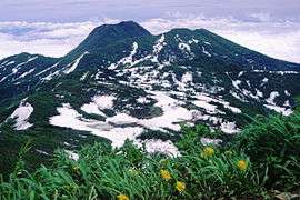

Cities
Twenty cities are located in Niigata Prefecture:
Towns and villages
These are the towns and villages in each district:
Mergers
Economy
Agriculture, forestry and fishing
The major industry in Niigata Prefecture is agriculture. Rice is the principal product, and among the prefectures of Japan Niigata is second only to Hokkaidō in rice output. The area around Uonuma is known for producing the Koshihikari variety, widely considered to be the highest-quality rice produced in Japan.
Rice-related industries are also very important to the prefectural economy. Niigata Prefecture is known throughout Japan for its high-quality sake, senbei, mochi, and arare. In sake production, the prefecture comes third after Gunma and Kyoto prefectures.
The prefecture was also the place of origin of the ornamental carp known as koi.
Niigata Prefecture produces the highest volume of azaleas and cut lilies in Japan, and is increasing production of cut flowers and flower bulbs. Along with Toyama Prefecture, it produces the highest volume of tulips in the country.
Mining and manufacturing
Crude oil is produced in Niigata Prefecture, although Japan relies heavily on petroleum imported from other countries. Kerosene heaters are also produced for use in the cold Niigata winters.
Kinzan, on Sado Island, was an active gold mine until it was closed in 1989.
Sanjō and Tsubame produce 9 percent of all the silverware made in Japan. The two cities are second after Osaka in the production of scissors, kitchen knives, and wrenches.
Niigata Prefecture may have been the first area in Japan to produce knitted textiles, although the earliest products may have been imported from China. The nuclear power plant which formerly had highest energy output in the world is located in the tiny village of Kariwa. It has been closed since the Fukushima Daiichi nuclear disaster.[5]
Demographics
In the Census of 2003, Niigata ranked as the 14th most populous.
Culture
Food
Niigata is known for the following regional specialities:
- Uonuma Koshihikari rice
- Shoyu (soy sauce) and Yofu (western-style) katsudon
- Shoyu sekihan
- Noppe stew
- Wappa-meshi (seafood and rice steamed in a bamboo basket)
- Sasa-dango (mochi balls filled with red bean paste, seasoned with mugwort and wrapped in bamboo leaves)
- Poppo-yaki (steamed bread flavored with brown sugar)
- Hegi-soba (soba from the Uonuma and Ojiya areas, which uses a special kind of seaweed)
- "Tsubame-Sanjō ramen" (ramen made using thick udon-style noodles)
- Tochio aburage (aburaage is called "aburage" in Tochio)
- Kirazu (dishes using okara)
- Kakinomoto (edible chrysanthemums)
- Kanzuri (a special seasoning from Myōkō made by leaving chili peppers exposed on snow, then adding flour, salt and yuzu)
- Yasuda yogurt
Niigata in popular culture
- Snow Country (1947): a novel by Nobel laureate Yasunari Kawabata set in Yuzawa
- "Niigata Snow": a track on the LP Aida, released by Derek Bailey in 1980
- Kura: a film and TV series (1995) based on the 1993 book by Tomiko Miyao, an award winning period piece about a Niigata family and its sake brewery
- Blue (1996): a manga about high school girls, set in Niigata City, adapted as a film in 2001
- Whiteout: an action film based on a novel published in 1995
- United States of Tara (2011): a comedy-drama series on Showtime; Kate is about to embark on a trip to teach English in Niigata when a flight attendant tells her that the only thing she will hopefully find in Niigata is "a life lesson and a bullet train back to Tokyo."
Tourism and sports
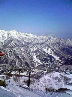
Much of the tourism in Niigata centers around skiing, especially in the alpine areas of Myōkō and Yuzawa, and going to onsen. Sado Island off the west coast of Niigata is accessible via ferry (taking one to two and a half hours) from Naoetsu or Niigata City.
Professional sports clubs include Albirex Niigata, a J-League Division 1 Soccer Club, and Niigata Albirex BB, a BJ (Basketball Japan) League team.
Festivals
- Murakami Taisai – July 6–7
- Iwafune Taisai – October 18–19, in Murakami
- Niigata Festival – August
- Niigata General Dancing Event -September 21–25
- Shirone Kite Festival – June
- Sanjo Kite Festival – June
- Nagaoka Festival (with fireworks) – August
- Niigata Tanrei Sake-no-Jin - March
- Tokamachi Snow Festival - February
- Echigo-Tsumari Festival - August and September (every third year)[6]
Education
Universities
- Niigata University
- Niigata University of International and Information Studies
- Niigata Sangyo University (Niigata Industrial University)
- Niigata University of Health and Welfare
- Niigata University of Pharmacy and Applied Life Sciences
- Niigata Institute of Technology
- Niigata University of Management
- Niigata College of Nursing
- Nippon Dental University
- Nagaoka University
- Nagaoka University of Technology
- Nagaoka Institute of Design
- International University of Japan
- Keiwa Gakuen University
Transport
Rail
Roads
Expressways
- Kanetsu Expressway
- Jōshinetsu Expressway
- Hokuriku Expressway
- Ban-etsu Expressway
- Nihonkai Tōhoku Expressway
National highways
- Route 7 (Niigata—Shibata—Murakami—Sakata—Akita—Noshiro—Hirosaki—Aomori)
- Route 8 (Niigata—Nagaoka—Kashiwazaki—Jōetsu—Toyama—Kanazawa—Tsuruga—Kyoto)
- Route 17 (Nagaoka—Ojiya—Minamiuonuma—Takasaki—Nihonbashi of Tokyo)
- Route 18 (Jōetsu—Myōkō—Nagano—Karuizawa—Takasaki)
- Route 49 (Niigata—Aizuwakamatsu—Kōriyama—Iwaki)
- Route 113 (Niigata—Arakawa—Nan'yō—Shiroishi—Sōma)
- Route 116 (Niigata—Tsubame—Izumozaki—Kashiwazaki)
- Route 117 (Ojiya—Tōkamachi—Iiyama)
- Route 148 (Itoigawa—Ōmachi)
- Route 252
- Route 253
- Route 289
- Route 290
- Route 291
- Route 292
- Route 345
- Route 350 (Sado Island)
- Route 351
- Route 352
- Route 353
- Route 402
- Route 403
- Route 404
- Route 405
- Route 459
- Route 460
Ports
- Niigata Port – Ferry route to Sado Island, Tsuruga, Akita, Otaru and Tomakomai, with International Container hub port
- Ryotsu Port – Ferry route to Niigata
- Ogi Port
- Naoetsu Port
Airports
Notable individuals
Politics and military
- Hachirō Arita (1884–1965), foreign minister, from Sado Island
- Kita Ikki (1883–1937), nationalist author and intellectual, from Sado Island
- Honma Masaharu World War II lieutenant-general executed by the United States by war crimes committed in the Philippines
- Isoroku Yamamoto (1884–1943), commander of the Japanese Imperial Navy, from Nagaoka
- Kakuei Tanaka (1918–1993), prime minister, from Urasa
- Hisashi Owada (born 1932), diplomat and father of Crown Princess Masako, from Shibata
- Makiko Tanaka (born 1944), first female foreign minister, from Kashiwazaki
Arts and culture
- Yaichi Aizu (1881–1956), poet, calligrapher and historian, from Niigata City
- Tetsuo Harada (born 1949 Niitsu-shi), sculptor working in Paris France
- Fubō Hayashi (1900–1935), novelist from Sado Island
- Daisuke Hirakawa (born 1973), voice actor
- Ryō Hirohashi (born 1977), voice actress, from Nagaoka
- Inoue Enryō (1858–1919), Buddhist philosopher, from Nagaoka
- Mina Fujii (born 1998), actress
- Yoko Ishida (born 1973), singer, from Niigata City
- Rumi Kasahara (born 1970), voice actress, from Itoigawa
- Makoto Kobayashi (born 1958), manga artist, from Niigata City
- Yoshifumi Kondō (1950–1998), animator, from Gosen
- Közi (born 1972), rock musician
- Haruo Minami (1923–2001), enka singer, from Nagaoka
- Hitomi Nabatame (born 1976), voice actress, from Sado Island
- Tatsuyuki Nagai (born 1976), anime director
- Kazuto Nakazawa (born 1968), animator
- Kiriko Nananan (born 1972), manga artist, from Tsubame
- Yukari Nozawa (born 1957), actor and voice actor
- Takeshi Obata (born 1969), manga artist, from Niigata City
- Etsushi Ogawa (born 1969), manga artist
- Ikue Otani (born 1965), voice actress, from Kashiwazaki
- Ryōkan (1758–1831), Zen Buddhist monk and poet, from Izumozaki
- Ango Sakaguchi (1906–1955), novelist and essayist, from Niigata City
- Daisuke Sakaguchi (born 1973), voice actor, from Kashiwazaki
- Kazuyuki Sekiguchi (born 1955), bass player for the rock group Southern All Stars, from Agano
- Shuichi Shigeno (born 1958), manga artist, from Tōkamachi
- Bin Shimada (born 1954), voice actor, from Niigata City
- Kunio Shimizu (born 1936), playwright from Niigata
- Motoei Shinzawa (born 1958), manga artist, from Kashiwazaki
- Yōko Sōmi (born 1965), voice actress
- Rumiko Takahashi (born 1957), manga artist, from Niigata City
- Kazuya Tsurumaki (born 1966), animator, from Gosen
- Hajime Watanabe (born 1957), animator
- Ken Watanabe (born 1959), stage, TV and film actor, from Niigata
- Nobuhiro Watsuki (born 1970), manga artist, from Nagaoka
- Hiroki Yagami (born 1967), manga artist, from Kashiwazaki
- Akiko Yajima (born 1967), voice actress, from Kashiwazaki
- Kimio Yanagisawa (born 1948), manga artist, from Gosen
- Keiko Yokozawa (born 1952), voice actress, from Niigata City
- Kusumi Koharu (born 1992), former member of Morning Musume, actor and model, from Washima
Sports
- Haguroyama Masaji (1914–1969), sumo wrestler from Nakanokuchi who was yokozuna for 12 years and three months; an all-time record
- Shohei Baba (1938–1999), professional wrestler, from Sanjō
- Sawao Kato (born 1946), winner of 12 Olympic medals in gymnastics
- Killer Khan (born 1947), professional wrestler, from Tsubame
See also
Notes
- ↑ Nussbaum, Louis-Frédéric. (2005). "Niigata-ken" in Japan Encyclopedia, p. 711, p. 711, at Google Books
- ↑ Nussbaum, "Niigata" at p. 711, p. 711, at Google Books
- ↑ Nussbaum, "Provinces and prefectures" at p. 780, p. 780, at Google Books
- ↑ "General overview of area figures for Natural Parks by prefecture" (PDF). Ministry of the Environment. 1 April 2014. Retrieved 14 February 2015.
- ↑ "Japanese Anti-nuclear Candidate Wins Election at Site of World's Biggest Atomic Power Station". The Guardian. Reuters. 17 October 2016. Retrieved 17 October 2016.
- ↑ http://www.echigo-tsumari.jp/eng/about/triennale_2015/
References
- Nussbaum, Louis-Frédéric and Käthe Roth. (2005). Japan encyclopedia. Cambridge: Harvard University Press. ISBN 978-0-674-01753-5; OCLC 58053128
External links
| Wikimedia Commons has media related to Niigata prefecture. |
- Official Niigata Prefecture website (requires Macromedia Flash plugin)
- Niigata JET (Japan Education and Teaching Programme) Website
- Enjoy Niigata Niigata prefecture tourism guide
Coordinates: 37°37′N 138°52′E / 37.617°N 138.867°E