Newport Wetlands
| Newport Wetlands | |
|---|---|
| Wlyptiroedd Casnewydd | |
|
Wetlands visitor centre, West Nash, Newport | |
 | |
| Type | National nature reserve |
| Nearest city | Newport, Wales |
| Coordinates | 51°32′46″N 2°57′40″W / 51.546°N 2.961°WCoordinates: 51°32′46″N 2°57′40″W / 51.546°N 2.961°W |
| Area | 437 hectares (1,080 acres) |
| Created | 2000 |
| Operated by | |
| Blog |
rspb |
| Website |
rspb |
Newport Wetlands is a wildlife reserve covering parts of Uskmouth, Nash and Goldcliff, in the south-east of the city of Newport, South Wales.
History
The reserve was established in 2000 to mitigate losses of wildlife habitat when the Cardiff Bay Barrage scheme was undertaken.
The site is owned and managed by Natural Resources Wales, the successor body to the Countryside Council for Wales. A purpose-built visitor and education centre for the site was opened, in West Nash, in March 2008 by the Royal Society for the Protection of Birds (RSPB) with help from Newport City Council and water level management assistance by Caldicot and Wentloog Levels Internal Drainage Board.[1]
The reserve covers 437 hectares (1,080 acres)[2] of the Caldicot Level, a low-lying area of land bordering the northern shore of the Severn Estuary. Part of the site is a reclaimed fuel ash disposal site, although some farmland in Goldcliff and Nash has also had to be flooded to complete the work.
The reserve was made a national nature reserve on 16 April 2008.[3]
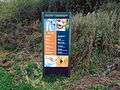
Entrance


Entrance is free, with car parking facilities open every day of the year from 8:30 am until 5:30 pm. The visitor and education centre opening hours are 9:00 am until 5:00 pm (except Christmas day).[4]
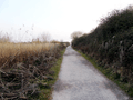
Dogs and cyclists are permitted outside the visitor centre and along a specially marked six-kilometre (3.7 mi) circular route around the reserve's perimeter.
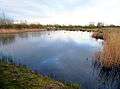
Habitats and species
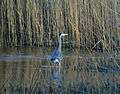
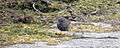
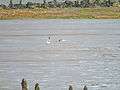
The reserve includes a wide variety of habitats which include grazed pasture with hedgerows, ditches, reens, reed beds and grasslands. These help to attract breeding birds such as lapwings, redshanks, oystercatchers, little ringed plovers and ringed plovers, as well as visitors such as wigeon, shovellers, teal, shelduck and pintails, bitterns, hen harriers and short-eared owls.
In January 2012 two rarely seen glossy ibises were sighted near Boat Road at Goldcliff.[5]
Comprehensive observation data for the region can be obtained from, and submitted at eBird.
-

Mute swans with male and female tufted ducks in the background
-

Eurasian coot and tufted duck near Newport Wetlands RSPB Reserve visitor centre/picnic and play area
-

Tufted duck near Newport Wetlands RSPB Reserve visitor centre/picnic and play area
-

Mallard duck and moorhen foraging at Newport Wetlands RSPB Reserve picnic area
-

Mallard ducks swimming on waterway near picnic area
-

Ring-necked pheasants on shore of the Severn Estuary at Newport Wetlands RSPB Reserve
-

Great crested grebe calling on Newport Wetlands RSPB Reserve fenced lagoon
-

Little grebe on Newport Wetlands RSPB Reserve fenced lagoon
-
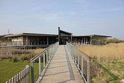
Grey heron fishing on Newport Wetlands RSPB Reserve fenced lagoon
-

Eurasian coot Near Newport Wetlands RSPB Reserve floating walkway
-

Tufted ducks at Newport Wetlands RSPB Reserve floating walkway
-

Canada geese Near Newport Wetlands RSPB Reserve lighthouse
-
Canada geese and tufted ducks on pond at Newport Wetlands RSPB Reserve near visitor centre and picnic and play area
-

Little egret and teal ducks on Lagoon near the hide at Newport Wetlands RSPB Reserve
-
Dunnock at cycling and dog path around perimeter of Newport Wetlands RSPB Reserve
-
Common shelducks foraging on mudflats of the Severn Estuary at Newport Wetlands RSPB Reserve
-

Reed bunting near fenced lagoon at Newport Wetlands RSPB Reserve
-

Wren singing on branch facing Severn Estuary at Newport Wetlands RSPB Reserve
-

Carrion crow on branch facing Severn Estuary
-

Magpies foraging on field viewed from woodland trail
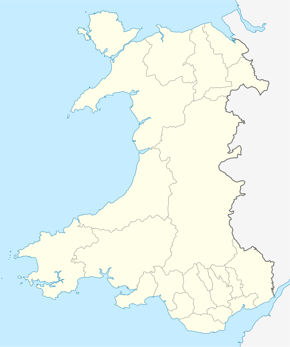
Visitor centre
The visitor centre provides a shop, refreshments, bathroom facilities, viewing facilities and guided tours.[6]

-

Nature Reserve and visitor centre sign in English and Welsh
-

Visitor centre entrance and exit facing car park
-

Visitor centre sign outside car park in English and Welsh
-
Newport Wetlands RSPB Nature Reserve visitor centre sign in English and Welsh
-

View of play area from Newport Wetlands RSPB Reserve visitor centre bench
-

Newport Wetlands RSPB Reserve visitor centre as seen from picnic and play area
-

Visitor centre and picnic and play area seen from hill
Picnic and play area
The picnic and play area situated next to the visitor centre provides a children's play area, education zone, and benches for picnics. It is surrounded by wetlands and reed beds, home to many resident and migratory birds.

-
Newport Wetlands RSPB Reserve approaching picnic and play area
-
Newport Wetlands RSPB Reserve exiting picnic and play area
-

Approaching play and picnic area of Newport Wetlands RSPB Reserve
-

Children's playground
-
Pond and wild bird scrape near Newport Wetlands RSPB Reserve visitor centre/picnic and play area
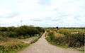
Hill
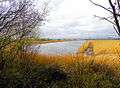
Past the picnic and play area is a hill, which continues directly ahead south towards the floating walkway and lighthouse (see below). Three lagoons are located on the top of the hill, immediately before approaching the floating walkway. These are R5, R6 (fully viewable from two fenced overpasses on the hill) and R8 (partially viewable from a fenced overpass on the hill but best viewed from the woodland trail viewpoint).

-
Looking down from hill at Newport Wetlands RSPB Reserve
-

Junction at hill at Newport Wetlands RSPB Nature Reserve
-
Northwards view from hill at Newport Wetlands RSPB Reserve
-

Fences around Newport Wetlands RSPB Reserve fenced lagoon
-
Newport Wetlands RSPB Reserve fenced lagoon
-

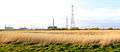
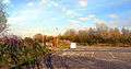
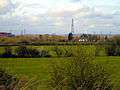
View of Uskmouth power station
Floating walkway
A new feature part of the reserve's development was an artificial floating walkway, which provides a direct route to the lighthouse over lagoon R7. This lagoon is part of a series of a total of three lagoons spanning the coastal path (east to west). The most eastward lagoon (R9) is overlooked by the bird hide in addition to being viewable from a fenced overpass (currently closed for the stated reason of protecting wildlife), and the most westwardly lagoon (R4) is viewable from a fenced overpass.

-

Floating walkway with lighthouse in the background
-
Tufted ducks visible from Newport Wetlands RSPB Reserve floating walkway
Estuary trail
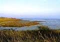
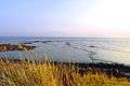
The far end of the trail faces south towards the Severn Estuary, along which the East Usk Lighthouse is situated at and the bird hide lies at the end of.

-

View of Severn Estuary From Newport Wetlands RSPB Reserve
-
View of Severn Estuary Rocks From Newport Wetlands RSPB Reserve
-
View of Severn Estuary through reeds from Newport Wetlands RSPB Reserve
-
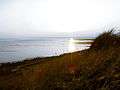
View of sun setting over Severn Estuary from Newport Wetlands RSPB Reserve
East Usk Lighthouse
 East Usk lighthouse, near Perry Lane, West Nash, Newport | |
 Wales | |
| Location |
Uskmouth Newport Wales United Kingdom |
|---|---|
| Coordinates | 51°32′24″N 2°58′01″W / 51.540005°N 2.966974°W |
| Year first constructed | 1893 |
| Construction | cast iron tower |
| Tower shape | cylindrical tower with balcony and lantern |
| Markings / pattern | white tower and lantern |
| Height | 13 metres (43 ft) |
| Focal height | 11 metres (36 ft) |
| Light source | mains power |
| Characteristic | Fl (2) WRG 10s. |
| Admiralty number | A5454 |
| NGA number | 5904 |
| ARLHS number | WAL-005 |
| Managing agent |
Newport Harbour Commissioners[7] [8] |
The East Usk Lighthouse is within the reserve on the estuary trail facing towards the Severn Estuary. It is a basic lamphousing with no accommodation. The more substantial decommissioned West Usk Lighthouse, currently operating as a hotel, is on the opposite (west) bank of the River Usk and can be viewed from the reserve.
-

View of lighthouse across reeds
-

East Usk Lighthouse at Newport Wetlands RSPB Nature Reserve
-

East Usk Lighthouse with floating walkway in the background to the right
-

East Usk Lighthouse at Newport Wetlands RSPB Nature Reserve facing east towards bird hide
-

East Usk Lighthouse at Newport Wetlands RSPB Nature Reserve from a distance
-

West Usk Lighthouse viewed from Newport Wetlands RSPB Nature Reserve
Bird hide
The bird hide is located on the far side of the trail and provides shelter for up-close viewing of birds on one of the trail's many lagoons (R9).
-

The bird hide entrance
-

The bird hide frontal exterior
-
Lagoon R9 overlooked by Newport Wetlands RSPB Reserve bird hide
-

Inside view of bird hide
-

Bird hide entrance and bench
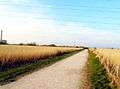
Cycling and dog walking path
The cycling (and dog walking) route is accessed via a path next to the car park exit. Initially heading west, the 6 kilometres (3.7 mi) circular route follows alongside the power station then turns to the east past the East Usk Lighthouse and along the Severn Estuary (Wales Coast Path). After dropping below the sea wall the path splits, with a pedestrian and dog walking route returning to the visitor centre via a marked path to the left. A longer pedestrian and cycling route continues forwards towards Goldcliff village and the local road network.
-
View of car park exit from cycling path entrance
-
Typical sight of a dunnock greeting visitors who enter the cycle path
-

View of lighthouse and fenced overpass from cycle path
-

View of lighthouse from cycle path
-

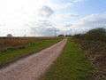
Typical stretch of cycle path
-

Cycle path alongside power station
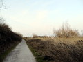
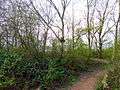
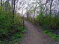
Woodland trail
The woodland trail is entered by turning left at the top of the hill, and travels past neighbouring farmland, through the reserve's woodlands, past a lagoon viewing platform and bird hide and onto the estuary trail.
-
Newport Transporter Bridge viewed from woodland trail
-
Field viewed from woodland trail
-

Cows resting in field viewed from woodland trail
-
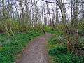
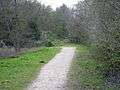
Stretch of woodland trail
-

Bend at woodland trail
-

Bench at woodland trail
-
Inside woodlands at woodland trail
-

Approaching bird hide/estuary trail from woodland trail
Woodland trail viewpoint
A notable feature of the reserve which may be missed by the hurried explorer is the viewing platform overlooking lagoon R8. It is located in a relatively secluded area of the reserve, found by turning right before leaving the woodland trail when heading southwards towards the bird hide/estuary trail.
-
Woodland trail before turning right onto viewing platform
-
Viewing platform and nest boxes
-
Viewing platform
-
Lagoon R8 overlooked by viewing platform
References
- ↑ C&WLIDB News Article
- ↑ Newport Wetlands at bbc.co.uk
- ↑ CCW press release
- ↑ The RSPB: About Newport Wetlands
- ↑ "Sightings" at gwentbirds.org.uk
- ↑ The RSPB: Newport Wetlands: Facilities
- ↑ East Usk The Lighthouse Directory. University of North Carolina at Chapel Hill. Retrieved 3 June 2016
- ↑ East Usk Light Lighthouse Explorer. Retrieved 3 June 2016
External links
- RSBP trail map
- Newport City Council - Newport Wetlands
- BBC News - £3m visitors' centre for wetlands
- BBC - Newport Wetlands
- RSPB - Newport Wetlands
- Caldicot & Wentlooge Level Internal Drainage Board
- www.geograph.co.uk : photos of Newport Wetlands Reserve and surrounding area
- eBird.org