Newland, North Carolina
| Newland, North Carolina | |
|---|---|
| Town | |
|
Avery County Courthouse | |
 Location of Newland, North Carolina | |
| Coordinates: 36°5′11″N 81°55′36″W / 36.08639°N 81.92667°WCoordinates: 36°5′11″N 81°55′36″W / 36.08639°N 81.92667°W | |
| Country | United States |
| State | North Carolina |
| County | Avery |
| Incorporated | 1911 |
| Government | |
| • Type | Mayor-council |
| • Mayor | Valerie Jaynes |
| Area | |
| • Total | 0.7 sq mi (1.7 km2) |
| • Land | 0.7 sq mi (1.7 km2) |
| • Water | 0.0 sq mi (0.0 km2) |
| Elevation | 3,606 ft (1,099 m) |
| Population (2010) | |
| • Total | 698 |
| • Density | 997.1/sq mi (410.5/km2) |
| Time zone | Eastern (EST) (UTC-5) |
| • Summer (DST) | EDT (UTC-4) |
| ZIP code | 28657 |
| Area code(s) | 828 |
| FIPS code | 37-46740[1] |
| GNIS feature ID | 1013943[2] |
| Website | Newland, North Carolina |

Newland is a town in Avery County, North Carolina, United States. The population was 698 at the 2010 census. It is the county seat of Avery County.[3]
History
Before its founding, the area was known as Old Fields or Old Fields of Toe. In 1911 it was renamed Newland, after North Carolina Lieutenant Governor William C. Newland, and simultaneously became the county seat for Avery County.
The Avery County Courthouse and Avery County Jail are listed on the National Register of Historic Places.[4]
Geography
Newland is located at 36°5′11″N 81°55′36″W / 36.08639°N 81.92667°W (36.086509, -81.926664).[5]
According to the United States Census Bureau, the town has a total area of 0.7 square miles (1.8 km2), all land.
At an elevation of 3621 feet (1104m), it is the highest county seat in the Eastern United States (based on elevations in the USGS database).
The East Tennessee and Western North Carolina Railroad ("Tweetsie") passed through the town until 1940.
Demographics
| Historical population | |||
|---|---|---|---|
| Census | Pop. | %± | |
| 1920 | 289 | — | |
| 1930 | 328 | 13.5% | |
| 1940 | 471 | 43.6% | |
| 1950 | 425 | −9.8% | |
| 1960 | 564 | 32.7% | |
| 1970 | 524 | −7.1% | |
| 1980 | 722 | 37.8% | |
| 1990 | 645 | −10.7% | |
| 2000 | 704 | 9.1% | |
| 2010 | 698 | −0.9% | |
| Est. 2015 | 686 | [6] | −1.7% |
As of the census[1] of 2000, there were 704 people, 334 households, and 207 families residing in the town. The population density was 1,044.4 people per square mile (405.7/km²). There were 363 housing units at an average density of 538.5 per square mile (209.2/km²). The racial makeup of the town was 99.01% White, 0.99% from other races. Hispanic or Latino of any race were 1.56% of the population.
There were 334 households out of which 25.7% had children under the age of 18 living with them, 42.5% were married couples living together, 15.9% had a female householder with no husband present, and 38.0% were non-families. 34.7% of all households were made up of individuals and 17.7% had someone living alone who was 65 years of age or older. The average household size was 2.09 and the average family size was 2.63.
In the town the population was spread out with 20.3% under the age of 18, 9.9% from 18 to 24, 26.7% from 25 to 44, 22.9% from 45 to 64, and 20.2% who were 65 years of age or older. The median age was 40 years. For every 100 females there were 89.2 males. For every 100 females age 18 and over, there were 84.5 males.
The median income for a household in the town was $24,375, and the median income for a family was $33,875. Males had a median income of $22,917 versus $24,500 for females. The per capita income for the town was $18,344. About 16.3% of families and 21.2% of the population were below the poverty line, including 21.8% of those under age 18 and 21.3% of those age 65 or over.
Notable people
- Paul Johnson: Football coach at Georgia Southern, Navy, and Georgia Tech.
- Joyce McKinney: Became notorious for the alleged kidnap and rape of Mormon missionary Kirk Anderson in England in 1977, and hit the news again in 2008 for cloning her pit bull terrier in Korea.[8]
See also
References
- 1 2 "American FactFinder". United States Census Bureau. Retrieved 2008-01-31.
- ↑ "US Board on Geographic Names". United States Geological Survey. 2007-10-25. Retrieved 2008-01-31.
- ↑ "Find a County". National Association of Counties. Retrieved 2011-06-07.
- ↑ National Park Service (2009-03-13). "National Register Information System". National Register of Historic Places. National Park Service.
- ↑ "US Gazetteer files: 2010, 2000, and 1990". United States Census Bureau. 2011-02-12. Retrieved 2011-04-23.
- ↑ "Annual Estimates of the Resident Population for Incorporated Places: April 1, 2010 to July 1, 2015". Retrieved July 2, 2016.
- ↑ "Census of Population and Housing". Census.gov. Retrieved June 4, 2015.
- ↑ Dobner, Jennifer (2008-08-09). "Bernann McKinney, Joyce McKinney: Cloned puppies and a mormon sex slave? > Is the woman who cloned her puppies the same one who held a mormon missionary hostage 31 years ago?". Chicago Tribune. Retrieved 2009-02-24.
Joyce McKinney surfaced again in Utah in May 1984 and was arrested for allegedly stalking the workplace of the same Mormon man she was accused of imprisoning in England. News reports say that police found a length of rope and handcuffs in the trunk of McKinney’s car, along with notebooks detailing the man’s daily activities.
External links
Municipalities and communities of Avery County, North Carolina, United States | ||
|---|---|---|
| Towns | 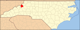 | |
| Villages | ||
| Unincorporated communities | ||
| Footnotes | ‡This populated place also has portions in an adjacent county or counties | |