New Zealand State Highway 53
| ||||
|---|---|---|---|---|
| Route information | ||||
| Maintained by New Zealand Transport Agency | ||||
| Length: | 17.8 km (11.1 mi) | |||
| Tourist routes: | Classic New Zealand Wine Trail | |||
| Major junctions | ||||
| North end: |
| |||
| South end: | Memorial Square, Martinborough | |||
| Location | ||||
| Primary destinations: | Featherston, Martinborough | |||
| Highway system | ||||
| ||||

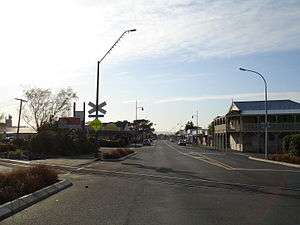
State Highway 53 (SH 53) is a New Zealand state highway linking SH 2 at Featherston with Martinborough. The highway is a 17.8 km long two lane carriageway and forms part of the Classic New Zealand Wine Trail.
Route
SH 53 commences from SH 2 at the intersection of Fitzherbert and Revans Streets, Featherston. It proceeds along Revans Street until the intersection with Boundary Road, at which point the highway takes the name State Highway 53. The highway crosses two major rivers: the Tauherenikau River near Featherston and the Ruamahanga River near Martinborough. West of the Ruamahanga crossing it has a TOTSO intersection with Bidwills Crossing Road, which links Martinborough with Greytown. When the highway reaches Martinborough State Highway 53 becomes known as Kitchener Street until it reaches its terminus at Memorial Square.[1][2]
Major intersections

| Territorial authority | Location | km | jct | Destinations | Notes |
|---|---|---|---|---|---|
| Tararua District | Featherston | 0 | |
|
SH 53 begins |
| 0.15 | |
Wairarapa Line | |||
| 4.3 | |
Tauherenikau River | |||
| Bidwells Cutting | 12.4 | |
Bidwells Cutting Road – Greytown | ||
| Martinborough | 14.7 | |
Ruamahanga River | ||
| 17.8 | |
Memorial Square | SH 53 ends | ||
See also
References
- ↑ [Civildefence.govt.nz Wellington - Risk to lifelines from natural hazards], Chapter 4: Transportation, NZ Government publication
- ↑ State Highway 53 on Google Maps
External links
| National | ||
|---|---|---|
| North Island |
| |
| South Island | ||
| Former state highways | ||
| Touring routes |
| |