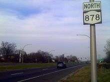
New York State Route 878
| ||||
|---|---|---|---|---|
| Nassau Expressway | ||||
|
Map of western Long Island with NY 878 highlighted in red | ||||
| Route information | ||||
| Maintained by NYSDOT and NYCDOT | ||||
| Length: | 5.69 mi[1] (9.16 km) | |||
| History: | Designated I-878 on January 1, 1970;[2] mostly redesignated NY 878 by 1991[3] | |||
| Northern segment | ||||
| Length: | 3.73 mi[1] (6.00 km) | |||
| West end: |
| |||
| Major junctions: |
| |||
| East end: | Farmers / Rockaway Boulevards in Queens | |||
| Southern segment | ||||
| Length: | 1.96 mi[1] (3.15 km) | |||
| North end: | Burnside Avenue / Rockaway Boulevard in Inwood | |||
| South end: | Atlantic Beach Bridge / Seagirt Boulevard in Lawrence | |||
| Location | ||||
| Counties: | Queens, Nassau | |||
| Highway system | ||||
| ||||


New York State Route 878 (NY 878) is a state highway in the U.S. state of New York, forming the Nassau Expressway. The route exists in two sections connected by Rockaway Boulevard and Rockaway Turnpike, maintained in part by New York City, the New York State Department of Transportation (NYSDOT) (as NY 909G), and Nassau County.[4][5] The termini of the combined route are the Belt Parkway and Conduit Avenue (NY 27) in Ozone Park, southern Queens, and the Atlantic Beach Bridge in Lawrence, southwestern Nassau County.
The 0.70 miles (1.13 km) of NY 878 from I-678 east to the JFK Expressway is designated but not signed as Interstate 878 (I-878).
Route description
Northern segment
The 3.73-mile (6.00 km) northwest section in Queens is mostly built to freeway standards and lies along the north edge of John F. Kennedy Airport, just south of the Belt Parkway and Conduit Avenue (NY 27). Officially it stretches from the interchange between the Belt Parkway, Conduit Avenue (NY 27) and Cross Bay Boulevard east to the intersection of Rockaway Boulevard and Farmers Boulevard.[6][7] The eastbound freeway does in fact begin in the median of Conduit Avenue just west of Cross Bay Boulevard – but it carries NY 27 until a point between the IND Rockaway Line underpass and Lefferts Boulevard. The separate NY 878 begins at that split, and carries eastbound one-way traffic only until the junction with I-678 (Van Wyck Expressway). There it becomes two-way, continuing east past the JFK Expressway; the freeway ends at traffic light at North Hangar Road. NY 878 ends soon after at Rockaway Boulevard and Farmers Boulevard, the second traffic signal after North Hangar Road. (The first is Rockaway Boulevard south-eastbound.)
The 0.70 miles (1.13 km) stretch from I-678 (Van Wyck Expressway) east to the JFK Expressway is designated but not signed as I-878 by the Federal Highway Administration,[7][8] making it the shortest three-digit Interstate Route in the Interstate Highway System.[9] This designation is not signed or used internally by the New York State Department of Transportation (NYSDOT); in fact, this section of NY 878 is only signed eastbound, not on the shorter westbound side.[10]
Between the two halves of NY 878, traffic uses Rockaway Boulevard in Queens and Rockaway Turnpike in Nassau County. From the end of NY 878 to near Guy R. Brewer Boulevard, the road is maintained by the New York City Department of Transportation. From there to just short of the city line is NY 909G; the last 0.07 miles (0.11 km) are again city-maintained.[7][11] The part of Rockaway Turnpike that helps connect NY 878 is maintained by Nassau County.[5][12]
Southern segment
The 2.40-mile (3.86 km) southeast section of NY 878 is a surface expressway, with only two bridges – over the Far Rockaway Branch of the Long Island Rail Road and under Seagirt Boulevard at a trumpet interchange.[13] As signed, NY 878 runs from the split with Rockaway Turnpike south to the toll plaza of the Atlantic Beach Bridge.[10][14] However, only the 1.96-mile (3.15 km) piece from Burnside Avenue in Inwood south to the Atlantic Beach Bridge toll plaza in Lawrence is actually considered NY 878 by NYSDOT;[1] the road is county-maintained from Rockaway Turnpike to Burnside Avenue.[3][6][12][13] The southern section of NY 878 is one of several NYS touring routes with no connections to other state routes.
History
The portion of Rockaway Boulevard and Rockaway Turnpike between NY 27 and the Atlantic Beach Bridge was originally designated as NY 104 in the early 1930s.[15] This designation was removed by 1932.[16]
From 1959 to 1970, the I-878 designation was used for a section of what is now I-278 (Bruckner Expressway) between the Sheridan Expressway (I-895) and the Cross Bronx Expressway (I-95) in the Bronx.[17] I-278 was routed north on the Sheridan, while its present route was taken by I-878.
At that time, the northwest piece of present NY 878 was to be part of I-78, which would have continued from the Holland Tunnel along the Lower Manhattan Expressway, Williamsburg Bridge and Bushwick Expressway to reach the Nassau Expressway at Cross Bay Boulevard.[17] Northeast of Kennedy Airport, I-78 was to turn north onto the Clearview Expressway, using the Throgs Neck Bridge and Cross Bronx Expressway to end at the Bruckner Interchange.[17]
The one-way eastbound section of the Nassau Expressway from Cross Bay Boulevard to the Van Wyck Expressway was built in the late 1960s as part of I-78.[18] I-78 through New York City was canceled in March 1971, but the Nassau Expressway continued to be signed as I-78. However, effective January 1, 1970, the Nassau Expressway and unbuilt Cross Brooklyn Expressway, stretching from I-278 at the Verrazano-Narrows Bridge east to the Atlantic Beach Bridge, was officially designated I-878 by the New York State Department of Transportation.[2] The Nassau Expressway was redesignated as NY 878 by 1991.[3]
Until 2005, the southern terminus of the southern portion of NY 878 was at Meadow Causeway.[19] At the time, the portion of the Nassau Expressway from Meadow Causeway to the Seagirt Boulevard interchange was maintained by Nassau County[3] while the section between the Seagirt Boulevard interchange and the Atlantic Beach Bridge toll barrier was maintained by the New York State Department of Transportation as NY 900V, a 0.25-mile (0.40 km) long reference route.[13] In 2005, NY 878 was extended south to its present terminus at the Atlantic Beach Bridge toll barrier, resulting in an overlap with NY 900V.[20] The NY 900V designation, now redundant to NY 878, was removed by October 2007.[21]
Major intersections
The northern segment of NY 878 is a limited-access highway; the southern segment is a surface road with at-grade intersections. Exit numbers on NY 878's northern segment are only signed eastbound.
| County | Location | mi[1] | km | Exit | Destinations | Notes | |
|---|---|---|---|---|---|---|---|
| Queens | Ozone Park | 0.00 | 0.00 | Westbound exit and eastbound entrance | |||
| Westbound exit and eastbound entrance | |||||||
| Lefferts Boulevard – Long-term parking | Eastbound exit and entrance | ||||||
| 2.22 | 3.57 | 1S | No westbound entrance; westbound exit is combined with NY 27 west | ||||
| 1N | No westbound entrance | ||||||
| 2.76 | 4.44 | 2S | No westbound exit | ||||
| 2N | Eastbound exit only | ||||||
| East end of freeway section | |||||||
| 3 | Intersection with westbound jughandle | ||||||
| 3.73 | 6.00 | Rockaway Boulevard / Farmers Boulevard | |||||
| Gap in designation | |||||||
| Nassau | Inwood | 0.00 | 0.00 | Burnside Avenue | |||
| Lawrence | 1.71 | 2.75 | Seagirt Boulevard | Trumpet interchange | |||
| 1.96 | 3.15 | Atlantic Beach Bridge toll barrier | |||||
| 1.000 mi = 1.609 km; 1.000 km = 0.621 mi | |||||||
See also
-
.svg.png) New York Roads portal
New York Roads portal
References
- 1 2 3 4 5 "2008 Traffic Data Report for New York State" (PDF). New York State Department of Transportation. June 16, 2009. p. 325. Retrieved January 24, 2010.
- 1 2 State of New York Department of Transportation (January 1, 1970). Description of Touring Routes in New York State for the Interstate (I), Federal (U.S.) and State (N.Y.) Route Number Systems (PDF). Retrieved March 26, 2009.
- 1 2 3 4 Lawrence Digital Raster Quadrangle (Map). 1:24,000. New York State Department of Transportation. 1991. Retrieved March 26, 2009.
- ↑ Jamaica Digital Raster Quadrangle (Map). 1:24,000. New York State Department of Transportation. 1975. Retrieved March 26, 2009.
- 1 2 Lynbrook Digital Raster Quadrangle (Map). 1:24,000. New York State Department of Transportation. 1991. Retrieved March 26, 2009.
- 1 2 New York State Department of Transportation (October 2004). Official Description of Highway Touring Routes, Scenic Byways & Bicycle Routes in New York State (PDF). Retrieved March 26, 2009.
- 1 2 3 New York State Department of Transportation (2003). "Queens County traffic counts" (PDF). Retrieved March 26, 2009.
- ↑ Federal Highway Administration. "Auxiliary Routes of the Dwight D. Eisenhower National System Of Interstate and Defense Highways as of October 31, 2002". Retrieved March 26, 2009.
- ↑ American Association of State Highway and Transportation Officials. "Interstate Highway System Fascinating Facts". Retrieved July 24, 2006.
- 1 2 Field, Andy; Nitzman, Alex (December 2, 2005). "Interstate 878 (Nassau Expressway) / New York 878 (Rockaway Boulevard)". AARoads. Retrieved January 3, 2010.
- ↑ "Local Roads Listing – New York City" (PDF). New York State Department of Transportation. July 27, 2011. Retrieved January 12, 2012.
- 1 2 "County Roads Listing – Nassau County" (PDF). New York State Department of Transportation. July 26, 2011. Retrieved January 12, 2012.
- 1 2 3 New York State Department of Transportation (2003). "Nassau County traffic counts" (PDF). Retrieved March 26, 2009.
- ↑ Kerr, Douglas (August 4, 2002). "NY State Route 878 Ends". New York State Highway Termini. Retrieved March 26, 2009.
- ↑ Anderson, Steve. "State Roads on Long Island". NYCRoads. Retrieved April 5, 2009.
- ↑ Texaco Road Map – New York (Map). Cartography by Rand McNally and Company. Texas Oil Company. 1932.
- 1 2 3 Anderson, Steve. "Nassau Expressway (NY 878)". NYCRoads. Retrieved March 26, 2009.
- ↑ National Bridge Inventory, a database compiled by the United States Department of Transportation Federal Highway Administration, available at www.nationalbridges.com.
- ↑ New York State Department of Transportation. "2004 Traffic Data Report for New York State" (PDF). Retrieved March 26, 2009.
- ↑ New York State Department of Transportation (August 16, 2006). "2005 Traffic Data Report for New York State" (PDF). Retrieved March 26, 2009.
- ↑ New York State Department of Transportation (October 2007). Official Description of Highway Touring Routes, Bicycling Touring Routes, Scenic Byways, & Commemorative/Memorial Designations in New York State.
External links
| Wikimedia Commons has media related to |
- New York State Route 878 at Alps' Roads • New York Routes • New York State Highway Termini
- NY 878 (Greater New York Roads)
| ||