New Trier, Minnesota
| New Trier, Minnesota | |
|---|---|
| City | |
 Location of the city of New Trier within Dakota County, Minnesota | |
| Coordinates: 44°36′10″N 92°56′0″W / 44.60278°N 92.93333°W | |
| Country | United States |
| State | Minnesota |
| County | Dakota |
| Area[1] | |
| • Total | 0.21 sq mi (0.54 km2) |
| • Land | 0.21 sq mi (0.54 km2) |
| • Water | 0 sq mi (0 km2) |
| Elevation | 981 ft (299 m) |
| Population (2010)[2] | |
| • Total | 112 |
| • Estimate (2012[3]) | 113 |
| • Density | 533.3/sq mi (205.9/km2) |
| Time zone | Central (CST) (UTC-6) |
| • Summer (DST) | CDT (UTC-5) |
| Area code(s) | 651 |
| FIPS code | 27-46024[4] |
| GNIS feature ID | 0648522[5] |
New Trier is a city in Dakota County, Minnesota, United States. The population was 112 at the 2010 census.[6] Minnesota Highway 50 serves as a main route in the community.
History
A post office called New Trier was established in 1867, and remained in operation until it was discontinued in 1933.[7] A share of the early settlers being natives of Trier, Germany caused the name to be selected.[8]
Geography
According to the United States Census Bureau, the city has a total area of 0.21 square miles (0.54 km2), all of it land.[1]
New Trier is located entirely within Hampton Township geographically but is a separate entity. New Trier is in the southeast part of Dakota County.
Demographics
| Historical population | |||
|---|---|---|---|
| Census | Pop. | %± | |
| 1880 | 104 | — | |
| 1890 | 129 | 24.0% | |
| 1900 | 126 | −2.3% | |
| 1910 | 144 | 14.3% | |
| 1920 | 122 | −15.3% | |
| 1930 | 80 | −34.4% | |
| 1940 | 79 | −1.2% | |
| 1950 | 73 | −7.6% | |
| 1960 | 106 | 45.2% | |
| 1970 | 153 | 44.3% | |
| 1980 | 115 | −24.8% | |
| 1990 | 96 | −16.5% | |
| 2000 | 116 | 20.8% | |
| 2010 | 112 | −3.4% | |
| Est. 2015 | 113 | [9] | 0.9% |

2010 census
As of the census[2] of 2010, there were 112 people, 41 households, and 34 families residing in the city. The population density was 533.3 inhabitants per square mile (205.9/km2). There were 42 housing units at an average density of 200.0 per square mile (77.2/km2). The racial makeup of the city was 97.3% White, 0.9% African American, 0.9% Native American, and 0.9% from two or more races.
There were 41 households of which 36.6% had children under the age of 18 living with them, 68.3% were married couples living together, 12.2% had a female householder with no husband present, 2.4% had a male householder with no wife present, and 17.1% were non-families. 14.6% of all households were made up of individuals. The average household size was 2.73 and the average family size was 3.00.
The median age in the city was 35.4 years. 25.9% of residents were under the age of 18; 6.3% were between the ages of 18 and 24; 33.1% were from 25 to 44; 25.9% were from 45 to 64; and 8.9% were 65 years of age or older. The gender makeup of the city was 50.0% male and 50.0% female.
New Trier is the smallest incorporated city (by population) within the seven-county metro area of the Twin Cities.
2000 census
As of the census[4] of 2000, there were 116 people, 31 households, and 27 families residing in the city. The population density was 592.0 people per square mile (223.9/km²). There were 31 housing units at an average density of 158.2 per square mile (59.8/km²). The racial makeup of the city was 94.83% White, 1.72% Native American, and 3.45% from two or more races. Hispanic or Latino of any race were 3.45% of the population.
There were 31 households out of which 54.8% had children under the age of 18 living with them, 77.4% were married couples living together, 6.5% had a female householder with no husband present, and 12.9% were non-families. 3.2% of all households were made up of individuals and none had someone living alone who was 65 years of age or older. The average household size was 3.68 and the average family size was 3.89.
In the city the population was spread out with 38.8% under the age of 18, 6.9% from 18 to 24, 33.6% from 25 to 44, 15.5% from 45 to 64, and 5.2% who were 65 years of age or older. The median age was 31 years. For every 100 females there were 127.5 males. For every 100 females age 18 and over, there were 97.2 males.
The median income for a household in the city was $59,583, and the median income for a family was $71,875. Males had a median income of $31,875 versus $30,179 for females. The per capita income for the city was $18,427. There were no families and 2.5% of the population living below the poverty line, including no under eighteens and none of those over 64.
References
- 1 2 "US Gazetteer files 2010". United States Census Bureau. Retrieved 2012-11-13.
- 1 2 "American FactFinder". United States Census Bureau. Retrieved 2012-11-13.
- ↑ "Population Estimates". United States Census Bureau. Retrieved 2013-05-28.
- 1 2 "American FactFinder". United States Census Bureau. Retrieved 2008-01-31.
- ↑ "US Board on Geographic Names". United States Geological Survey. 2007-10-25. Retrieved 2008-01-31.
- ↑ "2010 Census Redistricting Data (Public Law 94-171) Summary File". American FactFinder. United States Census Bureau. Retrieved 27 April 2011.
- ↑ "Dakota County". Jim Forte Postal History. Retrieved 10 May 2015.
- ↑ Upham, Warren (1920). Minnesota Geographic Names: Their Origin and Historic Significance. Minnesota Historical Society. p. 167.
- ↑ "Annual Estimates of the Resident Population for Incorporated Places: April 1, 2010 to July 1, 2015". Retrieved July 2, 2016.
- ↑ "Census of Population and Housing". Census.gov. Retrieved June 4, 2015.
External links
Coordinates: 44°36′05″N 92°56′03″W / 44.60139°N 92.93417°W
Municipalities and communities of Dakota County, Minnesota, United States | ||
|---|---|---|
| Cities | 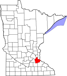 | |
| Townships | ||
| Unincorporated communities | ||
| Ghost towns | ||
| Indian reservation | ||
| Footnotes | ‡This populated place also has portions in an adjacent county or counties | |