New Oxford, Pennsylvania
| New Oxford, Pennsylvania Providence | |
|---|---|
| Borough | |
|
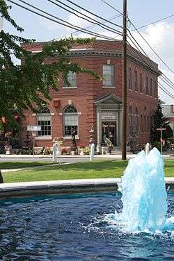
Downtown New Oxford | |
| Nickname(s): Oxfordtown | |
 Location in Adams County and the state of Pennsylvania. | |
| Coordinates: 39°51′48″N 77°03′23″W / 39.86333°N 77.05639°WCoordinates: 39°51′48″N 77°03′23″W / 39.86333°N 77.05639°W | |
| Country | United States |
| State | Pennsylvania |
| County | Adams |
| Settled | 1792 |
| Incorporated | 1874 |
| Government | |
| • Type | Borough Council |
| Area | |
| • Total | 0.6 sq mi (2 km2) |
| Elevation | 558 ft (170 m) |
| Population (2010) | |
| • Total | 1,783 |
| • Density | 2,700.7/sq mi (1,042.7/km2) |
| Time zone | Eastern (EST) (UTC-5) |
| • Summer (DST) | EDT (UTC-4) |
| Zip code | 17350 |
| Area code(s) | 717 |
New Oxford is a borough in Adams County, Pennsylvania, United States . It was originally platted in 1792 for Henry Kuhn by James Bolton and identified as "Oxford town" due to the presence of a nearby stream ford and a local establishment named "Dutch Frederick's stand" with the head of an ox on the front of the building.[1] This was changed again in 1822 by the town's first postmaster, Dr. Pfeiffer to "New Oxford".[2] New Oxford was incorporated as borough in August 20, 1874 and Joseph S. Gitt was elected as its first president and then served as secretary thru 1891.[3][4] In 1886, the population was 209 with 67 horses,40 cows, 65 "pleasure carriages" and 14 gold watches.[1]
The population was 1,783 at the 2010 census. Within New Oxford there are several large manufacturing plants. Among these are Winter Gardens, which manufactures products such as chicken salad; Yazoo Mills, which manufactures paper products; Pilgrim's Pride, which processes turkeys; and Aero Energy, which refurbishes propane and C02 containers for Blue Rhino. New Oxford is also a popular location for many antique shops, and is a destination for antique enthusiasts. The Chamber of Commerce sponsors an annual antique and crafts show on the third Saturday in June which is one of the largest of its kind in the east.
Geography
New Oxford is located at 39°51′48″N 77°3′23″W / 39.86333°N 77.05639°W (39.863208, -77.056475).[5]
According to the United States Census Bureau, the borough has a total area of 0.6 square miles (1.6 km2), all of it land.
Demographics
| Historical population | |||
|---|---|---|---|
| Census | Pop. | %± | |
| 1840 | 225 | — | |
| 1880 | 501 | — | |
| 1890 | 585 | 16.8% | |
| 1900 | 663 | 13.3% | |
| 1910 | 838 | 26.4% | |
| 1920 | 949 | 13.2% | |
| 1930 | 1,138 | 19.9% | |
| 1940 | 1,194 | 4.9% | |
| 1950 | 1,366 | 14.4% | |
| 1960 | 1,407 | 3.0% | |
| 1970 | 1,495 | 6.3% | |
| 1980 | 1,921 | 28.5% | |
| 1990 | 1,617 | −15.8% | |
| 2000 | 1,696 | 4.9% | |
| 2010 | 1,783 | 5.1% | |
| Est. 2015 | 1,796 | [6] | 0.7% |
| Sources:[7][8][9] | |||
As of the census[8] of 2000, there were 1,696 people, 678 households, and 448 families residing in the borough. The population density was 2,700.7 people per square mile (1,039.4/km²). There were 725 housing units at an average density of 1,154.5 per square mile (444.3/km²). The racial makeup of the borough was 92.45% White, 1.36% African American, 0.24% Native American, 0.18% Asian, 0.18% Pacific Islander, 4.42% from other races, and 1.18% from two or more races. Hispanic or Latino of any race were 8.96% of the population.
There were 678 households, out of which 33.0% had children under the age of 18 living with them, 47.1% were married couples living together, 13.0% had a female householder with no husband present, and 33.8% were non-families. 27.7% of all households were made up of individuals, and 10.0% had someone living alone who was 65 years of age or older. The average household size was 2.50 and the average family size was 3.05.
In the borough the population was spread out, with 26.6% under the age of 18, 9.3% from 18 to 24, 30.3% from 25 to 44, 20.7% from 45 to 64, and 13.1% who were 65 years of age or older. The median age was 35 years. For every 100 females there were 99.1 males. For every 100 females age 18 and over, there were 98.6 males.
The median income for a household in the borough was $36,991, and the median income for a family was $43,036. Males had a median income of $30,203 versus $22,455 for females. The per capita income for the borough was $18,065. About 7.3% of families and 7.6% of the population were below the poverty line, including 10.0% of those under age 18 and 4.4% of those age 65 or over.
School District
Conewago Valley School District
References
- 1 2 "History of Adams County". The Gettysburg Times (Gettysburg, Pennsylvania). March 18, 1932. Retrieved 5 May 2013.
- ↑ "History of Adams County, page 6". The Gettysburg Times (Gettysburg, Pennsylvania). March 21, 1932. Retrieved 5 May 2013.
- ↑ "Gitt Resigns from Council". New Oxford Item (New Oxford, Pennsylvania). February 7, 1891. Retrieved 6 May 2013.
- ↑ "Gitt Autobiographical article". Gettysburg Compiler (Gettysburg, Pennsylvania). June 26, 1900. Retrieved 6 May 2013.
- ↑ "US Gazetteer files: 2010, 2000, and 1990". United States Census Bureau. 2011-02-12. Retrieved 2011-04-23.
- ↑ "Annual Estimates of the Resident Population for Incorporated Places: April 1, 2010 to July 1, 2015". Retrieved July 2, 2016.
- ↑ "Census of Population and Housing". U.S. Census Bureau. Retrieved 11 December 2013.
- 1 2 "American FactFinder". United States Census Bureau. Retrieved 2008-01-31.
- ↑ "Incorporated Places and Minor Civil Divisions Datasets: Subcounty Resident Population Estimates: April 1, 2010 to July 1, 2012". Population Estimates. U.S. Census Bureau. Retrieved 11 December 2013.
External links
Municipalities and communities of Adams County, Pennsylvania, United States | ||
|---|---|---|
| Boroughs | 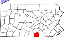 | |
| Townships | ||
| CDPs | ||
| Unincorporated communities | ||
| Ghost town | ||