New Lynn
| New Lynn | |
|---|---|
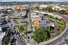 Aerial view of New Lynn town centre in 2013 | |
| Basic information | |
| Local authority | Auckland Council |
| Electoral ward | Whau |
| Population | 16,461 (2013) |
| Facilities | |
| Train station(s) | New Lynn Station, Fruitvale Road Station |
| Surrounds | |
| North | (Whau River) |
| Northeast | Avondale |
| East | New Windsor |
| Southeast | Blockhouse Bay |
| South | Green Bay |
| Southwest | Titirangi North |
| West | Glen Eden |
| Northwest | Kelston |
New Lynn is a residential suburb in Auckland, New Zealand. It has 5859 occupied dwellings and a population of 16,461 (2013 census). The population has seen a 17 per cent (2,400 people) increase since 2001.[1]
New Lynn is located towards the west of the Auckland urban area, 10 kilometres to the southwest of the Auckland city centre. The former boundary between Waitakere City and Auckland City lay at the eastern edge of the suburb. Suburbs surrounding New Lynn include Blockhouse Bay, Avondale, Titirangi and Green Bay.
New Lynn is located at a narrowing of the Auckland isthmus, and one of the two narrowest points joining the Northland Peninsula to the rest of the North Island (the other is at Otahuhu, to the southeast). At this point, between the Whau River (an estuarial arm of the Waitemata Harbour) in the north and Blockhouse Bay in the south, the island is a mere 2800 metres wide.
The town centre is undergoing a transformation as part of the Auckland City brownfield redevelopment programme, but currently remains dominated by a suburban mall, LynnMall. In the town centre one of Auckland's main public transit interchanges links west Auckland with other parts of the city by rail and bus. At the southern end of the suburb is one of Auckland's best known golf courses, Titirangi Golf Club.
Although the early houses in New Lynn were made of locally produced brick, most older houses are of weatherboard and corrugated iron, and were originally on large sections. Many of these sections have since been subdivided, with modern brick and tile houses added. High-density housing is predominantly near the railway line, with the start of a trend towards high rise apartments being built in the town centre.[2]
History
Māori use of the area began long before the arrival of Europeans, and a Māori portage existed between the Waitemata and Manukau harbours before European colonisation.[3] Some time after European colonisation of the Auckland Isthmus began, the area of New Lynn was surveyed by Frederick Utting in 1863, who named it after King's Lynn in Norfolk because of a similarity in the countryside.[4]
A brickyard was established by Dr Pollen by Whau Creek in 1852. He brought in brickmakers from Staffordshire in England, four of whom later established their own yards along the creek. By 1870 there were 13 brick and clay yards on the local waterways, exploiting the high-quality pleistocene clay in the area. Many of the ceramics companies failed due to the 1880s depression, competition, and changing preferences to use wood rather than bricks for construction. By 1910, there were only two ceramics companies in New Lynn, and two more in Avondale.[4]
The population was less than 100 in 1900, but grew rapidly over the next decade due to the expansion of the Western railway line, which had been established in 1880,[5] and New Lynn's development as an industrial centre. New Lynn became a Town District in 1910, and a Borough in 1939.[4]
One of the ceramics companies grew to become the largest brick-producer in New Zealand. A merger of four companies in 1929 formed the Amalgamated Brick and Pipe Company, later called Ceramco. It produced the well-known Crown Lynn pottery. It closed down in 1989.[6]
In 1935, the population of New Lynn was 3,500. The Great Depression caused high levels of unemployment. During World War II, the area was considered strategic due to the Whau River and the railway. Machine gun posts and tank traps were built, and the bridge over the Whau was mined with explosives. Fear of possible Japanese bombing led to air raid shelters being built.[4]
LynnMall was the first American-style shopping mall in Auckland when it opened in 1963. It became the first air-conditioned mall in New Zealand in 1987, the first to open on Sundays in 1991, and the first to be smoke-free in 1994. The mall was substantially expanded in 1999.[7]
In September 1974, New Zealand's first Pizza Hut restaurant opened in New Lynn.[8] It became the final eat-in Pizza Hut to be demolished in 2016.
The New Lynn Borough became part of Waitakere City in the local body reforms of 1989.[4] Today, New Lynn is part of Auckland's Council's Whau Local Board area.
Transport
New Lynn Train Station, located next to the bus transport centre and the LynnMall shopping centre, was upgraded in 2008–2010 to cater for the increased frequency of trains expected on the Auckland regional network after its electrification. The section of track on the Western line between Portage Road and Titirangi Road was trenched to allow trains to pass beneath the New Lynn town centre. A new twin-platform station was built below road level near the site of the existing station. The works were expected to "revitalise New Lynn", sinking the rail line which currently "splits" the town in two.[9][10] As part of the redevelopment projects for the area, part of Totara Avenue, in the New Lynn town centre, is being transformed into shared space.[11]
New Lynn has had ready road access to the Auckland CBD since the Northwestern Motorway and an expressway through Waterview were completed in the late 1970s.[12]
Education
Arahoe School, Fruitvale Road School and New Lynn School are coeducational contributing primary (years 1-6) schools with rolls of 790, 237 and 401 respectively.[13] New Lynn School opened in 1888,[14] Arahoe School opened in 1958[15] and Fruitvale Road School opened about 1961.
Oaklynn Special School is a coeducational school with a roll of 136. It is a special school for students with intellectual impairments.[16] The school runs ten satellite classes at nearby primary, intermediate and secondary schools.[17]
New Lynn has no secondary schools but is serviced by large school campuses in surrounding suburbs, including Kelston Boys High School, Kelston Girls' College, Avondale College (co-ed), Green Bay High School (co-ed).
Notes
- ↑ The figures given combine Statistics New Zealand unit area census populations for New Lynn North, New Lynn South, Lynmall, Fruitvale and Rewarewa
- ↑ Stephen Hart, ed. (2008). Where to Live in Auckland. Barbican Publishing. p. 120. ISBN 978-0-473-14244-5.
- ↑ "New Lynn: The Town of the Future" (PDF). Life in New Lynn, Glen Eden, Kelston, Blockhouse Bay & Avondale. Suburban Newspapers. 2002. p. 3. Retrieved 2009-05-12.
- 1 2 3 4 5 "New Lynn Reserves Management Plan" (PDF). Waitakere City Council. 2004. pp. 48–59. Retrieved 2009-05-12.
- ↑ Brookes, Nigel. "19th Century". From Green Bay to Gondwanaland. Archived from the original on 5 December 2008. Retrieved 2009-05-12.
- ↑ Pickmere, Arnold (18 June 2005). "Obituary: Tom Clark". The New Zealand Herald. Retrieved 2009-05-12.
- ↑ "Shop till you drop at LynnMall!" (PDF). Life in New Lynn, Glen Eden, Kelston, Blockhouse Bay & Avondale. Suburban Newspapers. 2002. p. 8. Retrieved 2009-05-12.
- ↑ "About Us". Pizza Hut New Zealand. Retrieved 2 March 2016.
- ↑ Dearnaley, Mathew (20 December 2006). "Rail trench saviour for New Lynn shopping centre". The New Zealand Herald.
- ↑ "Milestone reached in New Lynn rail trench project". Auckland Trains. 25 March 2009. Retrieved 2009-05-12.
- ↑ "Transforming New Lynn". Our Auckland. Auckland Council. April 2011. p. 23.
- ↑ "Northwestern Motorway" (PDF). Auckland Motorways. New Zealand Transport Agency. p. 18.
- ↑ "Directory of Schools - as at 2 August 2016". New Zealand Ministry of Education. Retrieved 2016-08-16.
- ↑ New Lynn School - 75th Jubilee Book 1888-1963. 1963. Retrieved 2009-05-11.
- ↑ "Arahoe School - About Us". Retrieved 29 June 2015.
- ↑ "Education Review Report: Oaklynn Special School". Education Review Office. June 2007. Retrieved 2009-05-11.
- ↑ "Our Place : Satellite Classes". Oaklynn Special School. Retrieved 2009-05-11.
External links
- Photographs of New Lynn held in Auckland Libraries' heritage collections.
Coordinates: 36°54′35″S 174°41′00″E / 36.90972°S 174.68333°E