New Coalinga Municipal Airport
| New Coalinga Municipal Airport | |||||||||||||||
|---|---|---|---|---|---|---|---|---|---|---|---|---|---|---|---|
|
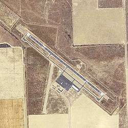
2006 USGS airphoto | |||||||||||||||
| IATA: CLG – ICAO: none – FAA LID: C80 | |||||||||||||||
| Summary | |||||||||||||||
| Airport type | Public | ||||||||||||||
| Owner | City of Coalinga | ||||||||||||||
| Location | Coalinga, California | ||||||||||||||
| Elevation AMSL | 622 ft / 190 m | ||||||||||||||
| Coordinates | 36°09′47″N 120°17′38″W / 36.16306°N 120.29389°W | ||||||||||||||
| Map | |||||||||||||||
 C80 Location of Coalinga Municipal Airport | |||||||||||||||
| Runways | |||||||||||||||
| |||||||||||||||
| Helipads | |||||||||||||||
| |||||||||||||||
| Statistics (2003) | |||||||||||||||
| |||||||||||||||
New Coalinga Municipal Airport (IATA: CLG, FAA LID: C80) is a public airport located three miles (5 km) east of the central business district of Coalinga, in Fresno County, California, United States. It is owned by the city of Coalinga.[1]
The original Coalinga Municipal Airport was located about 0.5 mile (1 km) north of the town center, just north of Cambridge Avenue and west of East Elm Avenue. It was established sometime in the 1920s.[2] As of 2012 traces of it could still be seen on aerial photographs and satellite images. The New Coalinga Municipal Airport was built in the late 1990s east of the town center, with an entrance road from West Phelps Avenue.
Facilities and aircraft
New Coalinga Municipal Airport covers an area of 1,002 acres (405 ha) which contains two runways (1/19: 2,500 x 60 ft (18 m), 12/30: 5,000 x 100 ft) and one helipad (H1: 50 x 50 ft). For the 12-month period ending May 9, 2003, the airport had 2,400 aircraft operations, all of which were general aviation.[1]
References
- 1 2 3 FAA Airport Master Record for C80 (Form 5010 PDF), effective 2007-07-05
- ↑ http://www.militarymuseum.org/LemooreELF.html Lemoore Emergency Landing Field. Retrieved 2012-01-17.
External links
- Resources for this airport:
- FAA airport information for C80
- AirNav airport information for C80
- ASN accident history for CLG
- FlightAware airport information and live flight tracker
- SkyVector aeronautical chart for C80