New Baltimore, Pennsylvania
| New Baltimore, Pennsylvania | |
|---|---|
| Borough | |
|
| |
 | |
| Coordinates: 39°59′02″N 78°46′20″W / 39.98389°N 78.77222°WCoordinates: 39°59′02″N 78°46′20″W / 39.98389°N 78.77222°W | |
| Country | United States |
| State | Pennsylvania |
| County | Somerset |
| Settled | 1829 |
| Incorporated | 1874 |
| Government | |
| • Type | Borough Council |
| Area | |
| • Total | 0.3 sq mi (0.8 km2) |
| Population (2000) | |
| • Total | 168 |
| • Density | 531.7/sq mi (205.3/km2) |
| Time zone | Eastern (EST) (UTC-5) |
| • Summer (DST) | EDT (UTC-4) |
| Zip code | 15553 |
| Area code(s) | 814 |

New Baltimore is a borough in Somerset County, Pennsylvania, United States. The population was 168 at the 2000 census. It is part of the Johnstown, Pennsylvania Metropolitan Statistical Area.
History
The first settler was Michael Riddlemoser, who built a house here in 1820, and laid out the street plan in 1829. The community was initially known as Mosersburg, and was later renamed New Baltimore, after Riddlemoser’s hometown.[1] The borough was incorporated in 1874.
In the 1880s, a major railroad yard and maintenance facility were planned for New Baltimore to serve the South Pennsylvania Railroad. In the end, construction on the railroad stopped and the tracks were never laid, and New Baltimore lost its chance to become a significant railroading center.[2]
The New Baltimore Bridge, built in 1879, was added to the National Register of Historic Places in 1980.[3]
Geography
New Baltimore is located at 39°59′2″N 78°46′20″W / 39.98389°N 78.77222°W (39.983808, −78.772154).[4]
According to the United States Census Bureau, the borough has a total area of 0.3 square miles (0.78 km2), all of it land.
Farmlands dominate the village and the mountain range with the majority forested to the west.
Demographics
| Historical population | |||
|---|---|---|---|
| Census | Pop. | %± | |
| 1880 | 150 | — | |
| 1890 | 185 | 23.3% | |
| 1900 | 201 | 8.6% | |
| 1910 | 177 | −11.9% | |
| 1920 | 174 | −1.7% | |
| 1930 | 137 | −21.3% | |
| 1940 | 260 | 89.8% | |
| 1950 | 221 | −15.0% | |
| 1960 | 263 | 19.0% | |
| 1970 | 214 | −18.6% | |
| 1980 | 221 | 3.3% | |
| 1990 | 162 | −26.7% | |
| 2000 | 168 | 3.7% | |
| 2010 | 180 | 7.1% | |
| Est. 2015 | 175 | [5] | −2.8% |
| Sources:[6][7][8] | |||
As of the census[7] of 2000, there were 168 people, 66 households, and 48 families residing in the borough. The population density was 531.7 people per square mile (202.7/km²). There were 75 housing units at an average density of 237.4 per square mile (90.5/km²). The racial makeup of the borough was 96.43% White and 3.57% Asian.
There were 66 households out of which 31.8% had children under the age of 18 living with them, 65.2% were married couples living together, 4.5% had a female householder with no husband present, and 25.8% were non-families. 22.7% of all households were made up of individuals and 12.1% had someone living alone who was 65 years of age or older. The average household size was 2.53 and the average family size was 2.92.
In the borough the population was spread out with 22.6% under the age of 18, 4.8% from 18 to 24, 30.4% from 25 to 44, 25.0% from 45 to 64, and 17.3% who were 65 years of age or older. The median age was 39 years. For every 100 females there were 104.9 males. For every 100 females age 18 and over, there were 109.7 males.
The median income for a household in the borough was $30,000, and the median income for a family was $37,500. Males had a median income of $27,500 versus $22,031 for females. The per capita income for the borough was $14,552. About 8.0% of families and 5.8% of the population were below the poverty line, including 9.3% of those under the age of eighteen and 5.9% of those sixty five or over.
Transportation
New Baltimore is just north of the Pennsylvania Turnpike (Interstates 70 and Interstate 76) but it has no interchange, it is also accessed via U.S. 30 (Lincoln Highway).
Church of the Turnpike
New Baltimore is perhaps best known for being home to the St. John's Church, a Carmelite church located on the southern end of town. The church is unique in that it has two sets of steps along the Pennsylvania Turnpike at milepost 129, one set of each side of the highway. (The church itself is located on the eastbound side of the highway.) The steps dated from when the Turnpike first opened, as part of an informal, unwritten pact between the Pennsylvania Turnpike Commission and the church after St. John's Church was separated from the rest of New Baltimore due to the Turnpike passing through.[9] In addition, Carmelite priests were buried on the right-of-way of the Turnpike, and their graves had to be moved.[10] The steps have long been a novelty of the Turnpike and to curious travelers who have stopped along the Turnpike just to stop at the church.
On March 12, 2007, the PTC announced that it would eventually remove the steps that lead to St. John's Church.[11] The steps are primarily being removed due to a widening project for the Turnpike. While a written pact has not been found by either the church or the PTC, even if a written pact were to be found, the Turnpike is forbidden by federal regulations to replace the steps in any case due to safety concerns.[10][11]
References
- ↑ History of Bedford, Somerset and Fulton Counties, Pennsylvania. Chicago, Illinois: Waterman, Watkins, & Co. 1884. p. 585.
- ↑ Harwood, Herbert H. (2010). The Railroad that Never Was: Vanderbilt, Morgan, and South Pennsylvania Railroad. Bloomington, Indiana: Indiana University Press. pp. 57–58. ISBN 978-0253355485.
- ↑ National Park Service (2010-07-09). "National Register Information System". National Register of Historic Places. National Park Service.
- ↑ "US Gazetteer files: 2010, 2000, and 1990". United States Census Bureau. 2011-02-12. Retrieved 2011-04-23.
- ↑ "Annual Estimates of the Resident Population for Incorporated Places: April 1, 2010 to July 1, 2015". Retrieved July 2, 2016.
- ↑ "Census of Population and Housing". U.S. Census Bureau. Retrieved 11 December 2013.
- 1 2 "American FactFinder". United States Census Bureau. Retrieved 2008-01-31.
- ↑ "Incorporated Places and Minor Civil Divisions Datasets: Subcounty Resident Population Estimates: April 1, 2010 to July 1, 2012". Population Estimates. U.S. Census Bureau. Retrieved 11 December 2013.
- ↑ http://scottbeveridge.blogspot.com/2008/09/church-of-turnpike.html
- 1 2 http://tribune-democrat.com/local/x519138366/Turnpike-changes-bring-an-end-to-church-steps?keyword=secondarystory
- 1 2 http://www.usatoday.com/travel/news/2007-03-12-pa-turnpike-church_N.htm
Municipalities and communities of Somerset County, Pennsylvania, United States | ||
|---|---|---|
| Boroughs | 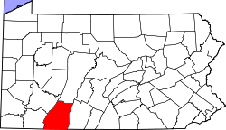 | |
| Townships | ||
| CDPs | ||
| Unincorporated communities | ||
| Footnotes | ‡This populated place also has portions in an adjacent county or counties | |