Neuburg-Schrobenhausen
| Neuburg-Schrobenhausen | |
|---|---|
| District | |
 | |
| Country |
|
| State | Bavaria |
| Adm. region | Oberbayern |
| Capital | Neuburg an der Donau |
| Area | |
| • Total | 740 km2 (290 sq mi) |
| Population (31 December 2015)[1] | |
| • Total | 94,654 |
| • Density | 130/km2 (330/sq mi) |
| Time zone | CET (UTC+1) |
| • Summer (DST) | CEST (UTC+2) |
| Vehicle registration | ND, SOB |
| Website | neuburg-schrobenhausen.de |
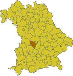
Neuburg-Schrobenhausen is a district in Bavaria, Germany. It is bounded by (from the east and clockwise) the districts of Pfaffenhofen, Aichach-Friedberg, Donau-Ries and Eichstätt, and by the city of Ingolstadt.
History
The district was established in 1972 by merging the former districts of Neuburg and Schrobenhausen.
Geography
The district consists of the previously swampy areas between the Danube and Paar rivers, that are called the Donaumoos. North of the Danube the district includes a small part of the Altmühl Valley Nature Park.
Coat of arms
 |
The coat of arms displays:
|
Towns and municipalities
| Towns | Municipalities | |
|---|---|---|
References
- ↑ "Fortschreibung des Bevölkerungsstandes". Bayerisches Landesamt für Statistik und Datenverarbeitung (in German). June 2016.
External links
| Wikimedia Commons has media related to Landkreis Neuburg-Schrobenhausen. |
- Official website (German)
Coordinates: 48°40′N 11°10′E / 48.67°N 11.17°E
This article is issued from Wikipedia - version of the 5/16/2015. The text is available under the Creative Commons Attribution/Share Alike but additional terms may apply for the media files.