Nether Providence Township, Delaware County, Pennsylvania
| Nether Providence Township | |
|---|---|
| Township | |
|
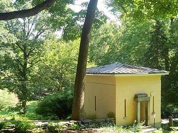
Helen Kate Furness Free Library | |
| Motto: A beautiful place to call home[1] | |
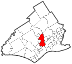 Location of Nether Providence Township in Delaware County | |
 Nether Providence Township Location in Pennsylvania | |
| Coordinates: 39°54′38″N 75°22′13″W / 39.91056°N 75.37028°WCoordinates: 39°54′38″N 75°22′13″W / 39.91056°N 75.37028°W | |
| Country | United States |
| State | Pennsylvania |
| County | Delaware |
| Area | |
| • Total | 4.7 sq mi (12 km2) |
| • Land | 4.7 sq mi (12 km2) |
| • Water | 0.0 sq mi (0 km2) |
| Elevation | 240 ft (70 m) |
| Population (2010) | |
| • Total | 13,706[2] |
| • Density | 2,907.7/sq mi (1,122.7/km2) |
| Time zone | EST (UTC-5) |
| • Summer (DST) | EDT (UTC-4) |
| Area code(s) | 610 |
| Website |
www |
Nether Providence Township is a first class township in Delaware County, Pennsylvania, United States. Many residents refer to the township by the name of its largest community, Wallingford, because the Wallingford postal code is used for most of the township. The population of the township was 13,706 at the 2010 census.[2]
Geography
Nether Providence Township is located in central Delaware County at 39°53′40″N 75°22′25″W / 39.89444°N 75.37361°W (39.894612, -75.373705).[3] It is bordered to the north by the borough of Media, the county seat. Other neighboring municipalities are Upper Providence Township to the north; Springfield Township, the borough of Swarthmore, and Ridley Township to the east; the city of Chester to the south; and the boroughs of Brookhaven and Rose Valley to the west.
According to the United States Census Bureau, the township has a total area of 4.7 square miles (12.2 km2), of which 0.01 square miles (0.02 km2), or 0.17%, is water.[2] Crum Creek forms the eastern boundary of the township, and Ridley Creek forms the western and southern border. Nether Providence's commercial area or downtown is located on Providence Road between the bridge over SEPTA's R3/Media Elwyn line and Wallingford Avenue. Interstate 476 runs up the east side of the township near Crum Creek, with access from Exit 3 (Baltimore Pike).
History
The first recorded inhabitants of Nether Providence Township were Native Americans of the Lenape tribe, who lived in the area for about five hundred years, but by 1740 few remained. On August 14, 1682, two months before William Penn's landing in Chester, John Sharpless came to the area. Penn had given Sharpless a thousand-acre (4-km²) tract, and he settled near Ridley Creek.
By the time Penn arrived, there were several small settlements in the area, which became known as Providence Township. Providence Township comprised today's Nether Providence, Rose Valley, Media, and Upper Providence. On October 17, 1683, the residents of Providence Township petitioned the Court of Chester County, of which they were then a part, to establish a road from Providence to Chester. The court approved the creation of Providence Great Road (now Route 252).
Nether Providence went through four distinct phases from farming, to manufacturing, to resort, and finally, to residential community. By 1729, the area was producing sufficient crops to allow exporting to New England, Canada, and Europe.
Fourteen major mill complexes were built in Nether Providence, six on Crum Creek and eight on Ridley Creek. The first, a cotton mill along Crum Creek, was started by Thomas Allen in 1763. He named his mill for his hometown, Wallingford, England. The mills played an essential part in the growth of Nether Providence. Millhands lived in the self-contained villages that grew up around the mills.
After the Civil War, wealthy Philadelphians built summer residences and vacation resorts in the area.
The first railway was the Leiper Railroad, a horse-drawn quarry rail line, constructed in 1809–1810 and used to haul cut stone until about 1828. That early rail line was superseded by the Leiper Canal.[4] The first steam-locomotive train came through in 1854; it used a single track with a sidetrack at Wallingford. The first post office in Nether Providence was established at Hinkson's Corner in 1873. Trolleys also contributed to the area's development. The first independent trolley was the Chester and Media Electric Railway, chartered in 1892. The last trolley through the township closed in 1938. The Nether Providence Police Department was established in 1935, and automobile parking was regulated in 1947 and speed in 1949.
Three sites within the township, Wolley Stille, the Thomas Leiper Estate, and Westlawn are listed on the National Register of Historic Places.
Demographics
| Historical population | |||
|---|---|---|---|
| Census | Pop. | %± | |
| 1930 | 2,833 | — | |
| 1940 | 3,793 | 33.9% | |
| 1950 | 6,173 | 62.7% | |
| 1960 | 10,380 | 68.2% | |
| 1970 | 13,589 | 30.9% | |
| 1980 | 12,730 | −6.3% | |
| 1990 | 13,229 | 3.9% | |
| 2000 | 13,456 | 1.7% | |
| 2010 | 13,706 | 1.9% | |
As of the census[5] of 2000, there were 13,456 people, 5,007 households, and 3,755 families residing in the township. The population density was 2,857.7 people per square mile (1,103.1/km²). There were 5,125 housing units at an average density of 1,088.4/sq mi (420.1/km²). The racial makeup of the township was 90.08% White, 6.12% African American, 0.10% Native American, 2.34% Asian, 0.04% Pacific Islander, 0.27% from other races, and 1.06% from two or more races. 1.13% of the population were Hispanic or Latino of any race.
There were 5,007 households, out of which 34.5% had children under the age of 18 living with them, 62.3% were married couples living together, 9.8% had a female householder with no husband present, and 25.0% were non-families. 21.7% of all households were made up of individuals, and 10.4% had someone living alone who was 65 years of age or older. The average household size was 2.62 and the average family size was 3.08.
In the township the population was spread out, with 25.4% under the age of 18, 4.9% from 18 to 24, 25.8% from 25 to 44, 26.3% from 45 to 64, and 17.5% who were 65 years of age or older. The median age was 42 years. For every 100 females there were 90.8 males. For every 100 females age 18 and over, there were 85.8 males.
The median income for a household in the township was $68,059, and the median income for a family was $78,491. Males had a median income of $72,370 versus $49,048 for females. The per capita income for the township was $32,946. About 3.1% of families and 3.4% of the population were below the poverty line, including 5.2% of those under age 18 and 2.1% of those age 65 or over.
Education
The first area school started in 1810 and was built on a portion of a 78-acre (32 ha) land grant of farmer and friend of William Penn, Matthew Thaddeus McGonigal of Wallingford, Pennsylvania. Nether Providence School District was formed in 1856; it merged with the Swarthmore School District in 1984, creating the Wallingford Swarthmore School District. The Helen Kate Furness Library was founded in 1902.
School-age children within the public education system attend the Nether Providence Elementary School (NPE), Swarthmore Rutledge Elementary School (SRS), or Wallingford Elementary School (WES) for grades K through 5. Strath Haven Middle School (SHMS) includes grades 6th through 8th. Formerly housed in the old Nether Providence High School (NPSH), SHMS was renovated during 2008 through 2010 to add a new wing facing Copples Lane and to demolish the 1927 NPHS building. Architectural elements from the NPSH facade will be incorporated into a stone wall. Strath Haven High School (SHHS), located directly across Providence Road from the Middle School, educates students in grades 9th through 12th. Students from the neighboring boroughs of Swarthmore, Rose Valley, and Rutledge attend the district schools. The only private school within Nether Providence boarders is Mother of Providence Regional Catholic School, which currently serves the parishes of St. John Chrysostom and Nativity BVM as well as surrounding parishes. It is located on Route 252 between Media and Chester.
Religious institutions

Several religious congregations serve Nether Providence.
Holy Trinity Lutheran Church
Holy Trinity is a Lutheran church located approximately at the intersection of Harvey Road and route 252.
Ohev Shalom
Congregation Ohev Ohev Shalom is a synagogue located on route 320 approximately at the junction with route 252.
St. John Chrysostom
St. John Chrysostom is a Roman Catholic church on route 252 across from Springhaven Country Club.
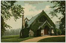
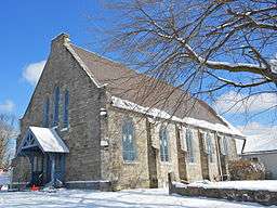
Wallingford Presbyterian Church
Wallingford Presbyterian Church is a Presbyterian church located at the intersection of Brookhaven Road and Avondale Road.
Greater Philadelphia Baptist Church
Formerly occupied by Zion African Methodist Episcopal, the church building was occupied by the Greater Philadelphia Church in 2015. It is located in South Media at the intersection of Manchester Ave. and Wallingford Ave.
Lieper Church
The historic Lieper church is located on Fairview Road in Ridley. In 2015 it became home to Holy Myrrh Bearers Ukrainian Catholic church.
Government and communities
Major communities in Nether Providence are Garden City, South Media and Wallingford. The South Media Fire Company was organized in 1922 and Garden City Fire Company in 1944. Ambulance service is provided by the Media Fire Company and Parkside Fire Company. The Moylan community near Rose Valley is also within Nether Providence Township, as are the Bowling Green, Park Ridge, Pine Ridge, and Wesley Manor communities located north of Baltimore Pike.
Garden City
Within Garden City area the Waterville, Lapidea, and Crum Creek Manor sections. The Crum Creek Manor section is known for its circular layout. Putnam Village is usually considered within the Garden City community.[6] Crum Creek Manor is known as a working class blue collar area of Garden City, made up of row houses and ranch houses built for returning World War II veterans in the 1940s.
The small community of Garden City is located in the southernmost part of Nether Providence. It borders Chester city to the south, where it is cut off by Ridley Creek. It lies southwest of the intersection where Route 252 (South Providence Road) and Route 320 (Chester Road) meet, and it is cut off by Route 252 (or sometimes Harvey Road) at the east. The north and west borders of the community are disputed. Moore Road is loosely used as a northern border for Garden City. West Brookhaven Road (or in some cases Putnam Village) is often used as the western border of Garden City.
Garden City is home to the Garden City Fire Co., the Garden City Chapel, and the Creekside Swim Club. Nether Providence Elementary School is the elementary school for the Garden City Community and is often considered within Garden City.
South Media
South Media is an unincorporated community bordering the southern edge of Media. The neighborhood lies within the Media, PA 19063 postal code. It lies north of Wallingford and Rose Valley and west of North Providence Road. East Baltimore Avenue is usually considered the northern border. It is a diverse working class to lower middle class community, and it is known as having a large African American population. It is home to the South Media Fire Co., the oldest fire company in Nether Providence.
Moylan


Moylan is an unincorporated community, founded on the land and tax reform principles of Henry George,[7] located partially in Nether Providence township and partially in Rose Valley Borough. It is home to the Moylan – Rose Valley commuter train station on the Media/Elwyn Line, which is located on Manchester Avenue. To the north Moylan borders the township of Upper Providence and the unincorporated community of South Media. The southern boundary is sometimes disputed, but it is approximately Rose Valley Road.
Wallingford
Wallingford is an unincorporated community in the middle of Nether Providence. Wallingford usually refers to the area in between Brookhaven Road, Route 252, Rosevalley Road and Avondale Road. The neighborhood of South Wallingford is also in Wallingford.
Neighborhoods
Bowling Green
Bowling Green is a neighborhood of detached houses north of Baltimore Pike bordering Media Borough. Streets in Bowling Green are Mulberry Lane, Bent Road, Quaint Road, Twyckenham Road, Truepenny Road, Luckie Lane, Hidden Acres Lane and Surrey Road while west of Beatty Road.
Pine Ridge
Pine Ridge is a neighborhood of detached houses north of Baltimore Pike. Streets in Pine Ridge are Hemlock Road, Beechwood Road and Pine Ridge Road. Pine Ridge is zoned to go to Swarthmore-Rutledge School even though it is in Nether Providence Township.
References
- ↑ Township website
- 1 2 3 "Geographic Identifiers: 2010 Demographic Profile Data (G001): Nether Providence township, Delaware County, Pennsylvania". U.S. Census Bureau, American Factfinder. Retrieved December 30, 2015.
- ↑ "US Gazetteer files: 2010, 2000, and 1990". United States Census Bureau. 2011-02-12. Retrieved 2011-04-23.
- ↑ Morlok, Edward K. (February 12, 2004). "Transportation Data". Retrieved May 7, 2011.
- ↑ "American FactFinder". United States Census Bureau. Retrieved 2008-01-31.
- ↑ Nether Providence / Wallingford PA Named to Money Magazine's Top 10 Places to Live, But Is the Ranking Truly Deserved?
- ↑ Dixon, Mark (2010). The hidden history of Delaware County : untold tales from Cobb's Creek to the Brandywine. Charleston, SC: History Press. ISBN 1609490657.
External links
Municipalities and communities of Delaware County, Pennsylvania, United States | ||
|---|---|---|
| City | 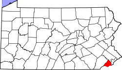 | |
| Boroughs | ||
| Townships | ||
| CDPs | ||
| Unincorporated communities |
| |
| Footnotes | ‡This populated place also has portions in an adjacent county or counties | |