Neshaminy State Park
| Neshaminy State Park | |
|---|---|
| Pennsylvania State Park | |
| Natural Monument (IUCN III) | |
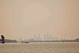 The Philadelphia skyline as seen from Neshaminy State Park | |
| Country | United States |
| State | Pennsylvania |
| County | Bucks |
| Township | Bensalem |
| Location | [1] |
| - coordinates | 40°04′42″N 74°55′59″W / 40.07833°N 74.93306°WCoordinates: 40°04′42″N 74°55′59″W / 40.07833°N 74.93306°W |
| - elevation | 26 ft (8 m) [1] |
| Area | 330 acres (134 ha) |
| Founded | 1956 |
| Managed by | Pennsylvania Department of Conservation and Natural Resources |
 Location of Neshaminy State Park in Pennsylvania | |
| Website : Neshaminy State Park | |
Neshaminy State Park is a 330-acre (134 ha) Pennsylvania state park in Bensalem Township, Bucks County, Pennsylvania in the United States. Visitors to the park can catch a glimpse of the Philadelphia skyline from a hiking trail on Logan Point. The park is located at the confluence of Neshaminy Creek and the Delaware River. Neshaminy State Park is just off Interstate 95 on Pennsylvania Route 132.
History
Most of the lands of Neshaminy State Park were donated to the Commonwealth of Pennsylvania by the estate of Robert R. Logan in 1956. Logan was a descendant of James Logan who was the colonial secretary to William Penn the founder of Pennsylvania. Dunks Ferry Road, which forms the western boundary of the park, is one of the oldest roads in Pennsylvania. It was built in 1679 by Dunken Williams to provide access to his ferry which crossed the Delaware River. Dunks Ferry Inn was a major rest stop that served travelers from the mid-18th until the late 19th century.[2]
Estuary
Neshaminy State Park is 116 miles (187 km) from the Atlantic Ocean, but it is at sea level. This combination of distance and elevation creates an estuary. The tidal affect causes the river to rise and fall each day. The Lenape who once lived on the banks of the river used tides to help them harvest fish. They built low fences in the tidal zone. At high tide the fish would swim in and be caught by the fences when the waters receded at low tide.[2]
Recreation
The Delaware River
Neshaminy State Park is the home of a 370 slip marina on the Delaware River. Demand for slips in the marina is always very high and the waiting list is long. This is due to the location of the park, it is located squarely within the heart of heavily populated southeastern Pennsylvania. Recreational boating on the Delaware River is especially popular in the summer months. Unlimited horsepower boats are permitted on the river. All boats must display a current registration with any state or have a launch permit from the Pennsylvania Fish and Boat Commission. The Delaware River is a warm water fishery. All fishermen are expected to follow the rules and regulations of the fish commission.[2]
Swimming
Swimming is not permitted in the river. A swimming pool is open daily from 10:00am until 5:00pm weekdays and 10:00 am until 6:00 pm weekends, Memorial Day weekend through Labor Day weekend. Lifeguards are on duty. Nine dollars admission is charged to the pool area. See neshaminypool.com. [2]
Hiking
There are 4 miles (6.4 km) of hiking trails at Neshaminy State Park. Logan Walk is the former driveway to the Logan home. This tree lined trail is paved and serves as a hiking trail and park service road. River Walk Trail is a loop that begins and ends at Logan Walk. It follows the bank of the Delaware River and passes by the estuary and tidal marsh.[2][3]
Nearby state parks
The following state parks are within 30 miles (48 km) of Neshaminy State Park:[4][5][6]
- Benjamin Rush State Park (Philadelphia County)
- Bull's Island Recreation Area (New Jersey)
- Delaware Canal State Park (Bucks and Northampton Counties)
- Delaware and Raritan Canal State Park (New Jersey)
- Evansburg State Park (Montgomery County)
- Fort Washington State Park (Montgomery County)
- Nockamixon State Park (Bucks County)
- Norristown Farm Park (Montgomery County)
- Ralph Stover State Park (Bucks County)
- Rancocas State Park (New Jersey)
- Ridley Creek State Park (Delaware County)
- Tyler State Park (Bucks County)
- Washington Crossing State Park (New Jersey)
References
- 1 2 "Neshamniny State Park". Geographic Names Information System. United States Geological Survey. August 30, 1990. Retrieved 2008-06-17.
- 1 2 3 4 5 "Neshaminy State Park". Pennsylvania Department of Conservation and Natural Resources. Retrieved January 17, 2007.
- ↑ "Neshaminy State Park". Trails.com. Retrieved 2007-01-17.
- ↑ "Find a Park by Region (interactive map)". Pennsylvania Department of Conservation and Natural Resources. Retrieved November 18, 2011.
- ↑ Michels, Chris (1997). "Latitude/Longitude Distance Calculation". Northern Arizona University. Retrieved 2008-04-23.
- ↑ "2007 General Highway Map Bucks County Pennsylvania" (PDF) (Map). 1:65,000. Pennsylvania Department of Transportation, Bureau of Planning and Research, Geographic Information Division. Retrieved 2006-07-27. Note: shows Neshaminy State Park
External links
| Wikimedia Commons has media related to Neshaminy State Park. |
- "Neshaminy State Park official map" (PDF). (320.0 KB)