Neajlov River
| Neajlov River | |
| River | |
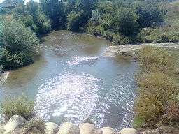 Neajlov near Dealu, Giurgiu | |
| Countries | Romania |
|---|---|
| Counties | Argeș, Dâmbovița, Giurgiu |
| Tributaries | |
| - right | Dâmbovnic, Câlniștea |
| Mouth | Argeș |
| - location | Comana |
| - coordinates | 44°11′14″N 26°12′22″E / 44.18722°N 26.20611°ECoordinates: 44°11′14″N 26°12′22″E / 44.18722°N 26.20611°E |
| Length | 188 km (117 mi) |
| Basin | 3,718.5 km2 (1,436 sq mi) |
| Progression | Argeș→ Danube→ Black Sea |
The Neajlov is a river in Romania. It is a right tributary of the river Argeș, which it meets near Comana, Giurgiu County. It rises from the Getic plateau. It is 188 km (117 mi) long and its basin area is 3,718.5 km2 (1,435.7 sq mi).[1]
Location
The river basin is located in the southern part of Romania, the geographic position being 24°51’12”-26°13’52” E longitude and 43°55’31”-44°49’32” N latitude.
Towns and villages
The following towns and villages are situated along the river Neajlov, from source to mouth: Oarja, Morteni, Petrești, Uliești, Corbii Mari, Vânătorii Mici, Crevedia Mare, Clejani, Bulbucata, Iepurești, Singureni, Călugăreni, Comana.
Tributaries
The following rivers are tributaries to the river Neajlov:
Left: Glonț, Teiș, Neajlovel, Neajlovel, Izvor, Izvorul Dealului, Ilfovăț, Bătrâna, Stătoaica
Right: Valea Adâncă, Cristia, Holboca, Baracu, Chiricanu, Dâmbovnic, Bălăria, Câlniștea, Țânțăroasa, Buda, Dadilovăț, Gurban
Lakes
Comana
References
- ↑ Angheluță Vădineanu, Carmen Postolache, Georgia Cosor, Teodora Pălărie, Costel Negrei, Magdalena Bucur - Case Study Report - The Neajlov Catchment
- Administrația Națională Apelor Române - Cadastrul Apelor - București
- Institutul de Meteorologie și Hidrologie - Rîurile României - București 1971
- ICPA - Comune vulnerabile - județul Argeș
- ICPA - Comune vulnerabile - Județul Teleorman
- Trasee turistice - județul Giurgiu