Nationalpark Kalkalpen
| Kalkalpen National Park | |
|---|---|
|
IUCN category II (national park) | |
|
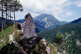
The Reichraminger Hintergebirge, seen from Kalkalpen National Park | |
 Kalkalpen National Park Location within Austria | |
| Location | Northern Limestone Alps, Upper Austria, Austria |
| Coordinates | 47°47′24″N 14°22′25″E / 47.79000°N 14.37361°ECoordinates: 47°47′24″N 14°22′25″E / 47.79000°N 14.37361°E |
| Area | 20,825 hectares (51,460 acres) |
| Established | 25 July 1997 |
| http://www.kalkalpen.at/ | |
Kalkalpen National Park (in English literally Limestone Alps National Park) is a national park within the Northern Limestone Alps mountain range, located in the state of Upper Austria, Austria.[1] The park was established in 1997.
Description
The park contains Central Europe's largest forested area, as well the largest karst region in Austria.[2] It opened on 25 July 1997,[3][4] and has an area of 20,825 hectares (51,460 acres).[5]
Features
Kalkalpen National Park has visitors centers in Molln, Ennstal, and at the Hengstpaßhütt near Rosenau.[6][7] [8] The Wurbauerkogel, a 21 metres (69 ft) high panorama view tower, is located near Windischgarsten. It is accessible by a chair lift and hiking paths. In clear weather 21 peaks of 2,000 metres (6,600 ft) or greater in elevation can be seen from Wurbauerkogel.[9]
The park has numerous hiking, mountain biking, and horseback riding trails. The former Steyr Valley Railway, with sections now the Steyrtal rail trail, pass through the park in the Molln area. In the winter there are snowshoe hiking and alpine skiing routes.
The national park's lodge and seminar center is the 1907 Villa Sonnwend, located in Windischgarsten.[10]
See also
- Limestone Alps
- List of national parks in the Alps
- National parks of Austria
- Ennstal Alps
- Southern Limestone Alps
References
- ↑ Kalkalpen.at: Nationalpark Kalkalpen (Limestone Alps National Park)−(English) . accessed 11.11.2015.
- ↑ "Kalkalpen National Park". Urlaubsregion Pyhrn-Priel. Retrieved 1 September 2013.
- ↑ "Background Info: Kalkalpen National Park". Nationalpark Kalkalpen. Retrieved 1 September 2013.
- ↑ "Zeittafel" [Timeline] (in German). Nationalpark Kalkalpen. Retrieved 1 September 2013.
- ↑ "Rahmenvereinbarung Nationalpark Kalkalpen Region". CIPRA. Retrieved 1 September 2013.
- ↑ Nationalpark Kalkalpen: Molln Visitor Center
- ↑ Nationalpark Kalkalpen: Ennstal Visitor Center
- ↑ Nationalpark Kalkalpen: Hengstpaßhütte (Rosenau)
- ↑ Nationalpark Kalkalpen: Wurbauerkogel panoramic view tower
- ↑ Villa Sonnwend website−(German)
External links
- (English)—Official Nationalpark Kalkalpen (Limestone Alps National Park) website
 Media related to Northern Limestone Alps at Wikimedia Commons
- Media related to Nationalpark Kalkalpen at Wikimedia Commons
