| [3] |
Name on the Register[4] |
Image |
Date listed[5] |
Location |
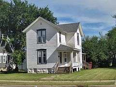
City or town |
Description |
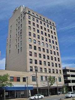
|---|
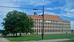
| 1 |
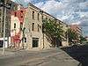
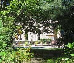
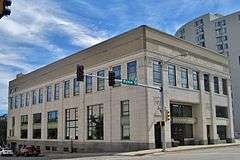
Barber–Colman Company Historic District |
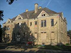
|
000000002006-08-08-0000August 8, 2006
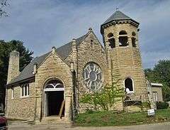
(#06000674) |
100 Loomis, 1202-1322 (even) Rock Street
42°15′34″N 89°05′52″W / 42.259444°N 89.097778°W / 42.259444; -89.097778 (Barber–Colman Company Historic District) |
Rockford |
|
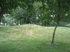
| 2 |
Beattie Park Mound Group |
|
000000001991-02-27-0000February 27, 1991
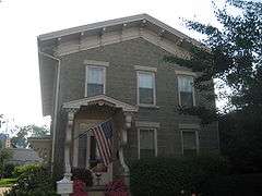
(#91000084) |
North Main Street between Park and Mound Avenues
42°16′28″N 89°05′30″W / 42.274444°N 89.091667°W / 42.274444; -89.091667 (Beattie Park Mound Group) |
Rockford |
|
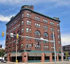
| 3 |
William Brown Building |
|
000000002000-08-10-0000August 10, 2000
(#00000946) |
226-228 South Main Street
42°16′10″N 89°05′43″W / 42.269444°N 89.095278°W / 42.269444; -89.095278 (William Brown Building) |
Rockford |
|
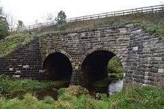
| 4 |
Chicago & North Western Railway Stone Arch Bridge |
|
000000001993-08-19-0000August 19, 1993
(#93000840) |
0.6 miles (0.97 km) east of Illinois Route 251, 0.6 miles (0.97 km) west of Interstate 90 and 0.2 miles (0.32 km) south of Burr Oak Road
42°24′57″N 88°59′51″W / 42.415833°N 88.9975°W / 42.415833; -88.9975 (Chicago & North Western Railway Stone Arch Bridge) |
Roscoe Township |
|
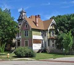
| 5 |
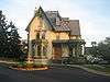
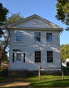
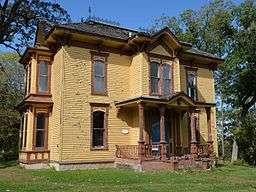
Chick House |
|
000000001997-02-07-0000February 7, 1997
(#97000031) |
119-123 South Main Street
42°16′14″N 89°05′43″W / 42.270556°N 89.095278°W / 42.270556; -89.095278 (Chick House) |
Rockford |
|
| 6 |
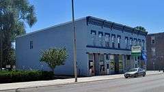
Condon Brothers and R. H. Shumway Building |
|
000000002015-08-18-0000August 18, 2015
(#15000524) |
624-642 Cedar St.
42°16′11″N 89°06′09″W / 42.269613°N 89.102524°W / 42.269613; -89.102524 (Condon Brothers and R. H. Shumway Building) |
Rockford |
|
| 7 |
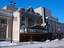
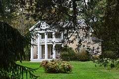
Coronado |
|
000000001979-09-06-0000September 6, 1979
(#79000878) |
312-324 North Main Street
42°16′26″N 89°05′35″W / 42.273889°N 89.093056°W / 42.273889; -89.093056 (Coronado) |
Rockford |
|
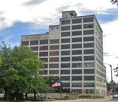
| 8 |
East Rockford Historic District |
|
000000001980-03-20-0000March 20, 1980
(#80001422) |
Roughly bounded by Rock River and Market, 4th, and Walnut Streets
42°16′04″N 89°05′16″W / 42.267778°N 89.087778°W / 42.267778; -89.087778 (East Rockford Historic District) |
Rockford |
|
| 9 |
Garrison–Coronado–Haskell Historic District |
|
000000002012-01-12-0000January 12, 2012
(#11001030) |
Roughly bounded by Salem, Summer, Main, Court, Whitman, and Winnebago Sts., and Fisher, Ridge, and North Aves.
42°16′55″N 89°05′10″W / 42.281897°N 89.086207°W / 42.281897; -89.086207 (Garrison–Coronado–Haskell Historic District) |
Rockford |
|
| 10 |
Garrison School |
|
000000002006-02-09-0000February 9, 2006
(#06000005) |
1105 North Court Street
42°17′01″N 89°05′09″W / 42.283544°N 89.085727°W / 42.283544; -89.085727 (Garrison School) |
Rockford |
|
| 11 |
Graham–Ginestra House |
|
000000001979-06-11-0000June 11, 1979
(#79000879) |
1115 South Main Street
42°15′42″N 89°06′02″W / 42.261667°N 89.100556°W / 42.261667; -89.100556 (Graham–Ginestra House) |
Rockford |
|
| 12 |
Greenwood Cemetery Chapel and Crematory |
|
000000002012-08-28-0000August 28, 2012
(#12000554) |
1011 Auburn St.
42°17′25″N 89°04′40″W / 42.290223°N 89.077841°W / 42.290223; -89.077841 (Greenwood Cemetery Chapel and Crematory) |
Rockford |
|
| 13 |
Haight Village Historic District |
|
000000001987-11-20-0000November 20, 1987
(#87002044) |
Roughly bounded by Walnut and Kishwaukee Streets, the Chicago Northwestern railroad tracks, and Madison Street
42°15′55″N 89°05′22″W / 42.265278°N 89.089444°W / 42.265278; -89.089444 (Haight Village Historic District) |
Rockford |
|
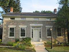
| 14 |
Herrick Cobblestone |
|
000000001980-05-14-0000May 14, 1980
(#80001423) |
2127 Broadway
42°15′08″N 89°03′44″W / 42.252222°N 89.062222°W / 42.252222; -89.062222 (Herrick Cobblestone) |
Rockford |
|
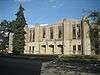
| 15 |
Illinois National Guard Armory |
|
000000002000-08-10-0000August 10, 2000
(#00000948) |
605 North Main Street
42°16′37″N 89°05′22″W / 42.276944°N 89.089444°W / 42.276944; -89.089444 (Illinois National Guard Armory) |
Rockford |
|
| 16 |
Indian Hill Manor and Farm Historic District |
|
000000002001-06-21-0000June 21, 2001
(#01000667) |
6901-7057 Kishwaukee Road
42°10′47″N 89°08′06″W / 42.179722°N 89.135°W / 42.179722; -89.135 (Indian Hill Manor and Farm Historic District) |
Rockford Township |
|
| 17 |
Lysander Jacoby House |
|
000000001982-03-05-0000March 5, 1982
(#82002607) |
2 Jacoby Place
42°17′14″N 89°03′45″W / 42.287222°N 89.0625°W / 42.287222; -89.0625 (Lysander Jacoby House) |
Rockford |
|
| 18 |
H.D. Jameson House |
|
000000002003-09-14-0000September 14, 2003
(#03000915) |
900 North Prairie Street
42°27′46″N 89°04′26″W / 42.462778°N 89.073889°W / 42.462778; -89.073889 (H.D. Jameson House) |
Rockton |
|
| 19 |
Lake–Peterson House |
|
000000001980-06-25-0000June 25, 1980
(#80001424) |
1313 East State Street
42°16′01″N 89°04′28″W / 42.266944°N 89.074444°W / 42.266944; -89.074444 (Lake–Peterson House) |
Rockford |
|
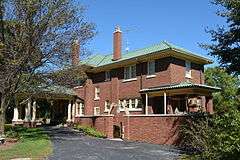
| 20 |
Kenneth and Phyllis Laurent House |
|
000000002012-08-28-0000August 28, 2012
(#12000555) |
4646 Spring Brook Rd.
42°17′59″N 89°01′28″W / 42.299754°N 89.02435°W / 42.299754; -89.02435 (Kenneth and Phyllis Laurent House) |
Rockford |
|
| 21 |
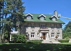
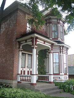
Charles Lundberg House |
|
000000002008-12-30-0000December 30, 2008
(#08001251) |
946 N. 2nd St.
42°16′44″N 89°04′40″W / 42.278889°N 89.077778°W / 42.278889; -89.077778 (Charles Lundberg House) |
Rockford |
|
| 22 |
Macktown Historic District |
|
000000001978-01-05-0000January 5, 1978
(#78001201) |
West of Rockton on the Pecatonica River
42°27′00″N 89°05′17″W / 42.45°N 89.088056°W / 42.45; -89.088056 (Macktown Historic District) |
Rockton |
|
| 23 |
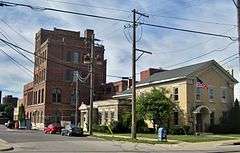
Peacock Brewery |
|
000000002011-11-22-0000November 22, 2011
(#11000851) |
200 Prairie and 500 N. Madison Sts.
42°16′23″N 89°05′12″W / 42.273056°N 89.086667°W / 42.273056; -89.086667 (Peacock Brewery) |
Rockford |
|
| 24 |
William H. Roberts House |
|
000000001979-09-06-0000September 6, 1979
(#79000877) |
523 Main Street
42°18′43″N 89°21′35″W / 42.311944°N 89.359722°W / 42.311944; -89.359722 (William H. Roberts House) |
Pecatonica |
|
| 25 |
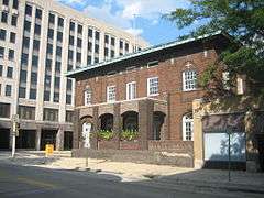
Rockford Elk's Lodge #64 |
|
000000002005-02-28-0000February 28, 2005
(#05000113) |
210 West Jefferson
42°16′30″N 89°05′35″W / 42.275°N 89.093056°W / 42.275; -89.093056 (Rockford Elk's Lodge #64) |
Rockford |
|
| 26 |
Rockford Morning Star Building |
|
000000001999-08-12-0000August 12, 1999
(#99000972) |
127 North Wyman Street
42°16′18″N 89°05′35″W / 42.271667°N 89.093056°W / 42.271667; -89.093056 (Rockford Morning Star Building) |
Rockford |
|
| 27 |
Rockton Historic District |
|
000000001978-05-02-0000May 2, 1978
(#78001202) |
Roughly bounded by River, Warren, Cherry, and West Streets
42°27′11″N 89°04′23″W / 42.453056°N 89.073056°W / 42.453056; -89.073056 (Rockton Historic District) |
Rockton |
|
| 28 |
Seventh Street Commercial Historic District |
|
000000002005-03-23-0000March 23, 2005
(#04001304) |
Roughly bounded by 7th Street, Charles Street, 6th Street, and Keith Creek
42°15′44″N 89°04′50″W / 42.262222°N 89.080556°W / 42.262222; -89.080556 (Seventh Street Commercial Historic District) |
Rockford |
|
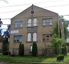
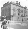
| 29 |
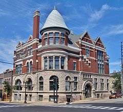
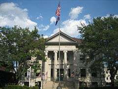
Soldiers and Sailors Memorial Hall |
|
000000001976-01-31-0000January 31, 1976
(#76000731) |
211-215 North Main Street
42°16′21″N 89°05′35″W / 42.2725°N 89.093056°W / 42.2725; -89.093056 (Soldiers and Sailors Memorial Hall) |
Rockford |
|
| 30 |
Amos Catlin Spafford House |
|
000000001980-02-20-0000February 20, 1980
(#80001425) |
501 North Prospect Street
42°16′21″N 89°03′58″W / 42.2725°N 89.066111°W / 42.2725; -89.066111 (Amos Catlin Spafford House) |
Rockford |
|
| 31 |
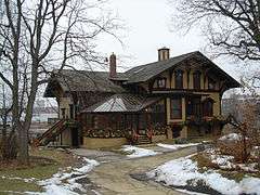
Tinker Swiss Cottage |
|
000000001972-12-27-0000December 27, 1972
(#72000468) |
411 Kent Street
42°15′55″N 89°06′07″W / 42.265278°N 89.101944°W / 42.265278; -89.101944 (Tinker Swiss Cottage) |
Rockford |
|
| 32 |
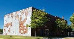
Turner School |
Upload image |
000000002015-12-29-0000December 29, 2015
(#15000934) |
1410 Broadway
42°15′09″N 89°04′29″W / 42.252509°N 89.074774°W / 42.252509; -89.074774 (Turner School) |
Rockford |
|
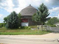
| 33 |
Robert Weber Round Barn |
|
000000001984-02-23-0000February 23, 1984
(#84001172) |
East of Durand
42°24′44″N 89°14′11″W / 42.412222°N 89.236389°W / 42.412222; -89.236389 (Robert Weber Round Barn) |
Harrison Township |
|
| 34 |
Valencia Court Apartments |
|
000000002009-12-22-0000December 22, 2009
(#09001123) |
500-518 Fisher Ave.
42°16′46″N 89°05′32″W / 42.279408°N 89.092172°W / 42.279408; -89.092172 (Valencia Court Apartments) |
Rockford |
|
| 35 |
West Downtown Rockford Historic District |
|
000000002007-09-05-0000September 5, 2007
(#07000899) |
Roughly bounded by Park Avenue, State Street, Church Street, and Wyman Street
42°16′22″N 89°05′38″W / 42.272742°N 89.093786°W / 42.272742; -89.093786 (West Downtown Rockford Historic District) |
Rockford |
|
| 36 |
Ziock Building |
|
000000002011-05-04-0000May 4, 2011
(#11000246) |
416 S. Main St.
42°16′04″N 89°05′48″W / 42.267778°N 89.096667°W / 42.267778; -89.096667 (Ziock Building) |
Rockford |
|