| [2] |
Name on the Register |
Image |
Date listed[3] |
Location |
Neighborhood |
Description |
|---|
| 1 |
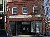
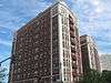
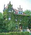
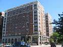
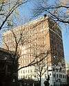
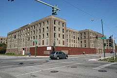
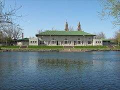
Robert S. Abbott House |
|
000000001976-12-08-0000December 8, 1976
(#76000686) |
4742 S. Dr. Martin Luther King Jr. Drive
41°48′36″N 87°36′58″W / 41.81°N 87.616111°W / 41.81; -87.616111 (Robert S. Abbott House) |
Grand Boulevard |
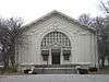
Home of Robert S. Abbott, founder of the Chicago Defender newspaper
|
| 2 |
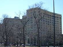
Armour Square |
|
000000002003-08-19-0000August 19, 2003
(#03000789) |
Bounded by W. 33rd Street, W. 34th Place, S. Wells Street and S. Shields Avenue
41°50′01″N 87°38′02″W / 41.833611°N 87.633889°W / 41.833611; -87.633889 (Armour Square) |
Armour Square |
|
| 3 |
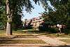
Auburn Gresham Bungalow Historic District |
|
000000002012-10-09-0000October 9, 2012
(#12000841) |
Roughly bounded by S. Paulina Street, W. 78th Street, W. 75th Street, & S. Winchester Avenue
41°45′17″N 87°40′08″W / 41.754778°N 87.66901°W / 41.754778; -87.66901 (Auburn Gresham Bungalow Historic District) |
Auburn Gresham |
Part of the Chicago Bungalows Multiple Property Submission (MPS)
|
| 4 |
AVR 661 |
Upload image |
000000001980-11-19-0000November 19, 1980
(#80001342) |
Calumet Harbor
41°39′43″N 87°34′30″W / 41.661944°N 87.575°W / 41.661944; -87.575 (AVR 661) |
South Deering |
|
| 5 |
Belmonte Flats |
|
000000001998-02-05-0000February 5, 1998
(#98000063) |
4257-4259 S. Dr. Martin Luther King Jr. Drive, and 400-412 E. 43rd Street
41°49′01″N 87°36′59″W / 41.816952°N 87.616374°W / 41.816952; -87.616374 (Belmonte Flats) |
Grand Boulevard |
|
| 6 |
Calumet Park |
|
000000002003-08-21-0000August 21, 2003
(#03000788) |
9801 S. Avenue G
41°43′00″N 87°31′41″W / 41.716667°N 87.528056°W / 41.716667; -87.528056 (Calumet Park) |
East Side |
|
| 7 |
Central Manufacturing District-Original East Historic District |
Upload image |
000000002016-02-15-0000February 15, 2016
(#16000004) |
3500-3700 blks. of S. Morgan, S. Racine Ave. & S. Iron St., 3500-3900 blks. of S. Ashland Ave, 1200-1600 W. 38th St.
41°49′45″N 87°39′24″W / 41.829048°N 87.656533°W / 41.829048; -87.656533 (Central Manufacturing District-Original East Historic District) |
Bridgeport and McKinley Park |
|
| 8 |
Central Manufacturing District–Pershing Road Development Historic District |
|
000000002015-08-18-0000August 18, 2015
(#15000522) |
S. side of W. Pershing Rd. from 1831 to 2245 & 1950
41°49′20″N 87°40′30″W / 41.822360°N 87.674955°W / 41.822360; -87.674955 (Central Manufacturing District–Pershing Road Development Historic District) |
New City |
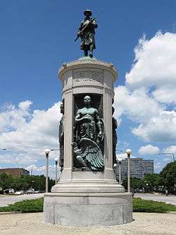
|
| 9 |
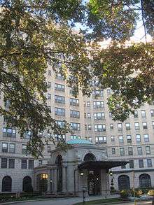
Chicago Beach Hotel |
|
000000001986-05-14-0000May 14, 1986
(#86001193) |
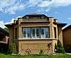
5100-5110 S. Cornell Avenue
41°48′08″N 87°35′13″W / 41.802222°N 87.586944°W / 41.802222; -87.586944 (Chicago Beach Hotel) |
Hyde Park |
|
| 10 |
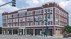
Chicago Bee Building |
|
000000001986-04-30-0000April 30, 1986
(#86001090) |
3647-3655 S. State Street
41°49′41″N 87°37′34″W / 41.828056°N 87.626111°W / 41.828056; -87.626111 (Chicago Bee Building) |
Douglas |
|
| 11 |
Chrysler Village |
|
000000002014-05-27-0000May 27, 2014
(#14000254) |
Bounded by S. Long and S. Lavergne Aves., W. 63rd and W. 65th Sts.
41°46′34″N 87°45′05″W / 41.7759932°N 87.7512806°W / 41.7759932; -87.7512806 (Chrysler Village) |
Clearing |
|
| 12 |
Arthur H. Compton House |
|
000000001976-05-11-0000May 11, 1976
(#76000687) |
5637 S. Woodlawn Avenue
41°47′31″N 87°35′47″W / 41.791944°N 87.596389°W / 41.791944; -87.596389 (Arthur H. Compton House) |
Hyde Park |
|
| 13 |
Cornell Square |
|
000000002005-08-11-0000August 11, 2005
(#05000875) |
1809 W. 50th Street
41°48′08″N 87°40′16″W / 41.802222°N 87.671111°W / 41.802222; -87.671111 (Cornell Square) |
New City |
|
| 14 |
Davis Square |
|
000000002003-08-18-0000August 18, 2003
(#03000787) |
Roughly bounded by W. 44th Street, W, 45th Street, S. Marshfield Avenue and S. Hemitage Avenue
41°48′47″N 87°40′03″W / 41.813056°N 87.6675°W / 41.813056; -87.6675 (Davis Square) |
New City |
|
| 15 |
Oscar Stanton De Priest House |
|
000000001975-05-15-0000May 15, 1975
(#75000646) |
4536-4538 S. Dr. Martin Luther King, Jr. Drive
41°48′42″N 87°37′05″W / 41.811667°N 87.618056°W / 41.811667; -87.618056 (Oscar Stanton De Priest House) |
Grand Boulevard |
|
| 16 |
Douglas Tomb State Memorial |
|
000000001976-05-28-0000May 28, 1976
(#76000689) |
636 E. 35th Street
41°49′54″N 87°36′30″W / 41.831667°N 87.608333°W / 41.831667; -87.608333 (Douglas Tomb State Memorial) |
Douglas |
|
| 17 |
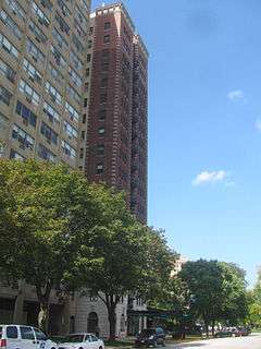
East Park Towers |
|
000000001986-05-14-0000May 14, 1986
(#86001197) |
5236-5252 S. Hyde Park Boulevard
41°47′59″N 87°35′04″W / 41.799722°N 87.584444°W / 41.799722; -87.584444 (East Park Towers) |
Hyde Park |
|
| 18 |
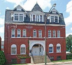
Ebenezer Missionary Baptist Church |
Upload image |
000000002016-10-24-0000October 24, 2016
(#16000734) |
4501 S. Vincennes Ave.
41°48′46″N 87°36′50″W / 41.812861°N 87.613820°W / 41.812861; -87.613820 (Ebenezer Missionary Baptist Church) |
|
|
| 19 |
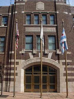
Eighth Regiment Armory |
|
000000001986-04-30-0000April 30, 1986
(#86001096) |
3533 S. Giles Avenue
41°49′50″N 87°37′10″W / 41.830556°N 87.619444°W / 41.830556; -87.619444 (Eighth Regiment Armory) |
Douglas |
|
| 20 |
Site of First Self-Sustaining Nuclear Reaction |
|
000000001966-10-15-0000October 15, 1966
(#66000314) |
S. Ellis Avenue between E. 56th Street and 57th Street
41°47′33″N 87°36′04″W / 41.7925°N 87.601111°W / 41.7925; -87.601111 (Site of First Self-Sustaining Nuclear Reaction) |
Hyde Park |
|
| 21 |
Flamingo-on-the-Lake Apartments |
|
000000001986-05-14-0000May 14, 1986
(#86001194) |
5500-5520 S. Shore Drive
41°47′41″N 87°34′51″W / 41.794722°N 87.580833°W / 41.794722; -87.580833 (Flamingo-on-the-Lake Apartments) |
Hyde Park |
|
| 22 |
Four Nineteen Building |
|
000000001999-08-12-0000August 12, 1999
(#99000973) |
419 E. 83rd Street
41°44′37″N 87°36′50″W / 41.74358°N 87.613898°W / 41.74358; -87.613898 (Four Nineteen Building) |
Chatham |
|
| 23 |
Fuller Park |
|
000000002002-11-20-0000November 20, 2002
(#02001347) |
331 W. 45th Street
41°48′46″N 87°38′03″W / 41.812778°N 87.634167°W / 41.812778; -87.634167 (Fuller Park) |
Fuller Park |
|
| 24 |
Garden Homes Historic District |
|
000000002005-02-28-0000February 28, 2005
(#05000108) |
Roughly bounded by S. Wabash Avenue, E. 87th Street, S. Indiana Avenue and E. 89th Street
41°44′11″N 87°37′18″W / 41.736389°N 87.621667°W / 41.736389; -87.621667 (Garden Homes Historic District) |
Chatham |
|
| 25 |
Goldblatt Bros. Department Store |
|
000000002006-11-15-0000November 15, 2006
(#06001016) |
4700 S. Ashland Avenue
41°48′30″N 87°39′55″W / 41.808333°N 87.665278°W / 41.808333; -87.665278 (Goldblatt Bros. Department Store) |
New City |
|
| 26 |
Grand Crossing Park |
|
000000002006-08-08-0000August 8, 2006
(#06000678) |
7655 S. Ingleside Avenue
41°45′25″N 87°36′01″W / 41.756944°N 87.600278°W / 41.756944; -87.600278 (Grand Crossing Park) |
Greater Grand Crossing |
|
| 27 |
John W. Griffiths Mansion |
|
000000001982-03-05-0000March 5, 1982
(#82002528) |
3806 S. Michigan Avenue
41°49′32″N 87°37′26″W / 41.825556°N 87.623889°W / 41.825556; -87.623889 (John W. Griffiths Mansion) |
Douglas |
Also designated a Chicago Landmark under the name Griffiths-Burroughs House
|
| 28 |
Hamilton Park |
|
000000001995-04-20-0000April 20, 1995
(#95000487) |
513 W. 72nd Street
41°45′42″N 87°38′14″W / 41.761667°N 87.637222°W / 41.761667; -87.637222 (Hamilton Park) |
Englewood |
|
| 29 |
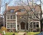
Anton E. Hanson House |
|
000000002006-02-09-0000February 9, 2006
(#06000008) |
7610 S. Ridgeland Avenue
41°45′31″N 87°34′57″W / 41.758611°N 87.5825°W / 41.758611; -87.5825 (Anton E. Hanson House) |
South Shore |
The Cook County Assessor shows the address as 7608 S. Cleveland
|
| 30 |
Isadore H. Heller House |
|
000000001972-03-16-0000March 16, 1972
(#72000450) |
5132 S. Woodlawn Avenue
41°48′05″N 87°35′35″W / 41.801389°N 87.593056°W / 41.801389; -87.593056 (Isadore H. Heller House) |
Hyde Park |
|
| 31 |
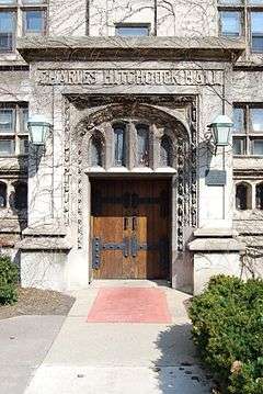
Charles Hitchcock Hall |
|
000000001974-12-30-0000December 30, 1974
(#74000751) |
1009 E. 57th Street
41°47′28″N 87°36′03″W / 41.791111°N 87.600833°W / 41.791111; -87.600833 (Charles Hitchcock Hall) |
Hyde Park |
|
| 32 |
Hotel Del Prado |
|
000000001986-05-14-0000May 14, 1986
(#86001195) |
5307 S. Hyde Park Boulevard
41°47′58″N 87°35′02″W / 41.799444°N 87.583889°W / 41.799444; -87.583889 (Hotel Del Prado) |
Hyde Park |
|
| 33 |
Hotel Windermere East |
|
000000001982-10-19-0000October 19, 1982
(#82000391) |
1642 E. 56th Street
41°47′35″N 87°35′00″W / 41.793056°N 87.583333°W / 41.793056; -87.583333 (Hotel Windermere East) |
Hyde Park |
|
| 34 |
Hyde Park-Kenwood Historic District |
|
000000001979-02-14-0000February 14, 1979
(#79000824) |
Roughly bounded by E. 47th Street and E. 59th Street, S. Cottage Grove Avenue and S. Lake Park Avenue; also 821-829 and 816-826 E. 49th Street; also 825-833 and 837-849 E. 52nd Street
41°47′53″N 87°35′51″W / 41.798056°N 87.5975°W / 41.798056; -87.5975 (Hyde Park-Kenwood Historic District) |
Hyde Park and Kenwood |
Second and third sets of boundaries represent boundary increases of 000000001984-08-16-0000August 16, 1984 and 000000001986-05-16-0000May 16, 1986 respectively
|
| 35 |
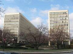
Illinois Institute of Technology Academic Campus |
|
000000002005-08-12-0000August 12, 2005
(#05000871) |
Roughly bounded by 31st Street, State Street, 35th Street and the Dan Ryan Expressway
41°50′06″N 87°37′42″W / 41.835°N 87.628333°W / 41.835; -87.628333 (Illinois Institute of Technology Academic Campus) |
Douglas |
|
| 36 |
Jackson Park Historic Landscape District and Midway Plaisance |
|
000000001972-12-15-0000December 15, 1972
(#72001565) |
Jackson and Washington Parks and Midway Plaisance roadway
41°46′48″N 87°34′38″W / 41.78°N 87.577222°W / 41.78; -87.577222 (Jackson Park Historic Landscape District and Midway Plaisance) |
Hyde Park, Washington Park and Woodlawn |
|
| 37 |
Jackson Shore Apartments |
|
000000002010-04-12-0000April 12, 2010
(#10000175) |
5490 S. Shore Drive
41°47′44″N 87°34′51″W / 41.7955°N 87.580861°W / 41.7955; -87.580861 (Jackson Shore Apartments) |
Hyde Park |
|
| 38 |
Jeffery-Cyril Historic District |
Upload image |
000000001986-05-05-0000May 5, 1986
(#86001007) |
7146-7148, 7128-7138 S. Cyril Avenue, 7144-7148, 7147 and 7130 S. Jeffery Boulevard, and 1966-1974 E. 71st Place
41°45′53″N 87°34′36″W / 41.764722°N 87.576667°W / 41.764722; -87.576667 (Jeffery-Cyril Historic District) |
South Shore |
|
| 39 |
Kehilath Anshe Ma'ariv Synagogue |
|
000000001973-04-26-0000April 26, 1973
(#73000696) |
3301 S. Indiana Avenue
41°50′04″N 87°37′20″W / 41.834444°N 87.622222°W / 41.834444; -87.622222 (Kehilath Anshe Ma'ariv Synagogue) |
Douglas |
|
| 40 |
Sydney Kent House |
|
000000001977-11-17-0000November 17, 1977
(#77000477) |
2944 S. Michigan Avenue
41°50′26″N 87°37′27″W / 41.840556°N 87.624167°W / 41.840556; -87.624167 (Sydney Kent House) |
Douglas |
|
| 41 |
Kenwood Evangelical Church |
|
000000001991-05-16-0000May 16, 1991
(#91000570) |
4600-4608 S. Greenwood Avenue
41°48′41″N 87°36′00″W / 41.811389°N 87.6°W / 41.811389; -87.6 (Kenwood Evangelical Church) |
Kenwood |
|
| 42 |
Lake-Side Terrace Apartments |
|
000000001984-11-13-0000November 13, 1984
(#84000289) |
7425-7427 S. South Shore Drive
41°45′44″N 87°33′25″W / 41.762222°N 87.556944°W / 41.762222; -87.556944 (Lake-Side Terrace Apartments) |
South Shore |
|
| 43 |
Frank R. Lillie House |
|
000000001976-05-11-0000May 11, 1976
(#76000696) |
5801 S. Kenwood Avenue
41°47′22″N 87°35′34″W / 41.789444°N 87.592778°W / 41.789444; -87.592778 (Frank R. Lillie House) |
Hyde Park |
|
| 44 |
Mayfair Apartments |
|
000000001986-05-14-0000May 14, 1986
(#86001198) |
1650-1666 E. 56th Street
41°47′43″N 87°35′03″W / 41.795278°N 87.584167°W / 41.795278; -87.584167 (Mayfair Apartments) |
Hyde Park |
|
| 45 |
Allan Miller House |
|
000000001991-08-23-0000August 23, 1991
(#91001082) |
7121 S. Paxton Avenue
41°45′57″N 87°34′16″W / 41.765833°N 87.571111°W / 41.765833; -87.571111 (Allan Miller House) |
South Shore |
|
| 46 |
Robert A. Millikan House |
|
000000001976-05-11-0000May 11, 1976
(#76000699) |
5605 S. Woodlawn Avenue
41°47′34″N 87°35′47″W / 41.792778°N 87.596389°W / 41.792778; -87.596389 (Robert A. Millikan House) |
Hyde Park |
|
| 47 |
The Narragansett |
|
000000002005-04-18-0000April 18, 2005
(#05000107) |
1640 E. 50th Street
41°48′16″N 87°35′05″W / 41.804444°N 87.584722°W / 41.804444; -87.584722 (The Narragansett) |
Kenwood |
|
| 48 |
Old Stone Gate of Chicago Union Stockyards |
|
000000001972-12-27-0000December 27, 1972
(#72000451) |
W. Exchange Avenue & S. Peoria Street
41°49′07″N 87°38′54″W / 41.818611°N 87.648333°W / 41.818611; -87.648333 (Old Stone Gate of Chicago Union Stockyards) |
New City |
|
| 49 |
Overton Hygienic Building |
|
000000001986-04-30-0000April 30, 1986
(#86001091) |
3619-3627 S. State Street
41°49′41″N 87°37′34″W / 41.828056°N 87.626111°W / 41.828056; -87.626111 (Overton Hygienic Building) |
Douglas |
|
| 50 |
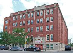
Anthony Overton Elementary School |
Upload image |
000000002016-09-06-0000September 6, 2016
(#16000578) |
221 E. 49th St.
41°48′20″N 87°37′14″W / 41.805656°N 87.620463°W / 41.805656; -87.620463 (Anthony Overton Elementary School) |
|
|
| 51 |
Palmer Park |
|
000000002007-08-30-0000August 30, 2007
(#07000855) |
201 E. 111th Street
41°41′33″N 87°37′06″W / 41.692597°N 87.618228°W / 41.692597; -87.618228 (Palmer Park) |
Roseland |
|
| 52 |
Parkway Garden Homes |
|
000000002011-11-22-0000November 22, 2011
(#11000848) |
6330-6546 S. Dr. Martin Luther King Jr Drive
41°46′36″N 87°36′59″W / 41.776667°N 87.616389°W / 41.776667; -87.616389 (Parkway Garden Homes) |
Greater Grand Crossing |
|
| 53 |
Poinsettia Apartments |
|
000000001986-05-14-0000May 14, 1986
(#86001199) |
5528 S. Hyde Park Boulevard
41°47′39″N 87°35′03″W / 41.794167°N 87.584167°W / 41.794167; -87.584167 (Poinsettia Apartments) |
Hyde Park |
|
| 54 |
Promontory Apartments |
|
000000001996-11-21-0000November 21, 1996
(#96001281) |
5530-5532 S. Shore Drive
41°47′39″N 87°34′51″W / 41.794167°N 87.580833°W / 41.794167; -87.580833 (Promontory Apartments) |
Hyde Park |
|
| 55 |
Pullman Historic District |
|
000000001969-10-08-0000October 8, 1969
(#69000054) |
Bounded by E. 103rd Street, C.S.S. and S.B. Railroad spur tracks, E. 115th Street and S. Cottage Grove Avenue
41°41′50″N 87°36′34″W / 41.697222°N 87.609444°W / 41.697222; -87.609444 (Pullman Historic District) |
Pullman |
|
| 56 |
Ridge Historic District |
|
000000001976-05-28-0000May 28, 1976
(#76000703) |
Roughly bounded by RR tracks, W. 87th Street, S. Prospect Avenue, S. Homewood Avenue, W. 115th Street, S. Lothair Avenue, S. Hamilton Avenue, and S. Western Avenue
41°42′36″N 87°40′13″W / 41.71°N 87.670278°W / 41.71; -87.670278 (Ridge Historic District) |
Beverly and Morgan Park |
|
| 57 |
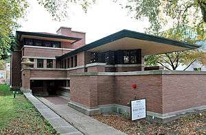
Frederick C. Robie House |
|
000000001966-10-15-0000October 15, 1966
(#66000316) |
5757 S. Woodlawn Avenue
41°47′23″N 87°35′45″W / 41.789722°N 87.595833°W / 41.789722; -87.595833 (Frederick C. Robie House) |
Hyde Park |
|
| 58 |
Martin Roche-John Tait House |
|
000000002000-11-08-0000November 8, 2000
(#00001338) |
3614 S. Dr. Martin Luther King Jr. Drive
41°49′46″N 87°37′04″W / 41.829444°N 87.617778°W / 41.829444; -87.617778 (Martin Roche-John Tait House) |
Douglas |
|
| 59 |
Robert Roloson Houses |
|
000000001977-06-30-0000June 30, 1977
(#77000479) |
3213-3219 S. Calumet Avenue
41°50′08″N 87°37′04″W / 41.835556°N 87.617778°W / 41.835556; -87.617778 (Robert Roloson Houses) |
Douglas |
|
| 60 |
Room 405, George Herbert Jones Laboratory, The University of Chicago |
|
000000001967-05-28-0000May 28, 1967
(#67000005) |
S. Ellis Avenue between E. 57th Street and 58th Street
41°47′25″N 87°36′04″W / 41.790278°N 87.601111°W / 41.790278; -87.601111 (Room 405, George Herbert Jones Laboratory, The University of Chicago) |
Hyde Park |
Site of the discovery of Plutonium
|
| 61 |
Rosenwald Apartment Building |
|
000000001981-08-13-0000August 13, 1981
(#81000218) |
4618 - 4646 S. Michigan Avenue
41°48′37″N 87°37′26″W / 41.810278°N 87.623889°W / 41.810278; -87.623889 (Rosenwald Apartment Building) |
Grand Boulevard |
|
| 62 |
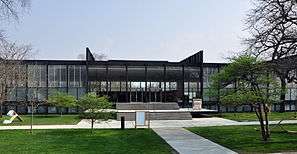
S.R. Crown Hall |
|
000000002001-08-07-0000August 7, 2001
(#01001049) |
3360 S. State Street
41°50′01″N 87°37′36″W / 41.833583°N 87.62675°W / 41.833583; -87.62675 (S.R. Crown Hall) |
Douglas |
|
| 63 |
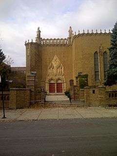
St. Thomas Church and Convent |
|
000000001978-12-18-0000December 18, 1978
(#78001132) |
5472 S. Kimbark Avenue
41°47′44″N 87°35′43″W / 41.795556°N 87.595278°W / 41.795556; -87.595278 (St. Thomas Church and Convent) |
Hyde Park |
|
| 64 |
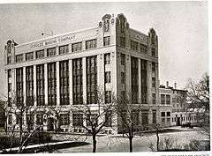
Schulze Baking Company Plant |
|
000000001982-11-12-0000November 12, 1982
(#82000393) |
40 E. Garfield Boulevard
41°47′44″N 87°37′29″W / 41.795556°N 87.624722°W / 41.795556; -87.624722 (Schulze Baking Company Plant) |
Washington Park |
|
| 65 |
Sherman Park |
|
000000001990-05-21-0000May 21, 1990
(#90000745) |
Bounded by W. 52nd Street, S. Racine Avenue, W. Garfield Boulevard, and S. Loomis Street
41°47′48″N 87°39′18″W / 41.796667°N 87.655°W / 41.796667; -87.655 (Sherman Park) |
New City |
|
| 66 |
Shoreland Hotel |
|
000000001986-05-14-0000May 14, 1986
(#86001201) |
5450-5484 S. Shore Drive
41°47′45″N 87°34′52″W / 41.795833°N 87.581111°W / 41.795833; -87.581111 (Shoreland Hotel) |
Hyde Park |
|
| 67 |
South Park Manor Historic District |
|
000000002004-02-25-0000February 25, 2004
(#04000076) |
Roughly bounded by S. Dr. Martin Luther King Jr. Drive., S. State Street, E. 75th Street and E. 79th Street
41°45′25″N 87°37′09″W / 41.756944°N 87.619167°W / 41.756944; -87.619167 (South Park Manor Historic District) |
Greater Grand Crossing |
|
| 68 |
South Shore Beach Apartments |
|
000000001978-06-09-0000June 9, 1978
(#78001131) |
7321 S. South Shore Drive
41°45′50″N 87°33′34″W / 41.763889°N 87.559444°W / 41.763889; -87.559444 (South Shore Beach Apartments) |
South Shore |
|
| 69 |
South Shore Bungalow Historic District |
|
000000002008-12-10-0000December 10, 2008
(#08001168) |
Bounded roughly by S. Crandon Avenue on the East, E. 78th Street on the South, S. Clyde Avenue on the West, E. 75th Street on the North
41°45′13″N 87°34′07″W / 41.753503°N 87.568661°W / 41.753503; -87.568661 (South Shore Bungalow Historic District) |
South Shore |
|
| 70 |
South Shore Country Club |
|
000000001975-03-04-0000March 4, 1975
(#75000652) |
7059 S. South Shore Drive
41°46′11″N 87°33′46″W / 41.769722°N 87.562778°W / 41.769722; -87.562778 (South Shore Country Club) |
South Shore |
|
| 71 |
Spiegel Office Building |
|
000000002009-02-18-0000February 18, 2009
(#09000025) |
1038 W. 35th Street
41°49′50″N 87°39′09″W / 41.830556°N 87.6525°W / 41.830556; -87.6525 (Spiegel Office Building) |
Bridgeport |
|
| 72 |
Stony Island Trust and Savings Bank Building |
|
000000002013-12-31-0000December 31, 2013
(#13001002) |
6760 S. Stony Island Ave.
41°46′18″N 87°35′12″W / 41.771664°N 87.586722°W / 41.771664; -87.586722 (Stony Island Trust and Savings Bank Building) |
Greater Grand Crossing |
|
| 73 |
Strand Hotel |
|
000000002013-01-29-0000January 29, 2013
(#12001237) |
6315-6323 S. Cottage Grove Avenue
41°46′47″N 87°36′21″W / 41.7796819°N 87.6058915°W / 41.7796819; -87.6058915 (Strand Hotel) |
Woodlawn |
|
| 74 |
Sutherland Hotel |
|
000000002011-05-04-0000May 4, 2011
(#11000243) |
4659 S. Drexel Boulevard
41°48′35″N 87°36′12″W / 41.809722°N 87.603333°W / 41.809722; -87.603333 (Sutherland Hotel) |
Kenwood |
|
| 75 |
Swift House |
|
000000001978-06-09-0000June 9, 1978
(#78001133) |
4500 S. Michigan Avenue
41°48′47″N 87°37′24″W / 41.813056°N 87.623333°W / 41.813056; -87.623333 (Swift House) |
Grand Boulevard |
|
| 76 |
Lorado Taft Midway Studios |
|
000000001966-10-15-0000October 15, 1966
(#66000317) |
6016 S. Ingleside Avenue
41°47′08″N 87°36′13″W / 41.785556°N 87.603611°W / 41.785556; -87.603611 (Lorado Taft Midway Studios) |
Woodlawn |
|
| 77 |
Trumbull Park |
|
000000001995-04-20-0000April 20, 1995
(#95000486) |
2400 E. 105th Street
41°42′23″N 87°33′52″W / 41.706389°N 87.564444°W / 41.706389; -87.564444 (Trumbull Park) |
South Deering |
|
| 78 |
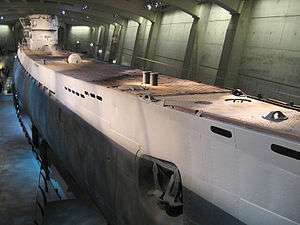
U-505 (IX C U-Boat) |
|
000000001989-06-29-0000June 29, 1989
(#89001231) |
Jackson Park
41°47′31″N 87°34′55″W / 41.791944°N 87.581944°W / 41.791944; -87.581944 (U-505 (IX C U-Boat)) |
Hyde Park |
|
| 79 |
Unity Hall |
|
000000001986-04-30-0000April 30, 1986
(#86001092) |
3140 S. Indiana Avenue
41°50′16″N 87°37′21″W / 41.837778°N 87.6225°W / 41.837778; -87.6225 (Unity Hall) |
Douglas |
|
| 80 |
University Apartments |
|
000000002005-12-22-0000December 22, 2005
(#04001301) |
1401 and 1451 E. 55th Street;1401 and 1450 E. 55th Place
41°47′50″N 87°35′27″W / 41.797222°N 87.590833°W / 41.797222; -87.590833 (University Apartments) |
Hyde Park |
|
| 81 |
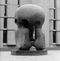
Victory Sculpture |
|
000000001986-04-30-0000April 30, 1986
(#86001089) |
E. 35th Street at S. Dr. Martin Luther King Jr. Drive
41°49′52″N 87°37′03″W / 41.831111°N 87.6175°W / 41.831111; -87.6175 (Victory Sculpture) |
Douglas |
|
| 82 |
Wabash Avenue YMCA |
|
000000001986-04-30-0000April 30, 1986
(#86001095) |
3763 S. Wabash Avenue
41°49′33″N 87°37′29″W / 41.825833°N 87.624722°W / 41.825833; -87.624722 (Wabash Avenue YMCA) |
Douglas |
|
| 83 |
Washington Park |
|
000000002004-08-20-0000August 20, 2004
(#04000871) |
5531 S. Dr. Martin Luther King Jr. Drive
41°47′45″N 87°36′40″W / 41.795833°N 87.611111°W / 41.795833; -87.611111 (Washington Park) |
Washington Park |
|
| 84 |
Ida B. Wells-Barnett House |
|
000000001974-05-30-0000May 30, 1974
(#74000757) |
3624 S. Dr. Martin Luther King Jr. Drive
41°49′47″N 87°37′03″W / 41.829722°N 87.6175°W / 41.829722; -87.6175 (Ida B. Wells-Barnett House) |
Douglas |
|
| 85 |
West Chatham Bungalow Historic District |
|
000000002010-04-19-0000April 19, 2010
(#10000176) |
Bounded roughly by S. Perry Ave on the East, S. 82nd Street on the South, S. Stewart Avenue on the West, and W. 79th Street on the North
41°44′53″N 87°37′50″W / 41.748175°N 87.630578°W / 41.748175; -87.630578 (West Chatham Bungalow Historic District) |
Chatham |
|
| 86 |
Dr. Daniel Hale Williams House |
|
000000001975-05-15-0000May 15, 1975
(#75000655) |
445 E. 42nd Street
41°49′07″N 87°36′55″W / 41.818611°N 87.615278°W / 41.818611; -87.615278 (Dr. Daniel Hale Williams House) |
Grand Boulevard |
|
| 87 |
The Yale |
|
000000001998-03-05-0000March 5, 1998
(#98000178) |
6565 S. Yale Avenue
41°46′28″N 87°37′53″W / 41.774444°N 87.631389°W / 41.774444; -87.631389 (The Yale) |
Englewood |
|


.jpg)
_and_North_elevations_-_HABS_ILL%2C16-CHIG%2C48-1.jpg)


.jpg)


.jpg)


.jpg)


.JPG)
.JPG)