| [2] |
Name on the Register |
Image |
Date listed[3] |
Location |
Neighborhood |
Description |
|---|
| 1 |
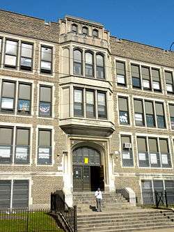
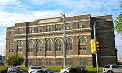
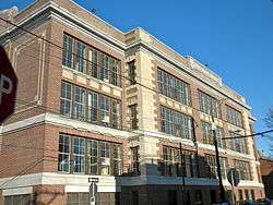
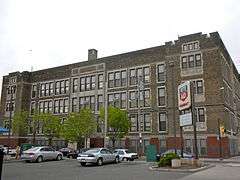
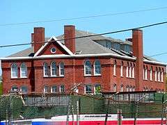
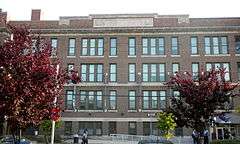
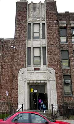
James Alcorn School |
|
000000001988-11-18-0000November 18, 1988
(#88002225) |
1500 South 32nd Street
39°56′07″N 75°11′51″W / 39.9353°N 75.1975°W / 39.9353; -75.1975 (James Alcorn School) |
Grays Ferry |
|
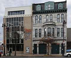
| 2 |
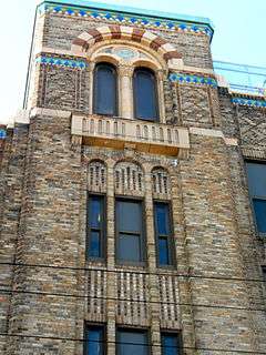
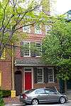
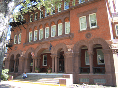
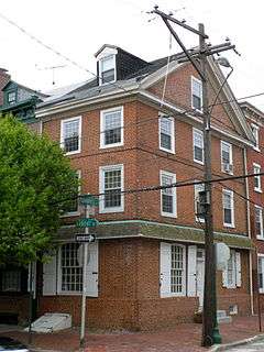
Marian Anderson House |
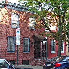
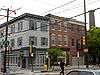
|
000000002011-04-14-0000April 14, 2011
(#11000198) |
762 South Martin Street
39°56′32″N 75°10′29″W / 39.942361°N 75.174861°W / 39.942361; -75.174861 (Marian Anderson House) |
Southwest Center City |
|
| 3 |
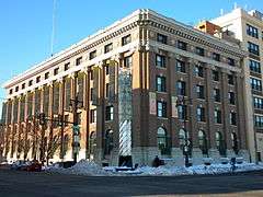
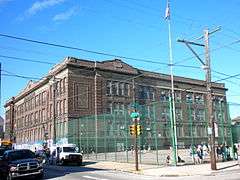
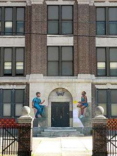
Charles Y. Audenried Junior High School |
|
000000001988-11-18-0000November 18, 1988
(#88002239) |
1601 South 33rd Street
39°56′01″N 75°11′58″W / 39.9336°N 75.1994°W / 39.9336; -75.1994 (Charles Y. Audenried Junior High School) |
Grays Ferry |
|
| 4 |
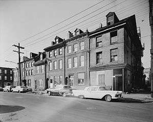
Baptist Institute for Christian Workers |
|
000000001983-04-21-0000April 21, 1983
(#83002265) |
1425–1429 Snyder Avenue
39°55′29″N 75°10′14″W / 39.9247°N 75.1706°W / 39.9247; -75.1706 (Baptist Institute for Christian Workers) |
West Passyunk |
|
| 5 |
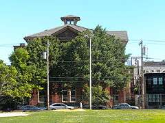
Bartlett School |
|
000000001986-12-04-0000December 4, 1986
(#86003315) |
1100 Catharine Street
39°56′24″N 75°09′42″W / 39.94°N 75.1617°W / 39.94; -75.1617 (Bartlett School) |
Hawthorne |
|
| 6 |
Bethel Burial Ground |
|
000000002016-01-05-0000January 5, 2016
(#15000734) |
405-425 Queen St.
39°56′16″N 75°09′04″W / 39.937778°N 75.151111°W / 39.937778; -75.151111 (Bethel Burial Ground) |
Queen Village |
|
| 7 |
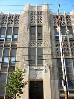
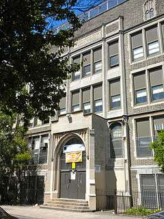
Edward Bok Vocational School |
|
000000001986-12-04-0000December 4, 1986
(#86003264) |
1901 South 9th Street
39°55′33″N 75°09′37″W / 39.9258°N 75.1603°W / 39.9258; -75.1603 (Edward Bok Vocational School) |
Central South Philadelphia |
|
| 8 |
F. Amadee Bregy School |
|
000000001988-11-18-0000November 18, 1988
(#88002249) |
1700 Bigler Street
39°54′52″N 75°10′36″W / 39.9144°N 75.1767°W / 39.9144; -75.1767 (F. Amadee Bregy School) |
Marconi Plaza |
|
| 9 |
George W. Childs School |
|
000000001988-11-18-0000November 18, 1988
(#88002257) |
1501 South 17th Street
39°55′53″N 75°10′22″W / 39.9314°N 75.1728°W / 39.9314; -75.1728 (George W. Childs School) |
Point Breeze |
Built 1894–96, designed by Joseph Anschutz[4]
|
| 10 |
Commandant's Quarters |
|
000000001976-06-03-0000June 3, 1976
(#76001661) |
U.S. Naval Base
39°53′48″N 75°10′38″W / 39.8967°N 75.1772°W / 39.8967; -75.1772 (Commandant's Quarters) |
Navy Yard |
|
| 11 |
Francis M. Drexel School |
|
000000001986-12-04-0000December 4, 1986
(#86003272) |
1800 South Sixteenth Street
39°55′42″N 75°10′23″W / 39.9283°N 75.1731°W / 39.9283; -75.1731 (Francis M. Drexel School) |
Point Breeze |
Built 1888–89, designed by Joseph Anschutz[4]
Demolished Feb., 2010
|
| 12 |
Federal Street School |
|
000000001986-12-01-0000December 1, 1986
(#86003294) |
1130–1148 Federal Street
39°56′05″N 75°09′48″W / 39.9347°N 75.1633°W / 39.9347; -75.1633 (Federal Street School) |
Passyunk Square |
|
| 13 |
D. Newlin Fell School |
|
000000001988-11-18-0000November 18, 1988
(#88002268) |
900 Oregon Avenue
39°54′56″N 75°09′48″W / 39.9156°N 75.1633°W / 39.9156; -75.1633 (D. Newlin Fell School) |
East Oregon |
|
| 14 |
Samuel S. Fleisher Art Memorial |
|
000000001982-11-14-0000November 14, 1982
(#82001547) |
711–721 Catharine Street
39°56′21″N 75°09′18″W / 39.9392°N 75.1551°W / 39.9392; -75.1551 (Samuel S. Fleisher Art Memorial) |
Bella Vista |
|
| 15 |
Franklin Hose Company No. 28 |
|
000000001980-12-03-0000December 3, 1980
(#80003604) |
730–732 South Broad Street
39°56′32″N 75°09′58″W / 39.9421°N 75.1661°W / 39.9421; -75.1661 (Franklin Hose Company No. 28) |
Southwest Center City |
|
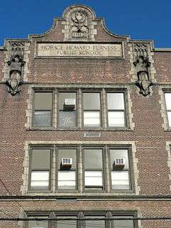
| 16 |
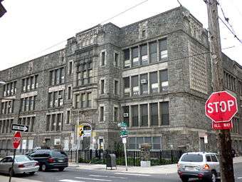
Horace Furness Junior High School |
|
000000001986-12-01-0000December 1, 1986
(#86003286) |
1900 South 3rd Street
39°55′26″N 75°09′03″W / 39.9238°N 75.1507°W / 39.9238; -75.1507 (Horace Furness Junior High School) |
Pennsport |
|
| 17 |
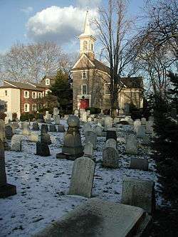
Gloria Dei (Old Swedes') Church National Historic Site |
|
000000001966-10-15-0000October 15, 1966
(#66000682) |
Swanson Street, between Christian and Water Streets
39°56′04″N 75°08′38″W / 39.9344°N 75.1439°W / 39.9344; -75.1439 (Gloria Dei (Old Swedes') Church National Historic Site) |
Queen Village |
|
| 18 |
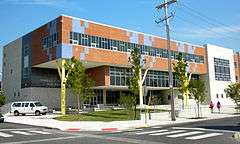
Grays Road Recreation Center |
|
000000001988-04-21-0000April 21, 1988
(#88000448) |
2501 Christian Street
39°56′33″N 75°11′06″W / 39.9425°N 75.1851°W / 39.9425; -75.1851 (Grays Road Recreation Center) |
Grays Ferry |
|
| 19 |
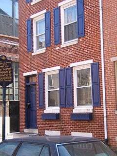
Frances Ellen Watkins Harper House |
|
000000001976-12-08-0000December 8, 1976
(#76001663) |
1006 Bainbridge Street
39°56′31″N 75°09′34″W / 39.9419°N 75.1594°W / 39.9419; -75.1594 (Frances Ellen Watkins Harper House) |
Bella Vista |
|
| 20 |
Nathaniel Hawthorne School |
|
000000001986-12-04-0000December 4, 1986
(#86003289) |
712 South 12th Street
39°56′30″N 75°09′44″W / 39.9417°N 75.1622°W / 39.9417; -75.1622 (Nathaniel Hawthorne School) |
Hawthorne |
|
| 21 |
Institute for Colored Youth |
|
000000001986-12-04-0000December 4, 1986
(#86003324) |
10th and Bainbridge Streets
39°56′31″N 75°09′28″W / 39.9419°N 75.1579°W / 39.9419; -75.1579 (Institute for Colored Youth) |
Bella Vista |
|
| 22 |
Nathaniel Irish House |
|
000000001972-03-16-0000March 16, 1972
(#72001160) |
704 South Front Street
39°56′24″N 75°08′40″W / 39.9399°N 75.1444°W / 39.9399; -75.1444 (Nathaniel Irish House) |
Queen Village |
|
| 23 |
Francis Scott Key School |
|
000000001986-12-01-0000December 1, 1986
(#86003296) |
2226–2250 South 8th Street
39°55′15″N 75°09′38″W / 39.9208°N 75.1606°W / 39.9208; -75.1606 (Francis Scott Key School) |
Central South Philadelphia |
Built 1889, designed by Joseph Anschutz[4]
|
| 24 |
Eliza Butler Kirkbride School |
|
000000001988-11-18-0000November 18, 1988
(#88002290) |
626 Dickinson Street
39°55′48″N 75°09′22″W / 39.93°N 75.1561°W / 39.93; -75.1561 (Eliza Butler Kirkbride School) |
Passyunk Square |
|
| 25 |
David Landreth School |
|
000000001986-12-04-0000December 4, 1986
(#86003299) |
1201 South 23rd Street
39°56′16″N 75°10′54″W / 39.9378°N 75.1817°W / 39.9378; -75.1817 (David Landreth School) |
Point Breeze |
Built 1889, designed by Joseph Anschutz[4]
|
| 26 |
Marine Barracks |
|
000000001976-07-13-0000July 13, 1976
(#76001664) |
Building 100, Philadelphia Naval Shipyard, 4800 S. 13th Street
39°53′32″N 75°10′28″W / 39.8921°N 75.1744°W / 39.8921; -75.1744 (Marine Barracks) |
Navy Yard |
|
| 27 |
Marine Corps Depot of Supplies, Schuylkill Warehouse |
|
000000002004-11-12-0000November 12, 2004
(#04001228) |
700–734 Schuylkill Avenue
39°56′41″N 75°11′12″W / 39.9447°N 75.1868°W / 39.9447; -75.1868 (Marine Corps Depot of Supplies, Schuylkill Warehouse) |
Schuylkill |
|
| 28 |
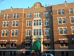
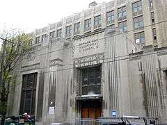
Marine Corps Supply Activity |
|
000000001975-08-06-0000August 6, 1975
(#75001662) |
1100 South Broad Street
39°56′15″N 75°10′02″W / 39.9376°N 75.1671°W / 39.9376; -75.1671 (Marine Corps Supply Activity) |
Point Breeze |
|
| 29 |
Delaplaine McDaniel School |
|
000000001986-12-04-0000December 4, 1986
(#86003303) |
2100 Moore Street
39°55′46″N 75°10′53″W / 39.9294°N 75.1814°W / 39.9294; -75.1814 (Delaplaine McDaniel School) |
Point Breeze |
|
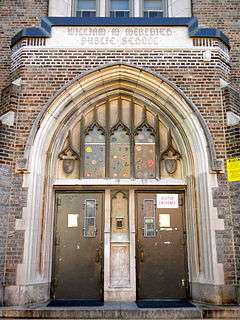
| 30 |
William M. Meredith School |
|
000000001986-12-04-0000December 4, 1986
(#86003307) |
5th and Fitzwater Streets
39°56′23″N 75°09′03″W / 39.9396°N 75.1508°W / 39.9396; -75.1508 (William M. Meredith School) |
Queen Village |
|
| 31 |
Capt. Thomas Moore House |
|
000000001972-03-16-0000March 16, 1972
(#72001165) |
702 South Front Street
39°56′24″N 75°08′40″W / 39.94°N 75.1444°W / 39.94; -75.1444 (Capt. Thomas Moore House) |
Queen Village |
|
| 32 |
George W. Nebinger School |
|
000000001988-11-18-0000November 18, 1988
(#88002303) |
601–627 Carpenter Street
39°56′12″N 75°09′14″W / 39.9367°N 75.1539°W / 39.9367; -75.1539 (George W. Nebinger School) |
Bella Vista |
|
| 33 |
Jeremiah Nichols School |
|
000000001988-11-18-0000November 18, 1988
(#88002241) |
1235 South 16th Street
39°56′06″N 75°10′14″W / 39.935°N 75.1706°W / 39.935; -75.1706 (Jeremiah Nichols School) |
Point Breeze |
|
| 34 |
William S. Peirce School |
|
000000001988-11-18-0000November 18, 1988
(#88002307) |
2400 Christian Street
39°56′30″N 75°10′58″W / 39.9418°N 75.1829°W / 39.9418; -75.1829 (William S. Peirce School) |
Southwest Center City |
|
| 35 |
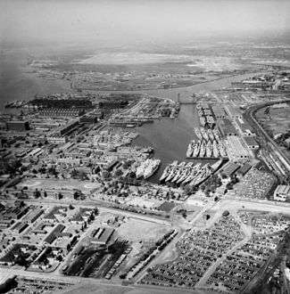
Philadelphia Naval Shipyard Historic District |
|
000000001999-12-22-0000December 22, 1999
(#99001579) |
South Broad Street
39°53′N 75°11′W / 39.89°N 75.18°W / 39.89; -75.18 (Philadelphia Naval Shipyard Historic District) |
Navy Yard |
|
| 36 |
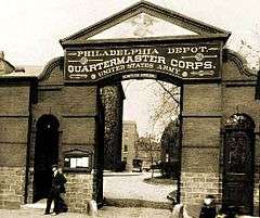
Philadelphia Quartermaster Depot |
|
000000002010-01-26-0000January 26, 2010
(#09001212) |
2724 South 20th Street
39°54′59″N 75°10′57″W / 39.916389°N 75.1825°W / 39.916389; -75.1825 (Philadelphia Quartermaster Depot) |
Girard Estate |
|
| 37 |
Philadelphia, Wilmington and Baltimore Railroad Freight Shed |
|
000000002011-09-08-0000September 8, 2011
(#11000649) |
1001 South 15th Street
39°56′21″N 75°10′04″W / 39.939028°N 75.167778°W / 39.939028; -75.167778 (Philadelphia, Wilmington and Baltimore Railroad Freight Shed) |
Southwest Center City |
|
| 38 |
Edgar Allan Poe School |
|
000000001986-12-04-0000December 4, 1986
(#86003318) |
2136 Ritner Street
39°55′20″N 75°10′59″W / 39.9221°N 75.1831°W / 39.9221; -75.1831 (Edgar Allan Poe School) |
Girard Estate |
|
| 39 |
Robert Ralston School |
|
000000001986-12-04-0000December 4, 1986
(#86003321) |
221 Bainbridge Street
39°56′26″N 75°08′48″W / 39.9406°N 75.1468°W / 39.9406; -75.1468 (Robert Ralston School) |
Queen Village |
|
| 40 |
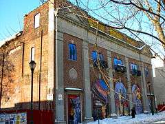
Royal Theater |
|
000000001980-02-08-0000February 8, 1980
(#80003619) |
1524–1534 South Street
39°56′38″N 75°10′06″W / 39.9439°N 75.1682°W / 39.9439; -75.1682 (Royal Theater) |
Southwest Center City |
|
| 41 |
St. Anthony de Padua Parish School |
|
000000001992-05-07-0000May 7, 1992
(#92000400) |
2317–2333 Carpenter Street
39°56′28″N 75°10′56″W / 39.9411°N 75.1821°W / 39.9411; -75.1821 (St. Anthony de Padua Parish School) |
Southwest Center City |
|
| 42 |
George Sharswood School |
|
000000001988-11-18-0000November 18, 1988
(#88002320) |
200 Wolf Street
39°55′07″N 75°09′03″W / 39.9187°N 75.1508°W / 39.9187; -75.1508 (George Sharswood School) |
Whitman |
|
| 43 |
Walter George Smith School |
|
000000001986-12-04-0000December 4, 1986
(#86003329) |
1300 South 19th Street
39°56′06″N 75°10′33″W / 39.935°N 75.1758°W / 39.935; -75.1758 (Walter George Smith School) |
Point Breeze |
|
| 44 |
South Front Street Historic District |
|
000000001972-04-25-0000April 25, 1972
(#72001171) |
700–712 South Front Street, western side of Bainbridge Street to Kenilworth Street
39°56′24″N 75°08′40″W / 39.94°N 75.1444°W / 39.94; -75.1444 (South Front Street Historic District) |
Queen Village |
|
| 45 |
Southwark District |
|
000000001972-05-19-0000May 19, 1972
(#72001172) |
Bounded by Delaware, Washington Aves., 5th, Lombard, Front, and Catherine Sts.
39°56′16″N 75°08′54″W / 39.9378°N 75.1483°W / 39.9378; -75.1483 (Southwark District) |
Southwark |
|
| 46 |
Southwark School |
|
000000001986-12-01-0000December 1, 1986
(#86003330) |
Eighth and Miflin Streets
39°55′31″N 75°09′36″W / 39.9253°N 75.16°W / 39.9253; -75.16 (Southwark School) |
Central South Philadelphia |
|
| 47 |
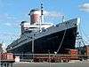
SS United States (Steamship) |
|
000000001999-06-03-0000June 3, 1999
(#99000609) |
Pier 82
39°55′06″N 75°08′11″W / 39.9183°N 75.1364°W / 39.9183; -75.1364 (SS United States (Steamship)) |
Whitman |
|
| 48 |
Edwin M. Stanton School |
|
000000001988-11-18-0000November 18, 1988
(#88002326) |
1616–1644 Christian Street
39°56′25″N 75°10′15″W / 39.9404°N 75.1708°W / 39.9404; -75.1708 (Edwin M. Stanton School) |
Southwest Center City |
|
| 49 |
George C. Thomas Junior High School |
|
000000001988-11-18-0000November 18, 1988
(#88002330) |
2746 South 9th Street
39°54′56″N 75°09′48″W / 39.9156°N 75.1633°W / 39.9156; -75.1633 (George C. Thomas Junior High School) |
East Oregon |
|
| 50 |
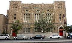
Tindley Temple United Methodist Church |
|
000000002011-04-15-0000April 15, 2011
(#11000199) |
750–762 South Broad Street
39°56′29″N 75°09′59″W / 39.941389°N 75.166389°W / 39.941389; -75.166389 (Tindley Temple United Methodist Church) |
Southwest Center City |
|
| 51 |
U.S. Naval Home |
|
000000001972-08-21-0000August 21, 1972
(#72001173) |
Gray's Ferry Avenue at 24th Street
39°56′38″N 75°11′01″W / 39.9439°N 75.1836°W / 39.9439; -75.1836 (U.S. Naval Home) |
Southwest Center City |
|
| 52 |
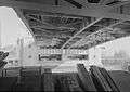
University Avenue Bridge |
|
000000001994-05-26-0000May 26, 1994
(#94000515) |
South University Avenue over the Schuylkill River
39°56′34″N 75°11′49″W / 39.9428°N 75.1969°W / 39.9428; -75.1969 (University Avenue Bridge) |
Grays Ferry |
Extends into West Philadelphia
|
| 53 |
Abigail Vare School |
|
000000001986-12-04-0000December 4, 1986
(#86003339) |
Morris Street and Moyamensing Avenue
39°55′38″N 75°09′03″W / 39.9272°N 75.1507°W / 39.9272; -75.1507 (Abigail Vare School) |
Pennsport |
|
| 54 |
Edwin H. Vare Junior High School |
|
000000001988-11-18-0000November 18, 1988
(#88002331) |
2102 South 24th Street
39°55′33″N 75°11′09″W / 39.9258°N 75.1858°W / 39.9258; -75.1858 (Edwin H. Vare Junior High School) |
Wilson Park |
|
| 55 |
Washington Avenue Historic District |
|
000000001984-09-07-0000September 7, 1984
(#84003561) |
Roughly bounded by Carpenter, Washington, 10th, and Broad Streets
39°56′17″N 75°09′44″W / 39.9381°N 75.1622°W / 39.9381; -75.1622 (Washington Avenue Historic District) |
Hawthorne |
|
| 56 |
George Washington School |
|
000000001986-12-04-0000December 4, 1986
(#86003343) |
Fifth and Federal Streets
39°56′01″N 75°09′10″W / 39.9337°N 75.1528°W / 39.9337; -75.1528 (George Washington School) |
Dickinson Narrows |
|
| 57 |
Anthony Wayne School |
|
000000001986-12-01-0000December 1, 1986
(#86003344) |
2700 Morris Street
39°55′55″N 75°11′28″W / 39.9319°N 75.1911°W / 39.9319; -75.1911 (Anthony Wayne School) |
Grays Ferry |
|
| 58 |
Widow Maloby's Tavern |
|
000000001972-03-16-0000March 16, 1972
(#72001175) |
700 South Front Street
39°56′24″N 75°08′40″W / 39.94°N 75.1444°W / 39.94; -75.1444 (Widow Maloby's Tavern) |
Queen Village |
|
| 59 |
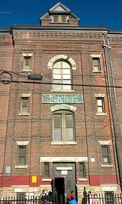
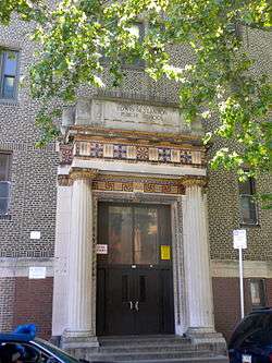
James Wilson Public School |
|
000000002012-12-12-0000December 12, 2012
(#88002238) |
1148 Wharton St.
39°56′01″N 75°09′49″W / 39.93348°N 75.16365°W / 39.93348; -75.16365 (James Wilson Public School) |
Passyunk Square |
|