National Register of Historic Places listings in New Madrid County, Missouri
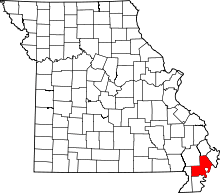
Location of New Madrid County in Missouri
This is a list of the National Register of Historic Places listings in New Madrid County, Missouri.
This is intended to be a complete list of the properties and districts on the National Register of Historic Places in New Madrid County, Missouri, United States. Latitude and longitude coordinates are provided for many National Register properties and districts; these locations may be seen together in a map.[1]
There are 9 properties and districts listed on the National Register in the county.
- This National Park Service list is complete through NPS recent listings posted December 16, 2016.[2]
Current listings
| [3] | Name on the Register | Image | Date listed[4] | Location | City or town | Description |
|---|---|---|---|---|---|---|
| 1 | Double Bridges Archeological Site | Upload image | (#74001085) |
2.5 miles (4.0 km) north of Stewart, along Open Bayou[5] 36°24′38″N 89°37′00″W / 36.410556°N 89.616667°W |
Portageville | |
| 2 | Hunter-Dawson House |  |
(#12000563) |
312 Dawson Rd. 36°35′48″N 89°31′31″W / 36.596667°N 89.525278°W |
New Madrid | |
| 3 | Hurricane Ridge Site | Upload image | (#72000725) |
Address Restricted |
Catron | |
| 4 | King II Archeological Site | Upload image | (#75001070) |
Address Restricted |
Howardville | |
| 5 | La Plant Archeological Site | Upload image | (#74001084) |
Northwest of Bayouville at the center of the northeastern quarter of Section 1, Township 23 North, Range 15 East[6]:140 36°40′07″N 89°22′42″W / 36.668611°N 89.378333°W |
La Forge | |
| 6 | Lilbourn Fortified Village Archeological Site |  |
(#69000118) |
U.S. Routes 61/62, in and east of Mound Cemetery[7]:72 36°34′17″N 89°35′15″W / 36.571389°N 89.587500°W |
Lilbourn | |
| 7 | Portwood Village and Mound | Upload image | (#77000812) |
Address Restricted |
Portageville | |
| 8 | Sikeston Fortified Village Archeological Site | Upload image | (#71000471) |
South of Sikeston near the confluence of the North Cut and St. John's Ditches[8] 36°48′55″N 89°33′35″W / 36.815278°N 89.559722°W |
Sikeston | |
| 9 | St. Johns-Laplant IV Archeological District | Upload image | (#75001069) |
Southeastern quarter of the southwestern quarter of Section 11, Township 23 North, Range 15 East[6]:140 36°38′47″N 89°24′21″W / 36.646389°N 89.405833°W |
Bayouville |
See also
- List of National Historic Landmarks in Missouri
- National Register of Historic Places listings in Missouri
References
| Wikimedia Commons has media related to National Register of Historic Places in New Madrid County, Missouri. |
- ↑ The latitude and longitude information provided in this table was derived originally from the National Register Information System, which has been found to be fairly accurate for about 99% of listings. For about 1% of NRIS original coordinates, experience has shown that one or both coordinates are typos or otherwise extremely far off; some corrections may have been made. A more subtle problem causes many locations to be off by up to 150 yards, depending on location in the country: most NRIS coordinates were derived from tracing out latitude and longitudes off of USGS topographical quadrant maps created under the North American Datum of 1927, which differs from the current, highly accurate WGS84 GPS system used by most on-line maps. Chicago is about right, but NRIS longitudes in Washington are higher by about 4.5 seconds, and are lower by about 2.0 seconds in Maine. Latitudes differ by about 1.0 second in Florida. Some locations in this table may have been corrected to current GPS standards.
- ↑ "National Register of Historic Places: Weekly List Actions". National Park Service, United States Department of the Interior. Retrieved on December 16, 2016.
- ↑ Numbers represent an ordering by significant words. Various colorings, defined here, differentiate National Historic Landmarks and historic districts from other NRHP buildings, structures, sites or objects.
- ↑ The eight-digit number below each date is the number assigned to each location in the National Register Information System database, which can be viewed by clicking the number.
- ↑ Morse, Dan F., and Phyllis A. Morse, eds. The Lower Mississippi Valley Expeditions of Clarence Bloomfield Moore. Tuscaloosa: U of Alabama P, 1998, 156.
- 1 2 O'Brien, Michael J., and Robert C. Dunnell, eds. Changing Perspectives on the Archaeology of the Central Mississippi Valley. Tuscaloosa and London: U of Alabama P, 1998.
- ↑ Chapman, Carl, et al. "Investigation and Comparison of Two Fortified Mississippian Traditional Archaeological Sites in Southeastern Missouri: A Preliminary Compilation". Missouri Archaeologist 38 Whole Volume (1977).
- ↑ Sussenbach, Tom, and R. Barry Lewis. Archaeological Investigations in Carlisle, Hickman, and Fulton Counties, Kentucky: Site Survey and Excavations. Western Kentucky Project Report #4. Champaign: U of Illinois Department of Anthropology, 1987, 2.
| Topics | |
|---|---|
| Lists by states |
|
| Lists by insular areas | |
| Lists by associated states | |
| Other areas | |
| |
Municipalities and communities of New Madrid County, Missouri, United States | ||
|---|---|---|
| Cities | | |
| Village | ||
| Townships |
| |
| Unincorporated communities | ||
| Ghost towns | ||
| Footnotes | ‡This populated place also has portions in an adjacent county or counties | |
This article is issued from Wikipedia - version of the 10/31/2016. The text is available under the Creative Commons Attribution/Share Alike but additional terms may apply for the media files.