National Register of Historic Places listings in Lee County, Alabama
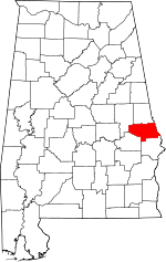
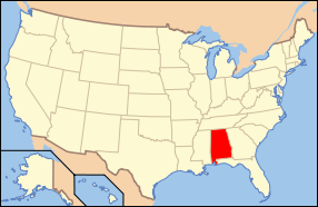
Location of Lee County in Alabama
This is a list of the National Register of Historic Places listings in Lee County, Alabama.
This is intended to be a complete list of the properties and districts on the National Register of Historic Places in Lee County, Alabama, United States. Latitude and longitude coordinates are provided for many National Register properties and districts; these locations may be seen together in a Google map.[1]
There are 26 properties and districts listed on the National Register in the county.
- This National Park Service list is complete through NPS recent listings posted December 16, 2016.[2]
Current listings
| [3] | Name on the Register | Image | Date listed[4] | Location | City or town | Description |
|---|---|---|---|---|---|---|
| 1 | Auburn Players Theater | 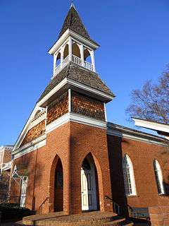 |
(#73000351) |
139 S. College Street 32°36′17″N 85°28′51″W / 32.604722°N 85.480833°W |
Auburn | Also known as the Auburn University Chapel |
| 2 | Auburn University Historic District |  |
(#76000338) |
Auburn University campus 32°36′17″N 85°28′58″W / 32.604722°N 85.482778°W |
Auburn | |
| 3 | Robert Wilton Burton House |  |
(#80000701) |
315 E. Magnolia Ave. 32°36′31″N 85°40′09″W / 32.608611°N 85.669167°W |
Auburn | The Robert Wilton Burton House was dismantled in 1993. |
| 4 | Cullars Rotation | 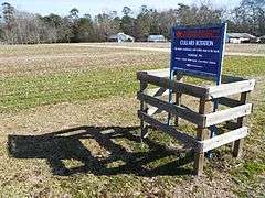 |
(#03000231) |
Woodfield Dr., east of U.S. Route 29 32°35′19″N 85°29′01″W / 32.588611°N 85.483611°W |
Auburn | |
| 5 | Dr. J.W. Darden House | 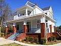 |
(#09000605) |
1323 Auburn St. 32°38′16″N 85°23′01″W / 32.637803°N 85.383575°W |
Opelika | |
| 6 | Ebenezer Missionary Baptist Church | 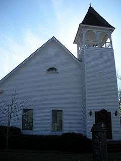 |
(#75000317) |
Thach St. and Auburn Dr., S. 32°36′14″N 85°28′24″W / 32.603889°N 85.473333°W |
Auburn | The building now houses the Auburn Unitarian Universalist Fellowship |
| 7 | Geneva Street Historic District | 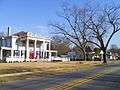 |
(#87000981) |
Roughly bounded by S. 7th, Glenn, Stowe, Geneva, and S. 10th Sts., and Ave. C 32°38′32″N 85°22′30″W / 32.642222°N 85.375°W |
Opelika | |
| 8 | Jenkins Farmhouse | 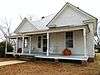 |
(#07001390) |
1190 County Road 38 32°28′18″N 85°21′19″W / 32.471609°N 85.355272°W |
Dupree | |
| 9 | Lee County Courthouse | .jpg) |
(#73000353) |
S. 9th St. between Aves. A and B 32°38′42″N 85°22′50″W / 32.645°N 85.380556°W |
Opelika | |
| 10 | Loachapoka Historic District | 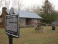 |
(#73000352) |
Both sides of State Route 14 in Loachapoka 32°36′16″N 85°35′37″W / 32.604444°N 85.593611°W |
Loachapoka | |
| 11 | Lowther House Complex |  |
(#93000986) |
County Road 318 32°32′35″N 85°03′14″W / 32.543056°N 85.053889°W |
Smiths Station | |
| 12 | Dr. Andrew D. McLain Office and Drug Store | 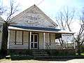 |
(#83002978) |
Main and Crawford Sts. 32°35′46″N 85°14′18″W / 32.596111°N 85.238333°W |
Salem | The Dr. Andrew D. McLain Office and Drug Store was destroyed by an F2 tornado on February 28, 2009. |
| 13 | Noble Hall | 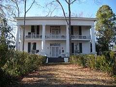 |
(#72000163) |
3 miles north of Auburn on Shelton Mill Rd. 32°38′23″N 85°27′55″W / 32.639722°N 85.465278°W |
Auburn | Otherwise known as the Frazer-Brown-Pearson Home. |
| 14 | Northside Historic District | 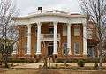 |
(#01001409) |
Roughly bounded by 7th Ave., 3rd St., 2nd Ave., and N. 11th St. 32°39′04″N 85°23′00″W / 32.651111°N 85.383333°W |
Opelika | |
| 15 | Old Main and Church Street Historic District | 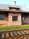 |
(#78003194) |
Roughly bounded by E. Drake Ave., the former Western Railway of Alabama line, N. Gay St., N. College St. and Bragg Ave. and Warrior Ct. 32°36′42″N 85°28′55″W / 32.611667°N 85.481944°W |
Auburn | The Auburn Depot, located in the Old Main and Church Street Historic District in Auburn, Alabama. |
| 16 | Old President's Mansion | 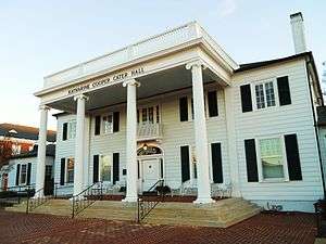 |
(#03000423) |
Located on the Thach Ave. concourse on the campus of Auburn University 32°36′12″N 85°29′06″W / 32.603333°N 85.485°W |
Auburn | Now known as Katherine Cooper Cater Hall |
| 17 | Old Rotation | 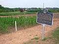 |
(#87002390) |
Auburn University campus 32°35′36″N 85°29′09″W / 32.593333°N 85.485833°W |
Auburn | |
| 18 | Pepperell Mill and Mill Village Historic District | 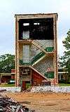 |
(#14000090) |
Pepperell Pkwy., 28th St. N., 1st Ave. & 30th St. N. 32°38′06″N 85°25′13″W / 32.6350°N 85.4202°W |
Opelika | |
| 19 | Railroad Avenue Historic District | 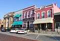 |
(#84000640) |
Roughly bounded by 7th and 10th Sts., 1st Ave., and Ave. B 32°38′50″N 85°22′48″W / 32.647222°N 85.38°W |
Opelika | |
| 20 | Scott-Yarbrough House | 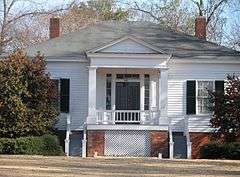 |
(#75000318) |
101 DeBardeleben St. 32°36′23″N 85°28′21″W / 32.606389°N 85.4725°W |
Auburn | Otherwise known as "Pebble Hill" or The Caroline Marshall Draughon Center for the Arts & Humanities |
| 21 | Spring Villa | 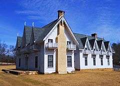 |
(#78000494) |
6 miles (9.6 km) southeast of Opelika on Spring Villa Rd. 32°35′15″N 85°18′42″W / 32.5875°N 85.311667°W |
Opelika | |
| 22 | Summers Plantation | 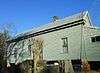 |
(#91000095) |
475 County Road 181 32°40′06″N 85°16′23″W / 32.668457°N 85.273079°W |
Opelika | |
| 23 | Sunny Slope | 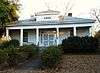 |
(#08001116) |
1031 S. College St. 32°35′10″N 85°29′13″W / 32.586117°N 85.4869°W |
Auburn | |
| 24 | U.S. Post Office | 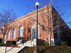 |
(#83002979) |
144 Tichenor Ave. 32°36′29″N 85°28′49″W / 32.6081°N 85.4802°W |
Auburn | |
| 25 | U.S. Post Office | 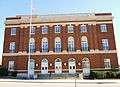 |
(#76000339) |
701 Ave. A 32°38′53″N 85°22′38″W / 32.648056°N 85.377222°W |
Opelika | |
| 26 | Franklin Yarbrough, Jr. Store | 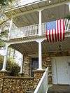 |
(#89000309) |
County Highway 68 32°42′39″N 85°11′01″W / 32.710833°N 85.183611°W |
Beulah | Also known as The Roger Brown Memorial Rock House Museum |
See also
| Wikimedia Commons has media related to National Register of Historic Places in Lee County, Alabama. |
- List of National Historic Landmarks in Alabama
- National Register of Historic Places listings in Alabama
References
- ↑ The latitude and longitude information provided in this table was derived originally from the National Register Information System, which has been found to be fairly accurate for about 99% of listings. For about 1% of NRIS original coordinates, experience has shown that one or both coordinates are typos or otherwise extremely far off; some corrections may have been made. A more subtle problem causes many locations to be off by up to 150 yards, depending on location in the country: most NRIS coordinates were derived from tracing out latitude and longitudes off of USGS topographical quadrant maps created under the North American Datum of 1927, which differs from the current, highly accurate WGS84 GPS system used by most on-line maps. Chicago is about right, but NRIS longitudes in Washington are higher by about 4.5 seconds, and are lower by about 2.0 seconds in Maine. Latitudes differ by about 1.0 second in Florida. Some locations in this table may have been corrected to current GPS standards.
- ↑ "National Register of Historic Places: Weekly List Actions". National Park Service, United States Department of the Interior. Retrieved on December 16, 2016.
- ↑ Numbers represent an ordering by significant words. Various colorings, defined here, differentiate National Historic Landmarks and historic districts from other NRHP buildings, structures, sites or objects.
- ↑ The eight-digit number below each date is the number assigned to each location in the National Register Information System database, which can be viewed by clicking the number.

Municipalities and communities of Lee County, Alabama, United States | ||
|---|---|---|
| Cities | | |
| Towns | ||
| Unincorporated communities | ||
| Footnotes | ‡This populated place also has portions in an adjacent county or counties | |
This article is issued from Wikipedia - version of the 5/21/2016. The text is available under the Creative Commons Attribution/Share Alike but additional terms may apply for the media files.