| [3] |
Name on the Register[4] |
Image |
Date listed[5] |
Location |
City or town |
Description |
|---|
| 1 |
Alice |
Upload image |
000000001984-06-14-0000June 14, 1984
(#84001291) |
Louisiana Highway 87
29°56′14″N 91°41′13″W / 29.937222°N 91.686944°W / 29.937222; -91.686944 (Alice) |
Jeanerette |
|
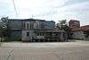
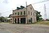
| 2 |
Bayside |
|
000000001987-01-29-0000January 29, 1987
(#86003747) |
Louisiana Highway 87
29°55′55″N 91°40′46″W / 29.931944°N 91.679444°W / 29.931944; -91.679444 (Bayside) |
Jeanerette |
|
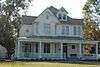
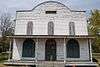
| 3 |
Amant Broussard House |
Upload image |
000000001980-06-09-0000June 9, 1980
(#80001729) |
1400 E. Main St.
29°59′36″N 91°47′40″W / 29.993333°N 91.794444°W / 29.993333; -91.794444 (Amant Broussard House) |
New Iberia |
|
| 4 |
Conrad Rice Mill |
|
000000001982-11-10-0000November 10, 1982
(#82000437) |
307 Ann St.
29°59′53″N 91°48′40″W / 29.998056°N 91.811111°W / 29.998056; -91.811111 (Conrad Rice Mill) |
New Iberia |
|
| 5 |
Darby Plantation |
|
000000001973-03-26-0000March 26, 1973
(#73000868) |
North of Iberia on Darby Lane
30°01′49″N 91°50′05″W / 30.030278°N 91.834722°W / 30.030278; -91.834722 (Darby Plantation) |
New Iberia |
|
| 6 |
Dulcito Plantation House |
Upload image |
000000001994-07-22-0000July 22, 1994
(#94000742) |
5918 Old Spanish Trail, W. (Louisiana Highway 182)
30°03′49″N 91°52′37″W / 30.063611°N 91.876944°W / 30.063611; -91.876944 (Dulcito Plantation House) |
New Iberia |
|
| 7 |
East Main Street Historic District |
Upload image |
000000001983-07-28-0000July 28, 1983
(#83000507) |
E. Main, Lee, Ann, and Phillip Sts.
30°00′04″N 91°48′29″W / 30.001111°N 91.808056°W / 30.001111; -91.808056 (East Main Street Historic District) |
New Iberia |
|
| 8 |
Enterprise Plantation |
Upload image |
000000001975-03-17-0000March 17, 1975
(#75000848) |
2 miles west of Jeanerette in Patoutville
29°54′28″N 91°43′19″W / 29.907778°N 91.721944°W / 29.907778; -91.721944 (Enterprise Plantation) |
Jeanerette |
|
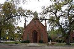
| 9 |
Episcopal Church of the Epiphany |
|
000000001977-04-29-0000April 29, 1977
(#77000670) |
303 W. Main St.
30°00′30″N 91°49′17″W / 30.008333°N 91.821389°W / 30.008333; -91.821389 (Episcopal Church of the Epiphany) |
New Iberia |
|
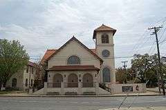
| 10 |
Auguste Erath Building |
|
000000001995-10-05-0000October 5, 1995
(#95001156) |
333-335 W. St. Peter St.
30°00′30″N 91°49′22″W / 30.008333°N 91.822778°W / 30.008333; -91.822778 (Auguste Erath Building) |
New Iberia |
|
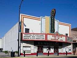
| 11 |
Evangeline Theater |
|
000000001999-02-18-0000February 18, 1999
(#99000234) |
129 E. Main St.
30°00′18″N 91°49′02″W / 30.005°N 91.817222°W / 30.005; -91.817222 (Evangeline Theater) |
New Iberia |
|
| 12 |
First United Methodist Church |
|
000000001989-11-16-0000November 16, 1989
(#89002002) |
119 Jefferson St.
30°00′28″N 91°49′17″W / 30.007778°N 91.821389°W / 30.007778; -91.821389 (First United Methodist Church) |
New Iberia |
|
| 13 |
Hewes House |
|
000000002005-01-19-0000January 19, 2005
(#04001515) |
1617 W. Main St.
29°55′10″N 91°40′12″W / 29.919444°N 91.67°W / 29.919444; -91.67 (Hewes House) |
Jeanerette |
|
| 14 |
Joseph Jefferson House |
Upload image |
000000001973-06-04-0000June 4, 1973
(#73000867) |
On Jefferson Island
29°58′29″N 91°58′27″W / 29.974722°N 91.974167°W / 29.974722; -91.974167 (Joseph Jefferson House) |
Jefferson Island |
|
| 15 |
Santiago Lamperez House |
|
000000001985-10-17-0000October 17, 1985
(#85003147) |
203 Front St.
30°00′26″N 91°49′01″W / 30.007222°N 91.816944°W / 30.007222; -91.816944 (Santiago Lamperez House) |
New Iberia |
|
| 16 |
LeJeune's Bakery |
|
000000002003-04-22-0000April 22, 2003
(#03000287) |
1510 W. Main St.
29°55′05″N 91°40′04″W / 29.918056°N 91.667778°W / 29.918056; -91.667778 (LeJeune's Bakery) |
Jeanerette |
|
| 17 |
Lutzenberger Foundry and Pattern Shop Building |
|
000000001998-03-12-0000March 12, 1998
(#98000228) |
502 and 505 Jane St.
30°00′41″N 91°49′17″W / 30.011389°N 91.821389°W / 30.011389; -91.821389 (Lutzenberger Foundry and Pattern Shop Building) |
New Iberia |
|
| 18 |
The Magnolias |
Upload image |
000000001979-12-06-0000December 6, 1979
(#79001065) |
115 Jefferson St.
30°00′28″N 91°49′16″W / 30.007778°N 91.821111°W / 30.007778; -91.821111 (The Magnolias) |
New Iberia |
|
| 19 |
Mintmere |
Upload image |
000000001980-06-06-0000June 6, 1980
(#80001730) |
1400 E. Main St.
29°59′39″N 91°47′40″W / 29.994167°N 91.794444°W / 29.994167; -91.794444 (Mintmere) |
New Iberia |
|
| 20 |
NEW IBERIA (steamboat) shipwreck |
Upload image |
000000002008-12-24-0000December 24, 2008
(#08001214) |
Address Restricted
|
New Iberia |
|
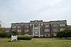
| 21 |
New Iberia High School |
|
000000001994-03-17-0000March 17, 1994
(#94000236) |
415 Center St.
29°59′58″N 91°49′11″W / 29.999444°N 91.819722°W / 29.999444; -91.819722 (New Iberia High School) |
New Iberia |
|
| 22 |
Olivier Store |
|
000000001982-10-25-0000October 25, 1982
(#82000438) |
Louisiana Highway 83
29°55′10″N 91°47′54″W / 29.919444°N 91.798333°W / 29.919444; -91.798333 (Olivier Store) |
Lydia |
|
| 23 |
Pascal Building |
|
000000001985-11-21-0000November 21, 1985
(#85003054) |
223 E. Main St.
30°00′15″N 91°48′59″W / 30.004167°N 91.816389°W / 30.004167; -91.816389 (Pascal Building) |
New Iberia |
|
| 24 |
People's National Bank |
Upload image |
000000002006-03-22-0000March 22, 2006
(#06000146) |
119 W. Main St.
30°00′22″N 91°49′07″W / 30.006111°N 91.818611°W / 30.006111; -91.818611 (People's National Bank) |
New Iberia |
|
| 25 |
Andrew Romero House |
Upload image |
000000001989-10-30-0000October 30, 1989
(#89001855) |
310 Marie St.
30°00′18″N 91°48′48″W / 30.005°N 91.813333°W / 30.005; -91.813333 (Andrew Romero House) |
New Iberia |
|
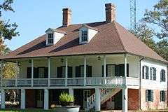
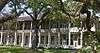
| 26 |
Shadows-on-the-Teche |
|
000000001972-10-05-0000October 5, 1972
(#72000553) |
E. Main St.
30°00′15″N 91°48′54″W / 30.004167°N 91.815°W / 30.004167; -91.815 (Shadows-on-the-Teche) |
New Iberia |
Mrs. Frances Weeks (Magill) Pruett and her children Mary Ida Magill and Augustine Magill were among the over 200 people, many of whom were of plantation society, who perished in the 1856 Last Island hurricane. The Greek Revival home was completed in 1834 on the Bayou Teche by wealthy planters David and Mary Weeks, within the town of New Iberia. It remained in the Weeks family until 1958, when William Weeks Hall died and donated the building to the National Trust for Historic Preservation. Open for tours.
|
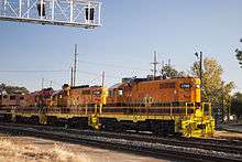
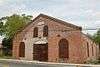
| 27 |
Southern Pacific Railroad Depot |
|
000000001987-11-30-0000November 30, 1987
(#87002082) |
402 W. Washington
30°00′30″N 91°49′26″W / 30.008333°N 91.823889°W / 30.008333; -91.823889 (Southern Pacific Railroad Depot) |
New Iberia |
|
| 28 |
Steamboat House |
|
000000001979-07-27-0000July 27, 1979
(#79001066) |
623 E. Main St.
30°00′01″N 91°48′26″W / 30.000278°N 91.807222°W / 30.000278; -91.807222 (Steamboat House) |
New Iberia |
|
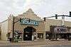
| 29 |
John R. Taylor Drugstore |
|
000000001996-01-22-0000January 22, 1996
(#95001563) |
145 W. Main St.
30°00′23″N 91°49′09″W / 30.006389°N 91.819167°W / 30.006389; -91.819167 (John R. Taylor Drugstore) |
New Iberia |
|
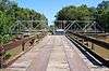
| 30 |
Vida Shaw Bridge |
|
000000002010-07-06-0000July 6, 2010
(#10000419) |
Vida Shaw Rd. near intersection with Louisiana Highway 344
30°01′54″N 91°44′12″W / 30.031667°N 91.736667°W / 30.031667; -91.736667 (Vida Shaw Bridge) |
Loreauville |
|
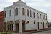
| 31 |
Wormser's Department Store |
|
000000001995-10-05-0000October 5, 1995
(#95001158) |
112 E. Main St.
30°00′18″N 91°49′05″W / 30.005°N 91.818056°W / 30.005; -91.818056 (Wormser's Department Store) |
New Iberia |
|


.jpg)