| [3] |
Name on the Register[4] |
Image |
Date listed[5] |
Location |
Description |
|---|
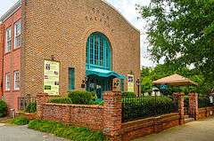
| 1 |
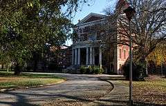
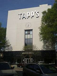
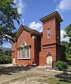
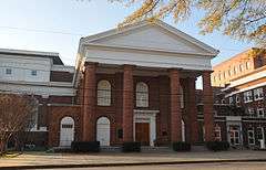
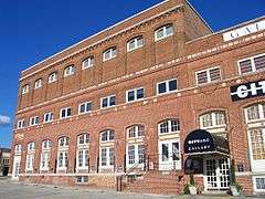
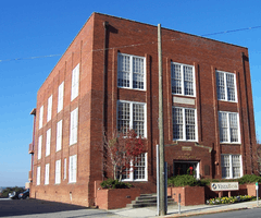
Allen University |
|
000000001975-04-14-0000April 14, 1975
(#75001705) |
1530 Harden St.
34°00′38″N 81°01′14″W / 34.010556°N 81.020556°W / 34.010556; -81.020556 (Allen University) |
|
| 2 |
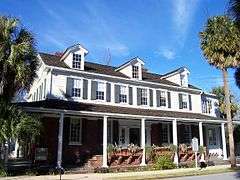
Alston House |
Upload image |
000000001979-03-02-0000March 2, 1979
(#79003359) |
1811 Gervais St.
34°00′16″N 81°01′25″W / 34.004444°N 81.023611°W / 34.004444; -81.023611 (Alston House) |
part of the Columbia Multiple Resource Area (MRA)
|
| 3 |
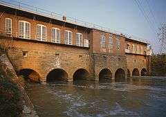
Alta Vista-Camp Fornance-Newman Park Historic District |
Upload image |
000000002015-11-17-0000November 17, 2015
(#15000808) |
Bounded by Lakewood Ave., Seaboard Airline RR., Earlewood & Marshall Parks, Northwood, Park, Lindsay & Marlboro Sts.
34°01′23″N 81°02′52″W / 34.0231°N 81.0479°W / 34.0231; -81.0479 (Alta Vista-Camp Fornance-Newman Park Historic District) |
|
| 4 |
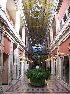
Arcade Building |
|
000000001982-11-17-0000November 17, 1982
(#82001525) |
1332 Main St.
34°00′12″N 81°02′04″W / 34.003333°N 81.034444°W / 34.003333; -81.034444 (Arcade Building) |
part of the Columbia MRA
|
| 5 |
Arsenal Hill |
|
000000001971-11-23-0000November 23, 1971
(#71000795) |
1800 Lincoln St.
34°00′29″N 81°02′32″W / 34.008056°N 81.042222°W / 34.008056; -81.042222 (Arsenal Hill) |
Palmetto Iron Works and Armory
|
| 6 |
Babcock Building, South Carolina State Hospital |
|
000000001981-10-30-0000October 30, 1981
(#81000570) |
Bull St.
34°00′51″N 81°01′49″W / 34.014167°N 81.030278°W / 34.014167; -81.030278 (Babcock Building, South Carolina State Hospital) |
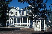
|
| 7 |
Bellevue Historic District |
Upload image |
000000001997-09-30-0000September 30, 1997
(#97001206) |
Roughly bounded by Sumter St., Anthony Ave., Bull St., and Elmwood Ave.
34°01′09″N 81°02′19″W / 34.019167°N 81.038611°W / 34.019167; -81.038611 (Bellevue Historic District) |
|
| 8 |
Benedict College Historic District |
Upload image |
000000001987-04-20-0000April 20, 1987
(#87000809) |
Roughly bounded by Laurel, Oak, Taylor, and Harden Sts. on the Benedict College campus
34°00′43″N 81°01′12″W / 34.011944°N 81.02°W / 34.011944; -81.02 (Benedict College Historic District) |
|
| 9 |
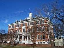
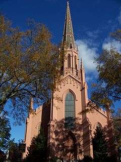
Florence C. Benson Elementary School |
Upload image |
000000002009-10-07-0000October 7, 2009
(#09000819) |
226 Bull St.
33°59′25″N 81°01′21″W / 33.990256°N 81.022467°W / 33.990256; -81.022467 (Florence C. Benson Elementary School) |
part of the Equalization Schools in South Carolina, 1951-1960 Multiple Property Submission (MPS)
|
| 10 |
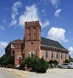
Bethel A.M.E. Church |
|
000000001982-05-24-0000May 24, 1982
(#82003899) |
1528 Sumter St.
34°00′25″N 81°02′03″W / 34.006944°N 81.034167°W / 34.006944; -81.034167 (Bethel A.M.E. Church) |
part of the Columbia MRA
|
| 11 |
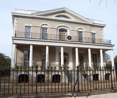
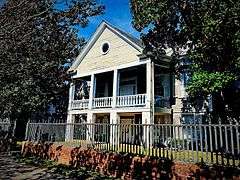
Keziah Goodwyn Hopkins Brevard House |
|
000000001986-03-27-0000March 27, 1986
(#86000535) |
Address Restricted
|
part of the Lower Richland County MRA
|
| 12 |
BROWN'S FERRY VESSEL |
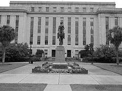
Upload image |
000000001979-05-18-0000May 18, 1979
(#79002391) |
Address Restricted
|
Currently on exhibit at the Rice Museum in Georgetown, South Carolina
|
| 13 |
Building at 1210-1214 Main Street |
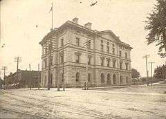
|
000000001979-03-02-0000March 2, 1979
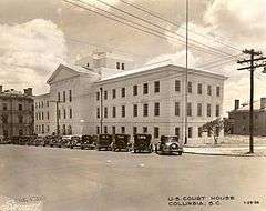
(#79003361) |
1210-1214 Main St.
34°00′04″N 81°02′07″W / 34.001111°N 81.035278°W / 34.001111; -81.035278 (Building at 1210-1214 Main Street) |
part of the Columbia MRA
|
| 14 |
Building at 1644 Main Street |
|
000000001979-03-02-0000March 2, 1979
(#79003377) |
1644 Main St.
34°00′27″N 81°02′11″W / 34.0075°N 81.036389°W / 34.0075; -81.036389 (Building at 1644 Main Street) |
part of the Columbia MRA
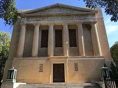
|
| 15 |
Building at 1722-1724 Main Street |
|
000000001980-11-25-0000November 25, 1980
(#80003694) |
1722-1724 Main St.
34°00′30″N 81°02′13″W / 34.008333°N 81.036944°W / 34.008333; -81.036944 (Building at 1722-1724 Main Street) |
part of the Columbia MRA
|
| 16 |
Building at 303 Saluda Avenue |
Upload image |
000000001982-05-24-0000May 24, 1982
(#82003900) |
303 Saluda Ave.
33°59′34″N 81°01′02″W / 33.992778°N 81.017222°W / 33.992778; -81.017222 (Building at 303 Saluda Avenue) |
part of the Columbia MRA
|
| 17 |
Caldwell-Hampton-Boylston House |
Upload image |
000000001971-05-06-0000May 6, 1971
(#71000796) |
829 Richland St.
34°00′32″N 81°02′36″W / 34.008889°N 81.043333°W / 34.008889; -81.043333 (Caldwell-Hampton-Boylston House) |
|
| 18 |
John C. Calhoun State Office Building |
Upload image |
000000002011-09-23-0000September 23, 2011
(#11000703) |
1015 Sumter St.
33°59′57″N 81°01′51″W / 33.999167°N 81.030833°W / 33.999167; -81.030833 (John C. Calhoun State Office Building) |
|
| 19 |
Canal Dime Savings Bank |
|
000000001980-11-25-0000November 25, 1980
(#80004468) |
1530 Main St.
34°00′20″N 81°02′08″W / 34.005556°N 81.035556°W / 34.005556; -81.035556 (Canal Dime Savings Bank) |
part of the Columbia MRA
|
| 20 |
Carolina Life Insurance Company |
Upload image |
000000002016-07-11-0000July 11, 2016
(#16000444) |
1501 Lady St.
34°00′15″N 81°01′44″W / 34.004234°N 81.028991°W / 34.004234; -81.028991 (Carolina Life Insurance Company) |
|
| 21 |
Carver Theatre |
Upload image |
000000002003-07-17-0000July 17, 2003
(#03000658) |
1519 Harden St.
34°00′37″N 81°01′18″W / 34.010278°N 81.021667°W / 34.010278; -81.021667 (Carver Theatre) |
|
| 22 |
Chappelle Administration Building |
|
000000001976-12-08-0000December 8, 1976
(#76001710) |
1530 Harden St.
34°00′39″N 81°01′16″W / 34.010833°N 81.021111°W / 34.010833; -81.021111 (Chappelle Administration Building) |
|
| 23 |
Chesnut Cottage |
|
000000001971-05-06-0000May 6, 1971
(#71000797) |
1718 Hampton St.
34°00′27″N 81°01′37″W / 34.0075°N 81.026944°W / 34.0075; -81.026944 (Chesnut Cottage) |
|
| 24 |
Claussen's Bakery |
|
000000001987-03-09-0000March 9, 1987
(#87000401) |
2001-2003 Green St.
34°00′00″N 81°01′05″W / 34.0°N 81.018056°W / 34.0; -81.018056 (Claussen's Bakery) |
part of the Columbia MRA
|
| 25 |
Columbia Canal |
|
000000001979-01-15-0000January 15, 1979
(#79002392) |
Eastern bank of the Broad and Congaree Rivers from the Diversion dam to the Southern railroad bridge
34°00′06″N 81°03′21″W / 34.001667°N 81.055833°W / 34.001667; -81.055833 (Columbia Canal) |
|
| 26 |
Columbia Central Fire Station |
Upload image |
000000002009-09-25-0000September 25, 2009
(#08001396) |
1001 Senate St.
33°59′58″N 81°02′10″W / 33.999325°N 81.0361°W / 33.999325; -81.0361 (Columbia Central Fire Station) |
|
| 27 |
Columbia City Hall |
|
000000001973-06-19-0000June 19, 1973
(#73001725) |
Main and Laurel Sts.
34°00′32″N 81°02′15″W / 34.008889°N 81.0375°W / 34.008889; -81.0375 (Columbia City Hall) |
|
| 28 |
Columbia Commercial Historic District |
Upload image |
000000002014-10-20-0000October 20, 2014
(#14000875) |
Portions of Main, Blanding, Taylor & Sumter Sts.
34°00′27″N 81°02′07″W / 34.0075°N 81.0352°W / 34.0075; -81.0352 (Columbia Commercial Historic District) |
|
| 29 |
Columbia Electric Street Railway, Light & Power Substation |
Upload image |
000000002011-02-04-0000February 4, 2011
(#10001220) |
Main and Laurel Sts.
34°00′09″N 81°02′10″W / 34.0025°N 81.036111°W / 34.0025; -81.036111 (Columbia Electric Street Railway, Light & Power Substation) |
|
| 30 |
Columbia Historic District I |
Upload image |
000000001971-05-06-0000May 6, 1971
(#71000798) |
Roughly bounded by Elmwood, Assembly, Laurel, and Wayne Sts.
34°00′37″N 81°02′13″W / 34.010278°N 81.036944°W / 34.010278; -81.036944 (Columbia Historic District I) |
|
| 31 |
Columbia Historic District II |
|
000000001971-05-06-0000May 6, 1971
(#71000799) |
Roughly bounded by Taylor, Richland, Pickens, and Barnwell Sts.
• Boundary increase (listed 000000001982-06-28-0000June 28, 1982, refnum 82003901): Blanding, Laurel, Richland, Calhoun, Marion, Bull, Pickens, Henderson, and Barnwell Sts.
34°00′39″N 81°02′01″W / 34.010833°N 81.033611°W / 34.010833; -81.033611 (Columbia Historic District II) |
|
| 32 |
Columbia Mills Building |
|
000000001982-05-24-0000May 24, 1982
(#82003902) |
On the Congaree River
33°59′55″N 81°02′53″W / 33.998611°N 81.048056°W / 33.998611; -81.048056 (Columbia Mills Building) |
Now houses the South Carolina State Museum; part of the Columbia MRA
|
| 33 |
Columbia Township Auditorium |
Upload image |
000000002005-09-28-0000September 28, 2005
(#05001104) |
1703 Taylor St.
34°00′33″N 81°04′40″W / 34.009167°N 81.077778°W / 34.009167; -81.077778 (Columbia Township Auditorium) |
part of the Segregation in Columbia, South Carolina MPS
|
| 34 |
Confederate Printing Plant |
Upload image |
000000001979-03-28-0000March 28, 1979
(#79002393) |
501 Gervais St.
33°59′53″N 81°02′41″W / 33.998056°N 81.044722°W / 33.998056; -81.044722 (Confederate Printing Plant) |
|
| 35 |
Consolidated Building |
|
000000001979-03-02-0000March 2, 1979
(#79003373) |
1326-1330 Main St.
34°00′12″N 81°02′04″W / 34.003333°N 81.034444°W / 34.003333; -81.034444 (Consolidated Building) |
part of the Columbia MRA
|
| 36 |
Harriet M. Cornwell Tourist House |
|
000000002007-10-05-0000October 5, 2007
(#07001083) |
1713 Wayne St.
34°00′27″N 81°02′43″W / 34.0075°N 81.045278°W / 34.0075; -81.045278 (Harriet M. Cornwell Tourist House) |
part of the Segregation in Columbia, South Carolina MPS
|
| 37 |
Curtiss-Wright Hangar |
Upload image |
000000001998-04-30-0000April 30, 1998
(#98000418) |
1400 Jim Hamilton Boulevard
33°58′34″N 81°00′07″W / 33.976111°N 81.001944°W / 33.976111; -81.001944 (Curtiss-Wright Hangar) |
|
| 38 |
Debruhl-Marshall House |
|
000000001972-03-23-0000March 23, 1972
(#72001218) |
1401 Laurel St.
34°00′38″N 81°02′02″W / 34.010556°N 81.033889°W / 34.010556; -81.033889 (Debruhl-Marshall House) |
|
| 39 |
Dovillers-Manning-Magoffin House |
Upload image |
000000001979-03-02-0000March 2, 1979
(#79003358) |
4203 St. Clair Dr.
34°00′34″N 80°58′39″W / 34.009444°N 80.9775°W / 34.009444; -80.9775 (Dovillers-Manning-Magoffin House) |
part of the Columbia MRA
|
| 40 |
Eau Claire Town Hall and Survey Publishing Company Building |
|
000000001979-03-02-0000March 2, 1979
(#79003371) |
3904 Monticello Rd.
34°02′21″N 81°03′08″W / 34.039167°N 81.052222°W / 34.039167; -81.052222 (Eau Claire Town Hall and Survey Publishing Company Building) |
part of the Columbia MRA
|
| 41 |
Ebenezer Lutheran Chapel |
|
000000001979-03-02-0000March 2, 1979
(#79003365) |
1301 Richland St.
34°00′41″N 81°02′09″W / 34.011389°N 81.035833°W / 34.011389; -81.035833 (Ebenezer Lutheran Chapel) |
part of the Columbia MRA
|
| 42 |
Efird's Department Store |
|
000000002012-10-09-0000October 9, 2012
(#12000850) |
1601 Main St.
34°00′24″N 81°02′10″W / 34.006575°N 81.036122°W / 34.006575; -81.036122 (Efird's Department Store) |
|
| 43 |
Elmwood Cemetery |
|
000000001996-09-06-0000September 6, 1996
(#96000984) |
501 Elmwood Ave.
34°00′50″N 81°03′13″W / 34.013889°N 81.053611°W / 34.013889; -81.053611 (Elmwood Cemetery) |
|
| 44 |
Elmwood Park Historic District |
|
000000001991-05-03-0000May 3, 1991
(#91000529) |
Roughly bounded by Elmwood Ave., Main St. and the former Seaboard Air Line railroad tracks
• Boundary increase (listed 000000002002-05-13-0000May 13, 2002, refnum 02000477): 2113 Park St.
34°00′49″N 81°02′34″W / 34.013611°N 81.042778°W / 34.013611; -81.042778 (Elmwood Park Historic District) |
|
| 45 |
Ensor-Keenan House |
|
000000001979-03-02-0000March 2, 1979
(#79003360) |
801 Wildwood Ave.
34°02′38″N 81°02′31″W / 34.043889°N 81.041944°W / 34.043889; -81.041944 (Ensor-Keenan House) |
part of the Columbia MRA
|
| 46 |
Fair-Rutherford and Rutherford Houses |
Upload image |
000000001984-04-05-0000April 5, 1984
(#84002093) |
1326 and 1330 Gregg St.
34°00′25″N 81°01′24″W / 34.006944°N 81.023333°W / 34.006944; -81.023333 (Fair-Rutherford and Rutherford Houses) |
|
| 47 |
Federal Land Bank Building |
Upload image |
000000002015-02-03-0000February 3, 2015
(#14001242) |
1401 Hampton St.
34°00′23″N 81°02′02″W / 34.0064°N 81.034°W / 34.0064; -81.034 (Federal Land Bank Building) |
|
| 48 |
First Baptist Church |
|
000000001971-01-25-0000January 25, 1971
(#71000800) |
1306 Hampton St.
34°00′20″N 81°02′00″W / 34.005556°N 81.033333°W / 34.005556; -81.033333 (First Baptist Church) |
|
| 49 |
First National Bank |
Upload image |
000000001980-11-25-0000November 25, 1980
(#80003695) |
1208 Washington St.
34°00′13″N 81°02′04″W / 34.003611°N 81.034444°W / 34.003611; -81.034444 (First National Bank) |
part of the Columbia MRA
|
| 50 |
First Presbyterian Church |
|
000000001971-01-25-0000January 25, 1971
(#71000801) |
1324 Marion St.
34°00′14″N 81°01′51″W / 34.003889°N 81.030833°W / 34.003889; -81.030833 (First Presbyterian Church) |
|
| 51 |
Forest Hills Historic District |
Upload image |
000000002007-09-28-0000September 28, 2007
(#07001024) |
Bounded by Gervais St., Manning St., Forest Dr., and Glenwood Rd.
34°00′45″N 81°00′12″W / 34.012617°N 81.003336°W / 34.012617; -81.003336 (Forest Hills Historic District) |
|
| 52 |
Gervais Street Bridge |
|
000000001980-11-25-0000November 25, 1980
(#80003676) |
Spans the Congaree River
33°59′47″N 81°02′55″W / 33.996389°N 81.048611°W / 33.996389; -81.048611 (Gervais Street Bridge) |
Extends into West Columbia in Lexington County; part of the Columbia MRA
|
| 53 |
Good Samaritan-Waverly Hospital |
Upload image |
000000002008-07-28-0000July 28, 2008
(#08000738) |
2204 Hampton St.
34°00′37″N 81°01′08″W / 34.010403°N 81.018972°W / 34.010403; -81.018972 (Good Samaritan-Waverly Hospital) |
Segregation in Columbia, South Carolina Multiple Property Submission; part of the Segregation in Columbia, South Carolina MPS
|
| 54 |
Granby Mill Village Historic District |
Upload image |
000000001993-09-20-0000September 20, 1993
(#93000905) |
Roughly bounded by Catawba, Gist, Heyward, and Church Sts.
33°58′59″N 81°02′22″W / 33.983056°N 81.039444°W / 33.983056; -81.039444 (Granby Mill Village Historic District) |
part of the Textile Mills designed by W.B. Smith Whaley MPS
|
| 55 |
Greyhound Bus Depot |
|
000000001989-12-28-0000December 28, 1989
(#82005383) |
1200 Blanding St.
34°00′29″N 81°02′08″W / 34.008056°N 81.035556°W / 34.008056; -81.035556 (Greyhound Bus Depot) |
part of the Columbia MRA
|
| 56 |
Hale-Elmore-Seibels House |
|
000000001971-05-06-0000May 6, 1971
(#71000804) |
1601 Richland St.
34°00′46″N 81°01′53″W / 34.012778°N 81.031389°W / 34.012778; -81.031389 (Hale-Elmore-Seibels House) |
|
| 57 |
Ainsley Hall House |
|
000000001970-07-16-0000July 16, 1970
(#70000595) |
1616 Blanding St.
34°00′34″N 81°01′45″W / 34.009444°N 81.029167°W / 34.009444; -81.029167 (Ainsley Hall House) |
Robert Mills House
|
| 58 |
Hampton-Preston House |
|
000000001969-07-29-0000July 29, 1969
(#69000172) |
1615 Blanding St.
34°00′37″N 81°01′46″W / 34.010278°N 81.029444°W / 34.010278; -81.029444 (Hampton-Preston House) |
|
| 59 |
Harden Street Substation |
Upload image |
000000002005-09-28-0000September 28, 2005
(#05001103) |
1901 Harden St.
34°00′53″N 81°01′25″W / 34.014722°N 81.023611°W / 34.014722; -81.023611 (Harden Street Substation) |
part of the Segregation in Columbia, South Carolina MPS
|
| 60 |
Heslep House |
Upload image |
000000001979-03-02-0000March 2, 1979
(#79003378) |
203 Saluda Ave.
33°59′31″N 81°01′00″W / 33.991944°N 81.016667°W / 33.991944; -81.016667 (Heslep House) |
part of the Columbia MRA
|
| 61 |
Horry-Guignard House |
|
000000001971-05-06-0000May 6, 1971
(#71000802) |
1527 Senate St.
34°00′06″N 81°01′38″W / 34.001667°N 81.027222°W / 34.001667; -81.027222 (Horry-Guignard House) |
|
| 62 |
House of Peace Synagogue |
|
000000001979-08-28-0000August 28, 1979
(#79003354) |
Hampton and Park Sts.
34°00′15″N 81°02′18″W / 34.004167°N 81.038333°W / 34.004167; -81.038333 (House of Peace Synagogue) |
Also known as the Big Apple Club. Part of the Columbia MRA.
|
| 63 |
B.B. Kirkland Seed and Distributing Company |
|
000000001979-03-02-0000March 2, 1979
(#79003370) |
912 Lady St.
34°00′03″N 81°02′18″W / 34.000833°N 81.038333°W / 34.000833; -81.038333 (B.B. Kirkland Seed and Distributing Company) |
part of the Columbia MRA
|
| 64 |
Kress Building |
|
000000001979-03-02-0000March 2, 1979
(#79003376) |
1508 Main St.
34°00′20″N 81°02′08″W / 34.005556°N 81.035556°W / 34.005556; -81.035556 (Kress Building) |
part of the Columbia MRA
|
| 65 |
Lace House |
|
000000001969-12-17-0000December 17, 1969
(#69000173) |
803 Richland St.
34°00′31″N 81°02′39″W / 34.008611°N 81.044167°W / 34.008611; -81.044167 (Lace House) |
|
| 66 |
Ladson Presbyterian Church |
|
000000001998-04-30-0000April 30, 1998
(#98000419) |
1720 Sumter St.
34°00′33″N 81°02′07″W / 34.009167°N 81.035278°W / 34.009167; -81.035278 (Ladson Presbyterian Church) |
|
| 67 |
Laurelwood |
|
000000001986-03-27-0000March 27, 1986
(#86000529) |
Address Restricted
|
part of the Lower Richland County MRA
|
| 68 |
Lever Building |
|
000000001979-03-02-0000March 2, 1979
(#79003372) |
1613 Main St.
34°00′24″N 81°02′12″W / 34.006667°N 81.036667°W / 34.006667; -81.036667 (Lever Building) |
part of the Columbia MRA
|
| 69 |
Logan School |
|
000000001979-03-02-0000March 2, 1979
(#79003367) |
815 Elmwood Ave.
34°00′43″N 81°02′42″W / 34.011944°N 81.045°W / 34.011944; -81.045 (Logan School) |
part of the Columbia MRA
|
| 70 |
Preston C. Lorick House |
Upload image |
000000001972-02-23-0000February 23, 1972
(#72001219) |
1727 Hampton St.
34°00′29″N 81°01′35″W / 34.008056°N 81.026389°W / 34.008056; -81.026389 (Preston C. Lorick House) |
|
| 71 |
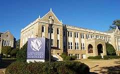
Lutheran Theological Seminary Building: Beam Dormitory |
|
000000001979-08-28-0000August 28, 1979
(#79003353) |
4201 Main St.
34°02′32″N 81°02′04″W / 34.042222°N 81.034444°W / 34.042222; -81.034444 (Lutheran Theological Seminary Building: Beam Dormitory) |
part of the Columbia MRA
|
| 72 |
Lyles-Gudmundson House |
|
000000001979-03-02-0000March 2, 1979
(#79003364) |
Address Restricted
33°59′32″N 81°00′55″W / 33.992222°N 81.015278°W / 33.992222; -81.015278 (Lyles-Gudmundson House) |
part of the Columbia MRA
|
| 73 |
Mann-Simons Cottage |
|
000000001973-04-23-0000April 23, 1973
(#73001726) |
1403 Richland St.
34°00′42″N 81°02′04″W / 34.011667°N 81.034444°W / 34.011667; -81.034444 (Mann-Simons Cottage) |
|
| 74 |
McCord House |
|
000000001979-03-02-0000March 2, 1979
(#79003357) |
1431 Pendleton St.
33°59′59″N 81°01′41″W / 33.999722°N 81.028056°W / 33.999722; -81.028056 (McCord House) |
part of the Columbia MRA
|
| 75 |
McMaster School |
Upload image |
000000001997-07-25-0000July 25, 1997
(#97000777) |
1106 Pickens St.
34°00′08″N 81°01′34″W / 34.002222°N 81.026111°W / 34.002222; -81.026111 (McMaster School) |
|
| 76 |
Melrose Heights-Oak Lawn-Fairview Historic District |
Upload image |
000000002016-11-02-0000November 2, 2016
(#16000756) |
Bounded by Butler and Princeton Sts., Maiden Ln., Michigan St. and Millwood Ave., Woodrow and King Sts., Kirby St., Trenholm Rd.
34°00′19″N 80°59′48″W / 34.005277°N 80.996741°W / 34.005277; -80.996741 (Melrose Heights-Oak Lawn-Fairview Historic District) |
|
| 77 |
Miller Brothers Cotton Warehouse |
Upload image |
000000002016-05-03-0000May 3, 2016
(#16000227) |
705 Gervais St.
33°59′57″N 81°02′28″W / 33.999130°N 81.041039°W / 33.999130; -81.041039 (Miller Brothers Cotton Warehouse) |
|
| 78 |
Millwood |
|
000000001971-03-18-0000March 18, 1971
(#71000803) |
East of Columbia on Garner's Ferry Rd.
33°59′16″N 80°57′45″W / 33.987778°N 80.9625°W / 33.987778; -80.9625 (Millwood) |
Home of Wade Hampton II.
|
| 79 |
Moore-Mann House |
Upload image |
000000001979-03-02-0000March 2, 1979
(#79003363) |
1611 Hampton St.
34°00′27″N 81°01′43″W / 34.0075°N 81.028611°W / 34.0075; -81.028611 (Moore-Mann House) |
part of the Columbia MRA
|
| 80 |
National Loan and Exchange Bank Building |
|
000000001979-03-02-0000March 2, 1979
(#79003374) |
1338 Main St.
34°00′13″N 81°02′05″W / 34.003611°N 81.034722°W / 34.003611; -81.034722 (National Loan and Exchange Bank Building) |
part of the Columbia MRA
|
| 81 |
Nipper Creek (38RD18) |
|
000000001986-12-24-0000December 24, 1986
(#86003474) |
Address Restricted
|
|
| 82 |
North Carolina Mutual Building |
Upload image |
000000001995-01-20-0000January 20, 1995
(#94001570) |
1001, 1001½, and 1003 Washington St.
34°00′10″N 81°02′17″W / 34.002778°N 81.038056°W / 34.002778; -81.038056 (North Carolina Mutual Building) |
|
| 83 |
North Columbia Fire Station No. 7 |
|
000000002005-06-01-0000June 1, 2005
(#05000518) |
2622 N. Main St.
34°01′14″N 81°02′32″W / 34.020556°N 81.042222°W / 34.020556; -81.042222 (North Columbia Fire Station No. 7) |
|
| 84 |
Old Campus District, University of South Carolina |
|
000000001970-06-05-0000June 5, 1970
(#70000596) |
Bounded by Pendleton, Sumter, Pickens, and Green Sts.
33°59′47″N 81°01′43″W / 33.996389°N 81.028611°W / 33.996389; -81.028611 (Old Campus District, University of South Carolina) |
|
| 85 |
Old Shandon Historic District |
Upload image |
000000002003-09-02-0000September 2, 2003
(#03000887) |
Roughly bounded by Cypress, Lee, Maple, Preston, and Woodrow St.
34°00′04″N 81°00′15″W / 34.001111°N 81.004167°W / 34.001111; -81.004167 (Old Shandon Historic District) |
|
| 86 |
Olympia Mill |
Upload image |
000000002005-02-02-0000February 2, 2005
(#04001590) |
500 Heyward St.
33°58′58″N 81°02′11″W / 33.982778°N 81.036389°W / 33.982778; -81.036389 (Olympia Mill) |
|
| 87 |
Owen Building |
Upload image |
000000002013-06-14-0000June 14, 2013
(#13000398) |
1321 Lady St.
34°00′14″N 81°01′54″W / 34.003880°N 81.031601°W / 34.003880; -81.031601 (Owen Building) |
|
| 88 |
Pacific Community Association Building |
Upload image |
000000002007-10-24-0000October 24, 2007
(#07001110) |
701 Whaley St. and 214 Wayne St.
33°59′08″N 81°02′07″W / 33.985617°N 81.035378°W / 33.985617; -81.035378 (Pacific Community Association Building) |
|
| 89 |
Palmetto Building |
|
000000001980-11-25-0000November 25, 1980
(#80003696) |
1400 Main St.
34°00′14″N 81°02′05″W / 34.003889°N 81.034722°W / 34.003889; -81.034722 (Palmetto Building) |
part of the Columbia MRA
|
| 90 |
Palmetto Compress and Warehouse Company Building |
Upload image |
000000001985-10-17-0000October 17, 1985
(#85003237) |
617 Devine St.
33°59′29″N 81°02′20″W / 33.991389°N 81.038889°W / 33.991389; -81.038889 (Palmetto Compress and Warehouse Company Building) |
The building may be demolished for student housing; part of the Columbia MRA
|
| 91 |
J. Davis Powell House |
Upload image |
000000002012-09-25-0000September 25, 2012
(#12000823) |
1410 Shirley St.
34°00′26″N 80°59′53″W / 34.007233°N 80.997929°W / 34.007233; -80.997929 (J. Davis Powell House) |
|
| 92 |
George R. Price House |
Upload image |
000000001998-04-30-0000April 30, 1998
(#98000417) |
3000 Forest Dr.
34°00′54″N 80°59′54″W / 34.015°N 80.998333°W / 34.015; -80.998333 (George R. Price House) |
|
| 93 |
Raymond Price House |
Upload image |
000000002007-09-27-0000September 27, 2007
(#07001022) |
3004 Forest Dr.
34°00′55″N 80°59′52″W / 34.015278°N 80.997778°W / 34.015278; -80.997778 (Raymond Price House) |
|
| 94 |
Randolph Cemetery |
|
000000001995-01-20-0000January 20, 1995
(#94001573) |
Western terminus of Elmwood Ave.
34°00′34″N 81°03′15″W / 34.009444°N 81.054167°W / 34.009444; -81.054167 (Randolph Cemetery) |
|
| 95 |
Richland Cotton Mill |
Upload image |
000000001983-11-10-0000November 10, 1983
(#83003933) |
211-221 Main St.
33°59′18″N 81°01′43″W / 33.988333°N 81.028611°W / 33.988333; -81.028611 (Richland Cotton Mill) |
|
| 96 |
St. Peter's Roman Catholic Church |
|
000000001989-09-28-0000September 28, 1989
(#89001610) |
1529 Assembly St.
34°00′19″N 81°02′17″W / 34.005278°N 81.038056°W / 34.005278; -81.038056 (St. Peter's Roman Catholic Church) |
part of the Columbia MRA
|
| 97 |
Sidney Park Colored Methodist Episcopal Church |
Upload image |
000000001996-10-24-0000October 24, 1996
(#96001222) |
1114 Blanding St.
34°00′26″N 81°02′15″W / 34.007222°N 81.0375°W / 34.007222; -81.0375 (Sidney Park Colored Methodist Episcopal Church) |
|
| 98 |
Modjeska Monteith Simkins House |
|
000000001994-03-25-0000March 25, 1994
(#94000263) |
2025 Marion St.
34°00′49″N 81°02′09″W / 34.013611°N 81.035833°W / 34.013611; -81.035833 (Modjeska Monteith Simkins House) |
|
| 99 |
South Carolina Governor's Mansion |
|
000000001970-06-05-0000June 5, 1970
(#70000597) |
800 Richland St.
34°00′28″N 81°02′37″W / 34.007778°N 81.043611°W / 34.007778; -81.043611 (South Carolina Governor's Mansion) |
|
| 100 |
South Carolina Memorial Garden |
|
000000002012-04-02-0000April 2, 2012
(#09000464) |
1919 Lincoln St.,
34°00′34″N 81°02′36″W / 34.009323°N 81.043323°W / 34.009323; -81.043323 (South Carolina Memorial Garden) |
|
| 101 |
South Carolina State Armory |
|
000000001999-02-05-0000February 5, 1999
(#99000099) |
1219 Assembly St.
34°00′05″N 81°02′10″W / 34.001472°N 81.036°W / 34.001472; -81.036 (South Carolina State Armory) |
|
| 102 |
South Carolina State Hospital, Mills Building |
|
000000001970-06-05-0000June 5, 1970
(#70000890) |
2100 Bull St.
34°00′52″N 81°02′00″W / 34.014444°N 81.033333°W / 34.014444; -81.033333 (South Carolina State Hospital, Mills Building) |
|
| 103 |
South Carolina Statehouse |
|
000000001970-06-05-0000June 5, 1970
(#70000598) |
Main St.
34°00′01″N 81°01′59″W / 34.000278°N 81.033056°W / 34.000278; -81.033056 (South Carolina Statehouse) |
|
| 104 |
Southern Cotton Oil Company |
Upload image |
000000001996-07-25-0000July 25, 1996
(#94001552) |
737 Gadsden St.
33°59′34″N 81°02′16″W / 33.992778°N 81.037778°W / 33.992778; -81.037778 (Southern Cotton Oil Company) |
|
| 105 |
A. Fletcher Spigner House |
Upload image |
000000002009-12-11-0000December 11, 2009
(#09001107) |
2028 Wheat St.
33°59′45″N 81°00′54″W / 33.995925°N 81.014967°W / 33.995925; -81.014967 (A. Fletcher Spigner House) |
|
| 106 |
Supreme Court of South Carolina Building |
|
000000001972-10-18-0000October 18, 1972
(#72001220) |
Northwestern corner of the junction of Gervais and Sumter Sts.
34°00′06″N 81°01′57″W / 34.001667°N 81.0325°W / 34.001667; -81.0325 (Supreme Court of South Carolina Building) |
|
| 107 |
Sylvan Building |
|
000000001972-03-23-0000March 23, 1972
(#72001221) |
1500 Main St.
34°00′18″N 81°02′07″W / 34.005°N 81.035278°W / 34.005; -81.035278 (Sylvan Building) |
|
| 108 |
Taylor House |
Upload image |
000000001982-07-06-0000July 6, 1982
(#82003903) |
1505 Senate St.
34°00′05″N 81°01′41″W / 34.001389°N 81.028056°W / 34.001389; -81.028056 (Taylor House) |
part of the Columbia MRA
|
| 109 |
Strom Thurmond Federal Building and United States Courthouse |
|
000000002014-09-10-0000September 10, 2014
(#14000599) |
1835-1845 Assembly St.
34°00′59″N 80°56′18″W / 34.0163°N 80.9384°W / 34.0163; -80.9384 (Strom Thurmond Federal Building and United States Courthouse) |
|
| 110 |
Town Theatre |
|
000000001974-10-09-0000October 9, 1974
(#74001873) |
1012 Sumter St.
34°00′00″N 81°01′51″W / 34.0°N 81.030833°W / 34.0; -81.030833 (Town Theatre) |
|
| 111 |
Trinity Episcopal Church |
|
000000001971-02-24-0000February 24, 1971
(#71000805) |
1100 Sumter St.
34°00′03″N 81°01′52″W / 34.000833°N 81.031111°W / 34.000833; -81.031111 (Trinity Episcopal Church) |
|
| 112 |
Union Station |
Upload image |
000000001973-06-19-0000June 19, 1973
(#73001728) |
401 S. Main St.
33°59′25″N 81°01′46″W / 33.990278°N 81.029444°W / 33.990278; -81.029444 (Union Station) |
|
| 113 |
University Neighborhood Historic District |
|
000000002004-10-13-0000October 13, 2004
(#04001150) |
Roughly bounded by Gervais St., the Southern railroad cut, Greene St., and Pickens St.
34°00′03″N 81°01′19″W / 34.000833°N 81.021944°W / 34.000833; -81.021944 (University Neighborhood Historic District) |
|
| 114 |
US Courthouse |
|
000000001979-03-02-0000March 2, 1979
(#79003375) |
1100 Laurel St.
34°00′31″N 81°02′17″W / 34.008611°N 81.038056°W / 34.008611; -81.038056 (US Courthouse) |
part of the Columbia MRA
|
| 115 |
Veterans Hospital |
Upload image |
000000002009-09-02-0000September 2, 2009
(#09000062) |
William Jennings Bryan Dorn Veterans Affairs Medical Center, University of South Carolina School of Medicine
33°58′39″N 80°57′40″W / 33.9775°N 80.961111°W / 33.9775; -80.961111 (Veterans Hospital) |
|
| 116 |
Wade Hampton State Office Building |
|
000000002007-03-07-0000March 7, 2007
(#07000126) |
1015 Sumter St.
34°00′05″N 81°01′56″W / 34.001389°N 81.032222°W / 34.001389; -81.032222 (Wade Hampton State Office Building) |
part of the Segregation in Columbia, South Carolina MPS
|
| 117 |
Wallace-McGee House |
Upload image |
000000001979-03-02-0000March 2, 1979
(#79003379) |
415 Harden St.
33°59′43″N 81°00′53″W / 33.995278°N 81.014722°W / 33.995278; -81.014722 (Wallace-McGee House) |
part of the Columbia MRA
|
| 118 |
Wardlaw Junior High School |
|
000000001984-09-13-0000September 13, 1984
(#84002096) |
1003 Elmwood Ave.
34°00′45″N 81°02′33″W / 34.0125°N 81.0425°W / 34.0125; -81.0425 (Wardlaw Junior High School) |
part of the Columbia MRA
|
| 119 |
Washington Street United Methodist Church |
Upload image |
000000001970-12-18-0000December 18, 1970
(#70000599) |
1401 Washington St.
34°00′19″N 81°01′53″W / 34.005278°N 81.031389°W / 34.005278; -81.031389 (Washington Street United Methodist Church) |
|
| 120 |
Waverly Historic District |
Upload image |
000000001989-12-21-0000December 21, 1989
(#89002154) |
Roughly bounded by Hampton St., Heidt St., Gervais St., and Harden St.
34°00′33″N 81°01′03″W / 34.009167°N 81.0175°W / 34.009167; -81.0175 (Waverly Historic District) |
|
| 121 |
Wesley Methodist Church |
Upload image |
000000002009-01-29-0000January 29, 2009
(#08001398) |
1727 Gervais St.
34°00′15″N 81°01′28″W / 34.004189°N 81.024492°W / 34.004189; -81.024492 (Wesley Methodist Church) |
part of the Segregation in Columbia, South Carolina MPS
|
| 122 |
West Gervais Street Historic District |
Upload image |
000000001983-04-27-0000April 27, 1983
(#83002206) |
Roughly bounded by Gadsen, Senate, Park, and Lady Sts.
33°59′56″N 81°02′21″W / 33.998889°N 81.039167°W / 33.998889; -81.039167 (West Gervais Street Historic District) |
part of the Columbia MRA
|
| 123 |
W. B. Smith Whaley House |
Upload image |
000000001979-03-02-0000March 2, 1979
(#79003362) |
1527 Gervais St.
34°00′11″N 81°01′40″W / 34.003056°N 81.027778°W / 34.003056; -81.027778 (W. B. Smith Whaley House) |
part of the Columbia MRA
|
| 124 |
A.P. Williams Funeral Home |
Upload image |
000000002005-09-28-0000September 28, 2005
(#05001102) |
1808 Washington St.
34°00′24″N 81°01′30″W / 34.006667°N 81.025°W / 34.006667; -81.025 (A.P. Williams Funeral Home) |
part of the Segregation in Columbia, South Carolina MPS
|
| 125 |
Thomas Woodrow Wilson Boyhood Home |
|
000000001972-02-23-0000February 23, 1972
(#72001222) |
1705 Hampton St.
34°00′29″N 81°01′38″W / 34.008056°N 81.027222°W / 34.008056; -81.027222 (Thomas Woodrow Wilson Boyhood Home) |
|
| 126 |
Woodrow Memorial Presbyterian Church |
Upload image |
000000001979-03-02-0000March 2, 1979
(#79003366) |
2221 Washington St.
34°00′34″N 81°01′05″W / 34.009444°N 81.018056°W / 34.009444; -81.018056 (Woodrow Memorial Presbyterian Church) |
part of the Columbia MRA
|
| 127 |
World War Memorial Building |
|
000000001995-05-26-0000May 26, 1995
(#95000637) |
920 Sumter St., at its junction with Pendleton St.
33°59′55″N 81°01′48″W / 33.998611°N 81.03°W / 33.998611; -81.03 (World War Memorial Building) |
|
| 128 |
Zimmerman House |
Upload image |
000000001979-03-02-0000March 2, 1979
(#79003355) |
1332 Pickens St.
34°00′19″N 81°01′41″W / 34.005278°N 81.028056°W / 34.005278; -81.028056 (Zimmerman House) |
part of the Columbia MRA
|
| 129 |
Zimmerman School |
Upload image |
000000001979-03-02-0000March 2, 1979
(#79003356) |
1336 Pickens St.
34°00′21″N 81°01′41″W / 34.005833°N 81.028056°W / 34.005833; -81.028056 (Zimmerman School) |
part of the Columbia MRA |

.JPG)
.jpg)
.jpg)
.jpg)
.jpg)
.JPG)
.jpg)
.JPG)
.jpg)
.jpg)
.jpg)

.JPG)

.JPG)

.JPG)

%2C_U.S._Route_76_(Garners_Ferry_Road)%2C_Columbia_vicinity_(Richland_County%2C_South_Carolina).jpg)


.jpg)
.JPG)
.JPG)


.jpg)