| [3] |
Name on the Register[4] |
Image |
Date listed[5] |
Location |
Description |
|---|
| 1 |
Alexandria Canal Tide Lock |
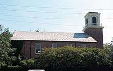
|
000000001980-01-15-0000January 15, 1980
(#80004305) |
Address Restricted
38°48′50″N 77°02′19″W / 38.813856°N 77.038686°W / 38.813856; -77.038686 (Alexandria Canal Tide Lock) |
|
| 2 |
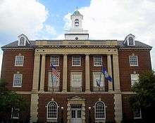
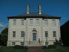
Alexandria City Hall |
|
000000001984-03-08-0000March 8, 1984
(#84003491) |
301 King St.
38°48′18″N 77°02′37″W / 38.805°N 77.043611°W / 38.805; -77.043611 (Alexandria City Hall) |
|
| 3 |
Alexandria Historic District |
|
000000001966-11-13-0000November 13, 1966
(#66000928) |
Bounded by
38°48′12″N 77°02′47″W / 38.803333°N 77.046389°W / 38.803333; -77.046389 (Alexandria Historic District) |
|
| 4 |
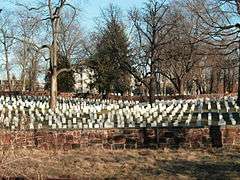
Alexandria National Cemetery |
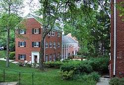
|
000000001995-03-02-0000March 2, 1995
(#95000106) |
1450 Wilkes St.
38°48′07″N 77°03′30″W / 38.801944°N 77.058333°W / 38.801944; -77.058333 (Alexandria National Cemetery) |
part of the Civil War Era National Cemeteries Multiple Property Submission (MPS)
|
| 5 |
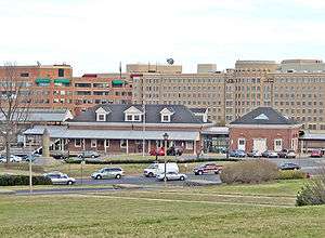
Alexandria Union Station |
|
000000002013-02-27-0000February 27, 2013
(#13000044) |
110 Callahan Dr.
38°48′23″N 77°03′44″W / 38.806419°N 77.062269°W / 38.806419; -77.062269 (Alexandria Union Station) |
|
| 6 |
Alfred Street Baptist Church |
|
000000002004-01-16-0000January 16, 2004
(#03001423) |
313 S. Alfred St.
38°48′09″N 77°03′00″W / 38.802594°N 77.049922°W / 38.802594; -77.049922 (Alfred Street Baptist Church) |
part of the African American Historic Resources of Alexandria, Virginia MPS
|
| 7 |
Bank of Alexandria |
|
000000001973-06-04-0000June 4, 1973
(#73002202) |
133 N. Fairfax St.
38°48′19″N 77°02′33″W / 38.805278°N 77.0425°W / 38.805278; -77.0425 (Bank of Alexandria) |
|
| 8 |
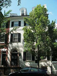
Bayne-Fowle House |
|
000000001986-11-06-0000November 6, 1986
(#86003136) |
811 Prince St.
38°48′15″N 77°02′58″W / 38.804167°N 77.049444°W / 38.804167; -77.049444 (Bayne-Fowle House) |
|
| 9 |
Beulah Baptist Church |
|
000000002004-01-16-0000January 16, 2004
(#03001424) |
320 S. Washington St.
38°48′07″N 77°02′51″W / 38.801964°N 77.047422°W / 38.801964; -77.047422 (Beulah Baptist Church) |
part of the African American Historic Resources of Alexandria, Virginia MPS
|
| 10 |
Bruin's Slave Jail |
|
000000002000-08-14-0000August 14, 2000
(#00000890) |
1707 Duke St.
38°48′15″N 77°03′32″W / 38.804167°N 77.058889°W / 38.804167; -77.058889 (Bruin's Slave Jail) |
|
| 11 |
Carlyle House |
|
000000001969-11-12-0000November 12, 1969
(#69000333) |
121 N. Fairfax St.
38°48′19″N 77°02′32″W / 38.805278°N 77.042222°W / 38.805278; -77.042222 (Carlyle House) |
|
| 12 |
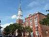
Christ Church |
|
000000001970-05-10-0000May 10, 1970
(#70000899) |
Southeast corner of Cameron and Columbus Sts.
38°48′23″N 77°02′51″W / 38.806314°N 77.047528°W / 38.806314; -77.047528 (Christ Church) |
|
| 13 |
Contrabands and Freedmen Cemetery |
|
000000002012-08-15-0000August 15, 2012
(#12000516) |
1001 S. Washington St.
38°47′40″N 77°02′59″W / 38.794567°N 77.049676°W / 38.794567; -77.049676 (Contrabands and Freedmen Cemetery) |
|
| 14 |
Davis Chapel |
|
000000002004-01-16-0000January 16, 2004
(#03001428) |
606-A S. Washington St.
38°47′56″N 77°02′52″W / 38.798842°N 77.047897°W / 38.798842; -77.047897 (Davis Chapel) |
part of the African American Historic Resources of Alexandria, Virginia MPS
|
| 15 |
Fairfax-Moore House |
|
000000001991-01-17-0000January 17, 1991
(#90002113) |
207 Prince St.
38°48′12″N 77°02′34″W / 38.803333°N 77.042778°W / 38.803333; -77.042778 (Fairfax-Moore House) |
|
| 16 |
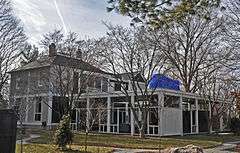
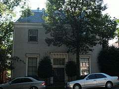
President Gerald R. Ford, Jr. House |
|
000000001985-12-17-0000December 17, 1985
(#85003048) |
514 Crown View Dr.
38°48′48″N 77°04′47″W / 38.813378°N 77.079661°W / 38.813378; -77.079661 (President Gerald R. Ford, Jr. House) |
|
| 17 |
Fort Ward |
|
000000001982-08-26-0000August 26, 1982
(#82004538) |
4301 W. Braddock Rd.
38°49′50″N 77°06′08″W / 38.830556°N 77.102222°W / 38.830556; -77.102222 (Fort Ward) |
|
| 18 |
Franklin and Armfield Office |
|
000000001978-06-02-0000June 2, 1978
(#78003146) |
1315 Duke St.
38°48′14″N 77°03′17″W / 38.803889°N 77.054722°W / 38.803889; -77.054722 (Franklin and Armfield Office) |
|
| 19 |
Gadsby's Tavern |
|
000000001966-10-15-0000October 15, 1966
(#66000913) |
128 N. Royal St.
38°48′20″N 77°02′38″W / 38.805556°N 77.043889°W / 38.805556; -77.043889 (Gadsby's Tavern) |
|
| 20 |
Charles M. Goodman House |
|
000000002013-05-28-0000May 28, 2013
(#13000334) |
510 N. Quaker Ln.
38°48′51″N 77°05′23″W / 38.81409°N 77.08970°W / 38.81409; -77.08970 (Charles M. Goodman House) |
|
| 21 |
Moses Hepburn Rowhouses |
|
000000002004-01-16-0000January 16, 2004
(#03001426) |
206-212 N. Pitt St.
38°48′23″N 77°02′40″W / 38.806344°N 77.044497°W / 38.806344; -77.044497 (Moses Hepburn Rowhouses) |
part of the African American Historic Resources of Alexandria, Virginia MPS
|
| 22 |
Dr. Albert Johnson House |
|
000000002004-01-16-0000January 16, 2004
(#03001422) |
814 Duke St.
38°48′10″N 77°02′57″W / 38.802897°N 77.049203°W / 38.802897; -77.049203 (Dr. Albert Johnson House) |
part of the African American Historic Resources of Alexandria, Virginia MPS
|
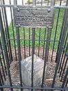
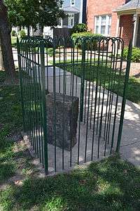
| 23 |
Jones Point Lighthouse and District of Columbia South Cornerstone |
|
000000001980-05-19-0000May 19, 1980
(#80000352) |
Jones Point Park
38°47′25″N 77°02′26″W / 38.790278°N 77.040556°W / 38.790278; -77.040556 (Jones Point Lighthouse and District of Columbia South Cornerstone) |
|
| 24 |
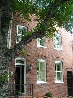
Robert E. Lee Boyhood Home |
|
000000001986-06-05-0000June 5, 1986
(#86001228) |
607 Oronoco St.
38°48′35″N 77°02′44″W / 38.809722°N 77.045556°W / 38.809722; -77.045556 (Robert E. Lee Boyhood Home) |
|
| 25 |
Lee-Fendall House |
|
000000001979-06-22-0000June 22, 1979
(#79003277) |
614 Oronoco St.
38°48′33″N 77°02′46″W / 38.809167°N 77.046111°W / 38.809167; -77.046111 (Lee-Fendall House) |
|
| 26 |
Lloyd House |
|
000000001976-07-12-0000July 12, 1976
(#76002222) |
220 N. Washington St.
38°48′25″N 77°02′49″W / 38.806944°N 77.046944°W / 38.806944; -77.046944 (Lloyd House) |
|
| 27 |
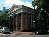
The Lyceum |
|
000000001969-05-27-0000May 27, 1969
(#69000334) |
201 S. Washington St.
38°48′13″N 77°02′51″W / 38.803697°N 77.047442°W / 38.803697; -77.047442 (The Lyceum) |
|
| 28 |
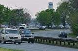
Mount Vernon Memorial Highway |
|
000000001981-05-18-0000May 18, 1981
(#81000079) |
Washington St. and George Washington Memorial Pkwy.
38°46′35″N 77°03′13″W / 38.776389°N 77.053611°W / 38.776389; -77.053611 (Mount Vernon Memorial Highway) |
|
| 29 |
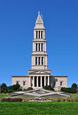
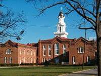
George Washington National Masonic Memorial |
|
000000002015-07-21-0000July 21, 2015
(#15000622) |
101 Callahan St.
38°48′27″N 77°03′58″W / 38.80748°N 77.06598°W / 38.80748; -77.06598 (George Washington National Masonic Memorial) |
Neoclassical tower is one of the largest private memorials to Washington, reflecting the Masonic involvement of many of the Founding Fathers
|
| 30 |
Odd Fellows Hall |
|
000000002004-01-16-0000January 16, 2004
(#03001427) |
411 S. Columbus St.
38°48′05″N 77°02′56″W / 38.801467°N 77.049022°W / 38.801467; -77.049022 (Odd Fellows Hall) |
part of the African American Historic Resources of Alexandria, Virginia MPS
|
| 31 |
Old Dominion Bank Building |
|
000000001980-03-20-0000March 20, 1980
(#80004307) |
201 Prince St.
38°48′12″N 77°02′31″W / 38.803306°N 77.041867°W / 38.803306; -77.041867 (Old Dominion Bank Building) |
|
| 32 |
Orange and Alexandria Railroad Hooff's Run Bridge |
|
000000002003-08-07-0000August 7, 2003
(#03000740) |
Jamieson Ave. at Hooff's Run
38°48′10″N 77°03′32″W / 38.802778°N 77.058889°W / 38.802778; -77.058889 (Orange and Alexandria Railroad Hooff's Run Bridge) |
|
| 33 |
Parkfairfax Historic District |
|
000000001999-02-22-0000February 22, 1999
(#99000146) |
Bounded by Quaker Ln., US 395, Beverley Dr., Wellington Rd., Gunston Rd., Virginialley Dr., Glebe Rd. and Four-mile Run
38°50′12″N 77°04′48″W / 38.836667°N 77.08°W / 38.836667; -77.08 (Parkfairfax Historic District) |
|
| 34 |
Old Presbyterian Meeting House |
|
000000002001-02-16-0000February 16, 2001
(#01000143) |
321 S. Fairfax St.
38°48′05″N 77°02′38″W / 38.801389°N 77.043889°W / 38.801389; -77.043889 (Old Presbyterian Meeting House) |
|
| 35 |
Protestant Episcopal Theological Seminary |
|
000000001980-11-17-0000November 17, 1980
(#80004166) |
3737 Seminary Rd.
38°49′12″N 77°05′32″W / 38.82°N 77.092222°W / 38.82; -77.092222 (Protestant Episcopal Theological Seminary) |
|
| 36 |
Rosemont Historic District |
|
000000001992-09-24-0000September 24, 1992
(#92001275) |
Roughly bounded by Commonwealth AVe., W. Walnut St., Russell Rd., Rucker Pl. and King St.
38°48′38″N 77°03′50″W / 38.810556°N 77.063889°W / 38.810556; -77.063889 (Rosemont Historic District) |
|
| 37 |
George Lewis Seaton House |
|
000000002004-01-16-0000January 16, 2004
(#03001425) |
404 S. Royal St.
38°48′03″N 77°02′39″W / 38.800953°N 77.044289°W / 38.800953; -77.044289 (George Lewis Seaton House) |
part of the African American Historic Resources of Alexandria, Virginia MPS
|
| 38 |
Southwest No. 1 Boundary Marker of the Original District of Columbia |
|
000000001991-02-01-0000February 1, 1991
(#91000006) |
1220 Wilkes St.
38°48′05″N 77°03′15″W / 38.801317°N 77.054269°W / 38.801317; -77.054269 (Southwest No. 1 Boundary Marker of the Original District of Columbia) |
part of the Boundary Markers of the Original District of Columbia MPS
|
| 39 |
Southwest No. 2 Boundary Marker of the Original District of Columbia |
|
000000001991-02-01-0000February 1, 1991
(#91000007) |
7 Russell Rd., on east side, north of the junction with King St.
38°48′32″N 77°03′45″W / 38.808889°N 77.0625°W / 38.808889; -77.0625 (Southwest No. 2 Boundary Marker of the Original District of Columbia) |
part of the Boundary Markers of the Original District of Columbia MPS
|
| 40 |
Southwest No. 3 Boundary Marker of the Original District of Columbia |
|
000000001991-02-01-0000February 1, 1991
(#91000008) |
2952 King St.
38°49′14″N 77°04′46″W / 38.820643°N 77.079318°W / 38.820643; -77.079318 (Southwest No. 3 Boundary Marker of the Original District of Columbia) |
part of the Boundary Markers of the Original District of Columbia MPS
|
| 41 |
Southwest No. 4 Boundary Marker of the Original District of Columbia |
|
000000001991-02-01-0000February 1, 1991
(#91000009) |
King St. north of the junction with Wakefield St.
38°49′54″N 77°05′32″W / 38.831667°N 77.092222°W / 38.831667; -77.092222 (Southwest No. 4 Boundary Marker of the Original District of Columbia) |
part of the Boundary Markers of the Original District of Columbia MPS
|
| 42 |
Southwest No. 5 Boundary Marker of the Original District of Columbia |
|
000000001991-02-01-0000February 1, 1991
(#91000010) |
Northeast of the junction of King St. and Walter Reed Dr.
38°50′31″N 77°06′22″W / 38.841944°N 77.106111°W / 38.841944; -77.106111 (Southwest No. 5 Boundary Marker of the Original District of Columbia) |
part of the Boundary Markers of the Original District of Columbia MPS
|
| 43 |
St. Paul's Episcopal Church |
|
000000001985-05-09-0000May 9, 1985
(#85000987) |
228 S. Pitt St.
38°48′09″N 77°02′43″W / 38.8025°N 77.045278°W / 38.8025; -77.045278 (St. Paul's Episcopal Church) |
|
| 44 |
Stabler-Leadbeater Apothecary Shop |
|
000000001982-11-24-0000November 24, 1982
(#82001796) |
105-107 S. Fairfax
38°48′15″N 77°02′35″W / 38.804167°N 77.043056°W / 38.804167; -77.043056 (Stabler-Leadbeater Apothecary Shop) |
|
| 45 |
Town of Potomac |
|
000000001992-09-10-0000September 10, 1992
(#92001186) |
Roughly bounded by Commonwealth Ave., US 1, E. Bellefonte Ave. and Ashby Ave.
38°49′37″N 77°03′24″W / 38.826944°N 77.056667°W / 38.826944; -77.056667 (Town of Potomac) |
|
| 46 |
Uptown-Parker-Gray Historic District |
|
000000002010-01-12-0000January 12, 2010
(#09001232) |
Roughly Cameron St. north to 1st St. and N. Columbus St.; west to the following streets forming west line: Buchanan St. and N. West St.
38°48′41″N 77°03′02″W / 38.811358°N 77.050675°W / 38.811358; -77.050675 (Uptown-Parker-Gray Historic District) |
|

.JPG)


.JPG)


.jpg)
.jpg)

_02.JPG)

.jpg)