Nash, Oklahoma
| Nash, Oklahoma | |
|---|---|
| Town | |
 Location of Nash, Oklahoma | |
| Coordinates: 36°39′54″N 98°3′9″W / 36.66500°N 98.05250°WCoordinates: 36°39′54″N 98°3′9″W / 36.66500°N 98.05250°W | |
| Country | United States |
| State | Oklahoma |
| County | Grant |
| Area | |
| • Total | 0.3 sq mi (0.8 km2) |
| • Land | 0.3 sq mi (0.8 km2) |
| • Water | 0.0 sq mi (0.0 km2) |
| Elevation | 1,115 ft (340 m) |
| Population (2000) | |
| • Total | 224 |
| • Density | 697.3/sq mi (269.2/km2) |
| Time zone | Central (CST) (UTC-6) |
| • Summer (DST) | CDT (UTC-5) |
| ZIP code | 73761 |
| Area code(s) | 580 |
| FIPS code | 40-50300[1] |
| GNIS feature ID | 1095749[2] |
Nash is a town in Grant County, Oklahoma, United States. The population was 204 at the 2010 census, an 8.9 percent decline from 224 at the 2000 census.[3] Nash onced shared a school district with the town of Jet, several miles away along U.S. Highway 64, but the school folded in 2013 and the town now goes to Timberlake Regional School District based in Helena. The elementary school is still located in Jet.
Geography
Nash is located at 36°39′54″N 98°3′9″W / 36.66500°N 98.05250°W (36.664892, -98.052487).[4]
According to the United States Census Bureau, the town has a total area of 0.3 square miles (0.78 km2), all of it land.
Demographics
| Historical population | |||
|---|---|---|---|
| Census | Pop. | %± | |
| 1910 | 348 | — | |
| 1920 | 439 | 26.1% | |
| 1930 | 412 | −6.2% | |
| 1940 | 348 | −15.5% | |
| 1950 | 290 | −16.7% | |
| 1960 | 230 | −20.7% | |
| 1970 | 294 | 27.8% | |
| 1980 | 301 | 2.4% | |
| 1990 | 281 | −6.6% | |
| 2000 | 224 | −20.3% | |
| 2010 | 204 | −8.9% | |
| Est. 2015 | 204 | [5] | 0.0% |
As of the census[1] of 2000, there were 224 people, 95 households, and 66 families residing in the town. The population density was 697.3 people per square mile (270.3/km²). There were 128 housing units at an average density of 398.5 per square mile (154.4/km²). The racial makeup of the town was 95.54% White, 3.12% Native American, 0.89% Asian, and 0.45% from two or more races.
There were 95 households out of which 31.6% had children under the age of 18 living with them, 64.2% were married couples living together, 5.3% had a female householder with no husband present, and 29.5% were non-families. 28.4% of all households were made up of individuals and 17.9% had someone living alone who was 65 years of age or older. The average household size was 2.36 and the average family size was 2.90.
In the town the population was spread out with 22.8% under the age of 18, 5.8% from 18 to 24, 28.1% from 25 to 44, 23.7% from 45 to 64, and 19.6% who were 65 years of age or older. The median age was 40 years. For every 100 females there were 82.1 males. For every 100 females age 18 and over, there were 88.0 males.
The median income for a household in the town was $24,063, and the median income for a family was $39,375. Males had a median income of $30,714 versus $16,667 for females. The per capita income for the town was $13,864. None of the families and 3.8% of the population were living below the poverty line, including no under eighteens and 8.9% of those over 64.
References
- 1 2 "American FactFinder". United States Census Bureau. Retrieved 2008-01-31.
- ↑ "US Board on Geographic Names". United States Geological Survey. 2007-10-25. Retrieved 2008-01-31.
- ↑ CensusViewer:Nash, Oklahoma Population
- ↑ "US Gazetteer files: 2010, 2000, and 1990". United States Census Bureau. 2011-02-12. Retrieved 2011-04-23.
- ↑ "Annual Estimates of the Resident Population for Incorporated Places: April 1, 2010 to July 1, 2015". Retrieved July 2, 2016.
- ↑ "Census of Population and Housing". Census.gov. Retrieved June 4, 2015.
Municipalities and communities of Grant County, Oklahoma, United States | ||
|---|---|---|
| Cities | 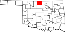 | |
| Towns | ||
| Unincorporated communities |
| |